
Central Richmond
Conservation Area Appraisal
Conservation area no.17
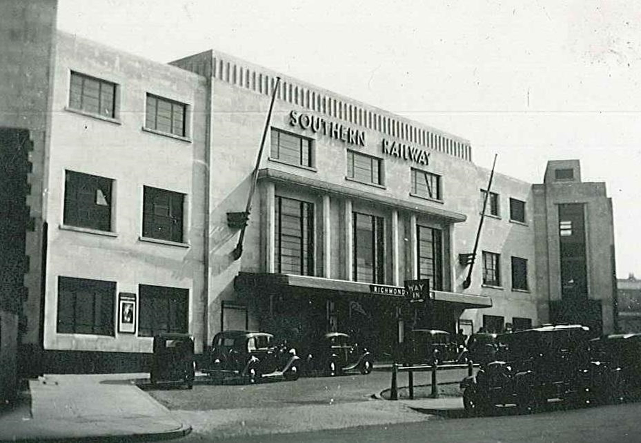
Figure 1 Richmond Railway Station, 1937
Contents
- Introduction
- Statement of Significance
- Location and Setting
- Historical Development
- Architectural Quality and Built Form
- Architectural Details
- Open Space, Parks, Gardens and Trees
- Management Plan
1. Introduction
Central Richmond Conservation Area is closely linked in terms of its history and development with two adjacent Conservation Areas - Richmond Green and Richmond Riverside – and this Appraisal Document should be considered in the context of the special relationship between them. The Appraisals for each Area can be viewed by clicking their respective names above.
Purpose of this document
The principal aims of conservation area appraisals are to:
- Describe the historic and architectural character and appearance of the area which will assist applicants in making successful planning applications and decision makers in assessing planning applications;
- Raise public interest and awareness of the special character of their area;
- Identify the positive features which should be conserved, as well as negative features which indicate scope for future enhancements.
This document has been produced using the guidance set out by Historic England in the 2019 publication titled Understanding Place: Conservation Area Designation, Appraisal and Management, Historic England Advice Note 1 (Second Edition).
This document will be a material consideration when assessing planning applications.
What is a conservation area?
The statutory definition of a conservation area is an ‘area of special architectural or historic interest, the character or appearance of which it is desirable to preserve or enhance’. The power to designate conservation areas is given to local authorities through the Planning (Listed Buildings and Conservations Areas) Act, 1990 (Sections 69 to 78).
Once designated, proposals within a conservation area become subject to local conservation policies set out in the Council’s Local Plan and national policies outlined in the National Planning Policy Framework (NPPF) and the London Plan.
Our overarching duty, which is set out in the Act, is to preserve and/or enhance the historic or architectural character or appearance of the conservation area.
Conservation Areas SPD (pdf, 653 KB)
Buildings of Townscape Merit
Buildings of Townscape Merit (BTMs) are buildings, groups of buildings or structures of historic or architectural interest, which are locally listed due to their considerable local importance. The policy, as outlined in the Council’s Local Plan, sets out a presumption against the demolition of BTMs unless structural evidence has been submitted by the applicant, and independently verified at the cost of the applicant. Locally specific guidance on design and character is set out in the Council’s Buildings of Townscape Merit Supplementary Planning Document (2015) (pdf, 895 KB), which applicants are expected to follow for any alterations and extensions to existing BTMs, or for any replacement structures.
Designation and Adoption Dates
Central Richmond Conservation Area was designated on the 14th January 1969.
It was subsequently extended on the 5th July 1977, 14th June 1988, 17th January 2000, 23rd September 2003, and 7th November 2005.
Following approval from the Environment, Sustainability, Culture and Sports Committee on the 21st June 2022, a public consultation on the draft Appraisal was carried out between the 4th July and 1st September 2022.
This Appraisal was adopted on the 20th November 2023.
Map of Conservation Area
2. Statement of Significance
Summary of special architectural and historic interest of conservation area.
Central Richmond forms the historic core of the settlement of Richmond, which has origins dating from the 14th century. The area serves as the commercial centre, and the linear main commercial thoroughfare of George Street is an important feature which reflects how the area has grown and developed. George Street formed part of an important coaching route to London, and so the area has repeatedly been redeveloped, resulting in a townscape noteworthy for its variety, with a consistently high quality and many exuberant individual buildings. Many of the 18th century buildings of George Street, The Quadrant , and Sheen Road were replaced piecemeal by the mid to late 19th and early 20th century commercial architecture, providing shops for the needs of the expanded local community after the arrival of the railway. However, some earlier fabric on the high street survives, embedded to the rear behind more modern frontages. The area maintains important linkages to the neighbouring historic areas through the retention of alleys and lanes which form a transitionary character with a greater level of intimacy and enclosure. These include alleys leading to Richmond Green, Richmond Riverside, and St Mary Magdalene’s Church, which make an important contribution to its historic character.
3. Location and Setting
General character and plan form, e.g. linear, compact, dense or dispersed; important views, landmarks, open spaces, uniformity.
Situated to the south west of London, Richmond lies between two significant areas of green space: The Old Deer Park/ Kew Gardens to the north and Richmond Park and Ham lands to the south. It is north east of Twickenham, north of Ham, south east of Isleworth, south west of Chiswick and west of Putney.
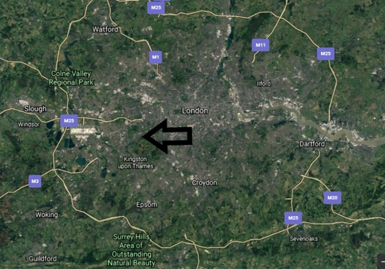
Figure 2 Aerial map showing Richmond in wider context
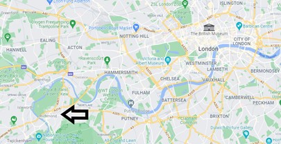
Figure 3 Map showing Richmond in wider context
The Conservation Area lies in the centre of the London Borough of Richmond upon Thames, and although it had its own distinct character, shares a relationship with both the Richmond Green Conservation Area, and the Richmond Riverside Conservation Area, and this context should be considered when studying any of the three.
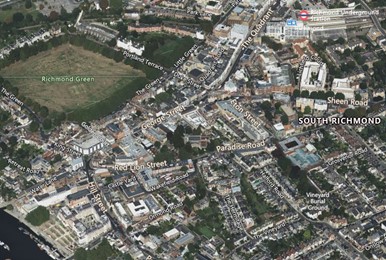
Figure 4 Aerial Map showing Central Richmond CAA in context
The Central Richmond Conservation Area is predominantly aligned along the main thoroughfare routes which includes Kew Road, The Quadrant, George Street, and Hill Street.
The South Western Railway and Underground lines run through its centre to Richmond Station, with connections to both central London and the west.
The western boundary is strictly defined by the presence of Richmond Green. To the north, the area is mostly residential in character, with the inclusion of Parkshot, St. John’s Road and Church Road, whereas the centre and southern ends are much more commercial in nature. The eastern side extends upwards to meet Richmond Hill Conservation Area and includes Paradise Road, Red Lion Street, Sheen Road and Eton Street, which have a mix of commercial and residential properties.
Topography
The Conservation Area is set above the banks of the Thames and is therefore relatively flat, with modern street patterns informed by historic roads and access to the ancient river crossing, replaced by Richmond Bridge.
Buildings and Townscape Overview
While the town centre of Richmond has a wealth of surviving historic fabric, town centres, by their nature as the centre of a community, evolve to reflect and meet the needs of their occupants. This can manifest in conjunction with advancements in ways of life and technologies and can result in a complexity of urban development and variations in their overall character. While this document identifies sub-areas that have a more obvious and legible shared character and appearance below, this section will broadly outline common styles, materials, and features, which are evident and relatively consistent throughout the Conservation Area. The descriptions are not exhaustive, and where clear variations exist, these will be addressed within the appropriate character area descriptions.
Townscape Details
Hard Landscaping
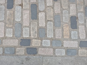
Footways are for the most part surfaced in large Yorkstone pavers with granite kerbs, which are high-quality finishes, and there is value in their consistent treatment. The colour of the pavers varies but is generally more muted in the residential area of Larkfield Road. Occasional patches of stone setts survive which add character and hint at historic passageways, with good examples visible at Water Lane as well as the junction of King and George Streets.
Loading bays/taxi ranks are often demarcated with multi-coloured granite setts.
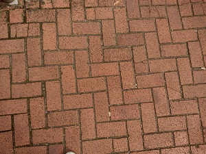
The Paradise & Sheen Roads character area differs in that paving is predominantly brick in a herringbone pattern, still with granite kerbs. While still a quality finish, there is some inconsistency in colour, with dominant stretches of red to the west entrances to both Paradise and Sheen Road, which contrasts with the grey/purple bricks common elsewhere.
Street Furniture
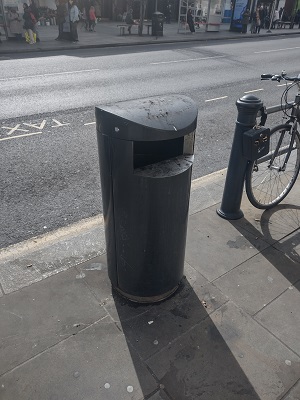
Bins
Bins are generally of two standard designs which are common throughout the Borough, simple black bins which are easily recognisable but do not draw attention.
Lampposts
Two types of lamp posts are found within the Conservation Area which are of a design typical to the Borough. A shorter green post is generally used for secondary streets and residential areas and has a simple modern design. To busier main roads, taller versions of a similar design are employed, painted black.
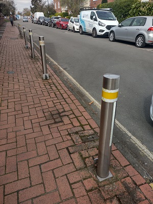
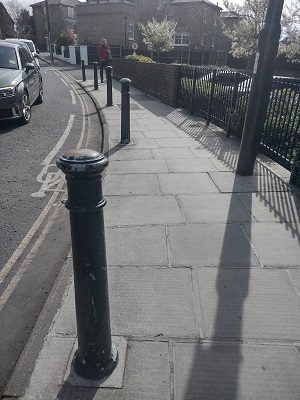
Bollards
Bollards are varied in their appearance including those which are linked to essentially form a ‘fence.’ Generally, they are painted black and range from simple smooth designs to more decorative, fluted columns. While there is inconsistency in their overall appearance, consistency to groups is uncompromised.
Architecture
Residential – Residential buildings are predominantly Victorian, with some pockets of later infill in sympathetic designs. The scale and design of residential buildings varies from simple workers’ cottages to speculative developments, to more robust villas. Despite a range of scales, housing remains typically terraced or semi-detached, and almost exclusively two storeys, often with an attic storey.
Commercial and Shopfronts – Commercial premises and historic shopfronts are predominantly within three and four storey buildings, which have a shopfront to ground floor with various uses above. Shopfronts appear in almost all character areas, and there are some good examples of surviving historic shopfronts, particularly to the passageways off George Street. More modern insertions are generally of a high-quality with traditional details and proportions. To more modern buildings, some shopfronts can be overly contemporary in their design and appearance.
Modern and Contemporary Development – More modern development has generally replaced low quality or infill buildings which were constructed in place of bomb-damaged buildings, and therefore some have a larger footprint than the otherwise tightly knit terraces most common to the area. While the developments replicate proportions and details such as window placements, they are often to a much larger scale, often stretching across multiple former plots but lacking variation in their elevations. These buildings are predominantly mixed-use in nature. Materials and styles are generally complementary but clearly contrast with the historic environment, employing various shades of brick and modern cladding. Modern design elements, such as extensive glazing and amenity spaces like balconies, also create visual contrast with the regular / consistent, simpler historic forms which surround.
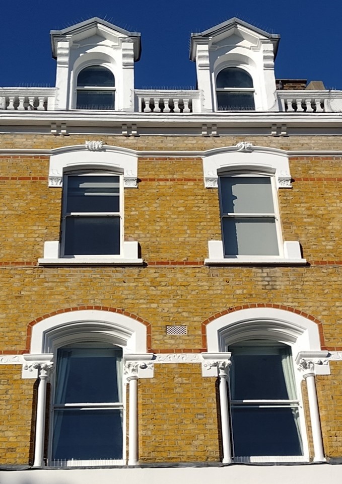
Windows make a substantial contribution to the appearance of an individual building and can enhance or interrupt the unity of a terrace or semi-detached pair of houses. The Conservation Area contains a wide variety of window styles, and many unsympathetic replacements, but it is important that a single pattern should be retained within any uniform composition. Generally, windows follow standard patterns/styles. Windows reduce in size and have simpler surrounds as they rise through the building demonstrating the hierarchy of internal spaces.
Window frames are most commonly white painted timber, and where uPVC replacements have been allowed, these are mostly white and reflect the historic glazing pattern. Casement windows are less common but appropriate where historical examples can be cited.
Bricks
Brick is the predominant building material, with a mixture of stock and red brick, with both often employing contrasting stone or decorative stone embellishments. Render is an increasingly common treatment, but large stretches create a homogenous townscape and sometimes dilute the richness and diversity offered by brick, particularly to groups.
Modern development has also employed brick skins to various degrees, generally paired with other more modern materials and executed in colours which are not necessarily common to the general palette of the area.
Roofs are most often finished in black slates or red tiles, and while extensions have become more commonplace to commercial buildings, residential properties remain relatively unaltered. Where commercial premises have been altered, this has been carried out through mansard style roof extensions in matching slate, set back from the parapet, or through simple, consistent dormers into the existing roof slope.
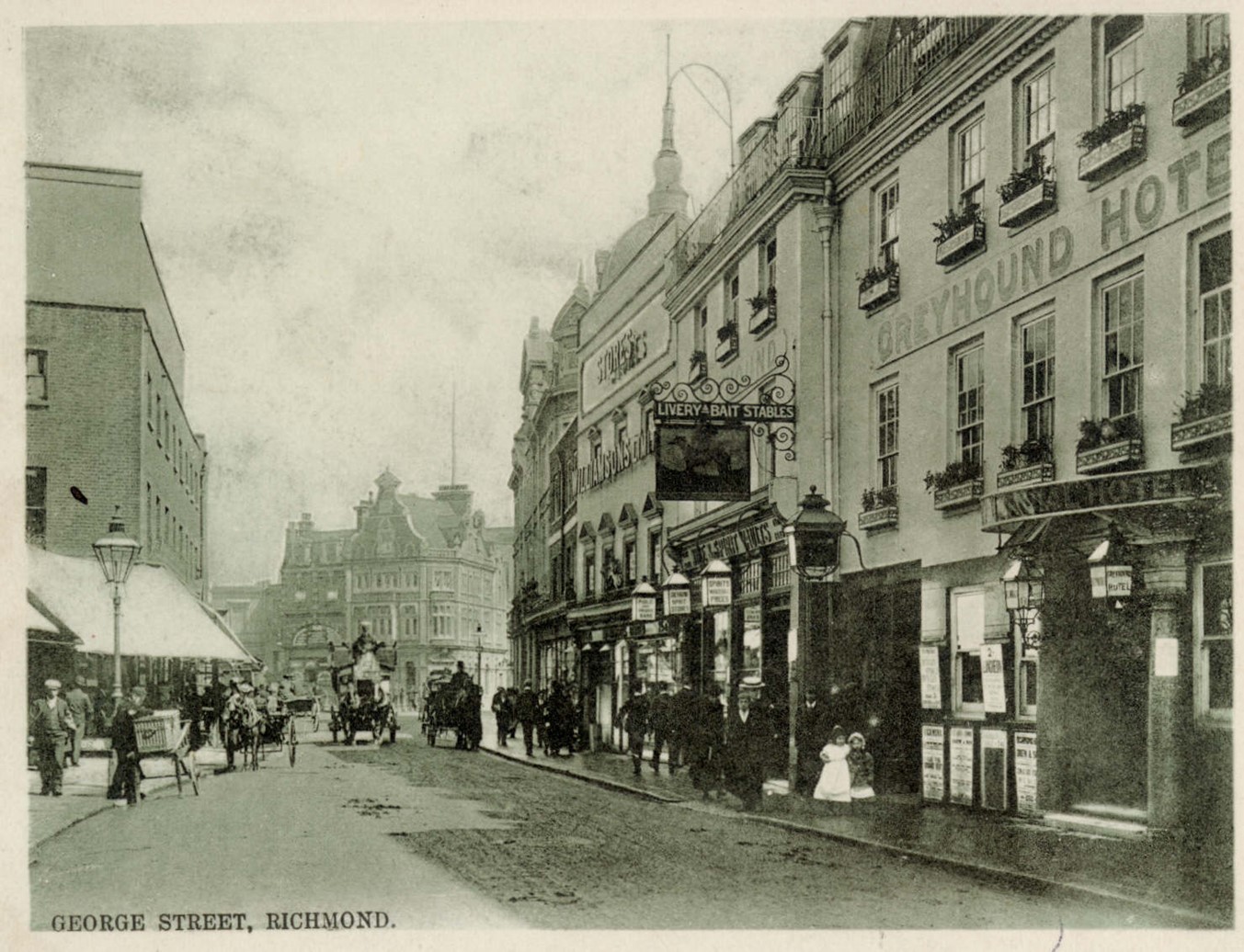
Figure 7 George Street with Greyhound Hotel on the right c.1900
4. Historical Development
Stages/phases of historical development and historic associations (archaeology etc.), which may be influencing how the area is experienced.
The growth of Richmond has been physically constrained by the large open spaces of Richmond Park and Petersham Common to the south and south-east, the River Thames to the west and the Old Deer Park to the north, later reinforced by the railway and A316 trunk road. Thus, throughout its development the town has only really been able to expand east and north-east.
The town’s history, and indeed its existence, is dominated by and owed to the medieval and Tudor royal manor and palace. It was not a medieval town as it was never granted a market or fair, and before 1501 it was known as Shene. The first record of the manor house of Shene was in the 12th century when it belonged to Henry I, who stayed there in 1126 and granted the manor to the Belet family. The settlement of Shene presumably gradually developed around the manor house and succeeding palaces but little is known of its role and layout, Given the regular visits by royalty, their courtiers and other high status visitors Richmond/Shene is unlikely to have been a typical medieval village.
The early medieval manor house was demolished by Richard II after the death of his Queen, and a new palace was built by Henry V &VI. After a fire in 1497 the palace was rebuilt by Henry VII, and from 1501, the village of Shene came to be known as Richmond, as Henry VII was the earl of Richmond in Yorkshire. The accession of the Stuarts saw the creation of the New Park (now the Old Deer Park) by James I from 1603 and Richmond Park by Charles I from 1634.
The village gradually developed into a town due to the presence of the palace, and decline followed its demolition. Prosperity returned towards the end of the 17th century as Londoners fled the plague and the discovery of a spring led to Richmond becoming a popular spa town over the following century. Richmond Bridge, built in 1774-7, and the arrival of the railway in 1846 were key developments leading to the quadrupling of the population from 1810 to 1890, the impetus for growth leading to the loss of many of the original large houses and grounds for redevelopment.
As Richmond continued to prosper and expand during the 19th century, shops in the town centre proliferated to serve the increasing population and surrounding communities. In July 1892, the Corporation formed a joint-stock company, the Richmond (Surrey) Electric Light and Power Company, and this wired the town for electricity by around 1896.
The popularity of the motor car saw a number of road improvements in the early 20th century, most notably the construction of the Great Chertsey Road and Twickenham Bridge (opened in 1933). The redevelopment of large houses continued, and notable buildings of the time include the Odeon cinema of 1930 and the railway station of 1937.
The war saw the destruction or damage of many properties in Richmond. Following demolition of these properties, there was an introduction of newer speculative housing groups as well as some larger infill development which created a more mixed-use character that is typical of a 20th century town centre. This character has continued to evolve and has resulted in a significant commercial and retail centre with a developed day and evening economy.
Archaeology
Most of the Conservation Area is, along with Richmond Green CA and part of Richmond Riverside CA, within Richmond Archaeological Priority Area (APA) 2.6 - Richmond Town, a Tier II APA. Tier II ‘indicates the presence or likely presence of heritage assets of archaeological interest.’
Shene/Richmond was neither a normal small market town nor a typical rural village. Its association with royal court and high-status visitors will likely have resulted in the provision of distinctive buildings, facilities, material culture, and foodstuffs. There is, therefore, potential for the Archaeological Priority Area to contain deposits of medieval and post-medieval date that relate to this development. Its significance lies within its potential to provide insight into settlement change, land use, domestic, and commercial aspects of life, and changes in lifestyle around the palace. It has the potential to inform understanding of local, community heritage assets, as well as nationally significant sites of Richmond Palace and the Shene Charterhouse.
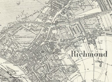
Figure 8 OS map, 1860s
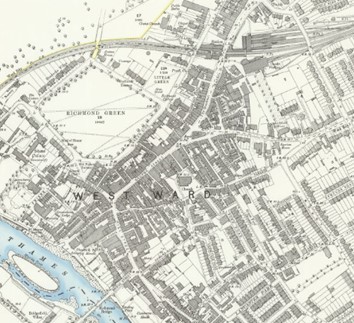
Figure 9 OS map, 1890s
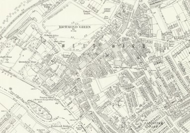
Figure 10 OS map, 1910s
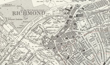
Figure 11 OS map, 1930s
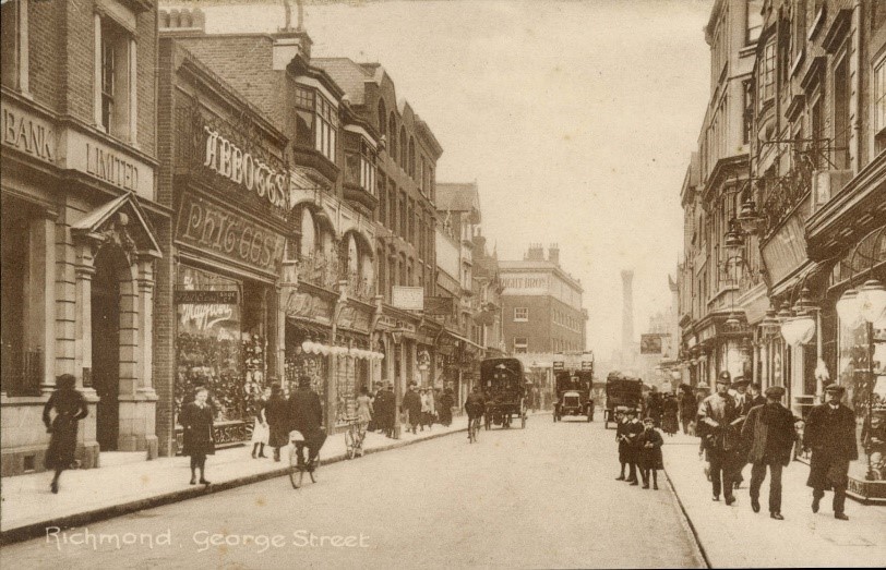
Figure 12 George Street, c.1900s
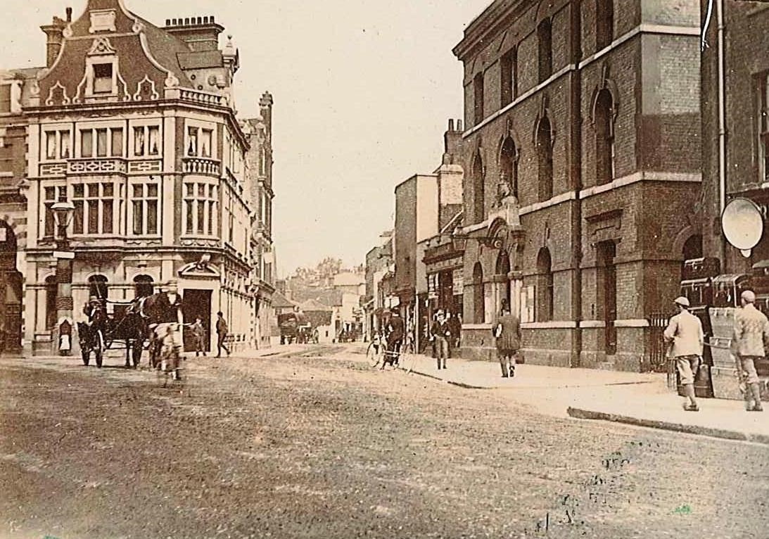
Figure 13 Lower George Street, late C19th
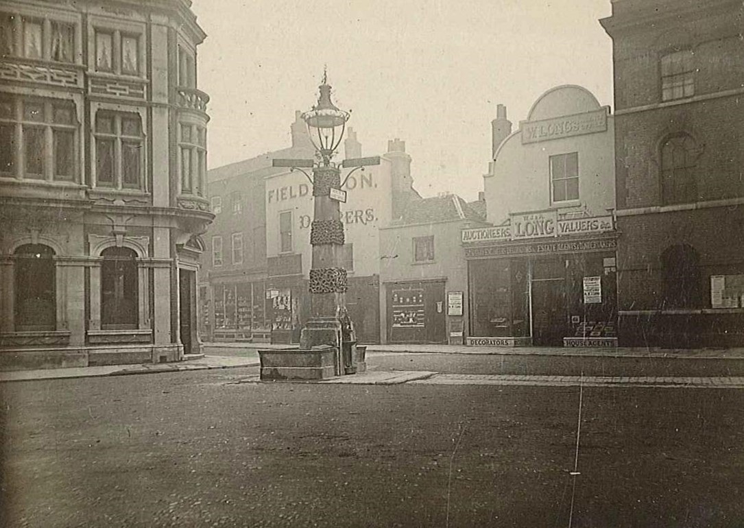
Figure 14 Junction of Lower George Street and George Square, late C19th
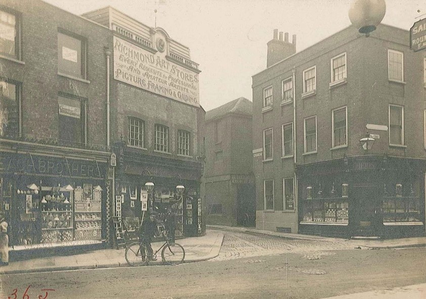
Figure 15 George Street, 1907
Figure 16 Design for new shop front in George Street, 1893
Figure 17 Richmond Riverside development as viewed from Bridge Street
Figure 18 Odeon cinema, Hill Street
5. Architectural Quality and Built Form
Character areas
Central Richmond has a varied character and for ease of appraisal, it has been divided into the following sub-areas each with its own distinct character:
1. The Commercial Core - consisting of Hill Street, George Street, The Quadrant, Kew Road, as well as the associated alleys and side streets.
2. Parkshot - giving access to Richmond Green.
3. Paradise & Sheen Roads - The edge of centre streets supporting a wider, less concentrated mix of uses along Sheen Road, Paradise Road, and Red Lion Street area.
4. St. John’s Road – a residential enclave including St. John’s Church , and Larkfield Roads
Character Area 1 - Shopping Core
Summary Description
The Central Richmond Conservation Area primarily covers the site of the former village centre associated with the royal manor and palace. Although this area had been substantially redeveloped in the 19th and 20th centuries, much of the historic street pattern has survived, including the numerous lanes and alleys leading off the main shopping streets, which are a particularly valuable characteristic of Richmond.
Character Appraisal
Townscape and Spatial Analysis
Bridge and Hill Streets
The junction of Hill Street, Bridge Street and Hill Rise marks a strong gateway into the town centre, contrasting with the open aspect of the river and the well-treed approaches from Richmond Hill and Petersham Road. The junction is defined by the prominent high-quality buildings of Bridge House and the Odeon cinema. From a pedestrian perspective, this is not a pedestrian friendly environment due to the high volume of traffic that converges at the roundabout in front of the cinema; however, the recent installation of a zebra crossing near Richmond Bridge between the Pitcher and Piano pub and Bills Restaurant now provides a safe crossing point.
Figure 19 Passageway between Ormond and Wakefield Roads
Figure 18 Ormond Terrace (in CA 5) with view of the Odean cinema on the left
Ormond Road and Castle Yard lead off Hill Street. Ormond Road is located in the adjoining Richmond Hill Conservation Area. It is a narrow street with pleasant views to the residential area beyond. Initially it is a well-defined space framed by an impressive, listed terrace on one side and the varied side elevation of the Odeon cinema on the other. Beyond the cinema the enclosure is weakened with views into Castle Yard. This is a rather nondescript space with the modern Castle Yard House dominating the street, and the cinema annex providing an uninviting facade, though there is an important view through to the Old Town Hall.
Figure 20 Macarthur House, Castle Yard
Figure 21 Lewis Road looking towards Lion House with old police station on the right
Figure 22 Castle Yard, between Hill Street and Lewis Road
Figure 23 3 Castle Yard
George Street
At its northern end, Hill Street takes a strong north-western turn and transitions into George Street, a linear section of the ‘high street’ area which has a strong sense of enclosure and views outward at either end are characterised by distinctive buildings. At the northern end, a distinctive pair of buildings are at the centre - the ornate Dutch gable of 39 and glazed elevation of No. 40, behind which the fish-scaled zinc cupolas of the listed Dome Buildings emerge. These buildings form an interesting and rich visual experience, as well as a focal point before the street splits to form Lower George Street and The Quadrant beyond. Looking southwards, there continues to be a mixed array of architectural styles, with a number of more modern buildings including 67, 80 and 83-84 George Street.
80 George Street is one of the landmark properties in Richmond town centre. It is a dominant viewpoint and landmark for anyone approaching the town centre from the direction of Richmond Bridge.
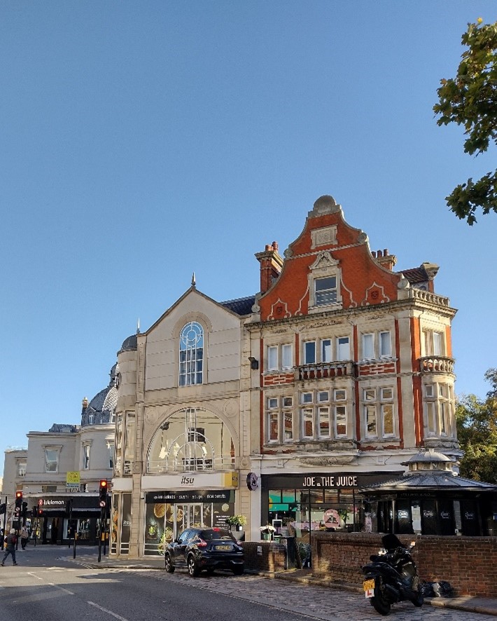
Figure 25 Lower George Street and The Square
Figure 24 Former House of Fraser building, 75-81 George Street
Figure 26 George Street with 75-81 on the left
Figure 27 83-84 Hill Street / Water Lane Building looking towards Water Lane
The town centre has no significant formal open spaces. However, at either end of George Street there are distinctly identifiable urban spaces punctuating the tight knit urban form. The junction of five streets at the southern end is a space in which the human scale is overpowered by the busy traffic and its currently unavoidable plethora of signs and traffic lights which also disrupt views of the buildings.
At the northern end is the pedestrian area of Lower George Street and the wider environs of The Square and the Dome Building, which together form part of an interesting sequence and tapestry of rich and varied urban spaces enclosed and defined by a number of buildings of considerable townscape interest.
The modern corner building at Lower George Street/ Eton Street is a good example of incorporating a new building in the existing townscape.
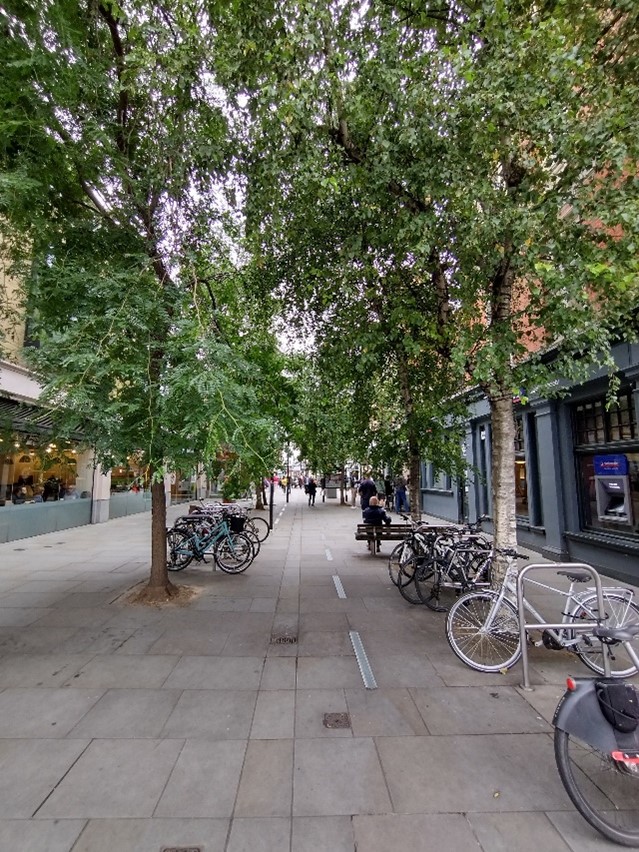
Figure 28 Pedestrianised Lower George Street
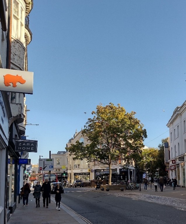
Figure 29 George Street looking towards Lower George Street
Golden Court and Brewers Lane are both historic narrow pedestrian lanes lined with small shops and are ancient routes linking the town and Green. They are quiet, intimate spaces offering a respite from the busy George Street. Traditional hanging signs and a number of historic shopfronts characterise the lanes adding charm and visual interest. Some of the upper floors remain residential, and Brewers Lane has some of the oldest surviving small-scale development in Richmond, much of which is listed. Though the majority of Brewers Lane is located within Richmond Green Conservation Area, it impacts on the character of Central Richmond, showcasing the interconnected characters of these neighbouring conservation areas.
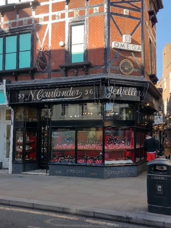
Figure 30 Courlander's shop front 55-56 George Street, on corner of Brewers Lane
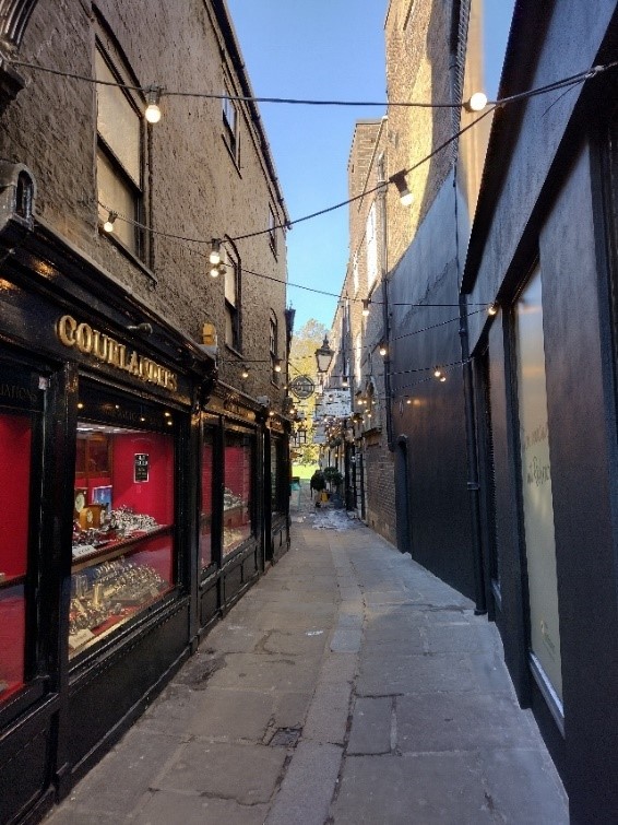
Figure 31 Brewers Lane looking towards Richmond Green
Figure 32 Golden Court looking towards George Street
Figure 33 Church Court
Figure 34 Shopfront in Church Court
Figure 35 Church Walk
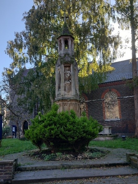
Figure 36 War memorial, Church Walk
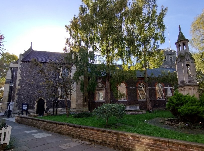
Figure 37 St Mary Magdelene’s Church
On the opposite side of George Street are Victoria Place, Church Court and Church Walk. The entrance to Victoria Place is narrow and lined with good quality side elevations of shops which front George Street. The space opens out into a wide paved area lined by two very distinctive and pleasant terraces of flats with small front gardens and external staircases. The rise in level and a number of large trees give the area a distinctive character and, together with the parade of shops on Red Lion Street, give the space some sense of enclosure. The narrow Church Court is lined on one side by attractive shops and a pub with alfresco dining, and this opens out into Church Walk a quiet pocket space, which contributes to the human scale and activity of the space. The path rises gently to the prominent memorial, consisting of a tall cross with the figure of Saint George, terminating the view and giving glimpses of the green space beyond where the path opens out dramatically to reveal the picturesque knapped-flint parish church of St. Mary Magdalene. Hard landscaping in the form of York stone pavers, and the decorative old lamp standards, make an appealing contribution to the character of the space and have positive townscape value. This is a quiet and secluded oasis of green space unique in the town centre.
The Quadrant
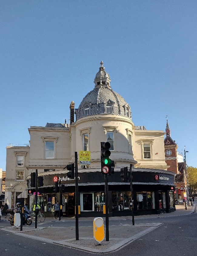
Figure 38 The Dome building, The Square
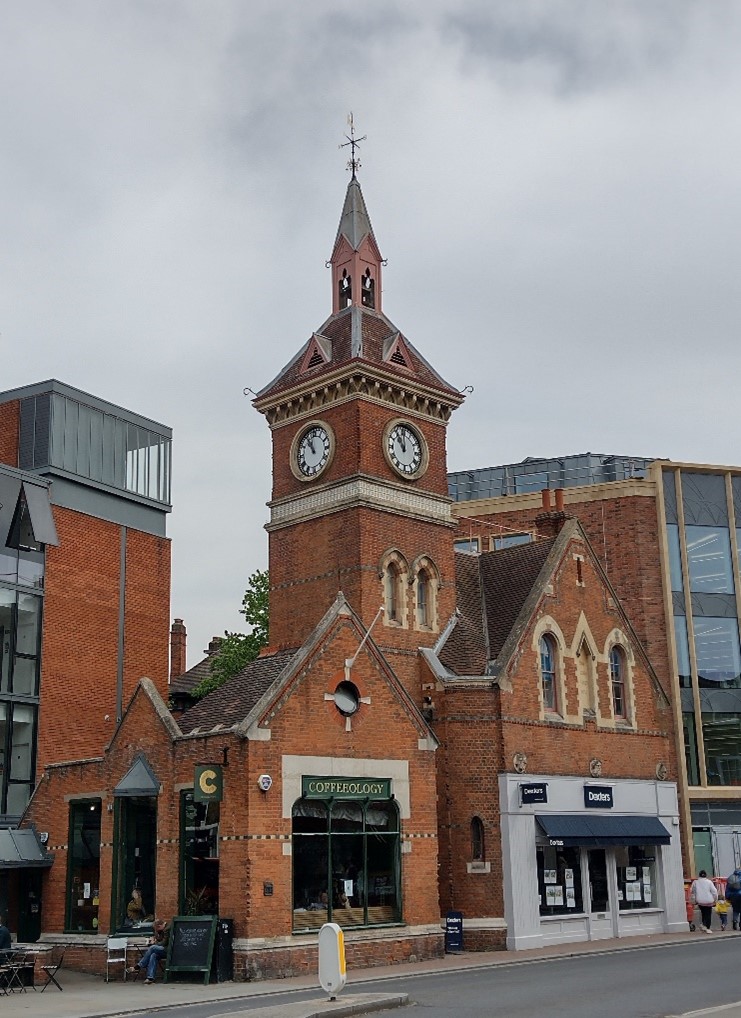
Figure 39 The old fire station, The Square
The island of buildings at Lower George Street and the Dome Building deflects the view into The Quadrant. The Dome Building (grade II listed) is an important landmark that holds and defines the space forming the junction of The Square, George Street and The Quadrant. It is a busy junction with a heavy amount of pedestrian activity. The traffic lights and other street furniture contribute to visual clutter that detracts from the quality of the space and views of the surrounding important buildings. In The Quadrant, the street curves away to the left; it gradually widens and then rises to pass as a bridge over the hidden railway line, opening out into the wider space in front of the railway station. Building forms become more mixed in terms of age and size as well as height, predominantly four storeys, with office buildings of varying scale and quality in the station area. These elements give the road a more spacious character contrasting with the tightness of urban form to George Street. There is a distinctive mixture of brick, stone and render which contributes positively to the character. Building heights are generally within four storeys.
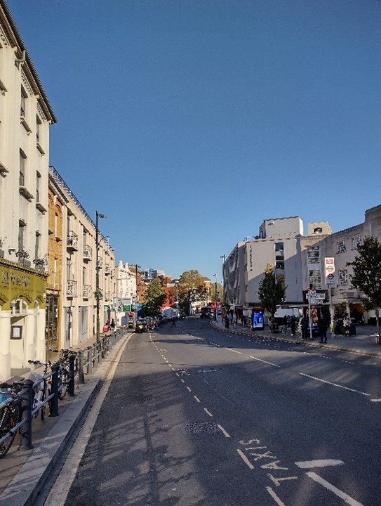
Figure 40 The Quadrant with Richmond Station on the right and Kew Road in the distance
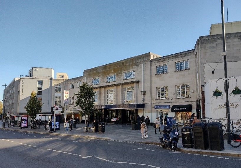
Figure 41 Richmond Station
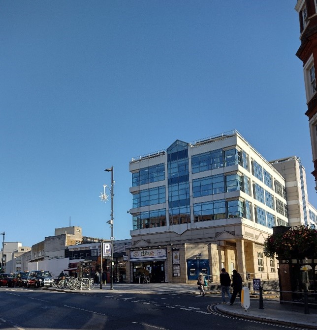
Figure 42 Drummonds Place with multistorey car park and office block
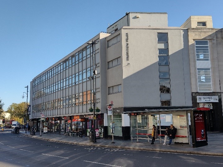
Figure 43 Westminster House
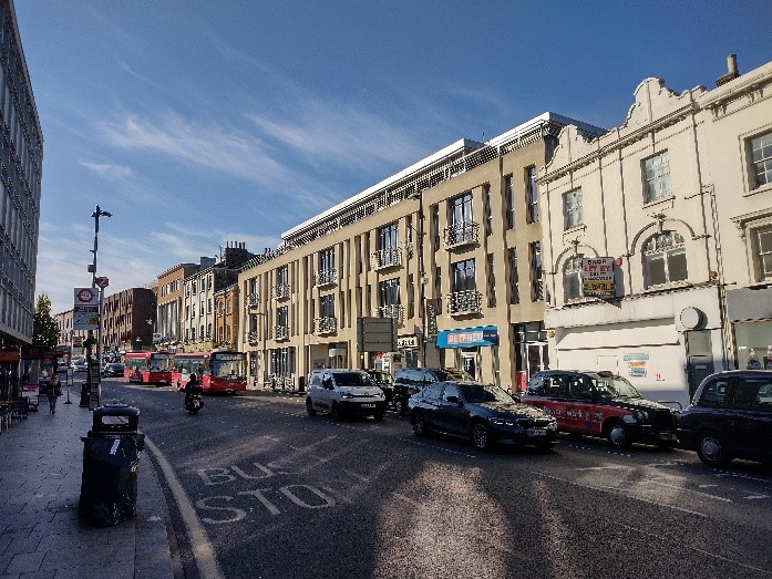
Figure 44 Parkshot House, Kew Road
There are two spaces which are centres of activity in the street: Richmond Station forecourt, and The Square. The area around the Dome Building is a fine townscape element with the adjacent island buildings and old fire station opposite. The heavy traffic mars the pedestrian quality of the space, and an escape can be found in the narrow pedestrian passage behind the Dome Building, where small retail units give the space an intimate and human feel. The space in front of the station is marked by the impressive and simple Art Deco façade of the station building. Previously, the space was dominated by taxis and buses, but it now forms a pedestrian-friendly public space that welcomes people as they emerge from the station to enter the town centre. Although there is an overall distinctive mixture of brick, stone and render finishes, which contributes positively to the character of this area, the setting of the station building is somewhat compromised by modern office blocks and car parks on all sides.
Richmond Station (which is a site allocation in the Council’s Local Plan) provides a major redevelopment opportunity in the area, which could provide substantial interchange improvements as well as a range of appropriate town centre uses. The site has been identified as being suitable to accommodate a taller landmark building, which should be contextual to its setting and the identified constraints of the site.
Kew Road
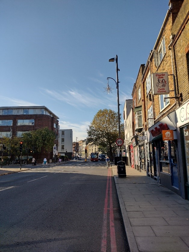
Figure 45 47-61 Kew Road looking towards the junction with Church Road
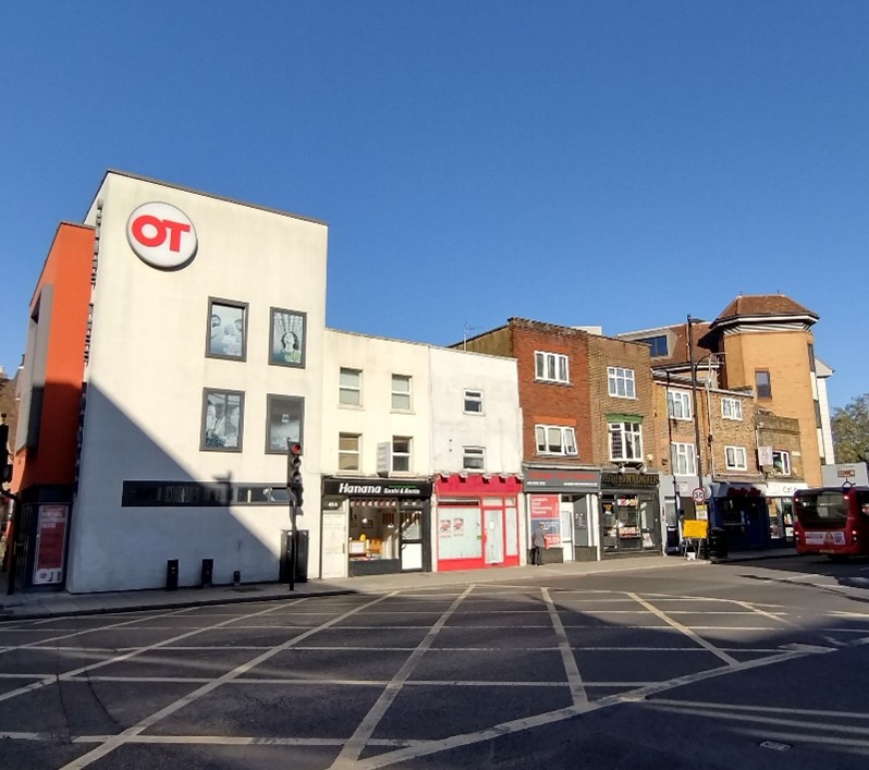
Figure 46 47-61 Kew Road, with the Orange Tree Theatre on the left corner
Beyond the station to the north, The Quadrant becomes Kew Road and again the character of the thoroughfare changes. As the road curves gently to the right, the building line continues in a straight line creating a small open space between the Orange Tree and former Duke of York public houses where outdoor planters and street trees help to define and enclose the space. There is a mixture of building styles of varying ages at this end of the conservation area, though the commercial nature of this area is a unifying factor. The Orange Tree Theatre was built specifically as a theatre in the round, and it is housed within a disused 1867 primary school, built in Victorian Gothic style.
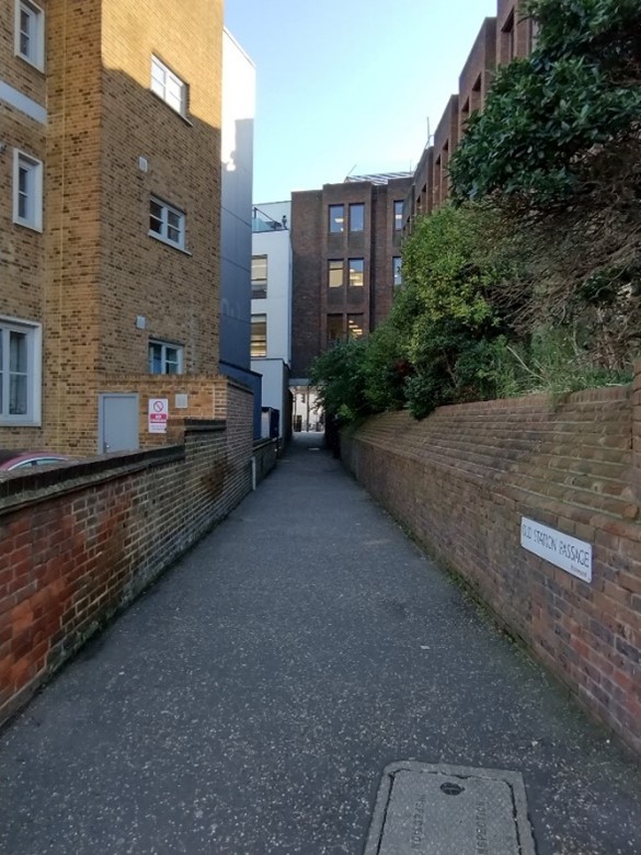
Figure 47 Old Station Passage
Two narrow alleys link Kew Road with the parallel Parkshot. Opposite the railway station a functional and bland thoroughfare – Old Station Passage, the name recalling the siting of the original mainline railway station – runs under Oriel House and is an important pedestrian link from the railway station to Parkshot and the Old Deer Park. Sun Alley is an historic thoroughfare running between the former Duke of York and Sun Inn public houses; very narrow and containing no shops, it is nevertheless more visually interesting than Old Station Passage, as it is lined with a variety of different elevations.
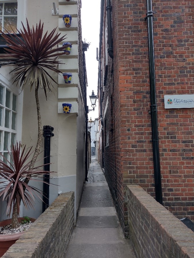
Figure 48 Sun Alley
Architecture
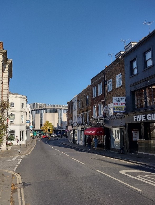
Figure 49 Hill Street looking towards George Street
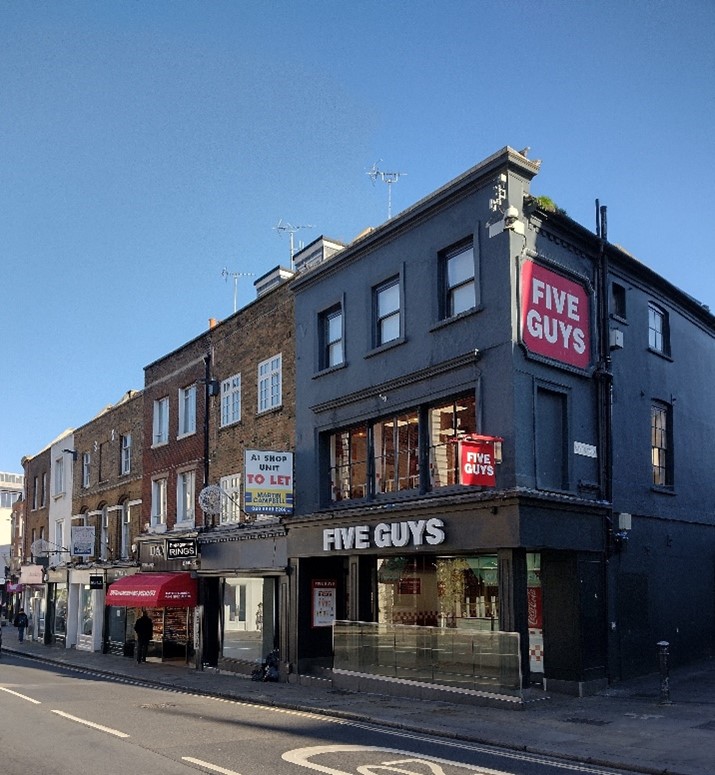
Figure 50 20 Hill Street on the corner of Castle Yard
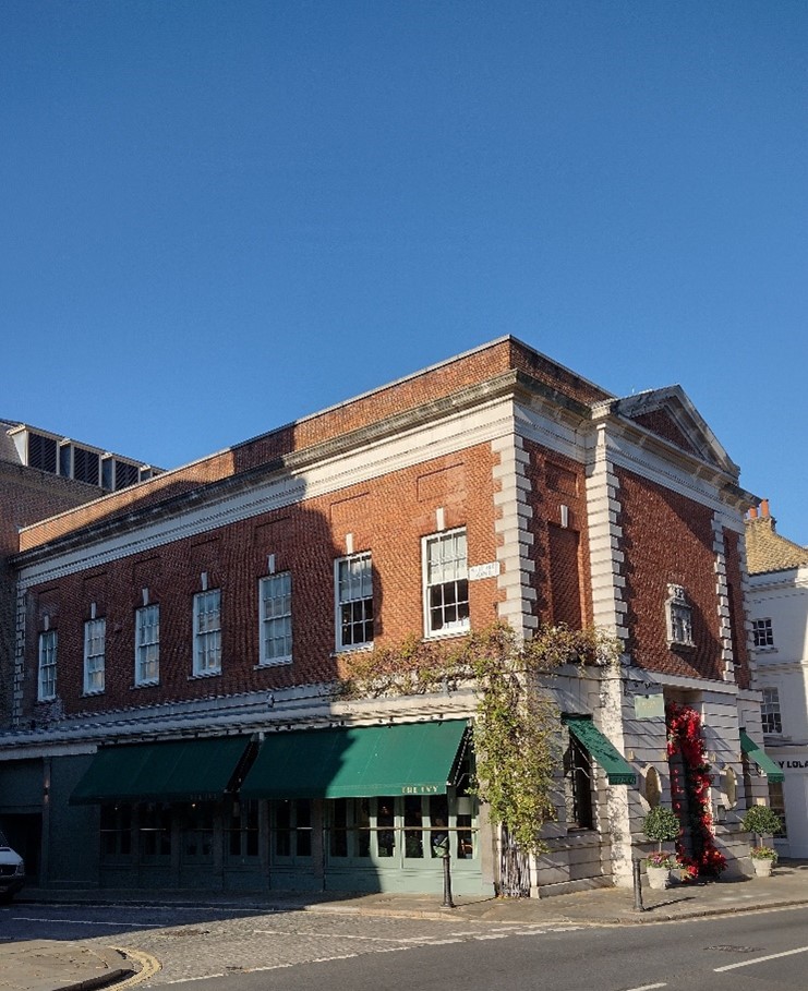
Figure 51 9-11 Hill Street / The Ivy on the corner of Whittaker Avenue
The east side of Hill Street contains mainly 19th century stock brick buildings on original narrow plots, two groups at nos. 2-20 (even) and nos. 22-34 (even) giving a strong vertical emphasis to the character of the street. In contrast, the west side of the street includes buildings which are more imposing in character, with half the frontage occupied by the Richmond Riverside development. It is balanced by the listed Odeon cinema opposite, and its associated block of flats and shops, an impressive expression of 1930s architectural style which forms a bookend to the town centre and focal point leading to the town centre from Richmond Bridge.
Built as a single development, the three-storey block at nos. 22-32 (even) is a cohesive and distinctive element in the townscape. Most of the upper floor windows remain in their original form. Unfortunately, rendering, painting and modern shopfront designs combine to dilute the simple elegance of the block. No. 34 has considerable presence in the street and its distinctiveness is characterised by the gault brick elevations with red brick bands and window arches. It is complemented by a good quality shopfront with polished granite pillars.
No. 5 Hill Street, a listed Georgian building, which was later converted to a cinema but now restored, forms a focal point as part of a historic group at the junction of Red Lion Street.
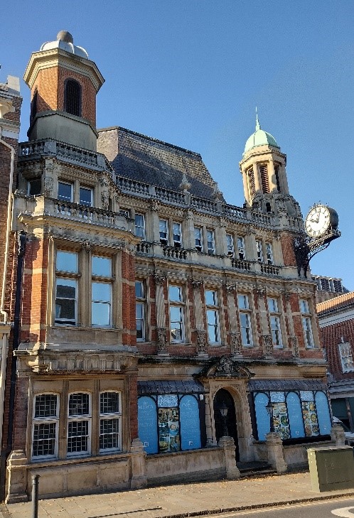
Figure 52 The Old Town Hall, Hill Street on the corner of Whittaker Avenue
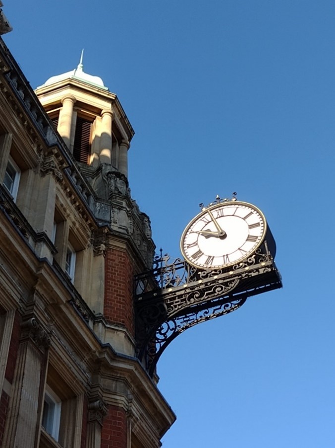
Opposite Castle Yard is the Old Town Hall, 2 Whittaker Avenue, an imposing local landmark with its turret and projecting clock on the corner. Built in 1893 by W. J. Ancell it is of red brick and stone, described by Pevsner as 'mixed renaissance' in style. Also of note is the adjacent former 9-11, a fine free-standing building in classical style which has been sensitively converted from a bank to restaurant and bar.
The eaves line of George Street is varied and uneven, reflecting widely differing architectural styles. Intensive development during the 19th and 20th century saw many new buildings competing for prominence resulting in contrasting materials, unusual details and rich decoration. At ground level many good quality buildings have fared less well. Very few shopfronts original to their buildings survive. Nevertheless, many contemporary shopfronts are of good design and make a positive contribution to the townscape; however, there are still examples that could be greatly improved using more sensitive detailing and materials. A number of brick-faced buildings have either been rendered or painted, often striking a discordant tone in the frontage. The restoration of painted or rendered facades to brick should be encouraged. Also disrupting the visual coherence of buildings are shopfronts which extend across the length of more than one building without altering their appearance to suit the character and proportions of each individual building.
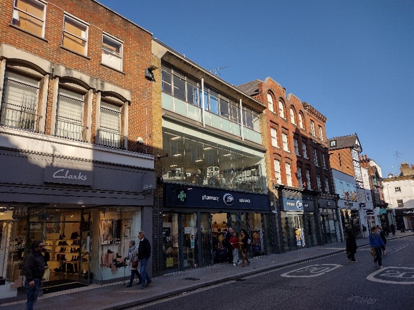
Figure 53 56-64 George Street
The Dome Building is probably one of the most distinctive and prominent buildings in the town centre which survives largely intact from its Victorian/Edwardian heyday, apart from the replacement shopfront. Free standing and semi-circular in shape, it is classical in style with a large fish scaled dome and cupola. Built in 1843 it was originally the Mechanical Institute and then the public baths. Now listed, it has been gradually extended over the years, not acquiring its dome until 1908. Important views of the building exist from George Street and Eton Street.
The old fire station is a local landmark of high quality. Built in red brick with a distinctive clock tower and spire, polychrome window arches and decorative stonework and roundels. It is also listed.
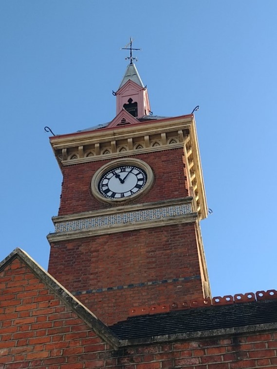
Figure 54 Clock Tower of the old fire station
Figure 55 2 Shopfront in The Quadrant
Nos. 1-18 (incl.) The Quadrant, a purpose-built parade, strongly defines the curve of the street at its southern end and is a good example of confident Victorian commercial architecture and a positive element of the townscape. The convex curve of the elevation ensures that it is never seen in its entirety. The elevations of some units have been altered over time, disrupting the cohesiveness of the façade. The quality of the shopfronts is mixed, with a number of both sensitive and insensitive examples. It is worth noting no. 2 with its unusual neo-Tudorbethan frontage.
Across the street the row of shops at nos. 44-50 (incl.) is an interesting and diverse mix of buildings of different ages and architectural styles, creating interest and variety in the streetscape. At the end of this block is a pedestrian alley leading into Waterloo Place, an important feature in the townscape, featuring a terrace of modestly scaled Grade II listed cottages.
Figure 56 Waterloo Place
The development at nos. 34-40 (incl.) is a modern building that competes with the Dome buildings in scale. The adjacent block at nos. 28-33 (incl.) is a collection of individual buildings of good quality and a variety of styles which are a positive element in the townscape. Of note is no. 28, originally the Railway Hotel and dating from 1888, which is prominently marked with a five-storey octagonal tower and is a local landmark. The listed St. John's Church spire is a landmark on the edge of the Conservation Area, though trees obscure the interesting façade.
Figure 57 29-34 Lower George Street
This building was once a department store topped with a fine dome, now removed.
Figure 58 The Railway Tavern, The Quadrant
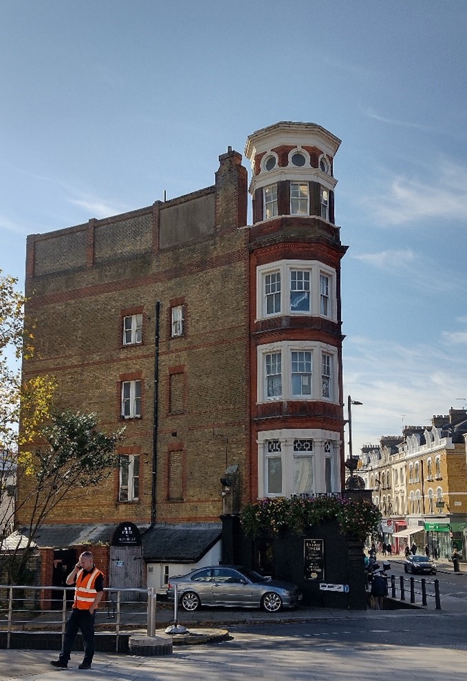
Figure 59 The Railway Tavern side elevation facing Drummonds Place
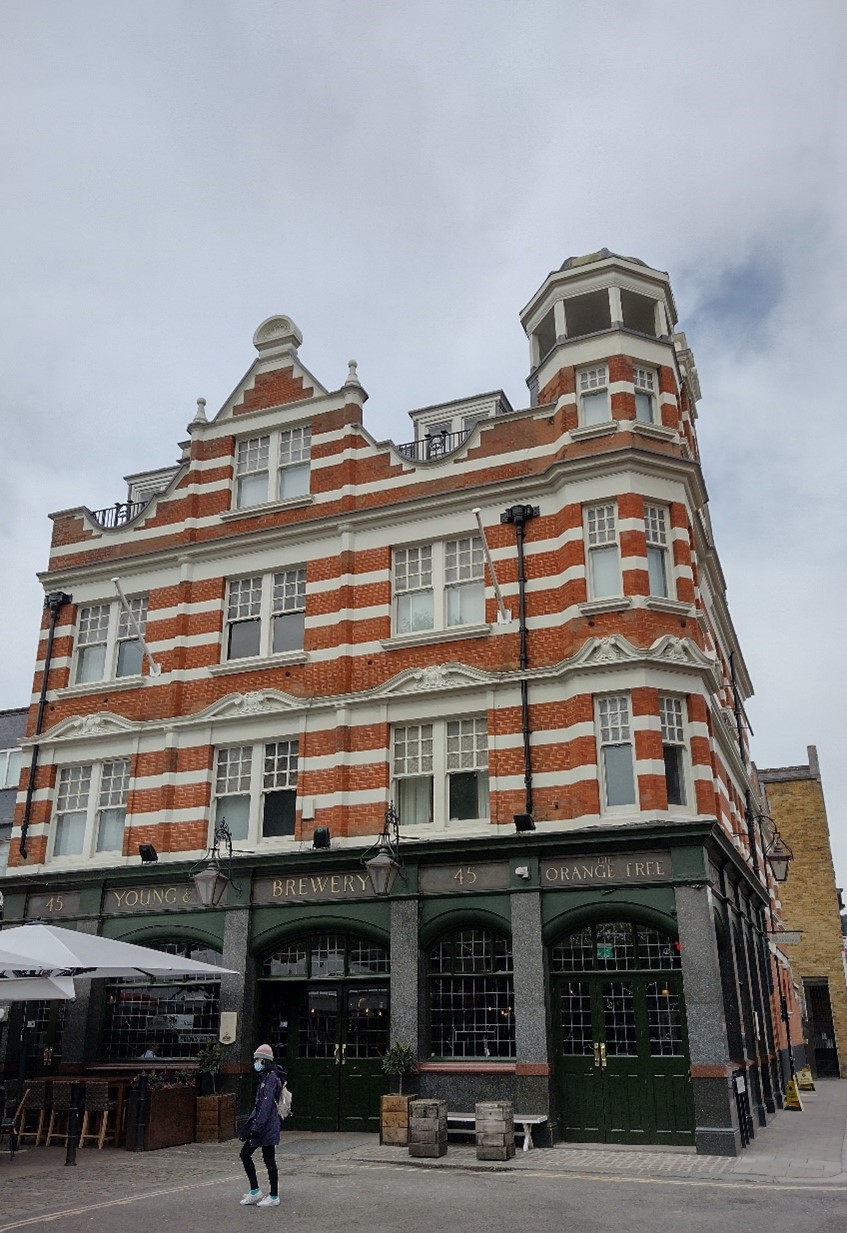
Figure 60 The Orange Tree public house
The west side of Kew Road is notable for its three fine public houses, One Kew Road, the former Duke of York and the Orange Tree. All are buildings which make a positive contribution to the character and appearance of the Conservation Area, though unfortunately the brick facades of One Kew Road and the former Duke of York have been painted over. The Orange Tree is the grandest, resplendent in its bright red façade. It is prominently striped in white stucco bands and a large gable vies for importance with an octagonal corner turret. The building enjoys a prominent corner site with good views from Church Road.
Character Area 2 – Parkshot
Summary Description
Parkshot was originally the lane which ran from Richmond Green alongside the edge of the gardens of the Palace. The A316 now severs this route which survives to the north as St. John's Grove and Kew Foot Road. It is characterised by a mix of building types, including more modern development, and feels somewhat separate and quieter than the town centre despite two linking passages. The primarily residential Park Lane is an important through route from the Old Deer Car Park to the town centre.
Character Appraisal
Townscape & Spatial Analysis
The character area of Parkshot comprises two streets, Parkshot, which is the main historic road, and Park Lane, which leads to the Old Deer Park. Parkshot is a relatively short and linear road, with wider and deeper plots than the town centre which allows for more robust buildings with more generous spacing and setbacks. The row of plane trees in front of Richmond Adult Community College gives most of the street a degree of isolation from the rest of the town, as well as a softer and more suburban character than the more open southern part of the street. The east side of the Street is more tightknit, characterised by larger buildings which fill entire plots and also have a George Street elevation, with some smaller, historic buildings, such as the public house, constructed in the back land of earlier shops. The west side has similarly scaled buildings in larger plots which allows for planting and other landscaping which softens their appearance, with development broken by liberal gaps between. The southern end is characterised by a short terrace of large Georgian townhouses and a modern building which turns the corner to Park Lane. South of this Area, starting at the bridge over the Area, is the Richmond Green Conservation Area.
Park Lane is more residential, with a group of simple two storey brick terraces occupying most of the south side. The terraces lack front gardens and soft landscaping and have a distinctly urban character which contrasts with the mature planting and gardens to the north side of the street. The north side is characterised by a large block of flats with distinct gambrel roofs and a former church building which have a more village/rural appearance. Park Lane terminates at the east entrance to the Old Deer Park carpark and is frequently used as an access point by pedestrians to reach the town centre, leading straight to Old Station Passage.
Architecture
Figure 61 Rear view of Parkshot House
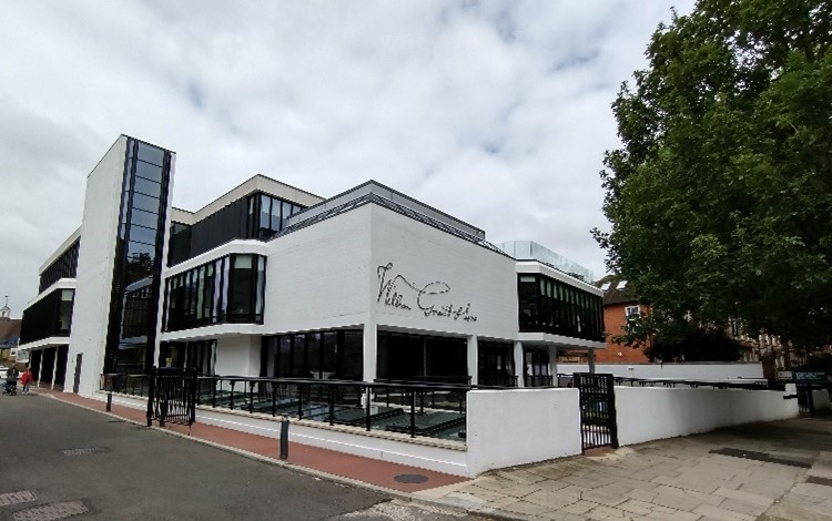
Figure 62 Former Magistrates' Court, Parkshot
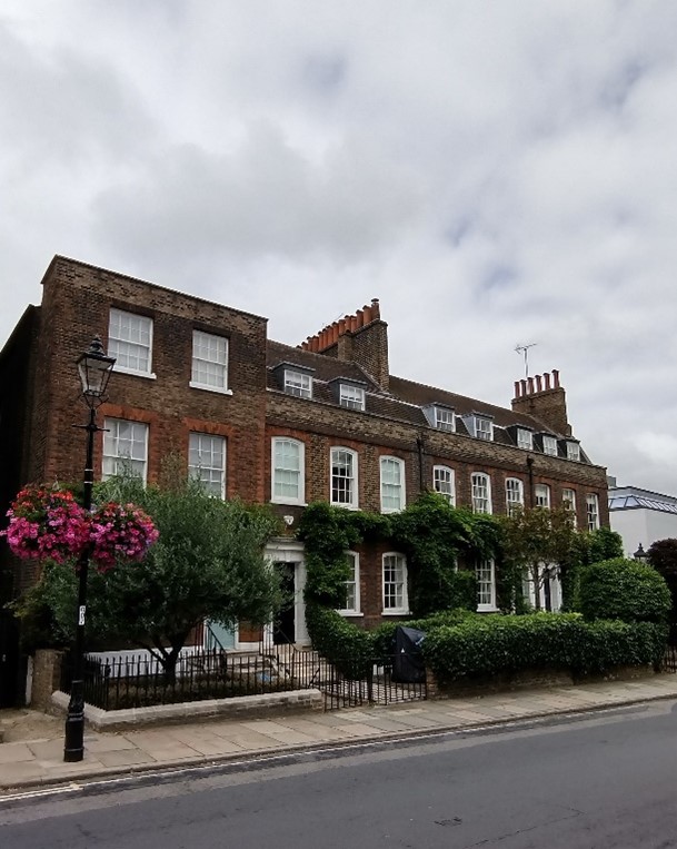
Figure 63 Terrace at 3-6 Parkshot
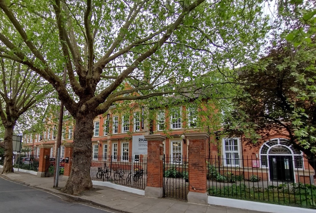
Figure 64 Richmond Adult Community College
The street is a wide mix of building types and scales ranging from 20th century office blocks to earlier buildings of a more domestic scale. The office buildings, concentrated on the eastern side of the street, are quite large with simple elevations. The former Magistrates Court, built in the 1970s, is an elegant and uncompromisingly contemporary design contrasting strongly with its more traditional neighbours - a fine 18th century group of listed townhouses and the handsome façade of the Community College. The College was built at the turn of the century as the Girls' County School and is suitably imposing, built in red brick with stone dressings and sitting behind high iron railings. A row of mature limes gives the boundary even stronger definition and reinforces the presence and setting of the building at close hand.
Park Lane also has a mixed character, built to a smaller scale and with less generous spacing. Nos. 1-14 are very simple stepped terraces, two storeys in in multi coloured brick, and have a modern, urban appearance in contrast to the buildings on the north side of the Lane. The Gateways is a large Arts & Crafts inspired block of flats with distinctive gambrel roofs flanking a central element with projecting bays and balconies. Just east of the flats is a converted Building of Townscape Merit, a former school building which has been expanded into flats. This original Victorian building is well preserved with ornate details prominent to its south elevation, and its appearance softened by a mature front garden.
Character Area 3 – Paradise and Sheen Roads
Summary Description
The streets to the edge of the town centre are transitionary in their character and use, and include Sheen Road, Paradise Road, Red Lion Street, and Eton Street. There is a notable increase in residential use, particularly as one travels east toward the area of Richmond Hill. The western side of the main roads maintain a commercial character with many buildings having shopfronts on ground floor, often with more clearly residential use above or within purpose-built blocks of flats. The scale of buildings remains robust in contrast to the terraced lined streets which surround to the south and west, but these larger buildings are more generously spaced and often set back into their plots, giving the impression of a more suburban character. Infill development of small cottage/terrace type groups with mature planting help amplify this character, as do the grounds around St Mary Magdalene Church, and more frequent employment of street trees.
Character Appraisal
Townscape & Spatial Analysis
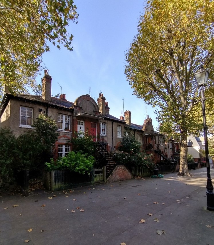
Figure 65 Victoria Place
Figure 66 Detailed view of house in Victoria Place
Figure 67 Victoria Place looking towards Red Lion Street
Originally, Red Lion Street was a narrow and winding alley, though Paradise Road was more suburban in character. Both streets were widened in the early 20th century though retaining some of their original winding nature. As a result, most of the buildings date from after this period. The streets have generally no strong sense of enclosure as building lines are varied with little continuous built frontage, although nos. 8-32 Red Lion Street are an exception to this. Another coherent building form can be found at the eastern end of Paradise Road. A positive feature of Red Lion Street is the group of mature London Plane trees at the top of Victoria Place which merge into the greenery of the trees in the graveyard of the parish church, its open aspect allowing important views of the church in its setting. The 18th century listed Halford House (located within Richmond Hill Conservation Area) terminates the vista along Halford Road from St Mary Magdalene’s Church, which is lined by pleasant terraces of houses. The northern section of Halford Road is located within this conservation area, with the majority being in neighbouring Richmond Hill.
Planting in Wellington Yard as well as Vineyard Passage and the Burial Ground (located within Richmond Hill Conservation Area), provide a further positive green break in the townscape.
Figure 68 Halford Road (from northern end)
Figure 69 Halford Road (from northern end)
Figure 70 Church Terrace (left) and Hermitage House (right)
The listed Church Terrace provides a positive element in this street of the same name. On the contrary, Wakefield Road is a rather uninspiring space; it suffers from views to the rear elevations of shops on Red Lion Street and the functional space of the bus station. This was once a cricket green with the Victorian pre-fabricated building with front gables facing it being the club house, but now a restaurant (in the Richmond Hill CA 5).
Figure 71 Wakefield Road with the bus station in the background
Figure 72 Wakefield Road (junction between conservation areas 5 and 17) with the old cricket pavilion on the left
Figure 73 St James' Cottages looking north
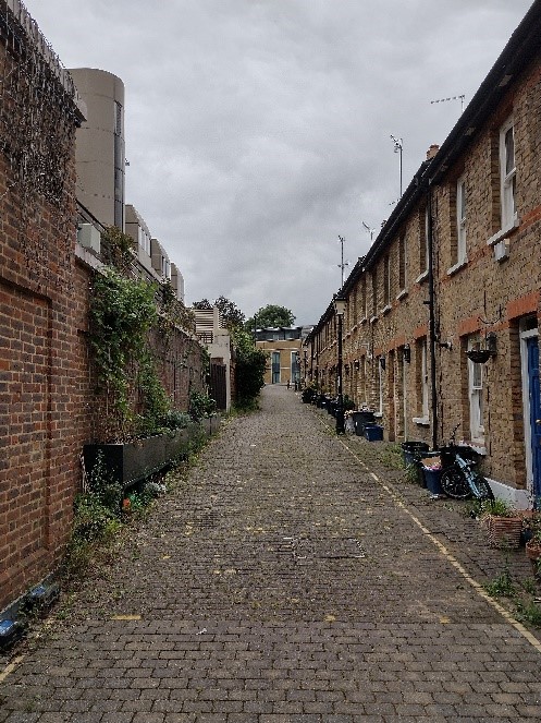
Figure 74 St James' Cottages looking south
Immediately adjacent to Wellington Yard is St. James's Cottages, a narrow lane lined on one side by a simple terrace of small Victorian cottages. Their character is defined by their seclusion and uniformity and intact elevations, the stepped eaves line and chimneys being dominant features. Where original brick setts survive, these also make a positive contribution to the streetscape.
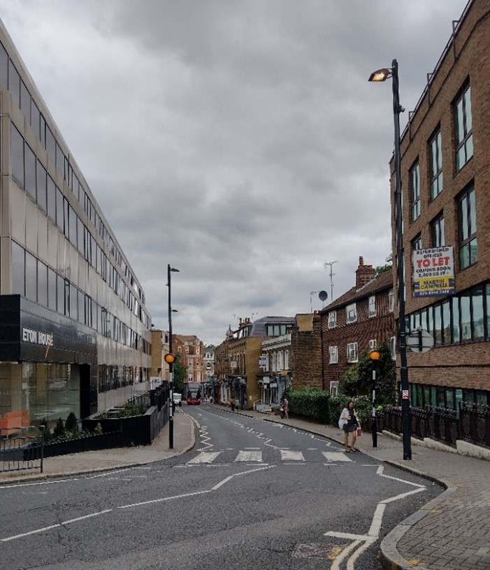
Figure 75 Eton Street as viewed from Paradise Road
From Eton Street, the cupola of the Dome Building and the corner of the island buildings define a fine and attractive view to the town centre, in stark contrast with the view in the opposite direction towards Ambassador House. The west side of Eton Street has suffered from insensitive modern development, but the east side of the street retains many of its brick-built 19th century buildings. Stepped parapets at nos. 2-10 (even) emphasise the slope of the street, and the group includes a number of original shopfronts of good quality which are attractively detailed and add interest and variety to the street scene.
The wide aspect of Sheen Road in conjunction with the angled parking, street trees and narrow ends to the street give it a strong sense of enclosure, the character being more of a 'place' than a thoroughfare. The town end of the street is the focus for a number of the alleys, which characterise the town centre. In addition to The Passage and Waterloo Place/Prince's Street, there is an interesting and secluded network of alleys behind the listed terrace at nos. 3-21 (odd) Sheen Road. The routes permeate into the heart of the block opening out into a series of informal, secluded and peaceful spaces with generous tree cover and focusing on Union Court.
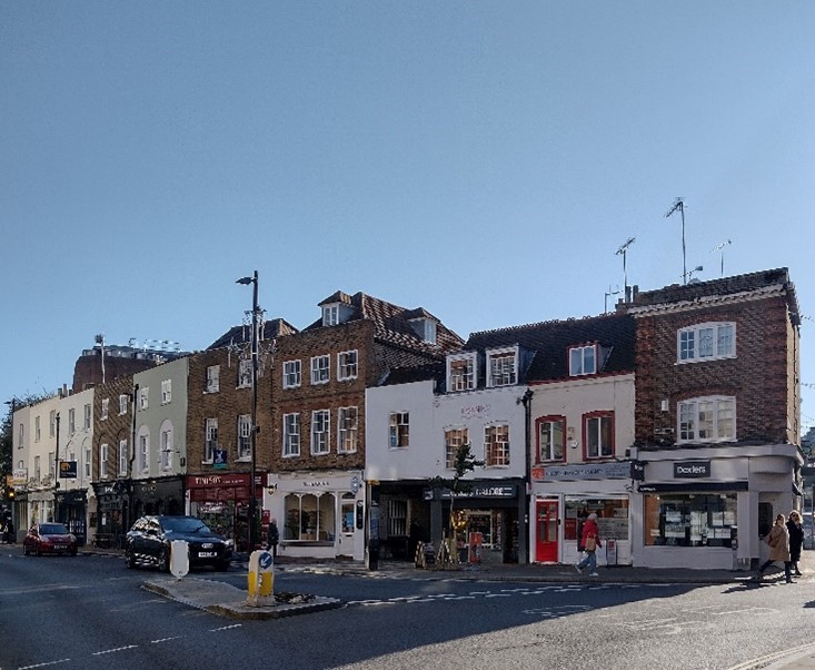
Figure 76 Numbers 1-21 Sheen Road
St. John's Church is most prominent from Church Road where the spire and south elevation terminate the view northwards. Here, the bend in the road creates a space which is characterised by a number of good-quality early Victorian town houses and the former church hall.
Architecture
The entrance to Red Lion Street is framed by the impressive, curved corner buildings at 1 George Street and nos. 2-6 (even) Hill Street. With pale yellow brick facade and curved bays above street level, Lion House presents a positive Art Deco façade.
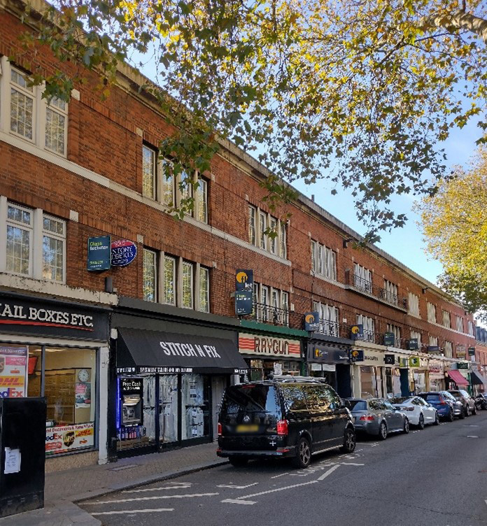
Figure 77 Numbers 8-32 Red Lion Street
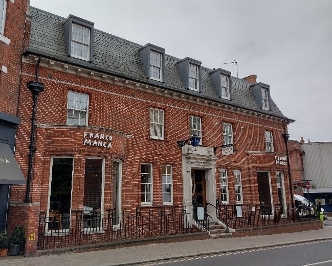
Figure 78 Old Police Station
The red brick former Police Station and 1920s terrace of shops at nos. 8-32 (even) Red Lion Street present a positive and lively aspect to the street and with the tree cover create a more pleasant and interesting space for pedestrians. Opposite the churchyard is a short terrace of buildings of varying appearance, and together, they have a rather pleasant organic and informal character. The refurbished cottages at nos. 10-16 (even) Paradise Road maintain the modest scale of the street at this point.
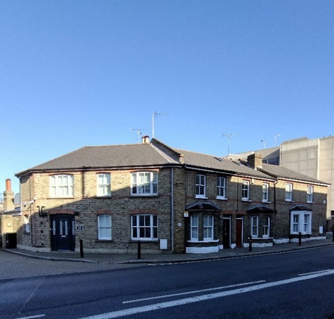
Figure 79 Numbers 10-16 Paradise Road
The many office buildings in this area have a particularly negative impact on the character of the Conservation Area, this being especially evident at the junction of Paradise Road with Eton Street near Grade II listed Hogarth House, once home to Virginia Woolf. Vestry House, no. 21 Paradise Road, originally the Old Courthouse and part forming the entrance to Vineyard Passage and Burial Ground, is a modest brick-built building retaining an air of civic importance and stands out as a positive element. The Christian Science Church at the junction with Sheen Road is a prominent local landmark at the gateway to the town centre from the east.
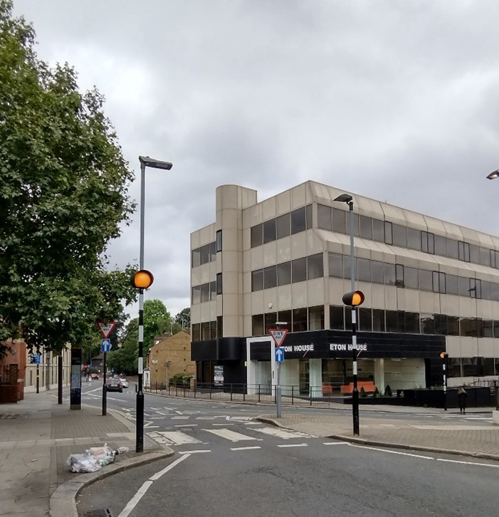
Figure 80 Eton House, 18-24 Paradise Road
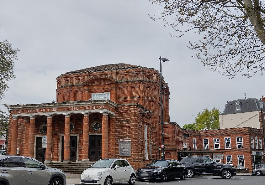
Figure 81 Christian Science Church, on corner of Paradise Road and Sheen Road
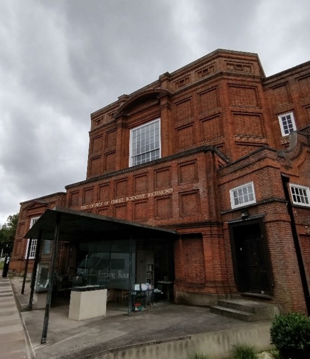
Figure 82 Christian Science Reading Room, Sheen Road
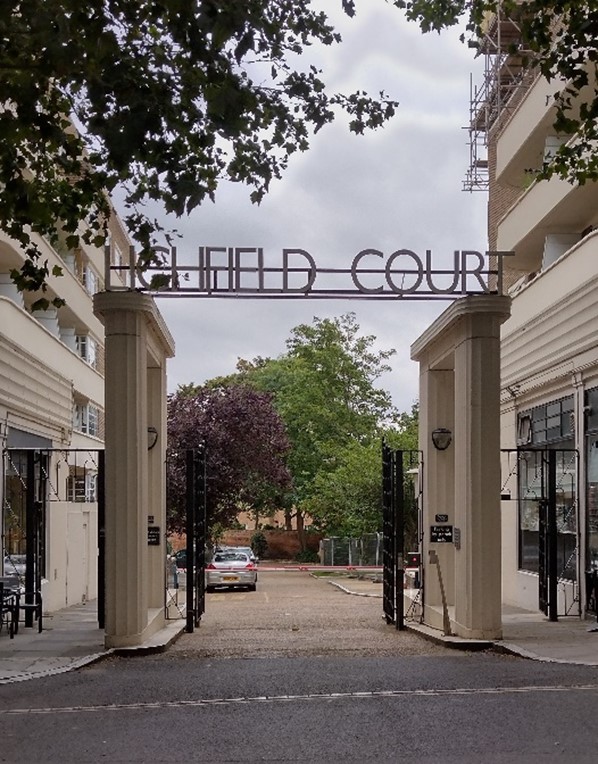
Figure 83 Lichfield Court, Sheen Road
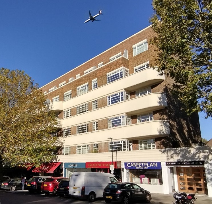
Figure 84 Lichfield Court, Sheen Road
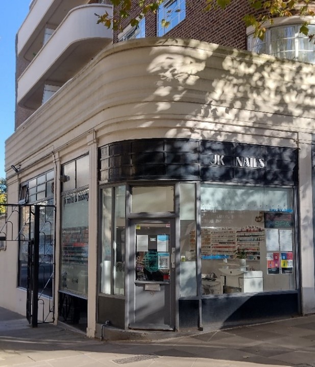
Figure 85 Shopfront, Lichfield Court, Sheen Road
Of the four residential blocks dating from when Sheen Road was widened, the two Art Deco blocks on the north side forming Lichfield Court are the most distinctive. The parades of shops, maturing trees and parking bays create a smaller human scale corridor of space away from the passing traffic. The listed terrace at nos. 1-21 (odd) is the only group on the street dating from before the road widening. It marks a return to the more pedestrian scale of building seen around the triangular public space. The wide pavement, street trees and seating in front of the terrace forms part of a series of small open spaces around this part of the town centre which includes The Passage, Prince's Street, Lower George Street, and Union Court.
Character Area 4: St. John's Road ( Or Church Road, St John’s Road, Larkfield Road
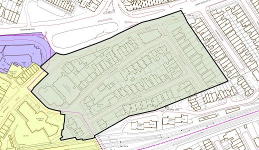
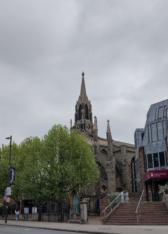
Figure 86 St John the Divine church
Summary Description
The north eastern end of the conservation area – incorporating Church Road, St John’s Road and Larkfield Road – were incorporated as an extension in 2003. This section is notably residential in nature, and contrasts rather starkly with the nearby Kew Road, having a much quieter character, with most traffic due to residents. It primarily contains detached and semi-detached dwelling with repeating patters of building type.
Character Appraisal
Townscape and Spatial Analysis
The character area is a small residential enclave which contains development which responds to the commercial High Street nature of Kew Road as well as more typical 19th century housing, in a slightly different style to the surrounding speculative / Victorian development contained within the adjacent Conservation Areas. The main access points to the area are from Church Road to the west, and both St John’s Road and Larkfield Road are tightly knit with three storey buildings. Both have terminating views toward Larkfield Road which gives the area sense of privacy and enclosure, a sharp contrast given the proximity to the bustling town centre.
Architecture
Church Road links Kew Road and Sheen Road, with the interconnecting St John’s Road and Larkfield Road joining it at the northern end. The bridge over the railway tracks on Church Road is a designated BTM and marks the boundary of Richmond Central Conservation Area with Sheen Road Conservation Area (31).
St John the Divine Church (Grade II listed) and church hall make a strong contribution to this end of the conservation area, with the main church façade and spire featuring along the thoroughfare of Kew Road and hall located next to the residential streets of Church Road and St John’s Road. Built in 1836, and a parish in its own right since 1838, it was designed by Lewis Vulliamy in the early Gothic Revival architectural style. The later church hall, built in brick, was constructed in 1911.
Both St John’s Road and Larkfield Road are lined on both sides with residential properties. Overall, they are predominantly characterised by two-storey detached and semi-detached houses, with canted bay windows, rendered window surrounds and pitched porches. Houses on Larkfield Road are largely constructed of yellow stock brick walling with red brick banding while those on St John’s Road are of red brick. A significant portion of the original front gardens with boundary walls have been replaced in favour of hardstanding for vehicular parking. Similarly, many of the original tiled paths have been removed and replaced with less decorative and less sensitive modern alternatives.
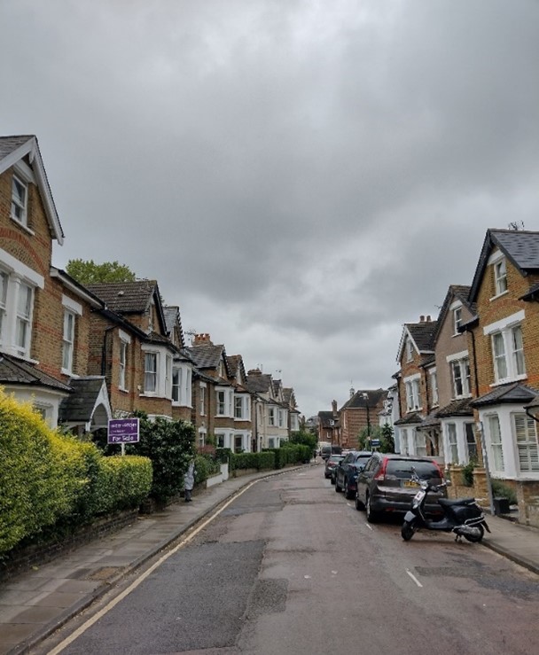
Figure 87 Larkfield Road
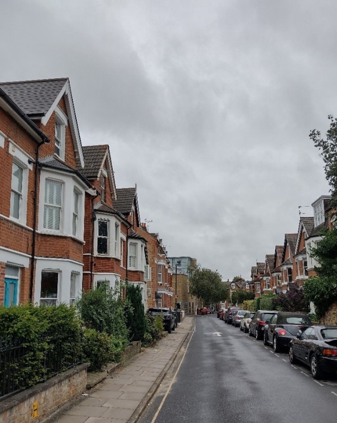
Figure 88 St John's Road
6. Architectural Details
The following section includes a selection of architectural details which are common to and characteristic of the Conservation Area as a whole. These are elements which add visual and historic interest and demonstrate the variety and richness of the area. They are both examples of features which are desirable to retain, as well as elements which can be used as inspiration for future development. The scope of this gallery is not exhaustive, and included images are merely a visual aid and their inclusion is not intended to highlight significance beyond elements which are not featured.
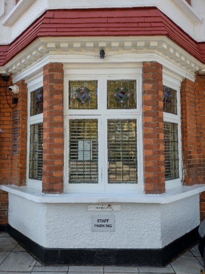
Canted bay window with stained glass detailing, Paradise Road
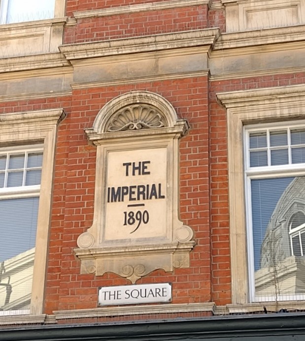
Plaque with building name and date inscription, The Square
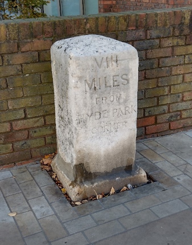
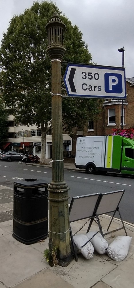
Masonry milestone, Kew Road
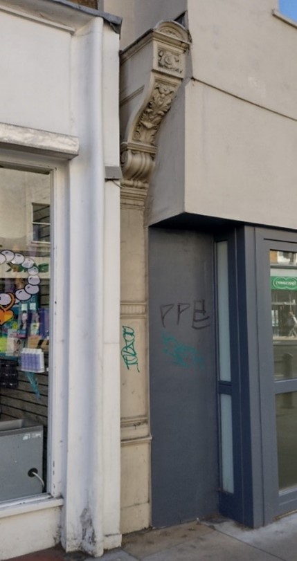
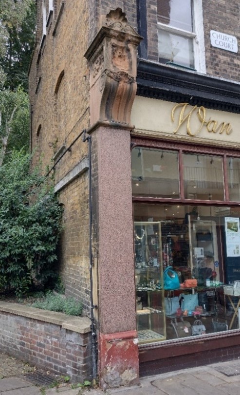
Shopfront pilaster and corbel bracket, The Quadrant
Cast iron window box, St John’s Road
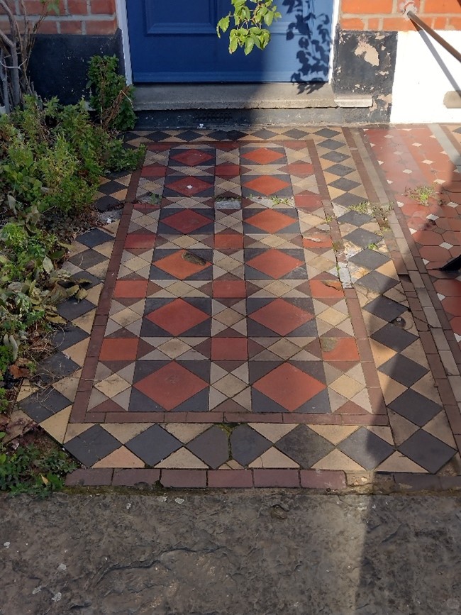
Geometric tiled entrance path, St John’s Road
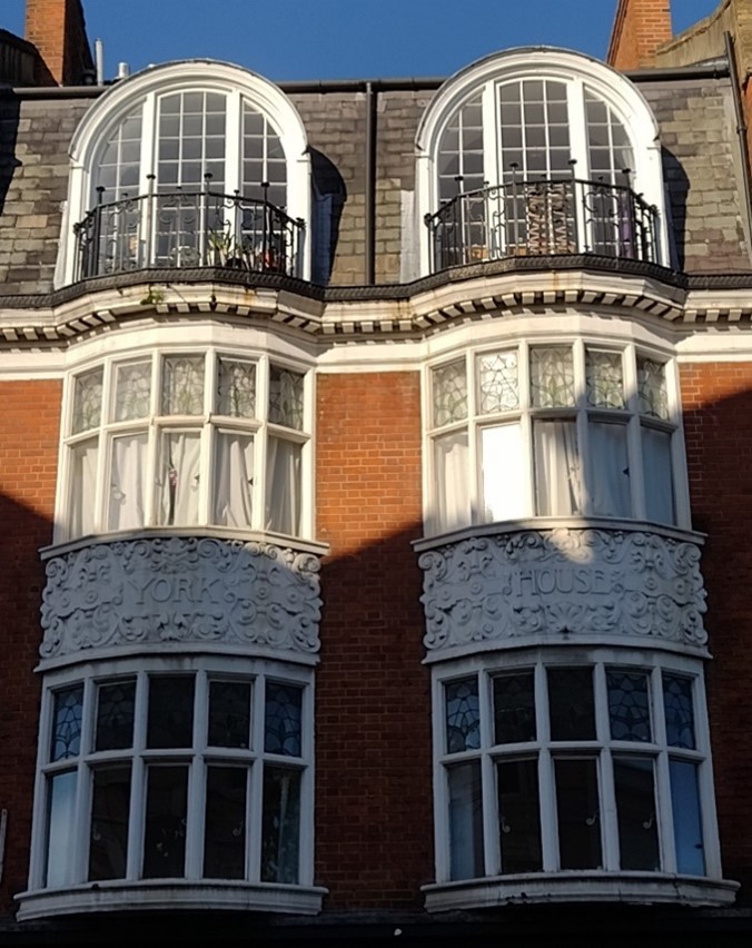
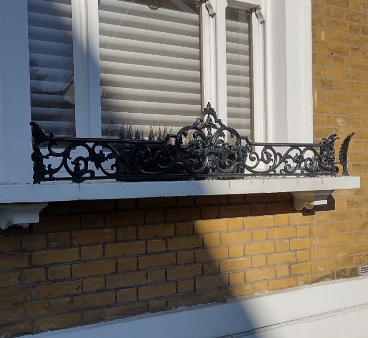
Bow windows, York House, George Street
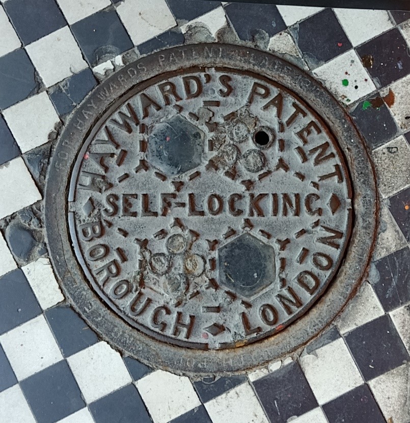
Historic coalhole, Church Court
Decorative window surrounds, The Quadrant
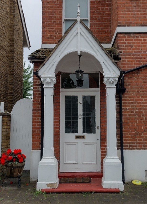
Decorative pitched porch, St John’s Road
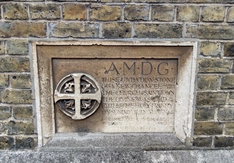
Foundation stone, St John the Divine Church
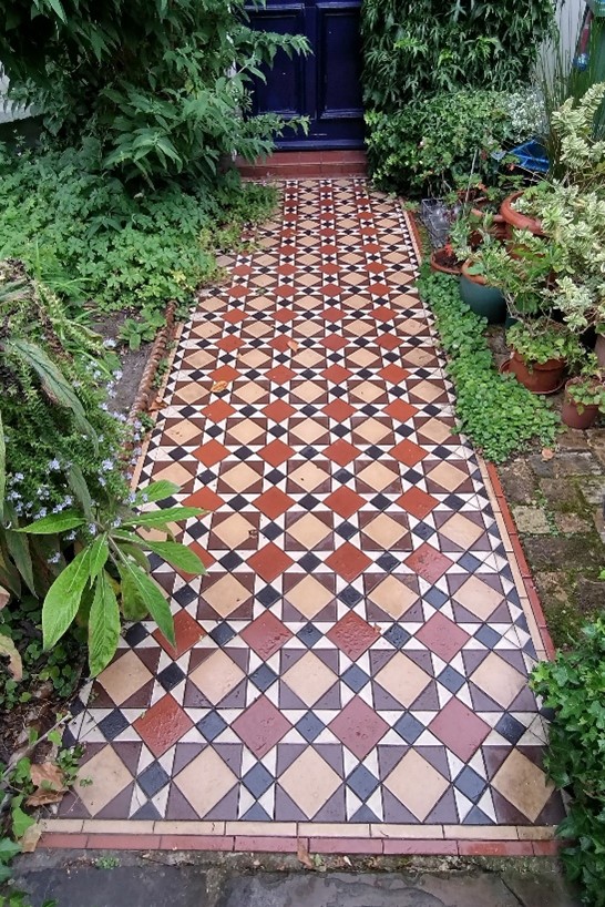
Geometric tiled entrance path, St John’s Road
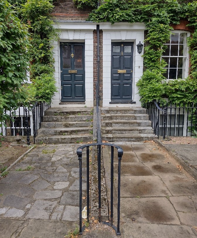
Raised entrances with railings, Parkshot
Opportunities for enhancement and recommendations
- Preservation, enhancement and reinstatement of architectural quality and unity.
- Encourage the restoration of painted and rendered brick facades to their original appearance.
- Retain and improve the quality of shopfronts and advertisements.
- Focus on further improvements for pedestrians in the town centres.
- Redevelopment to improve interchange facilities and the station car park to enhance the setting and sense of arrival to town centre (this is set out as part of a site allocation in the Council’s Local Plan).
- Improve the crossing point for pedestrians at Lower George Street/Eton Street
- Cleaning of the façade to Richmond Station.
- Maintain and improve the distinctive character of the alleyways.
- Resist excessive building heights where this may have a negative effect on character, such as at The Quadrant.
- Rationalise existing signage and street furniture where opportunities arise.
- Increase tree planting and greening of George Street.
- Encourage the reinstatement of appropriate walls, railings and hedges to boundaries throughout the conservation area. Also encourage improvement of existing boundaries where necessary.
- Investigate the potential to improve the service area behind Marks and Spencer to provide a positive frontage along Red Lion Street.
- Seek improvements to the Odeon annex and alley from Ormond Terrace to Castle Yard.
- Improve the appearance of the recycling facilities; those at the top of Eton Street and at Spencer House could be more sensitively sited.
- An upcoming multi-million pound scheme will soon provide a cycle parking hub for 1,000s of bikes at Richmond Station car park.
- Street scene general guidelines: existing areas of high-quality paving (such as stone and granite) should be maintained and extended if possible. Established patterns of street furniture should be continued or refer to the Council’s Public Space Design Guide. Colour street furniture generally black or dark grey.
Historic shopfront pilaster and masonry corbel bracket, Church Court
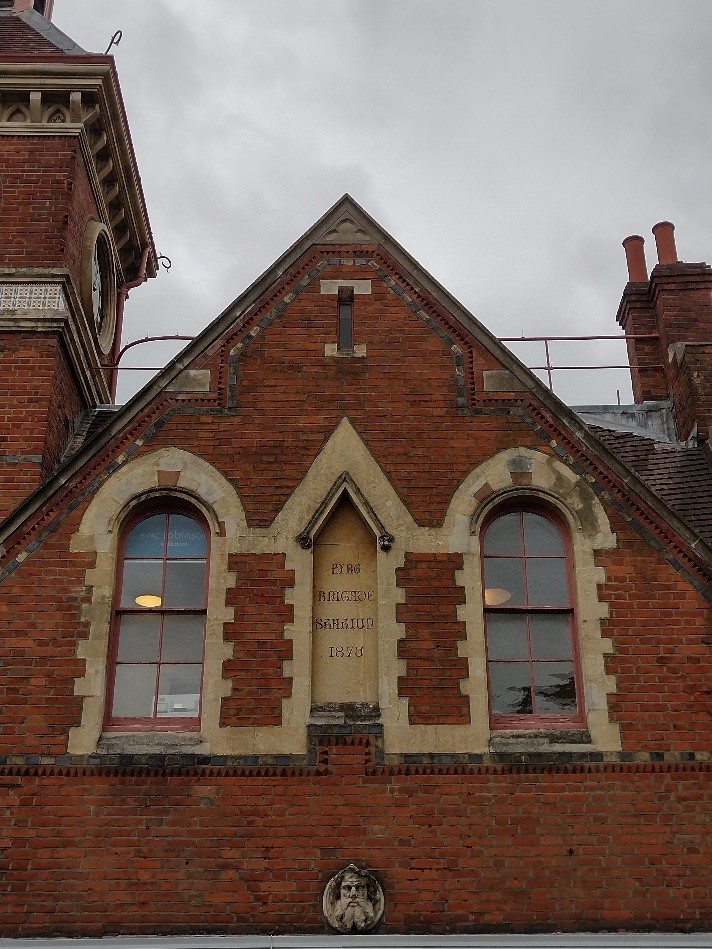
Masonry plaque with date inscription on former Fire Brigade Station, The Square
Sewer ventilation pipe (stink pipe), junction of Paradise Road and Sheen Road
Clock and corner tower, former Town Hall, Hill Street
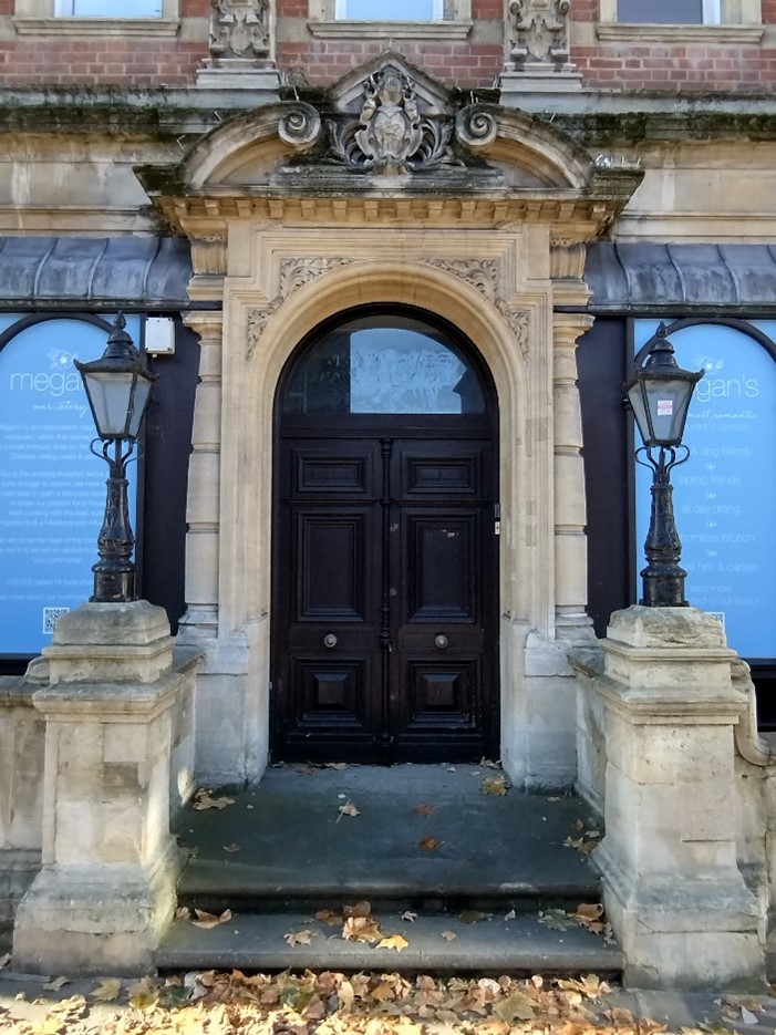
Main entrance, former Town Hall, Hill Street
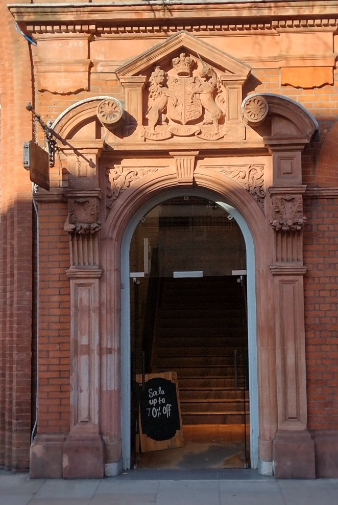
Decorative sandstone door surround, George Street
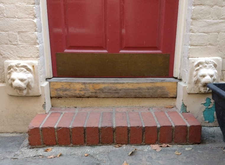
Lion head motifs, Golden Court
Historic curved shopfront, The Square
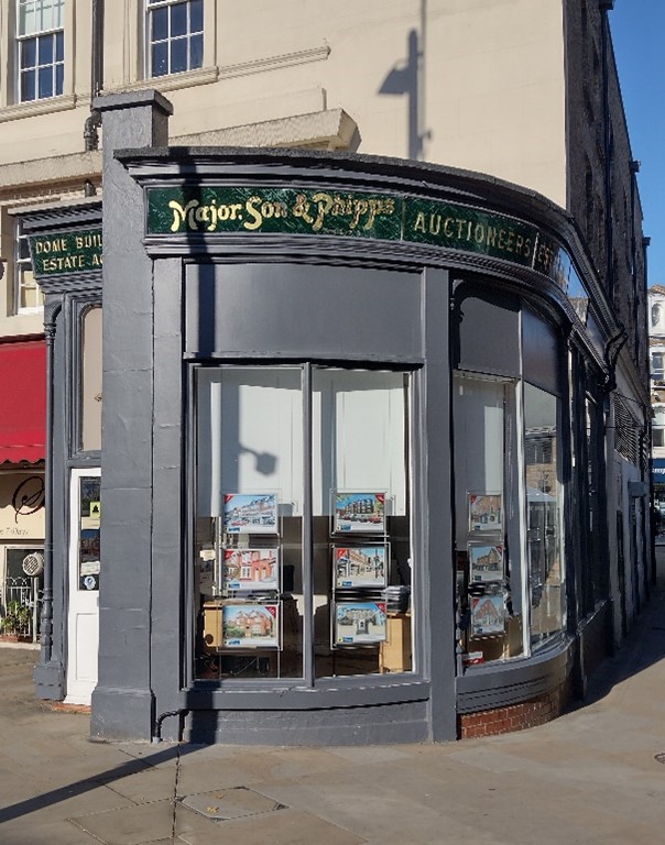
Historic shopfront, King Street
7. Open Space, Parks, Gardens and Trees
Private and public land, front gardens, trees, hedges and street greenery, parks, civic spaces their sense and contribution to the character and experience of an area.
The town centre is a densely compact urban area with no significant formal open spaces. The proximity of Richmond Green, the riverside and Richmond Park, however, means that open space is easily accessible from the urban core.
At either end of George Street there are urban spaces punctuating the tight urban form. At the northern end is the pedestrian area of Lower George Street, The Square and the Dome Building which provide space for cycle parking and outdoor dining for the various surrounding eateries.
Trees are distinctly lacking along the central thoroughfares of George Street and Hill Street, with only a handful at either end, and a slightly larger concentration in the centre, lining Lower George Street. The surrounding streets of Paradise Road, Sheen Road and Parkshot boast more greenery, though it is Victoria Place with its mature London Plane trees, Church Walk and the green space surrounding St. Mary Magdalene Church (the latter which is listed on the Gardens Trust Inventory) that provide a welcome secluded space in the centre where one can sit and relax away from the commercial thoroughfares and traffic.
Given the largely commercial nature of the Central Richmond Conservation Area, modest gardens are very much a feature almost exclusively limited to the residential streets and properties on the periphery of the main urban core, including Halford Road, Larkfield Road and St. John’s Road. Victoria Place and Waterloo Place are perhaps two of the few exceptions.
Part Three: Management Strategy
Summary
The Appraisal has assessed the quality and the condition of the Central Richmond Conservation Area. Several site visits were undertaken between May 2022 and April 2023, when the area was observed and photographed.
This Appraisal has summarised the strengths and weaknesses of the area and this management plan will set out a strategy to consolidate and enhance these strengths and prevent further erosion of the area’s special historic and architectural character.
The Conservation Area is well maintained, and it is hoped that this clearer, more extensively illustrated Appraisal will assist the Development Management process in making more informed planning decisions in respect of the Area’s character. It will also assist applicants to ensure their proposals contribute positively to the preservation or enhancement of the Conservation Area.
Under section 71 of the Planning (Listed Buildings and Conservation Areas) Act 1990 local planning authorities have a statutory duty to draw up and publish proposals for the preservation and enhancement of Conservation Areas in their area from time to time. Regularly reviewed appraisals, or shorter condition surveys, identifying threats and opportunities can be developed into a management plan that is specific to the Area’s needs.
Problems and pressures
General
- Development pressure which may harm the balance of views, skylines and landmarks, such as upwards extensions, building plat etc.
- Many good quality original shopfronts have been altered by the removal of historic features or addition of new poor-quality ones, inappropriate details such as disproportionate signage, excessive illumination, loss of detailing such as plinths, pilasters, inset doorways and poor materials.
- Loss of public houses.
- Loss of traditional architectural features and materials due to unsympathetic alterations.
- Use of poor-quality products in building works such as uPVC, roofing felt and GRP (glass-reinforced plastic) products.
- Painting and rendering of a number of building façades has a negative impact on the street scene and the intended appearance and proportions of the building, diluting the impact of detailing and hiding maintenance problems.
- The front façade of Richmond Station would benefit from cleaning.
Traffic management and transport
- Heavy traffic congestion at certain times in the day, particularly during times of unloading/unloading.
- Traffic volume and its associated noise, danger and pollution creates a relatively poor pedestrian and shopping environment.
- Conflicting parking needs of residents, shoppers, businesses and local employees.
Street furniture and materials
- Street clutter and traffic signs have a negative impact on the townscape.
Trees and landscape
- There is a lack of trees and planting, specifically along Hill Street and George Street.
Routes and spaces
- Narrow pavements in a number of places cause pinch points for pedestrians, especially at bus stops.
- Due to the impact of traffic, pedestrian crossing of streets can be difficult throughout the Conservation Area.
Eyesore sites
- The station car park.
- The service area to Marks and Spencer on Red Lion Street.
- Mini recycling areas at the top of Eton Street and at Spencer House.
Buildings
- A number of buildings in the Conservation Area have a particularly negative impact on the townscape due to either their form, massing or appearance. These include 45 & 59 George Street, 49-59 Kew Road, 3 Paradise Road, properties/area around Castle Yard & Glovers Lodge, Ambassador House, Oriel House and Eton House.
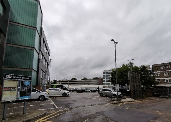
Figure 89 View toward the Station with multi-storey car park from the Station Park east of Church and Kew Roads
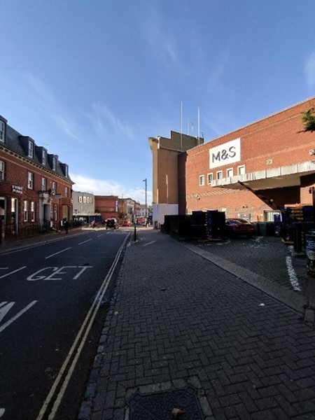
Figure 90 Rear of M&S, Red Lion Street
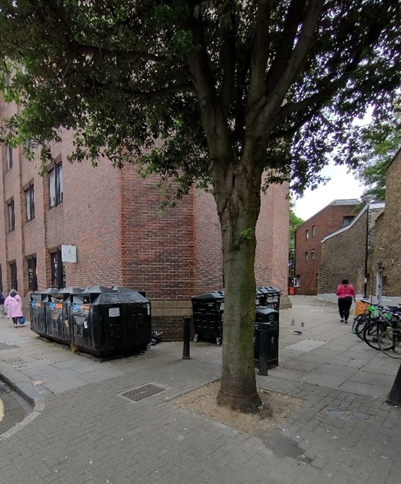
Figure 91 Recycling facility, Sheen Road
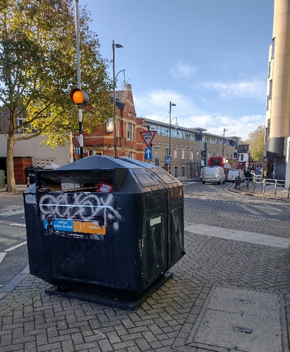
Figure 92 Recycling facility, corner of Paradise Road and Eton Street
Opportunity for Enhancement
• Preservation, enhancement and reinstatement of architectural quality and unity.
• Encourage the restoration of painted and rendered brick facades to their original appearance.
• Retain and improve the quality of shopfronts and advertisements.
• Focus on further improvements for pedestrians in the town centres.
• Redevelopment to improve interchange facilities and the station car park to enhance the setting and sense of arrival to town centre (this is set out as part of a site allocation in the Council’s Local Plan).
• Improve the crossing point for pedestrians at Lower George Street/Eton Street
• Cleaning of the façade to Richmond Station.
• Maintain and improve the distinctive character of the alleyways.
• Resist excessive building heights where this may have a negative effect on character, such as at The Quadrant.
• Rationalise existing signage and street furniture where opportunities arise.
• Replacement of the streetlights in a design more in keeping with the character and appearance of the Conservation Area
• Increased planting of street trees would improve urban greening and enhance the quality of the street scene, particularly to George Street.
• Encourage the reinstatement of appropriate walls, railings and hedges to boundaries throughout the conservation area. Also encourage improvement of existing boundaries where necessary.
• Investigate the potential to improve the service area behind Marks and Spencer to provide a positive frontage along Red Lion Street.
• Seek improvements to the Odeon annex and alley from Ormond Terrace to Castle Yard.
• Improve the appearance of the recycling facilities; those at the top of Eton Street and at Spencer House could be more sensitively sited.
• An upcoming multi-million pound scheme will soon provide a cycle parking hub for 1,000s of bikes at Richmond Station car park .
• Street scene general guidelines: existing areas of high-quality paving (such as stone and granite) should be maintained and extended if possible. Established patterns of street furniture should be continued or refer to the Council’s Public Space Design Guide. Colour street furniture generally black or dark grey.
Design Guidance
Historic England recommends that the Appraisal is also a source of guidance for applicants seeking to make changes that require planning permission, helping to make successful applications.
The guidance below will set out design guidance which encourages good quality of design, which will help to both preserve and enhance the Conservation Area.
Dwellings within the Conservation Area which are blocks of flats do not benefit from Permitted Development Rights, requiring planning permission to carry out alterations and extensions.
Windows
Windows make a substantial contribution to the appearance of an individual building and can enhance or interrupt the unity of a terrace, so it is important that a single pattern of glazing bars should be retained within any uniform composition. Generally, windows follow standard patterns/styles. In Georgian and early-mid Victorian terraces, each half of the sash was usually wider than it was high, but its division into six or more panes emphasised the window’s vertical proportions. Later Victorian and Edwardian buildings often employed a simpler pattern, with the top and bottom sash either having one large pane, or a single central glazing bar. Casement windows are also common in later buildings.
Many original timber framed windows survive within parts of the Conservation Area, and these make an important contribution to the special character and appearance. Where they have been lost, some replacements are of a different style and materiality which is unsympathetic to the historic appearance of the building and Conservation Area. This can be disruptive to the harmony and rhythm of legible groups and create inconsistences within otherwise congruous terraces.
The quality of these replacements can also vary, potentially diluting the consistent appearance of building groups, with some mimicking historic style while others are inappropriate uPVC and casement windows. Common issues with replacement timber sashes include being of a poor quality, with thicker frames and higher reflectiveness, varied horn details, and a variety of glazing bar formats. Casement windows often have wider frames which create larger or overlapping gaps to their hinges, giving the impression of two windows rather than a single window in two parts.
It is encouraged that, in the first instance, original timber windows are retained and repaired. If replacement is required, all aspects of the window should be considered including opening type, glazing bar pattern, horns to sashes, and depth. New windows should be timber and are often best informed by surviving examples within the building or in the context of its setting. Timber frames are not only the most appropriate option, but a natural material which helps reduce the use of plastics , often found in other windows. Timber windows also have the benefit of being more cost effective, being much more durable and repairable than alternatives, and there are options to maintain their appearance while introducing energy saving and noise reducing features.
Single glazing is perhaps the most common window type. As such, simple like-for-like replacements would likely cause the least harmful impact on the existing appearance of a building and therefore the character and appearance of the area. Like-for-like replacements also benefit from being able to be carried out without the need for planning permission. Existing windows can often be improved through secondary glazing, where an additional glass layer is installed behind an existing window. Secondary glazing is an unobtrusive option to increase efficiency, reduce noise, and avoid intervention to existing fabric, often performing as well, and lasting longer than double glazing. This approach also often benefits from not needing planning permission.
Where appropriate and where there is justification for full replacement, slimline double and triple glazing with timber frames helps maintain a consistent appearance, while offering similar benefits to secondary glazing. Where double/triple glazing is accepted, black spacing bars and seals should be avoided – these should instead be white to blend with the frame. Trickle vents should be avoided or well concealed within the frame to maintain consistency with historic appearance.
Windows to contemporary development can vary in detail but it is still important to consider their design and proportions in relation to the character of the area.
Doors
Like windows, it is encouraged that residents, in the first instance, retain and repair any existing original timber doors. This is best for the environment, for the character and appearance of the area, and is often a more inexpensive solution than complete replacement. Simple modifications can often be carried out internally which improves the weatherproofing of the door without impacting its external appearance.
If a replacement is required, then it should match the original door for the property or the group it forms a part of. Doors are typically simple timber four panel doors to Victorian buildings, and six panel doors to Georgian. Where decorative doors form an integral part of the character of an area or group, modern replacements or alternative designs will be resisted.
Existing styles of doors in the area generally manage to reflect the architectural style in which they are set, and original examples make a great contribution to the character of the area.
Roof Extensions
Roof extensions are uncommon and there is a consistency in scale within each character area which contributes to its special character and appearance. Where limited roof alterations have occurred, these are sympathetic to the host building, as well as to the surrounding context in terms of scale and level of intervention. Mansard style extensions behind parapets are found to commercial premises. Consistent roofscapes will not tolerate extension which erodes this consistency, nor will extensions which project above established and consistent building heights.
Gardens
As a primarily commercial area, front gardens are largely limited to residential enclaves to the peripheries of the Area or smaller infill development. Here, front gardens make a positive contribution to the setting of houses and mitigate an overly urban character, which helps create a contrast between the character and use of pockets of the Conservation Area. Consistent well planted front gardens can also unify streets and soften their overall appearance. A variety of planting types, including heights and blooming periods, is encouraged, to add interest year-round.
Full hard-surfaced frontages are generally uninviting and lessen the separation between the public and private realm, compromising the intended setting of the built environment. For these reasons, along with environmental and ecological reasons, they should be avoided.
Boundaries
Boundary treatments vary throughout the area, and piecemeal removal or alteration to the residential areas has resulted in inconsistent treatments. Despite this erosion, there is consistency in scale and materials, and boundary walls are generally low walls constructed of brick which matches the host property. Details of the walls design can vary but they are generally flat and without piers, though low rails above are not infrequent. More common are hedges above low walls which have the benefit of adding greenery to front gardens but can also prevent views into gardens and introduce an uncharacteristic degree of separation if they are allowed to grow too tall.
Pockets of smaller scale domestic architecture, such as the cottages to Waterloo Place, would have had simple timber boundary treatments, and there are a few modern replacements which retain the original intended character. The restoration of traditional boundary treatments enhances the appearance of the area, the cohesiveness of groups, and reflect the intended character of building typologies.
Painting and External Finishes
Painting is uncommon and should only occur if the existing location has already been painted, and an appropriate colour should be selected to maintain the overall neutral palette of the Conservation Area, excluding shopfronts. Most often existing colours should be refreshed, or neighbouring houses can be referenced to create a harmonious appearance.
External finishes are not a common feature to the Conservation Area as a whole but have become more prevalent as buildings are renovated or change use. The approach to their treatment is similar to paint – where existing finishes can be repaired and restored, and new finishes not normally approved. The predominant character of the area is derived from the consistent use of brick with some details and dressings. External treatments can often harm the architectural coherence of the terraced groups and creates a visual disruption and are often not as well maintained as original finishes.
Shopfronts and Signage
The quality of shopfronts within the area varies but are generally of a good quality with many good surviving shopfronts or shopfront elements. Where historic elements survive, these should be retained and repaired in the first instance. Where traditional forms have been replicated or contemporary shopfronts inserted, these should continue to follow traditional designs should they need to be altered or replaced. Any new or replacement shopfronts proposed will need to maintain or improve the appearance of the existing shopfront or also follow these traditional designs as outlined by policies in the Local Plan, as well as the, the Shopfronts Supplementary Planning Document (2010) https://www.richmond.gov.uk/media/7631/shopfronts_2010_lr.pdf
Signage should replicate traditional styles with painted or applied letters to the fascia and simple hanging signs. Modern signage, including corporate branding, internally illuminated projecting box signs, and plastic / box fascia signs, will be resisted. Projecting signs should be of an appropriate scale and design, attached to the fascia or to the building in an unobtrusive manner. Where hanging signs are employed, these should use a traditional bracket and be of a simple design, as outlined in the shopfront SPD.
Shopfront awnings were a common feature of historic shopfronts, and there are some examples of traditional awning styles sensitively reintroduced. Where appropriate, and where applied to traditionally styled shopfronts, awnings can add an attractive element and make a positive contribution to an active commercial streetscape. Awnings should be thoughtfully integrated into shopfront designs and positioned so that the other elements of the shopfront design are not impacted – typically set just below the fascia. Awnings of an overly modern design or material, or which contrast with the predominant palette of the area, may not be appropriate. Awnings to modern shopfronts are generally not appropriate.
Shopfront Security
Shopfront security can have an imposing impact on the appearance of the streetscape and create an uninviting atmosphere. For instance, projecting shutter boxes have a negative impact on the appearance of shopfronts and are not acceptable in Conservation Areas, nor are solid or perforated shutters. Instead, there are other systems which would be more suitable, and these are also outlined in the Shopfronts Supplementary Planning Document (2010) https://www.richmond.gov.uk/media/7631/shopfronts_2010_lr.pdf
Generally, shopfront security features are installed internally, which has benefited the appearance of the Conservation Area as a whole. For contemporary shopfronts, more passive security measures can be effective, such as laminated glass, which is not readily apparent and therefore mitigates security features from detracting from the appearance of the shopfront. Lattice brick-bond grilles can be installed internally behind the windows, with the box inserted into the ceiling – this prevents an external projecting box and the internal box from being visible through the shop window. This would allow for an appropriate level of security, while minimising the visual impact of shutters on the external appearance of the shopfront, and therefore on the Conservation Area. It also allows for passive observation by keeping the inside of the shop visible.
Energy Efficiency
Introducing energy efficient measures can reduce carbon emissions and fuel bills, and improve comfort levels. It is important that the appropriate course taken should be informed by the context of the building being improved, with each building having different opportunities and restrictions. Not all solutions will be appropriate across the Conservation Area, and the ‘Whole Building Approach’ advocated by Historic England encourages a case-by-case approach, which fundamentally considers the context, construction, and condition of a building to determine which solutions would be the most suitable and effective. More detailed advice can be found within the Guidance Note Energy Efficiency and Historic Buildings: How to Improve Energy Efficiency 2018.
Solar Panels
Solar Panels and equivalent technology are most suitably placed on rear or side elevations where they are hidden from the public realm – principal elevations and roof slopes facing the public realm are less appropriate as they generally make the most substantial contribution to the character and appearance of the Conservation Area. New technologies, such as PV panels disguised as slates and sitting flush with roof materials, may be suitable in the appropriate context, and will be considered on a case-by-case basis.
Up to: Conservation areas
Updated: 02 July 2026
