
Twickenham Green
Conservation Area Appraisal
Conservation Area no.9
Twickenham Green
Contents
Part 1: Introduction
Outline of Purpose
The principle aims of Conservation Area Appraisals are to:
- describe the architectural and historic character and appearance of the area, which will assist applicants in making successful planning applications, and decision makers in assessing planning applications;
- raise public interest and awareness of the special character of their area;
- identify the positive features which should be conserved, as well as the negative features which indicate scope for future enhancements.
It is important to note that no Appraisal can be completely comprehensive, and the omission of a particular building, feature, or open space should not be taken to imply that it is of no interest.
This document has been produced using the guidance set out by Historic England in the 2019 publication ‘Conservation Area Appraisal, Designation and Management: Historic England Advice Note 1 (Second Edition)’.
This document will be a material consideration when assessing planning applications.
What is a Conservation Area?
The statutory definition of a conservation area is an ‘area of special architectural or historic interest, the character or appearance of which it is desirable to preserve or enhance’. The power to designate conservation areas is given to local authorities through the Planning (Listed Buildings and Conservation Areas) Act 1990 (Sections 69 to 78).
Once designated, proposals within a conservation area become subject to local conservation policies set out in the Council’s Local Plan and national policy outlined in the National Planning Policy Framework (NPPF).
Our overarching duty, as set out in the Act, it to preserve and/or enhance the historic or architectural character or appearance of the conservation area.
What is an Article 4 Direction?
An Article 4 Direction is made by the local planning authority. It restricts the scope of permitted development rights either in relation to a particular area or site, or a particular type of development anywhere in the authority's area. The Council has powers under Article 4 of the Town and Country Planning (General Permitted Development) Order 2015 to remove permitted development rights.
Article 4 Directions are used to remove national permitted development rights only in certain limited situations where it is necessary to protect local amenity or the wellbeing of an area. An Article 4 Direction does not prevent the development to which it applies, but instead requires that planning permission is first obtained from the Council for that development. View further information about Article 4 Directions to check if any permitted developments rights in relation to a particular area/site or type of development apply in your area.
Buildings of Townscape Merit
Buildings of Townscape Merit (BTMs) are buildings, groups of buildings, or structures of historic or architectural interest, which are locally listed due to their considerable local importance. The policy, as outlined in the Council’s Local Plan, sets out a presumption against the demolition of BTMs unless structural evidence has been submitted by the applicant, and independently verified at the cost of the applicant. Locally specific guidance on design and character is set out in the Council’s Buildings of Townscape Merit Supplementary Planning Document (2015) which applicants are expected to follow for any alterations and extensions to existing BTMs, or for any replacement structures.
Designation and Adoption Dates
Twickenham Green Conservation Area was designated on the 14th January 1969. It has subsequently been extended four times:
- First Extension: 7th September 1982 (to include part of Hampton Road)
- Second Extension: 29th January 1991 (to include part of Second Cross Road)
- Third Extension: 24th March 1992 (to include parts of Albion Road, May Road, Vicarage Road, Hampton Road, and Second Cross Road)
- Fourth Extension: 20th November 2023 (minor boundary rationalisation)
Following approval from the Environment, Sustainability, Culture and Sports Committee on 17th January 2023, a public consultation on the draft Appraisal was carried out between 17th March and 28th April 2023.
This appraisal was adopted on 20th November 2023.
Other Planning Designations
Twickenham Green is designated as Other Open Land of Townscape Importance (OOLTI).
The Twickenham Village Planning Guidance was adopted on the 5th February 2018. Its purpose is to establish a vision and planning policy aims for Twickenham and assist in defining, maintaining and enhancing the character of Twickenham. It can be viewed on the Council's website here.
The Greater London Archaeology Advisory Service (GLAAS) completed its review of Richmond Borough's Archaeological Priority Areas (APAs) in 2022. Twickenham Green is close to several Tier 2 APAs, including Twickenham and Twickenham Riverside, and Strawberry Hill. The full review can be found on the Historic England website as well as further information and guidance on Archaeological Priority Areas.
Map of Conservation Area
Summary of Special Interest
The Twickenham Green Conservation Area contains some of the oldest development in the area outside Twickenham town centre. It was one of the first areas to be developed away from the riverside, following Enclosure in 1813 and constitutes a mix of modest early 19th century cottages, mid-19th century houses, and later 19th/early 20th century larger red brick houses and parades of shops. The Green is a prominent area of open space and a remnant of the once extensive Hounslow Heath. Its shape has defined development along the three sides, and its open, verdant nature has helped to maintain the semi-rural historic character of the area. The long views across the Green and the domestic scale of the townscape, unbroken by taller modern development, allow appreciation of its historic form and add greatly to the area's significance. These buildings reflect the growth of the area and development from a rural area to being subsumed into Twickenham as a whole. Relatively little change has occurred in the built environment since the early 20th century, with only a small amount of modern development, most notably the industrial estate.
Historic Development
Evidence for a settlement at Twickenham can be traced back to a land charter from 704 AD referencing a settlement called ‘Twicanhom’. After the Norman Conquest, the manor comprising Twickenham, Whitton, Isleworth, and Hounslow was given to Walter de St Valery, alongside the manor of Hampton, and lands in Suffolk. Twickenham is not mentioned separately in the Domesday Book but is estimated to have had 25 households. The land where the settlement was located was all to the south of the River Crane. Common meadows formed later on the riverbank to the east which stretched north to Isleworth. To the west was heathland which reached north to Hounslow Heath, and south to Bushy Park, which was formed in 1491. The first houses in Twickenham were built in the 1560s along the river. Along Heath Lane (the present Heath Road), the first houses had been built by 1635. Some enclosure south of Whitton had also taken place by this date. Over the next century and a half, land was gradually further enclosed and given over to market gardens, or gardens for large houses.
By the late 17th century, Twickenham had become a popular place for people of fashion, centred on Twickenham and the Riverside, but with grand houses extending west along Heath Road. At this point, there was still the large expanse of Twickenham Common to the west of Twickenham, although the triangular shape of the Green had already begun to be defined by the divergence of Heath Road, west towards Hanworth, and south towards Teddington and Hampton.
The Green is the remnant of this extensive 175 acre Common, land which was originally vital to the lives of the commoners, who held grazing and fuel gathering rights. Where the railway bridge is now, there was once a gate marking the entrance to the Common. On the north side of the Common, a hamlet around what is now Colne Road, made up largely of cottages, had been in existence since the 17th century. By the 18th century, the hamlet of Heath Row stood on the edge of the Common, and was linked to the main village by the buildings along Heath Road. Between the Common and the Crane was still largely open fields, and to the west the Common joined the main expanse of Hounslow Heath. A workhouse was constructed in 1725, on the present-day site of the industrial estate, and enlarged in 1803 and 1813 before being sold in 1838 and demolished in 1846.
The 1813 Twickenham Enclosure Act, followed by the 1818 Twickenham Enclosure Award gave rise to the Green in its existing form. 3.5 acres of land were awarded to the Workhouse, and the rest was set aside to compensate the parishioners who had relied upon it for grazing and fuel, with a physical division between the two. By this time, First Cross Road had been laid out, enclosing the Green in its triangular form. The enclosure was followed by building both around the Green and on the remainder of the Common west of the Green. Between 1821 and 1841, the number of houses in the parish grew from 740 to over 1000, and communication with London was improved by an hourly coach service. The railway arrived in 1848 and further building followed. In 1860, the Fuel, Land and Workhouse Allotment Charity, who owned the freehold to both parcels of land forming the Green, sold it to Twickenham Town Council for £2,238 for use as a public recreation ground. In October 1872, authorisation was given for the purchase of new trees around the Green. Further building occurred at the turn of the century, as did the arrival of the tram along the southern side of the Green towards Hampton. Since the early 20th century, relatively little development has occurred, apart from the industrial estate at the northwestern end of The Green.
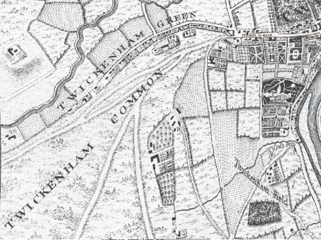
Figure 3: Extract from John Rocque's '10 miles round London' map (1746)
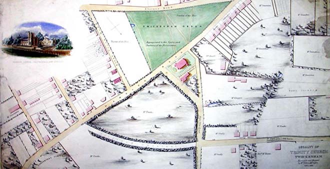
Figure 4: 'Locality of Trinity Church Twickenham' (1849)
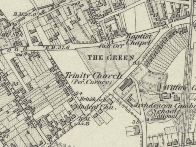
Figure 5: Extract from the 1864 Ordnance Survey Map of Middlesex
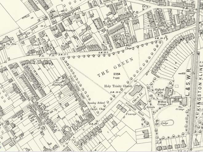
Figure 6: Extract from the 1893 Ordnance Survey Map of London
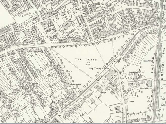
Figure 7: Extract from the 1913 Ordnance Survey Map of Middlesex
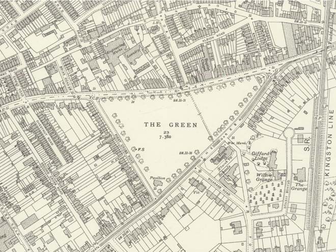
Figure 8: Extract from the 1934 Ordnance Survey Map of Middlesex
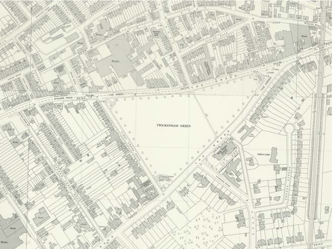
Figure 9: Extract from the 1959 Ordnance Survey National Grid Map
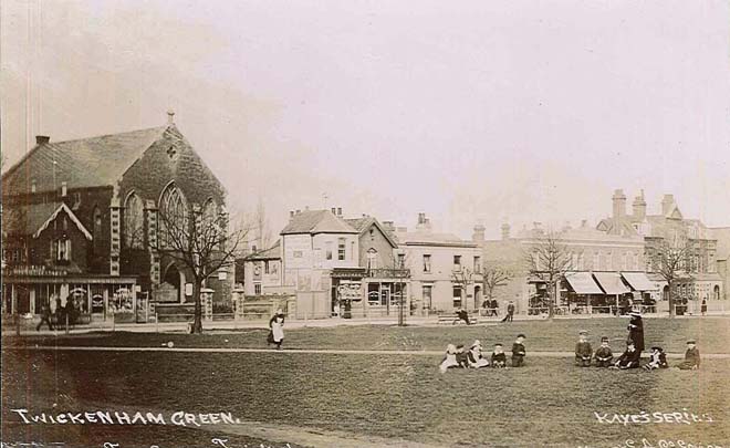
Figure 10: A view looking north across The Green (c.1900). The old Baptist church (demolished c.1913) is visible on the left
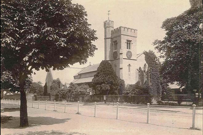
Figure 11: Holy Trinity Church (c.1915)
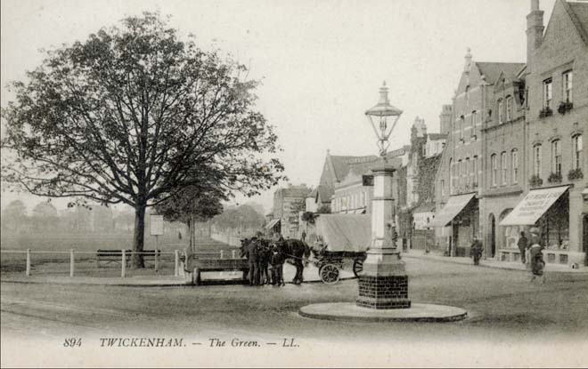
Figure 12: The eastern corner of The Green with the village pump in the foreground (1916)
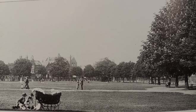
Figure 13: A view across The Green (1924)
Part 2: Conservation Area Appraisal
Location
Twickenham Green Conservation Area is centred on Twickenham Green at the convergence of Hampton and Staines Roads. It lies to the west of Twickenham town centre, between the railway line to the east and Second Cross Road to the west.
Setting and Topography
Twickenham Green Conservation Area is formed around the important open space of Twickenham Green. The busy roads on the north and south sides, and the more sedate First Cross Road have defined its distinctive triangular shape. The Green itself is edged with mature trees and a low two-bar fence which, together with the pavement, provide some separation from the roads. The Green is anchored by prominent buildings/structures at each corner which also serve as focal points in views along the roads and looking both in to, and out from The Green. The area itself also marks the transition from the busy, commercial Heath Road leading into Twickenham town centre, to the residential areas south-west towards Hampton. There are no discernible changes in topography, which allows for long views across The Green. These views are an important contribution to the character of the Conservation Area.
Townscape
The Green is enclosed by a diverse collection of fine buildings ranging in date from the early 19th century to the 21st century. The varied facades, materials, and roofscape of these buildings adds great interest to the area and provides an important townscape and encircling skyline to The Green. It also demonstrates the changing nature of the area from a predominantly rural one to a more residential area subsumed into wider development around Twickenham.
Key buildings include Holy Trinity Church, Twickenham Baptist Church, and Twickenham Congregational Church, each marking a side of The Green and dominating both the immediate streetscape and wider views across The Green. On the south side is the cohesive group of Apsley Villas (nos.1 – 29 (odd) The Green), whose late Regency style is distinctive along the streetscape and contributes to the more rural character of the area. Beyond, the streetscape is dominated by larger buildings, set back from the road in spacious plots. Red-brick late Victorian villas continue to the southwest along Hampton Road. Opposite, the streetscape is more eclectic, with the ornate Prince Albert public house forming the dominant feature.
First Cross Road has a largely unified streetscape of modest two-storey cottages set behind front gardens with well-defined boundaries. The large red-brick Congregational Church, and former Church Institute Building sit forward of the common building line and are highly prominent along the street.
Second Cross Road is similarly modest, characterised by two-storey semi-detached cottages, with no front gardens and variation in both materials, boundary treatment and roofscape.
The northern side of The Green is more varied, including residential, retail, and industrial uses. Beyond the industrial estate, the townscape is continuous, with a higher building density and a common building line. While the character of these buildings is varied, they are generally of a larger two/three storey scale than those on First Cross Road. Materials are predominantly stock brick and render, with slate roofs. The wide variation in architectural styles demonstrates the more piecemeal development of this side of The Green, with short parades of shops and red brick statement buildings such as Twickenham Baptist Church, and 28 & 30 The Green.
Overall, there is a good quality historic townscape surrounding The Green which has been built up gradually from the mid-19th century and into the 20th century. There is a collection of distinct architectural styles, but the phases of development fit well together and combine to create a townscape of strong historic interest.
Spatial Analysis
The Green forms a prominent area of open space which the Conservation Area is centred on. The surrounding roads form a triangle around The Green from where the Hampton and Staines Roads diverge at the north-east corner. South-west of The Green is a series of ‘cross roads’ linking Hampton and Staines Roads in a rough grid pattern; First Cross Road and Second Cross Road are the first two of these roads. To the north, May and Albion Roads form part of a loose grid pattern of mid/late 19th century development.
This northern side of The Green is densely developed, with little space between the individual buildings/parades of shops. As these buildings sit hard up against the pavement, the road does not create a significant spatial barrier between the buildings and The Green, which allows for a close visual relationship between the two. The historic streetscape opens out towards the north-western end of The Green due to the industrial estate.
To the north, the cottages on May Road and Albion Road sit tight in their plots, with little, or no front gardens
The south side is less densely developed. Apsley Villas have been joined together by infill development, and this presents as a continuous terrace rather than semi-detached pairs. They are set back from the road behind well-defined boundaries which contributes to the more spacious character of the southern side. The road on this side of The Green is wider than on the northern side, which also contributes to this spacious character, but creates slightly more of a detachment between the buildings and The Green.
Beyond Apsley Villas are the large plots of Holy Trinity Church, 59 The Green & 2 Vicarage Road and 69 The Green. Although outside the Conservation Area, Archdeacon Cambridge’s Primary School is set back from the front boundary which creates a visual break between the buildings on the south side of The Green and those along Hampton Road.
First Cross Road largely retains the original spatial arrangements of the 1818 Enclosure of The Green, with small cottages in long narrow plots. The long rear gardens of these plots are of historic importance in preserving the spatial arrangement of the road and the Conservation Area and make a positive contribution to its character. Properties on Second Cross Road similarly retain these long rear gardens.
Views
The views into, across, and out from The Green are an important part of the character of the Conservation Area. The view looking south from May Road towards The Green and Holy Trinity Church has been identified as an important local view in the draft Local Views Supplementary Planning Document.
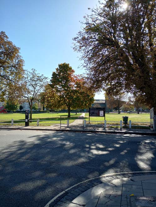
Figure 14: View looking south from the bottom of May Road across The Green to Holy Trinity Church
The views into and across The Green allow for long views across the open space. Prominent buildings such as Holy Trinity Church, and Twickenham Baptist Church are focal points in these views. The cricket pavilion, and the former public conveniences (now a restaurant) form smaller focal points in long views looking northeast, and southwest. There are also many intermediary views looking both into, and out from The Green which allows for glimpses of the surrounding buildings. The proximity of the houses on First Cross Road to The Green allows for views looking along the street incorporating both buildings, trees, and The Green.
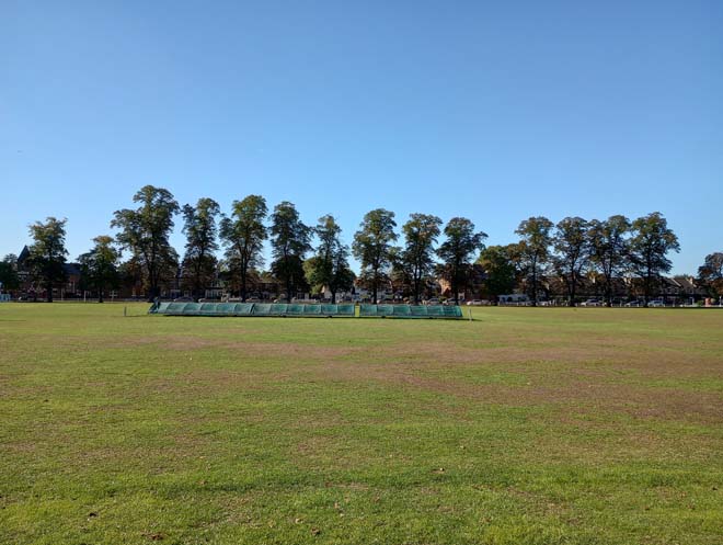
Figure 15: View from the middle of The Green looking west to First Cross Road
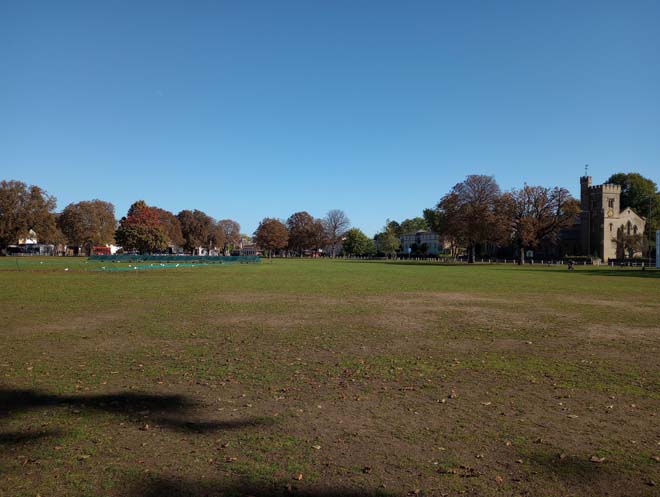
Figure 16: View looking east across The Green from First Cross Road
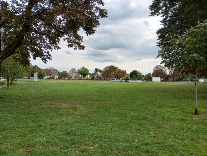
Figure 17: View looking south-east across The Green
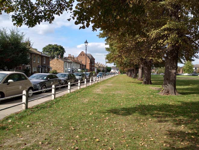
Figure 18: View looking north along First Cross Road
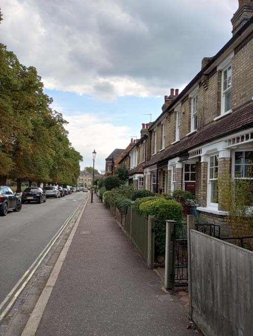
Figure 19: View looking south along First Cross Road
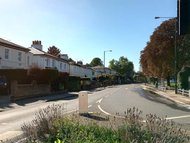
Figure 20: View looking south-west along the edge of The Green
Architecture and Built Form
The Green South
Views to the south side of the Green are dominated by the silhouette of the Grade II Listed Holy Trinity Church. The three-stage crenellated tower and octagonal stair tower are visible from many vantage points across and around the Green. This yellow stock brick church was designed by George Basevi and built 1840 – 1841 in a composition of Early English, Decorated, and Perpendicular styles. It was extended 20 years later by a pupil of Basevi, F.T. Dolman, who added the transepts and apsidal chancel. At the front of the church, facing the junction with Pope’s Avenue, is a War Memorial to local people who died in World War One.
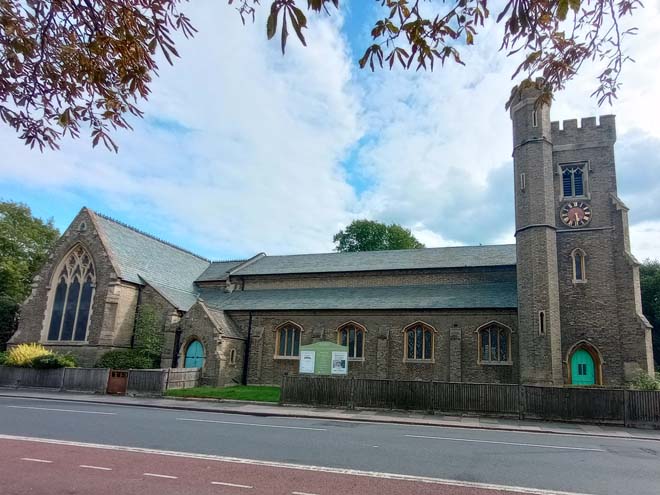
Figure 21: Holy Trinity Church
Curving round to Heath Road are nos.1 – 29 (odd) The Green (historically ‘Apsley Villas’), a fine group of rendered and slate roofed villas dating from 1845. Built on land from Twickenham House in Heath Lane, they are named after the Duke of Wellington’s London residence, Apsley House. Almost all have retained the original glazing pattern which consists of full-height glazed doors on the ground floor, and three-over-three sash windows on the first floor. Several of the original link walls have also been lost as the result of infill extensions. Low stock brick walls with railings are the most common form of boundary treatment. The occasional hedge provides a softer boundary and adds greenery to the area. Many front gardens have been given over to hardstanding for car parking to the detriment of the character and appearance of the area, breaking the consistent boundary line.
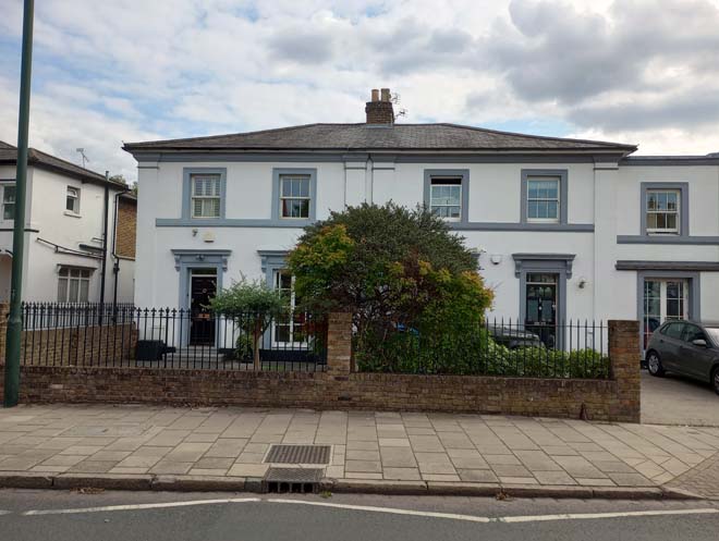
Figure 22: 5 & 7 The Green
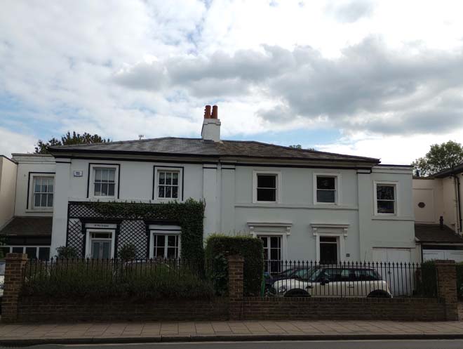
Figure 23: 15 & 17 The Green
Figure 24: 19 - 23 The Green
Between Apsley Villas and Holy Trinity Church is Gifford House, a modern building in an imitation-Georgian style, and in use as a care home for the elderly.
Southwest of the Church are nos.59 The Green & 2 Vicarage Road (one building), and 4 Vicarage Road, a pair of prominent red-brick building. The former is mid-19th century and include a few elements in the Tudor-Revival style, such as the two-storey square bay windows, topped with dormers, and black brick detailing. No.4 is later 19th century and was the Vicarage to Holy Trinity Church. It is a substantial building, faced in red brick, with white rendered quoins and string courses. It marks the transition from the large, elaborate buildings of the south side of the Green to the more modest residential streets surrounding Pope’s Avenue.
Figure 25: 59 The Green & 2 Vicarage Road
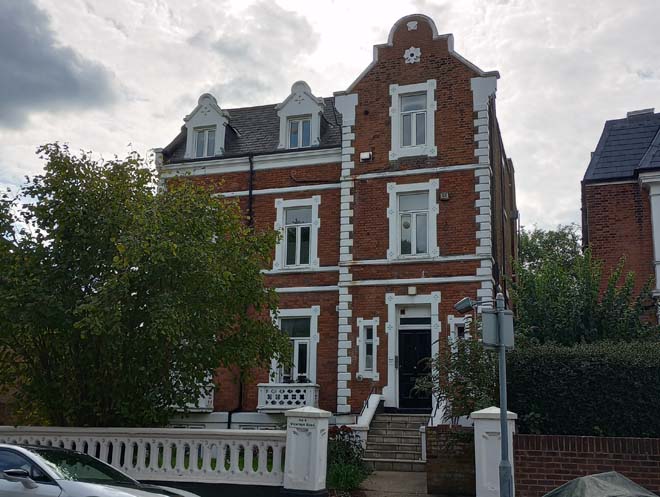
Figure 26: 4 Vicarage Road
Of similar scale is no.69 The Green, a four-storey late Victorian villa in Gault brick. It acts as a focal point in views looking south along First Cross Road, and is highly prominent given the absence of other buildings around it and its position in a spacious plot. To the right is its original coach house. Together, the buildings form an attractive group.
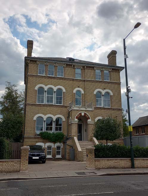
Figure 27: 69 The Green
Nos. 1 – 15 Hampton Road are a four pairs of late 19th century houses along the southern side of Hampton Road, leading away from The Green. These red-brick, three-storey buildings have typical late-Victorian features including two-storey bay windows, and timbered gable ends. Originally the front door was encased by a decorative brick surround, with pillars and a gable, but many have been infilled and a few have been lost altogether. Unsympathetic alteration, including the insertion of additional windows, and large rear extensions have obscured the original form of these buildings. Boundary treatment is inconsistent, and front gardens have been given over to hardstanding.
Figure 28: 5 & 7 Hampton Road
There is a more eclectic group of buildings on the northern side of Hampton Road, which contrast with the red-brick Victorian houses opposite. This group includes two pairs of mid-19th century cottages, nos.16 & 18 and 20 & 22, all of which have been substantially extended to the rear. No.24 is the earliest building in this group (dating from the first half of the 19th century) and although is set back from the street behind the garden of the Prince Albert public house, forms a distinctive feature in the street scene. As with many houses to the immediate west of the Green, it has a large rear garden which has remained as an important historic area of open space which contributes to the character of the Conservation Area. The Prince Albert is a two-storey brick building with green glazed tiles to the ground floor, and heavy white rendered rusticated quoins. To the left of the public house is a jumble of two-storey buildings, most likely with mid-19th century origins, but now heavily altered with front extensions and modern shopfronts.
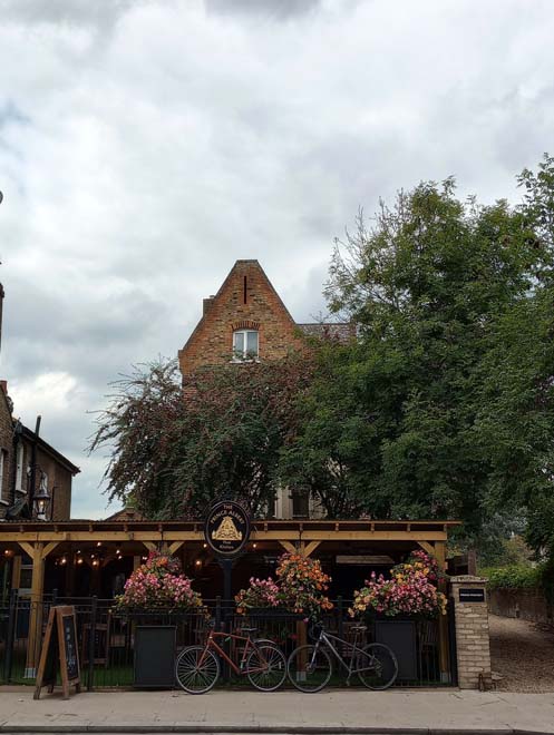
Figure 29: 24 Hampton Road, with the garden of the Prince Albert public house in the foreground
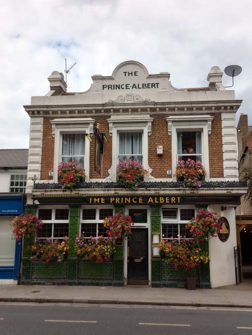
Figure 30: The Prince Albert public house
On the junction of Hampton Road and Second Cross Road is no.38, a mid-19th century white-rendered double fronted villa which was extended to the left in the 1930s. It is in a style otherwise uncommon within the Conservation Area and is prominent in the street scene due to the white render.
Figure 31: 38 Hampton Court Road
First Cross Road & Second Cross Road
First Cross Road contains some of the earliest development in the area. The predominantly two storey terraced cottages date from the first half of the 19th century, and were constructed soon after the enclosure of The Green. They are of modest design, albeit with some alterations, most commonly the addition of porches and the enlargement of windows. Nos. 11 & 12, and 21 – 23 are painted/rendered white and nos. 13 – 15 are, unusually, clad in white weatherboard. The rest are unpainted demonstrating varied shades of brickwork. The small front gardens are all defined by clear boundaries, white picket fencing being the most common boundary treatment.
These modest terraces are flanked on the southern side by the prominent Congregational Church (now the Twickenham United Reform Church) and Sunday School building. The core parts of the Church and School building date from 1844 and were enlarged in 1867 when the vestry was added, connecting the two. Constructed in a dark stock brick, with red brick detailing and a large circular window in the Geometric style, it marks a transition from the modest dwellings of First Cross Road down to the larger-scale dwellings along the south side of The Green and Hampton Road.
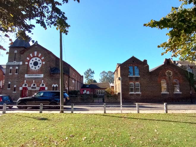
Figure 32: Twickenham United Reform Church
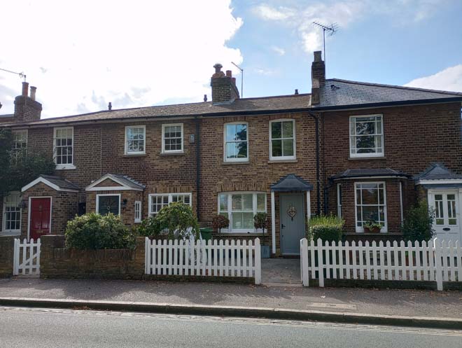
Figure 33: 7 - 10 First Cross Road
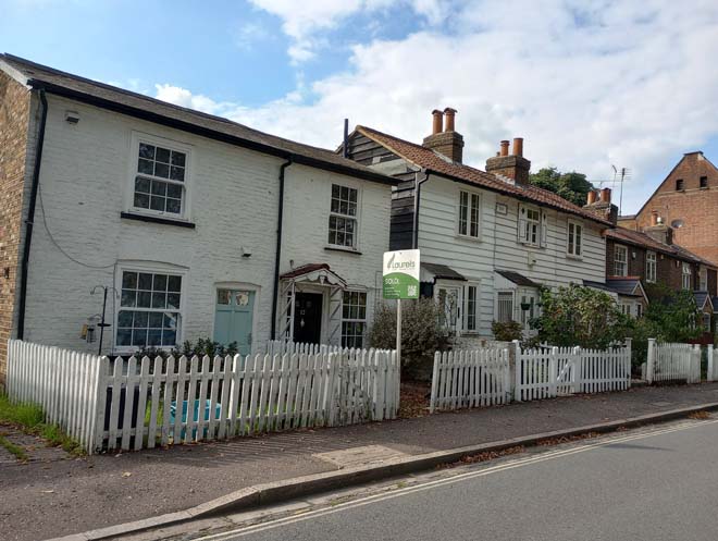
Figure 34: 11 - 15 First Cross Road
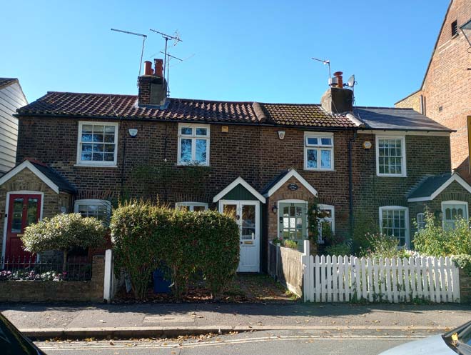
Figure 35: 16 - 19 First Cross Road
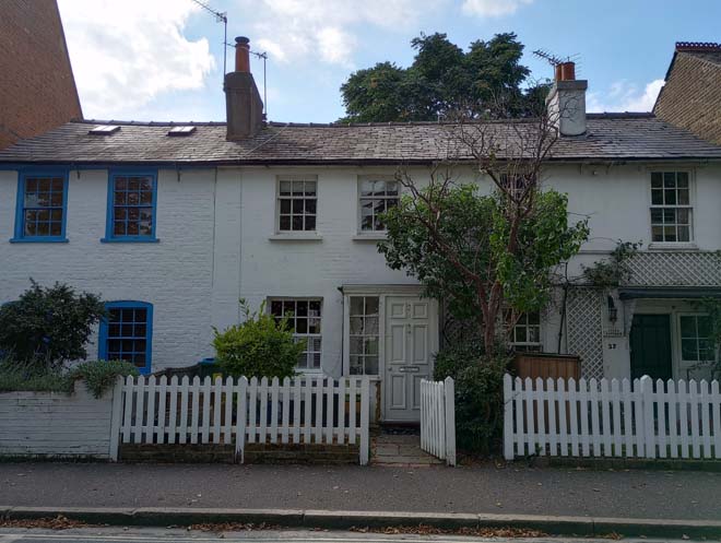
Figure 36: 21 - 23 First Cross Road
The former Church Institute building (no.20), now a nursery school, results in a sudden change in both architectural style and building height. A late-Victorian construction in red brick, with a prominent two-storey canted bay, it sits forward of the established building line and is highly prominent in views looking both north and south along First Cross Road.
Figure 37: 20 First Cross Road
The northern end of the street is marked by an early 20th century Gault brick terrace. This is a very well-preserved terrace, which has retained most of its original features including original glazing patterns, original doors, continuous projecting roof at first floor level with wooden spindle work and a tiled roof with two courses of scalloped tiles, and roof ridge tiles. The small front gardens, and predominantly fenced front boundaries are a positive contribution to the street scene and recall the once rural nature of the area. These properties are subject to an Article 4 Direction which removes certain permitted development rights. This is detailed below in Part 3: Management Plan.
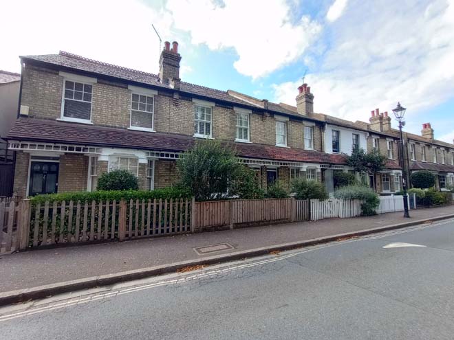
Figure 38: 24 - 30 First Cross Road
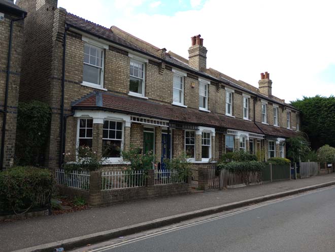
Figure 39: 29 - 33 First Cross Road
Second Cross Road comprises pairs of mid – late 19th century cottages, many of which have had unsympathetic alterations, including the addition of front porches, and the installation of UPVC windows. It is a quiet, residential street, with a distinct difference in character from the busy open space of The Green.
The long, narrow back gardens of the historic properties on First Cross Road and Second Cross road are of historic importance as indications of the original building plots after the enclosure of The Green in 1818. Together they form a valuable and attractive area of private open space and maintain the historic road and plot layouts.
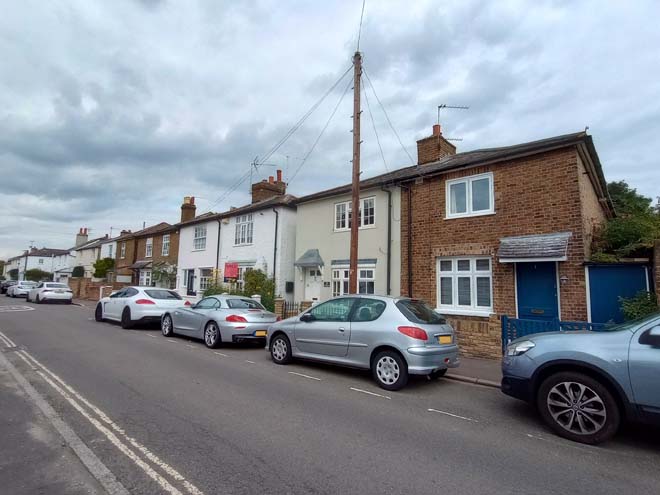
Figure 40: 1 - 11 Second Cross Road
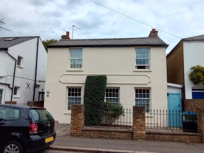
Figure 41: 19 Second Cross Road
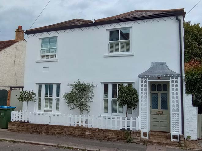
Figure 42: 27 Second Cross Road
The Green North
The north side of The Green consists of a more varied mix of uses incorporating residential, community, commercial, and industrial. The mid-19th century Prince Blucher public house is situated opposite the junction of The Green and First Cross Road and is partly visible in views up the Road. It marks the entrance to The Green from the west along Staines Road.
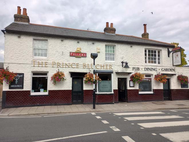
Figure 43: The Prince Blucher public house
106 – 114 The Green were originally two pairs of mid-19th century cottages, and while the pair on the left (nos.114 & 116) have retained their original form, the pair on the right have had a substantial extension built to the rear. Together they are isolated from the rest of the historic streetscape, although they have retained large front gardens with mature trees.
Figure 44: 106 - 114 The Green
The majority of the rest of the northern side of the Green is comprised of mid-19th century to early 20th century buildings which form a varied streetscape. Nos.80 – 88 are a three-storey stock brick parade of shops. The first and second floor windows have segmented overarches, but no original windows remain, and the existing windows are predominantly uPVC. The shopfronts are poorly designed, with overly large fascia boards, and flat frontages. Only the original corbels remain which give an indication of the height of the original shopfronts.
Figure 45: 80 - 88 The Green
Both nos.70 & 72, and no.64 have mid-19th century origins and are some of the oldest buildings on the north side of The Green. Situated between two three storey parades of shops, they are more modest in scale than the surrounding red-brick buildings. Nos.70 & 72 have had an uneven pattern of render applied, and the hardstanding to the front creates a poor setting. No.64 has retained it more generous original plot, with outbuildings to the rear along May Road. These outbuildings represent the early 19th century development of the Green and form part of the former industrial character of this part of the Conservation Area. While less architecturally elaborate than the main building fronting the Green, they maintain a traditional character which contributes positively to the overall character of the Conservation Area.
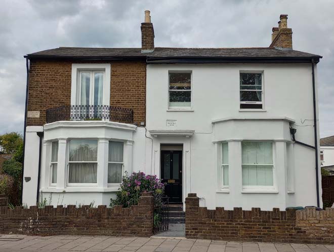
Figure 46: 70 & 72 The Green
Figure 47: 64 The Green
The red brick Baptist Church is the tallest building on the north side of The Green and prominent in views across The Green from the south side. The Twickenham Baptist Church was formed in 1852 and moved to the site on The Green a year later. The present Church was built in 1914 to the design of Ingall, Bridgewater & Porter of Birmingham, in memory of Marian Braithwaite.
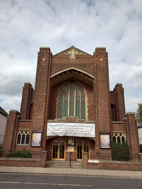
Figure 48: Twickenham Baptist Church
Nos.44 & 46 are a pair of mid-19th century houses in a similar style to Apsley Villas, with recessed entrance doors under arched porches, with keystones with decorative heads. They are set back from the building line and the front boundary is well defined by railings. They constitute a visual break between the predominantly three storey, brick buildings along the northern side of The Green.
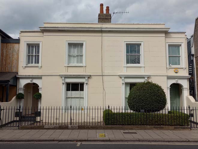
Figure 49: 44 & 46 The Green
Nos.28 & 30 comprise an elaborate pair of Victorian semi-detached villas, built in 1884. The curved first floor bay window is a central feature to the three-storey stock brick and red brick building, with recessed entrance doors under arched decorative porches and decorative panels and brickwork above the first-floor windows. In contrast is the plainer two storey red brick building next door, built in 1891 as the Salvation Army’s Good Templar Hall. A row of decorative terracotta tiles forms a string course, and there is brick detailing to the eaves of the gabled roof.
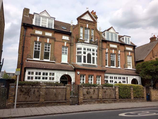
Figure 50: 28 & 30 The Green
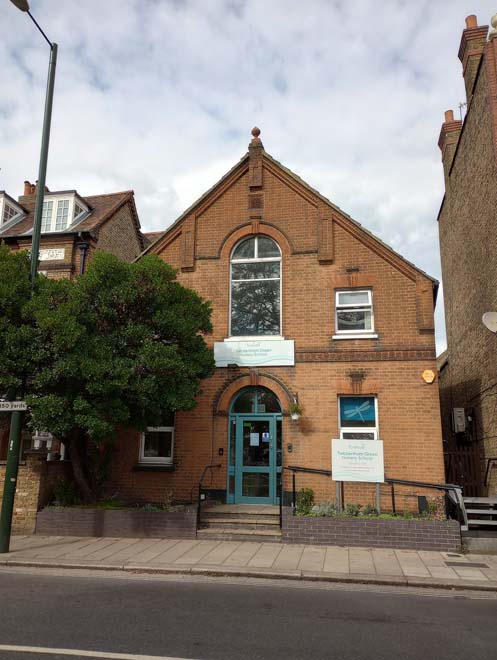
Figure 51: 26 The Green
At the eastern end of The Green, nos.20 – 24 bookend the run of largely two/three storey red brick buildings. No.22 has an interesting shopfront with large arched window, and retains its original windows at first floor level. The letters ‘J’ and ‘R’ and the date ‘1848’ are visible in roundels on the first floor level. No.20 retains its original corner entrance, flanked by pillars with a sign above, and the frames of the original shop windows. The large fascia sign obscures the surviving cornice.
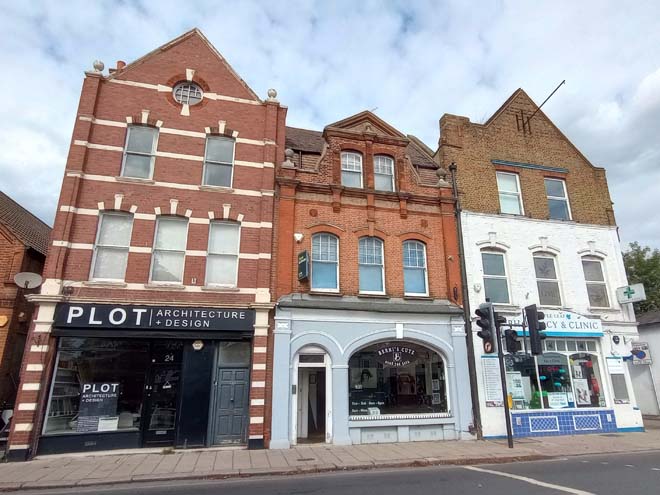
Figure 52: 20 - 24 The Green
Nos.14 and 16 survive as part of a small stretch of mid-19th century cottages which have been subject to unsympathetic shopfronts and alterations on either side of this pair. They are indicators of the historically more rural and domestic nature of The Green before the construction of the two/three storey late 19th century buildings on this side of The Green.
Figure 53: 6 - 18 The Green
Albion Road & May Road
The routes running north-south on to The Green from Albion and Colne Roads (May Road, Knowle Road, and Collis Alley) contribute to the setting of the space and also allow important views through on to The Green. May Road is particularly important in this respect, offering long views looking south down the road across The Green towards Holy Trinity Church. It is comprised of mid – late 19th century cottages in narrow plots. The terrace closest to The Green sits hard up against the pavement, resulting in a narrow road. Those further up the road on the western side are set back slightly and are also earlier in date.
Figure 54: 2 - 8 May Road
Figure 55: 18 - 32 May Road
On the southwest side of Albion Road is a terrace of modest mid-19th century cottages in dark stock brick under slate roofs, with the only architectural detailing being gauged brick flat arches above the doors and windows. This terrace reflects the rural, domestic heritage of the area surrounding The Green, and is largely well preserved. The pair on the junction with May Road are later 19th century additions, in a similar style, but with added red brick detailing, and roof ridge tiles.
Figure 56: 39 - 43 Albion Road
Figure 57: 47 & 49 Albion Road
Open Spaces
The Green
The Green is the remnant of the extensive 175 acre Common which once formed part of Hounslow Heath. Since the 1818 Enclosure, it has evolved into an important area of public open space. It is a large triangular shaped area of open space bordered with mature chestnut and lime trees. It is bisected by one path running north-south from opposite May Road to opposite Holy Trinity Church. The lack of planting or structures in the middle contributes to the wide, open character of The Green which offers respite from the densely developed residential areas to the north, west, and south, and the busy Heath Road leading into Twickenham town centre to the east. The buildings surrounding The Green are set back due to the trees, and roads, although the comparatively narrow First Cross Road means that these buildings enjoy a more intimate connection with The Green and are a remnant of the more rural historic character of the area. Holy Trinity Church, and Twickenham Baptist Church are highly prominent in views looking out from the centre of The Green.
The Green itself is separated from the road by the fence and pavement which widens at the three corners. Early photographic evidence from 1862 shows a three-rail fence in place around The Green. By the first decade of the 20th century this had been replaced by a one-rail fence. Hawthorn hedge and chain-link fence has also been used as boundary treatment. The current two-rail fence was installed in 1972. In places it is in poor condition, with flaking paint and evidence of rust.
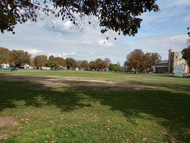
Figure 58: View of The Green looking east with Holy Trinity Church on the right
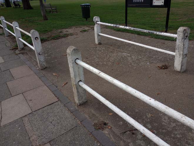
Figure 59: Fence on the south side of The Green
Situated at the eastern corner are the former public conveniences (now a restaurant), one of the three Grade II Listed K6 Telephone Boxes (converted to café kiosk) which mark each corner of The Green, and a water trough which has been in place since the early 20th century.
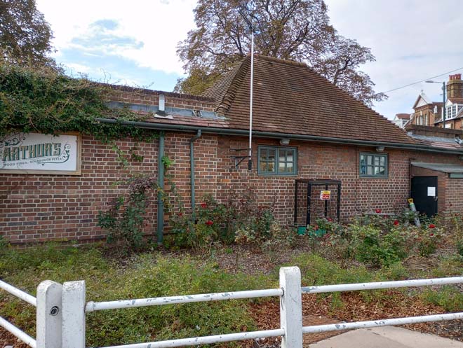
Figure 60: Former public conveniences
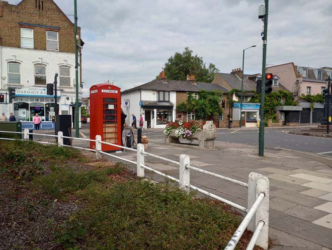
Figure 61: Eastern corner of The Green
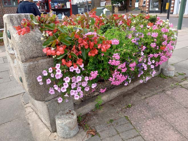
Figure 62: Water trough
The Twickenham Green Pump, which was given for use of the poor by Countess Waldegrave in 1894, is also situated at the north-eastern corner of The Green but is isolated on a small triangular island at the convergence of the roads along the northern and southern sides of The Green. Historic photographs show that it was always separate from The Green, but this separation has been enhanced due to the wide roads and high volumes of traffic. The pump itself was restored in 1977 to commemorate the Silver Jubilee. Around the pump are a couple of flower beds which were established in 1990 by the Rotary Clubs of Twickenham District.
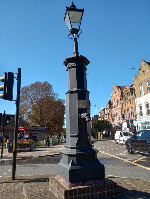
Figure 63: Twickenham Green Pump
Figure 64: The 'island' on which the Pump is located
The cricket pavilion mirrors the former public conveniences at the southern corner of The Green. There has been a pavilion on this site since at least the 1930s, but the current pavilion was constructed in the 1980s. It forms a focal point for views looking west across The Green and is a reminder of the local history of cricket in the area, as the Twickenham Cricket Club is one of the oldest in the world, dating back to 1833.
The K6 Telephone Box at this corner remains as a phone box and is well preserved.
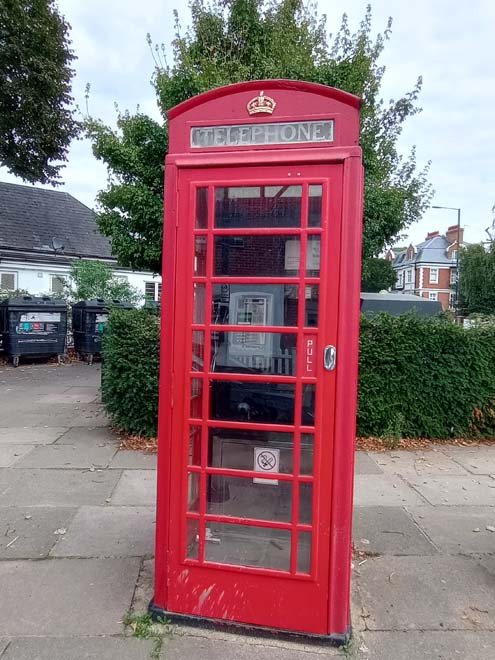
Figure 65: K6 Telephone Box at the south-western corner of The Green
The north-western corner of The Green is not defined by a building and is comparatively bare of features. The K6 telephone box is the only prominent feature and is in a poorer state of repair than the other two, with several missing panes of glass, and graffitied windows. The corner of The Green between the road and the fence is dominated by a bare expanse of hardstanding which creates a poor setting for both The Green and the houses on First Cross Road opposite.
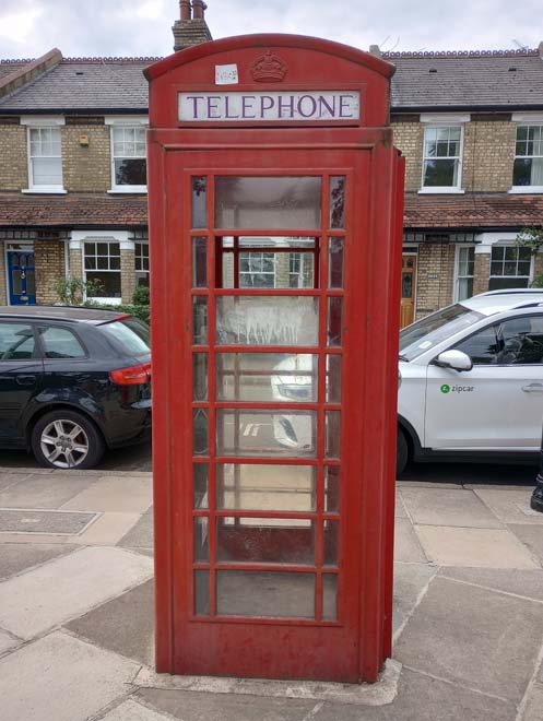
Figure 66: K6 Telephone Box at the north-western corner of The Green
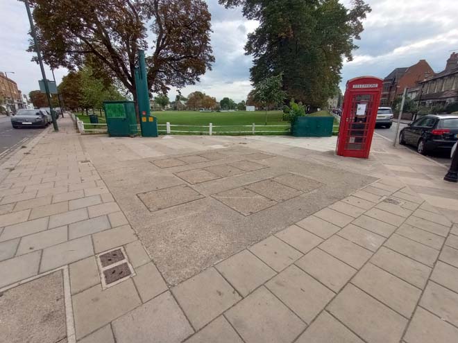
Figure 67: North-western corner of The Green
Street Furniture
Benches on The Green
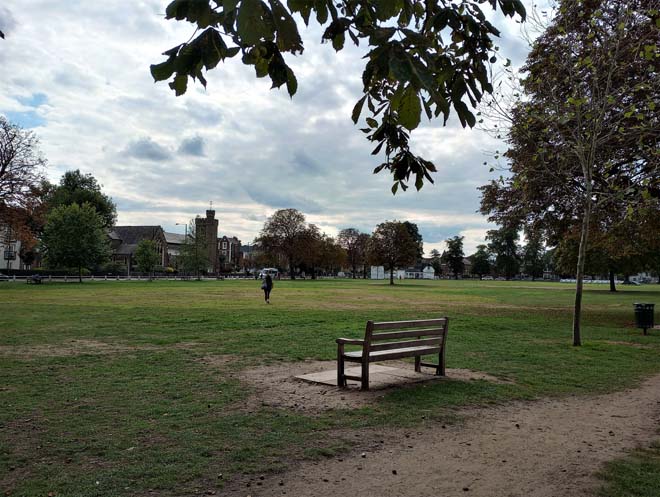
Wooden benches are spaced evenly along the northern and southern sides of The Green. They are generally in good condition, and some are dedicated to local people.
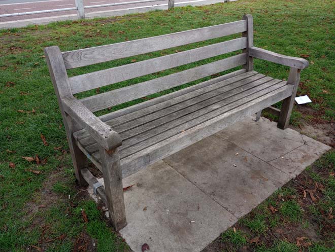
Figure 68: Bench on The Green
Lampposts
Heritage-style lampposts have been installed along First Cross Road, which contribute positively to the character of the area. Elsewhere around The Green, older sodium streetlights, painted green, are the most common form of lighting. LED lampposts have been placed by the Zebra crossing on the south side of The Green opposite the primary school and integrated with the Belisha Beacons.
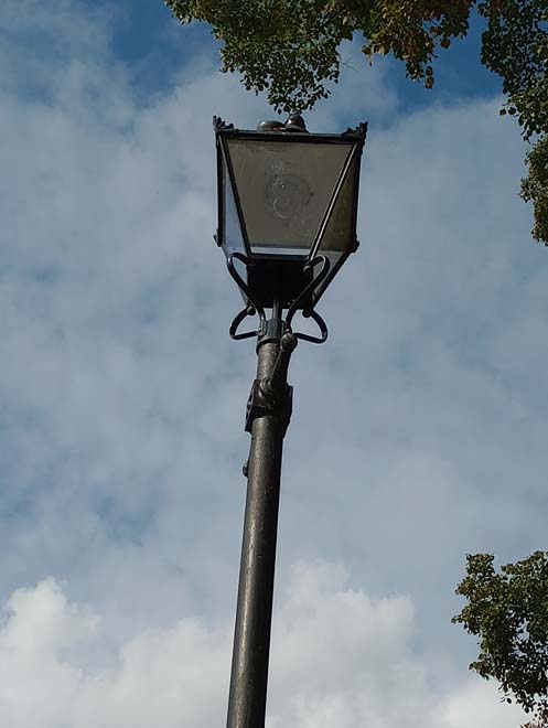
Figure 69: Heritage style lamppost on First Cross Road
EV charging points
Two EV charging points have been installed on the north side of The Green opposite nos.28 & 30. They are unobtrusive and are simply designed.
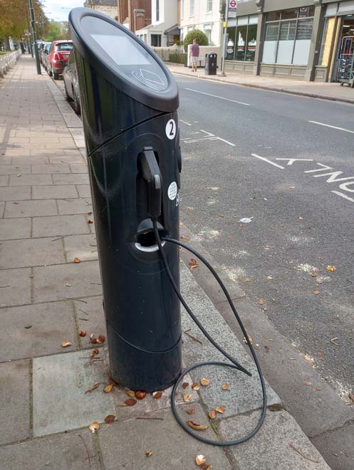
Figure 70: EV charging point
Street Signage
Street signage has been kept to a minimum and existing signposts/lampposts are utilised for signs such as parking information. This is a positive aspect as it reduces clutter in the streetscape.
Bollards
There are few bollards in the Conservation Area, except for strategic positions where they are used as traffic calming measures (entrance to Vicarage Road) or to prevent vehicles mounting the kerb (May Road).
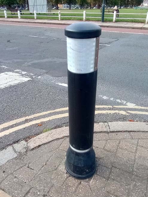
Figure 71: Bollard at the junction of Vicarage Road and The Green
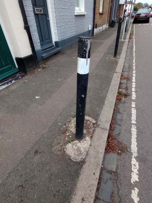
Figure 72: Bollards on May Road
Cycle Parking
A row of six silver Sheffield stands is situated on the northern side of The Green by the former public conveniences.
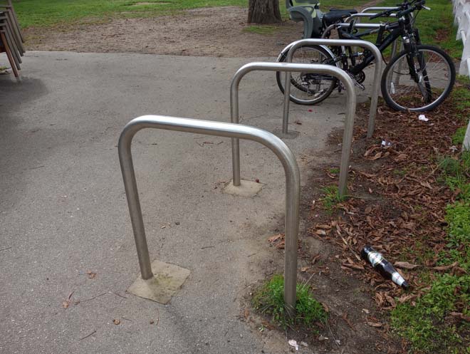
Figure 73: Sheffield stands
Bins
Bins are spaced evenly around the perimeter of The Green. They are cylindrical in design, and formed of a metal holder and green plastic container. They are well placed in relation to benches and entrance/exits and form unobtrusive features in the street scene.
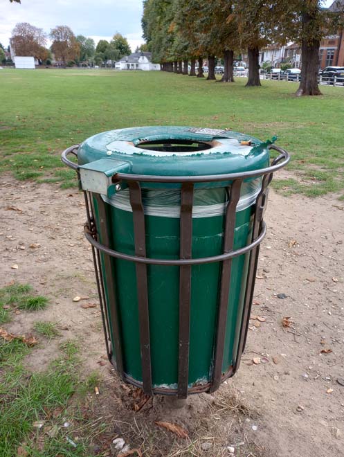
Figure 74: Example of a bin on The Green
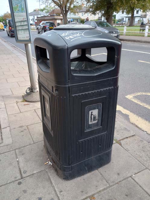
Figure 75: Bin outside 32 - 38 The Green
Behind the cricket pavilion is a recycling centre comprised of black recycling units. They are partly screened from the road by planting, but are still visually intrusive and detract from the setting of the entrance to The Green.
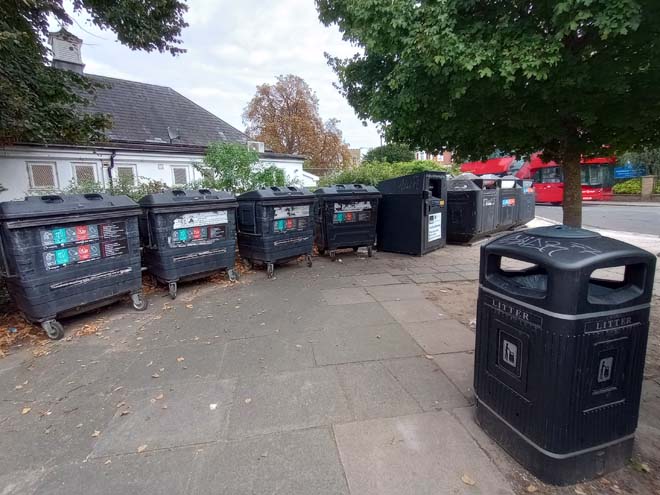
Figure 76: Recycling centre behind the Cricket Pavilion
Railings & Fences
Apart from the fence surrounding The Green, there are only a couple of safety fences situated opposite openings in the fence around The Green. They make a neutral contribution to the Conservation Area.
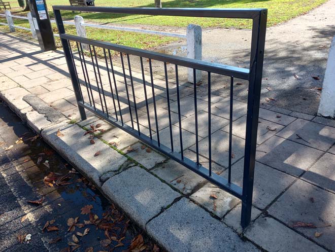
Figure 77: Safety fence on the north side of The Green
Paving
The pavements immediately surrounding The Green are paved in standard square concrete pavers, with granite kerb edges, and granite drainage channels in the roadway.
The smaller residential roads within the Conservation Area are paved in tarmac of varying quality and colour, which detracts from the setting of the surrounding historic buildings and fails to contribute to the character of the Conservation Area.
All three of the corners of The Green feature paved areas. The north-eastern and southern corners have been well-utilised, but the north-western corner has not, resulting in a bare expanse of hardstanding of different sizes and materials.
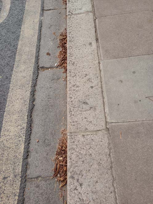
Figure 78: Granite kerb and drainage channel on the south side of The Green
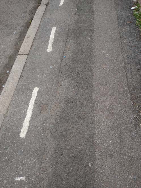
Figure 79: Paving along May Road
Figure 80: Paving along First Cross Road
Figure 81: The path across The Green
Part 3: Management Plan
Summary
This Appraisal has assessed the quality and condition of the Twickenham Green Conservation Area. Several site visits were undertaken in September 2022, where the area was observed and photographed.
The Appraisal has summarised the strengths and weaknesses of the Conservation Area, and this management plan sets out a strategy to consolidate and enhance these strengths and prevent further erosion of the area’s special architectural and historic character.
The built form of the Conservation Area remains largely unaltered, with only small amounts of modern development, most notably the industrial estate. The larger ‘statement buildings’ on the south side of The Green have retained their architectural character and form. The buildings facing into The Green are generally preserved, although several of those in retail use have poorly designed shopfronts and unsympathetic replacement windows. Most of the buildings on Second Cross Road have unsympathetic replacement windows, doors, and external finishes which obscure their historic nature as modest rural cottages.
The overall conclusion of the Appraisal is that all areas of the Conservation Area are worthy of inclusion. It is hoped that this clearer, more extensively illustrated Appraisal will assist the Development Management Process in making more informed planning decisions in respect of the Area’s character.
Furthermore, it is apparent that any further deterioration would endanger the character and appearance of the Conservation Area. An Article 4(2) Direction is in place covering nos.24 – 33 First Cross Road, which limits certain permitted development rights.
Under section 71 of the Planning (Listed Buildings and Conservation Areas) Act 1990, local planning authorities have a statutory duty to draw up and publish proposals for the preservation and enhancement of conservation areas in their area, from time to time. Regularly reviewed appraisals, or shorter condition surveys, identifying threats and opportunities can be developed into a management plan that is specific to the area’s needs.
Article 4(2) Direction
Conservation Area designation does not in itself introduce any greater level of statutory control over minor works to properties, such as the demolition of original features, the replacement of windows and doors, the loss of garden fences, or other boundary treatment. Such works are normally ‘permitted development’ for homeowners and no application for planning permission is normally required, despite the impact these works can often have on the appearance of an individual property and consequently the impact on the overall character of the Conservation Area.
Local Planning Authorities, however, have power to control these changes by removing certain permitted development rights by making an Article 4 Direction. Once a direction has been made, planning permission is required for those classes of development listed. Such directions only affect unlisted dwelling houses in single occupation (i.e. not subdivided into flats, or with individual rooms let to tenants) and only those elevations that front a highway, waterway, private street, or other publicly accessible space (including side elevations of corner properties). Flats, shops, offices and other commercial buildings and houses in multiple occupation do not have the benefit of permitted development rights and so planning permission for changes is required.
There is one existing Article 4(2) direction within the Conservation Area, which was made on the 26th October 1992.
Article 4(2) Restrictions Schedule
i) The enlargement, improvement or other alteration of the said properties including enlargements consisting of additions or alterations to their roofs
ii) The provision within the curtilages of the said properties of hard surfaces
iii) The installation, alteration or replacement of satellite antennae on the said properties or within their curtilages
iv) The erection, construction, maintenance, improvement or alteration of gates, fences, walls or other means of enclosure
v) The painting of the exterior of any building or work
Applies to the following addresses:
First Cross Road Nos 24 - 33
Problems and Pressures
- Loss of traditional architectural features and materials due to unsympathetic alterations.
- Loss of original windows and replacement with unsympathetic styles and materials.
- Painting and rendering of isolated properties in a terrace, or where it was not a feature of the original building, which disrupts the uniformity of the terrace, obscures detailing, and hides maintenance problems.
- Infill developments to the long rear gardens of properties on First Cross Road and Second Cross Road.
- Heavy traffic along both sides of The Green, and up Second Cross Road which is used as a cut-through between Staines Road and Hampton Road.
- Traffic volume and its associated noise, danger, and pollution creates a relatively poor pedestrian environment.
- Poor condition of the paint on the railway bridge, and susceptibility to graffiti. This forms an important part of the setting of the eastern end of the Conservation Area.
- The areas of hardstanding at the north-western and southwestern corners of The Green which have a negative visual impact on the setting of The Green and surrounding buildings.
- Areas of fencing around The Green are in a poor state of repair, with flaking paint and rust.
- Unsympathetic paving to First Cross Road, Second Cross Road, and May Road.
- A few poorly designed shopfronts along the north side of The Green.
- Isolation of the pump between three busy roads, and the domination of traffic lights and Belisha Beacons around it.
- Front gardens of larger properties given over to hardstanding for cars.
- Notable visual detractors:
- The northern side of the approach to the railway bridge from The Green
- 6 The Green
- 61 The Green
- 1a & 1b Second Cross Road
- 15 – 19 Albion Road
Opportunities for Enhancement
- Preservation, enhancement, and reinstatement of architectural quality and unity.
- Encourage the replacement of unsympathetic windows with sympathetic windows in both material and form.
- Encourage the restoration of painted and rendered brick facades to their original appearance.
- Encourage the retention of common boundary treatment and the replacement/installation where appropriate of lost boundary treatment.
- Encourage improvements to the quality and design of shopfronts.
- Improve the quality and materiality of pavements along First Cross Road, Second Cross Road, and May Road to be more sympathetic to the historic environment.
- Repairs and maintenance of the fence surrounding The Green.
- Public realm improvements to the north-western corner of The Green.
- Public realm improvements to the setting of the Twickenham Green Pump, and paving improvements to the eastern corner and setting of the water trough and telephone box.
- Maintenance and improvement of the railway bridge, and the approach on the northern side of the road, including the pedestrian guard rail.
- Preservation and repair of the Listed telephone boxes. One has been repurposed as a coffee kiosk. BT have an ‘Adopt a Kiosk’ scheme were Local Authorities, Parish/Town Councils, and charities can buy a phone box and convert it for another use.
Design Guidance
This Appraisal is also a source of guidance for applicants seeking to make changes that require planning permission, helping to make successful planning applications.
The advice below sets out guidance which encourages good quality of design which will help to both preserve and enhance the character of the Conservation Area.
Dwellings within Conservation Areas which have been divided into flats do not benefit from Permitted Development Rights, requiring planning permission to carry out alterations and extensions.
It is worth noting that full planning permission for any alteration to a shopfront that would change the shop’s appearance must be applied for. This includes replacement shopfronts, installation or replacement of doors and windows, and installation or replacement of external security measures. The installation of a new shopfront, or the significant altering of an existing shopfront is also development which requires planning permission.
Windows
Windows make a significant contribution to the appearance of an individual building and can enhance or interrupt the unity of a terrace, so it is important that a single pattern of glazing bars should be retained within any uniform composition. Generally, windows follow standard patterns and styles. In Georgian and early- to mid-Victorian terraces, each half of the sash is usually wider than it is high, and divided into six or more panes. Later Victorian, and Edwardian buildings often employ a simpler pattern, with the sashes either having one large pane, or a single central glazing bar. More elaborate Victorian villas often have multi-pane top sashes and single-pane bottom sashes.
The age and quality of windows varies significantly throughout the Conservation Area. Some original timber vertical sliding sash windows remain, notably on architecturally cohesive terraces (1 – 29 The Green, and 24 – 33 First Cross Road), and these make an important contribution to the special character and appearance of a building. Where original windows have been lost, the replacements vary in both quality and style. Where the original historic style is mimicked, the details are often not replicated, with thicker glazing bars, higher reflectiveness of the glass, and varied horn details. Others are inappropriate UPVC windows which do not replicate the original glazing patterns or opening systems.
It is encouraged that residents, in the first instance, retain and repair existing original timber windows. If replacement is required, all aspects of the window should be considered, including opening type, glazing bar patterns, horns to sashes, and depth. Windows should be timber sash and replicate the original glazing pattern. Timber frames are not only the most appropriate option, but are more sustainable being a natural material which helps reduce the use of single-use plastics, often found in other windows. Timber windows also have the benefit of being more cost effective, being much more durable and repairable than alternatives, and there are options to maintain their appearance while introducing energy saving and noise reducing features.
Single glazing is the most common approach and would be the most acceptable replacement to maintain the existing character and appearance of the area. Secondary glazing is an unobtrusive option to increase efficiency, reduce noise, and avoid intervention to existing fabric, often performing as well and lasting longer than double glazing. Where appropriate and where there is justification for full replacement, slimline double and triple glazing with timber frames helps maintain a consistent appearance, while offering similar benefits to secondary glazing. Where double/triple glazing is accepted, black spacing bars and seals should be avoided – these should instead be white to blend with the frame. Trickle vents should be avoided or well concealed within the frame to maintain consistency with historic appearance.
Doors
Doors, like windows, make a substantial contribution to the appearance of an individual building and can enhance or interrupt the unity of a terrace.
Nos.24 – 33 First Cross Road have retained their original doors. Elsewhere in the Conservation Area, the majority of doors are non-original and vary in colour, style, and materials.
It is encouraged that in the first instance, any surviving original timber doors are retained and repaired. This is best for the environment, for the character and appearance of the area, and is often a more inexpensive solution than complete replacement. Simple modifications can often be carried out internally which improves the weatherproofing of the door without impacting its external appearance.
If a replacement door is required, it should match the original door for the host building’s typology. In domestic properties, Victorian and Edwardian doors are typically four panels. For shopfronts, the design of the door should be sympathetic to the design of the shopfront.
Painting and External Finishes
External finishes are common features in the Conservation Area and have been carried out to varying levels of quality and effect. It is less successful where there are one or two properties which differ from the rest of the terrace as this disrupts the architectural cohesion of the terrace.
Painting and external finishes are recommended only when it forms part of the original design of the building. this should be regularly maintained and refreshed to prevent deterioration and water damage and to maintain the character of the building. Where non-original painting has been applied, this risks damaging the original brick beneath.
Boundary Treatment
Uniformity of boundary treatment can be achieved by replicating common examples evident within the same terrace groups, which would enhance the uniformity of the terrace as well as the character of the area. The retention of hedges is encouraged as they add a soft buffer to the front garden as well as providing added greenery to the area.
Shopfronts
The quality of design of shopfronts varies within the Conservation Area. No original shopfronts survive intact, but several have surviving elements, most commonly corbels. No.78 has retained its original door, although the shopfront is a modern replacement. No.76 adjacent has retained its moulded and dentiled cornice. No.20 has retained its original corner entrance door flanked by columns
Traditional (and traditionally designed) shopfronts make an important contribution to the character and appearance of the historic environment. Any existing historic shopfronts, or components of historic shopfronts, should be maintained and repaired in the first instance. Where traditional forms have been replicated, or contemporary shopfronts inserted, these should continue to follow traditional designs if they need to be altered or replaced. Any new or replacement shopfronts will need to maintain or improve the appearance of the existing shopfront. Guidance on the design of new shopfronts can be found in the 'Shopfronts' Supplementary Planning Document.
Signage should replicate traditional styles with painted or applied letters to the fascia and simple hanging signs. Modern signage, including corporate branding, internally illuminated projecting box signs, and box fascias are discouraged. Projecting/hanging bars should be sympathetically placed and attached to the fascia or building face. Where hanging signs are proposed, these should use a traditional bracket and be of a simple design.
Shopfront Security
Projecting shutter boxes have a negative impact on the appearance of shopfronts and are not acceptable in conservation areas, nor are solid or perforated shutters. Unless they are continuously back-lit, the perforation is only really apparent directly in front of the shopfront itself – from other angles and from further away they seem solid, and solid shutters create an unwelcoming, unattractive environment. By blocking the interior, they also prohibit passive surveillance and are more likely to be graffitied, which would cause further harm to the character and appearance of the conservation area.
Instead, there are other solutions which would be more suitable, and these are outlined in the 'Design Guidelines for Shopfront Security' Supplementary Planning Guidance. For contemporary shopfronts, more passive security measures can be effective, such as laminated glass, which is not readily apparent and therefore mitigates detracting from the appearance of the shopfront. Lattice brick-bond grilles can be installed internally behind the windows, with the box inserted into the ceiling – this prevents an external projecting box and the internal box from being visible through the shop window. This would allow for an appropriate level of security, while minimising the visual impact of shutters on the external appearance of the shopfront, and therefore of the conservation area. It also allows for passive observation by keeping the inside of the shop visible.
Energy Efficiency
Introducing energy efficient measures can reduce carbon emissions, fuel bills, and improve comfort levels. It is important that the appropriate course taken should be informed by the context of the building being improved, with each building having different opportunities and restrictions. Not all solutions will be appropriate across the Conservation Area, and the ‘Whole Building Approach’ advocated by Historic England encourages a case-by-case approach, which fundamentally considers the context, construction, and condition of a building to determine which solutions would be the most suitable and effective. More detailed advice can be found within the Historic England Guidance Note Energy Efficiency and Historic Buildings: How to Improve Energy Efficiency
Solar Panels
Solar Panels and equivalent technology are most suitably placed on rear or side elevations where they are hidden from the public realm – principal elevations and roof slopes facing the public realm are less appropriate as they generally make the most substantial contribution to the character and appearance of the Conservation Area. New technologies, such as PV panels disguised as slates and sitting flush with roof materials, may be suitable in the appropriate context, and will be considered on a case-by-case basis.
Streetscene and Public Realm
The public realm is an important part of the historic environment as it makes a significant contribution to the setting of buildings. Public spaces which are cluttered with unrelated elements can detract from the appearance of the area. It is therefore important that high quality materials and workmanship are used to develop good streetscapes and public spaces, which can contribute positively to the historic environment.
Large areas of bare hardstanding detract from the quality of the area and invite graffiti on them. Similarly, poor quality paving detracts from the setting of surrounding buildings.
The pavements surrounding The Green are relatively free of clutter. Parking meters and EV charge points are spaced evenly and do not dominate the pavements. Existing lampposts are utilised for street signage, except at the junction of First Cross Road and Staines Road
Good streetscape and public realm can be achieved through the use of high-quality additions which reflect the character of the area and contribute to the character and appearance of the Conservation Area. Surviving cast-iron street name plates should be identified and retained. The positioning of street furniture should be rationalised to ensure they are in the best possible locations and of appropriate design. Lamp and signpost columns should be green or black in colour and appropriate for the scale and character of the Conservation Area. Bollards should be of traditional cast iron design and plastic bollards should be avoided. The use of traditional paving slabs (ASP) and granite kerbs should be encouraged, and existing granite kerbs and drainage channels retained. Further guidance on the public realm can be found within the Council’s Public Space Design Guide
Part 4: Appendix
References
Historic Maps: National Library of Scotland and Layers of London
Historic Photographs & Images: Richmond Local Studies Library and Archives
The Environs of London Volume 3, County of Middlesex (British History Online)
A History of the County of Middlesex: Volume 3 (British History Online)
The History and Antiquities of Twickenham, Edward Ironside, 1797
Memorials of Twickenham, Richard Stuteley Cobbett, 1872
Borough of Twickenham Local History Society
Twickenham As It Was, Borough of Twickenham Local History Society, 1975
Twickenham, Teddington & Hampton: A Second Selection, Mike Cherry, Ken Howe, John Sheaf, 1988
Twickenham Past: A Visual History of Twickenham and Whitton, Donald Simpson, 1993
Up to: Conservation areas
Updated: 02 July 2026
