
Barnes Green
Conservation Area Appraisal
Conservation Area No.1
Barnes Green
Contents
- Part 1: Introduction
- Part 2: Conservation Area Appraisal
- Part 3: Management Strategy
- Part 4: Appendix
Part 1: Introduction
Outline of Purpose
The principle aims of Conservation Area Appraisals are to:
- Describe the architectural and historic character and appearance of the area, which will assist applicants in making successful planning applications, and decision makers in assessing planning applications
- Raise public interest and awareness of the special character of their area
- Identify the positive features which should be conserved, as well as the negative features which indicate scope for future enhancements
It is important to note that no Appraisal can be completely comprehensive, and the omission of a particular building, feature, or open space should not be taken to imply that it is of no interest.
This document has been produced using the guidance set out by Historic England in the 2019 publication ‘Conservation Area Appraisal, Designation and Management: Historic England Advice Note 1 (Second Edition)’.
This document will be a material consideration when assessing planning applications.
What is a Conservation Area?
The statutory definition of a conservation area is an ‘area of special architectural or historic interest, the character or appearance of which it is desirable to preserve or enhance’. The power to designate conservation areas is given to local authorities through the Planning (Listed Buildings and Conservation Areas) Act 1990 (Sections 69 to 78).
Once designated, proposals within a conservation area become subject to local conservation policies set out in the Council’s Local Plan and national policy outlined in the National Planning Policy Framework (NPPF).
Our overarching duty, as set out in the Act, it to preserve and/or enhance the historic or architectural character or appearance of the conservation area.
What is an Article 4 Direction?
An Article 4 Direction is made by the local planning authority. It restricts the scope of permitted development rights either in relation to a particular area or site, or a particular type of development anywhere in the authority's area. The Council has powers under Article 4 of the Town and Country Planning (General Permitted Development) Order 2015 to remove permitted development rights.
Article 4 Directions are used to remove national permitted development rights only in certain limited situations where it is necessary to protect local amenity or the wellbeing of an area. An Article 4 Direction does not prevent the development to which it applies, but instead requires that planning permission is first obtained from the Council for that development. View further information about Article 4 Directions to check if any permitted developments rights in relation to a particular area/site or type of development apply in your area.
Buildings of Townscape Merit
Buildings of Townscape Merit (BTMs) are buildings, groups of buildings, or structures of historic or architectural interest, which are locally listed due to their considerable local importance. The policy, as outlined in the Council’s Local Plan, sets out a presumption against the demolition of BTMs unless structural evidence has been submitted by the applicant, and independently verified at the cost of the applicant. Locally specific guidance on design and character is set out in the Council’s Buildings of Townscape Merit Supplementary Planning Document (2015) which applicants are expected to follow for any alterations and extensions to existing BTMs, or for any replacement structures.
Designation and Adoption Dates
The Barnes Green Conservation Area was designated on the 14th January 1969. It has subsequently been extended four times.
- First Extension: 7th September 1982 (to include Cleveland Road)
- Second Extension: 14th June 1988 (to include Malthouse Passage and part of Stanton Road)
- Third Extension: 13th January 2004 (to include Grange Road and part of Kitson Road)
- Fourth Extension: 24th April 2018 (to include Elm Bank Gardens)
- Fifth Extension: 8th February 2024 (minor boundary rationalisations)
Following approval from the Environment, Sustainability, Culture and Sports Committee on Monday 3rd July 2023, a public consultation on the draft Appraisal was carried out between Monday 18th September and Friday 27th October 2023.
This Appraisal was adopted on 8th February 2024.
Other Planning Designations
Barnes Green is a designated area of Metropolitan Open Land (MOL). The riverside between Barnes Bridge and The White Hart is also designated as Metropolitan Open Land (MOL) and an Other Site of Nature Importance (OSNI).
The Barnes Village Planning Guidance was adopted on the 8th January 2015. Its purpose is to establish a vision and planning policy aims for Barnes and assist in defining, maintaining, and enhancing the character of the Barnes. It can be viewed on the Council's website here: Barnes Village Planning Guidance.
The Greater London Archaeology Advisory Service (GLAAS) completed it's review of Richmond Borough's Archaeological Priority Areas (APAs) in 2022. This identifies the Barnes Green Conservation Area as covering the Tier 2 APA of Barnes as well as the eastern end of the Tier 2 APA of Mortlake. The full review can be found on the Historic England website as well as further information and guidance on Archaeological Priority Areas.
Map of conservation area
Summary of Special Interest
The Barnes Green Conservation Area covers the historic core of Barnes as well as late 19th century and early 20th century residential development to the east and west. It contains buildings ranging in date from the 17th to the 21st centuries, with many of high architectural quality, and the Grade II* Listed St Mary’s Church with 12th century origins. Barnes retained some of its rural village character into the 19th century, only undergoing transformation in the late 19th and early 20th centuries from a rural settlement into a suburban area, reflecting the urban sprawl of London in this period. Although Barnes has been encroached on by this suburban development, its rural character can still be read in the form of the Green and its framing architecture which contributes to its significance.
Barnes derives its identity from four distinct elements: the river, historic thoroughfares and the shopping centre, open space of the Green, and residential areas. Barnes has a long historic relationship with the river, along which many of the fine 18th century houses are located. Long panoramic views of Barnes Terrace and the riverside are complemented by further long views upstream to Mortlake and downstream to Chiswick. The medieval green acts as the focus for the village and is a welcome contrast to the dense and busy streets surrounding it. Barnes has maintained its commercial centre and similarly retains its strong historic character
Historic Development
Origins
There is some evidence of prehistoric activity in the Barnes area, including Neolithic flint working sites, and an early Iron Age settlement was found to the southeast at Barnes Common and Barn Elms. There is sparse Roman archaeological evidence at Barnes compared with a large amount recorded within the Putney area.
The manor of Barnes had been established prior to the Norman conquest and at one point formed part of the manor of Mortlake. It was granted to the Dean and Chapter of St Paul’s Cathedral by King Athelstan in the early 10th century. By the time of the Domesday Book in 1086, the settlement was recorded as ‘Berne’, being of 14 households and held by the Canons of St Paul. The foundation of the church is thought to have occurred within the next sixty years and is therefore thought to be the second oldest church in London (although there is some debate over which is the oldest).
St Mary's Church
Tradition says that the Church of St Mary was re-dedicated by Archbishop Stephen Langton in 1215 on his way back from signing the Magna Carta at Runneymede. It would have been a simple, rectangular chapel, with walls composed mostly of coursed flint. An early 13th century addition to the west enlarged the nave, and another to the east added a chancel with triple lancet windows. The octagonal red brick tower of c1485 was the last notable change until the demolition of the north wall in 1786 to make way for a north aisle.
The increase in population in the 19th century resulted in a major enlargement of the nave and north aisle by Charles Innes (architect of St Michael and All Angels), completed in 1906. The church was almost completely destroyed by fire on the 8th June 1978. During the rebuilding work evidence of the original 12th century flint structure was revealed, alongside several previously hidden 12th and 13th century features. However, the Victorian and Edwardian additions were completely lost. The architect Edward Cullinan rebuilt and extended the church, which was re-hallowed on the 26th February 1984. The lychgate was erected at the entrance to the churchyard in 1902 to commemorate the coronation of Edward VII. The Barnes War Memorial was unveiled in 1921.
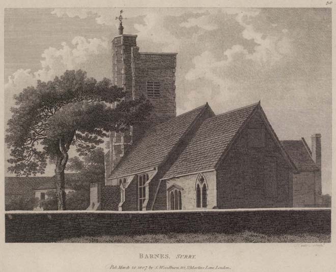
Figure 1: A drawing of St Mary's Church in 1807 (Orleans House Gallery
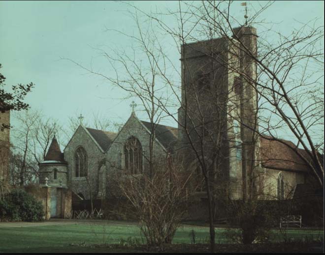
Figure 2: St Mary's Church in 1969 before the fire (Barnes and Mortlake Historical Society)
Medieval Period
The medieval settlement of Barnes originally developed around the Green. Partly triangular greens and ponds were common features of medieval settlements, and some of the long, narrow plots on the High Street may also be surviving medieval burgage plots. The High Street is thought to have developed along the course of a medieval trackway leading from the Green to a river docking place (recorded as the ‘new dock’ in the 1400s). Revenue and produce from the land were used to support and sustain those living within St Pauls. Except for during the Government of the Commonwealth (1649 – 1660), the freehold of the estate and certain areas of Barnes remained in the hands of the Cathedral. The last few freeholds of property built on church land were sold after the Second World War.
17th - 19th Centuries
At the beginning of the 17th century, Barnes had a population of around 150 – 200, and would have remained as a small village for much of this century. Some of the earliest surviving buildings in Barnes date from the 17th century, notably Milbourne House and 70 High Street (both later altered). By the 18th century, Barnes was becoming a desirable place for wealthy people to relocate to, which led to the development of large houses along The Terrace and Riverside, and smaller houses along Station Road. By the beginning of the 19th century, the population had grown to 860. The settlement was still very much situated along the historic thoroughfares and riverside, with some large houses in spacious grounds along Church Road. The land surrounding these houses was increasingly being used for market gardening, which had begun in the 17th century. By the mid-19th century, nearly half the land in Barnes was used to provide crops for market gardening to send to the London markets, and much of the rest was used to graze the gardeners’ horses. The height of the market gardening industry was the 1880s, but this height was short-lived, and had declined by the turn of the century as land became more valuable for building on.
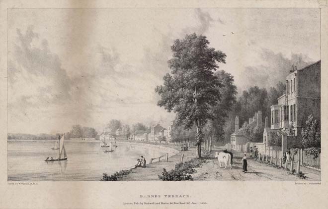
Figure 3: A view of The Terrace in 1823 (Orleans House Gallery)
Barnes Bridge was opened in 1849, but the advent of the railway did not immediately result in a large increase in building and population. Some development occurred between 1850 and 1890, including some infilling of the High Street and the formation of Stanton Road, Cleveland Road and Cleveland Gardens. However, it was from the 1890s onwards that saw a huge expansion of building in Barnes, with many of the large 18th and 19th century houses being lost. By the 1901 census, the population of Barnes was just below 10,000.
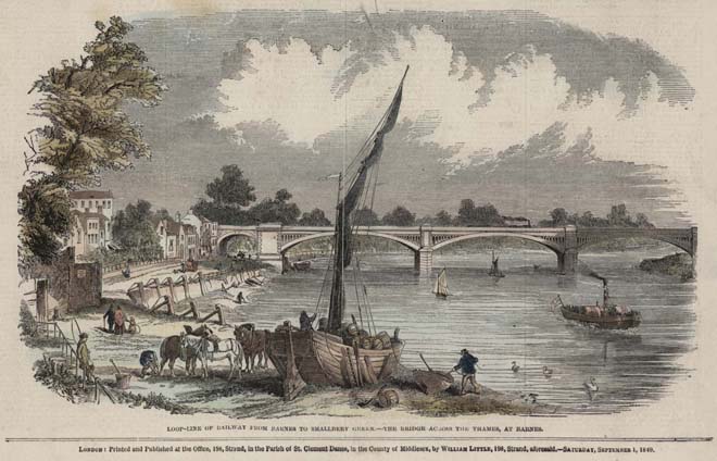
Figure 4: A view of Barnes Bridge in 1849 (Orleans House Gallery)
St Michael and All Angels Church
The congregation dates from 1876 when a ‘school church’ was erected in Archway Street at the instigation of Canon Melville, the then Rector of Barnes. Paid for by public subscription it was to serve the Westfields Area, which was being developed between The Terrace, railway lines, and White Hart Lane. A temporary iron church (a 'tin tabernacle') was erected alongside the school in 1878. The building of the present church was due to the Reverend L.T. Lochee who purchased the land from the Elm Bank Estate. It was built between 1891-1893 to designs by Charles Innes. The south aisle was added in 1905 by Meredyth Kitson, and the vestry in 1936. The modern community centre was added between 2006-2011, designed by Hugh Cullum Architect.
Elm Bank Mansions
Elm Bank Mansions were developed at the height of the major flat-building boom in London, which had caught on after the success of Albert Hall Mansions in Kensington in the 1880s and spread out to the Thameside suburbs. They were built on the site of Elm Bank House, a grand 18th century house and one of the large estates which were spread around Barnes in the 18th and 19th centuries. The land surrounding the estate was starting to be sold off from the late 1880s, and the house came up for auction in 1905. It was bought by the developer Robert Emerson who engaged local architect Robert Overton to design new mansion blocks. The blocks were designed and built in stages, with plans for the back block set out by October 1906, followed by the front block in August 1907. Both blocks had been completed by 1910.
The Lion Houses
The Lion Houses are one of the most distinctive and well-known groups of buildings in Barnes. They were built by developer James Nichols between 1899 and 1903. Nos.1 – 14 The Crescent were the first to be constructed, followed by Laurel Road, Hillersdon Avenue, and Glebe Road. Nichols’ building yard was on the site of Grove House, another large house which was lost amid the intense residential development of Barnes. Nichols also developed Brookwood Avenue on the front half of the site facing the Green (the houses he built were all destroyed in 1940 and the street redeveloped post-war) and the rear of the site became the Beverly Aeroplane Works. The lion figures identify his work, although their widespread use suggests he may have taken delivery of rather more than he intended, with one account indicating that 1000 lions were supplied by mistake for the 100 ordered. In any event, the small creatures were used with abandon and surmount gate piers, bays, and parapets to form an attractive and unusual feature of the houses.
20th Century Industry
Alongside the expansion in residential development was the expansion in industry. On the site of Nichols’ building yard, a sawmill opened in 1904, before becoming the Beverley Aeroplane works where aeroplane parts were made during the First World War. The factory designed the Beverley Barnes luxury car in 1924, but only a small number (estimates range from 15 to 25) were ever produced. It was subsequently acquired by Omes Works, who had a unique electro-forging technique and made aircraft, vehicle and armaments components during the Second World War. The factory closed in 1971, but the gates have been preserved. The latter half of the 20th century saw the decline of industry in Barnes, with the loss of the Zeeta Works (a chocolate factory and bakery), brass foundry on The Terrace (a former maltings, now the site of 1 – 4 Maltings Close), wireless factory (now the site of Seaforth Lodge), confectionary factory (now the site of part of Sussex Court) alongside the Omes Works.
Post-war Change
Barnes suffered some damage during the Second World War. Five houses on Stanton Road were lost in August 1940, and the whole of Brookwood Avenue and Willow Avenue were destroyed a month later. The former industrial sites were developed over the latter half of the 20th century, infilling large or previously vacant sites. The police station, a dominant presence on the High Street, was redeveloped in the early 2000s and was one of the last large industrial-style sites to be developed. Later modern development has included the M&S Foodhall (28 High Street), and Foundry Mews to the rear of Seaforth Lodge.
Barnes is now a busy mixed retail and commercial centre with great diversity of architecture and depth of history. Although very much part of suburban London, it retains its distinctive historic character
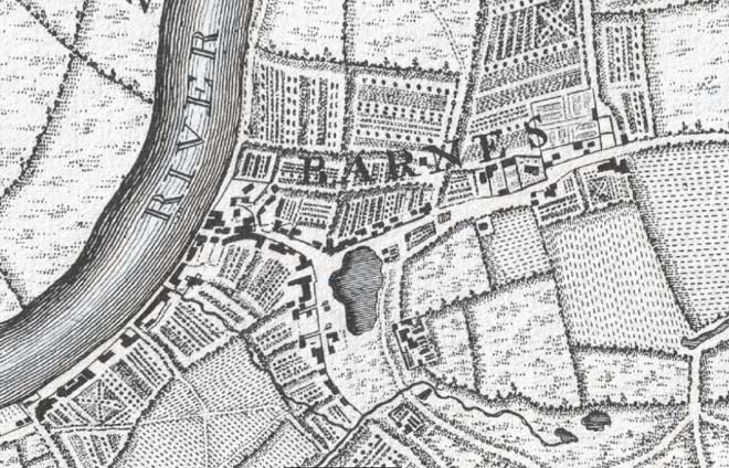
Figure 5: Extract from John Rocque’s ’10 miles round London map’ (Surveyed 1741 – 5, published 1746)
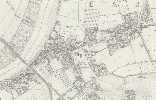
Figure 6: Extract from the 1867 Ordnance Survey Map of London
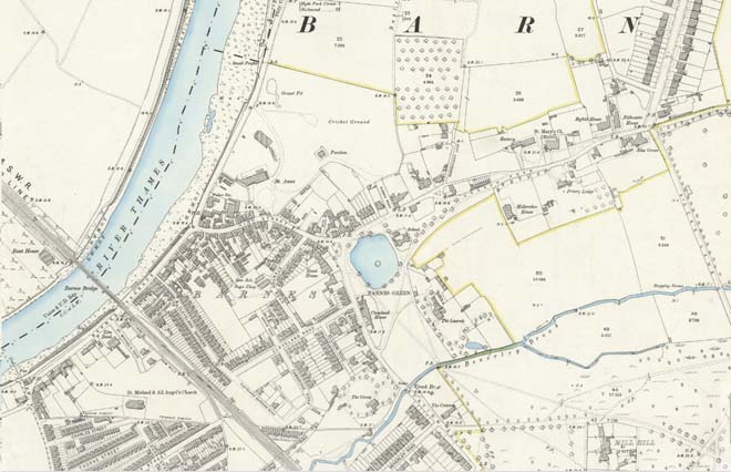
Figure 7: Extract from the 1891 Ordnance Survey Map of London
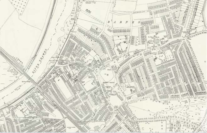
Figure 8: Extract from the 1913 Ordnance Survey Map of London
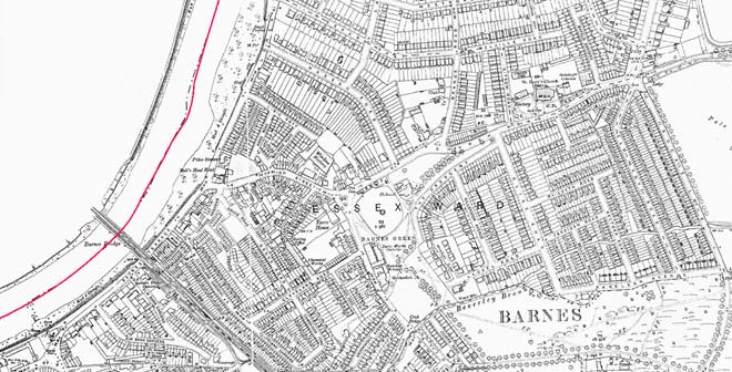
Figure 9: Extract from the 1933 Ordnance Survey Map of Surrey
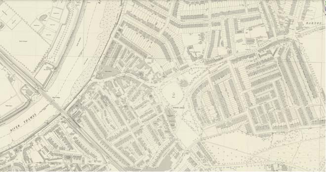
Figure 10: Extract from the 1951 Ordnance Survey National Grid Map
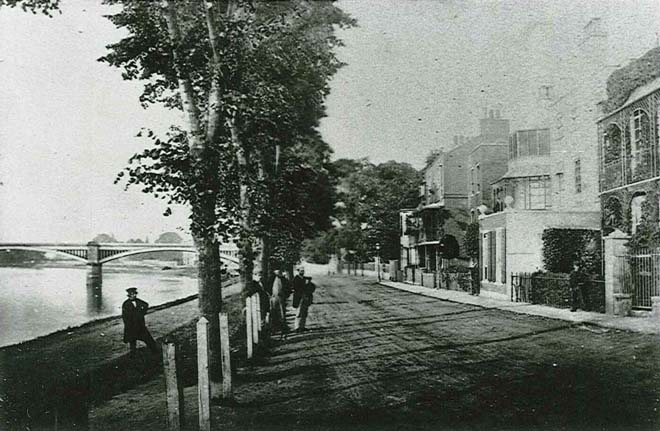
Figure 11: The Terrace looking north in the 1880s/early 1890s (before the construction of the second part of Barnes Bridge)
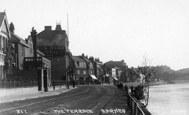
Figure 12: The Terrace looking south in the early 20th century
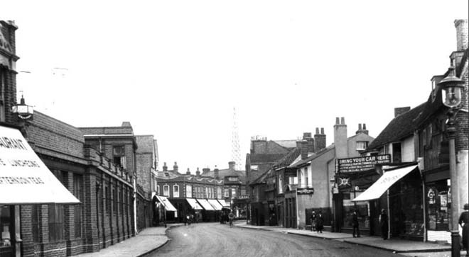
Figure 13: The High Street in the 1920s with the police station on the left
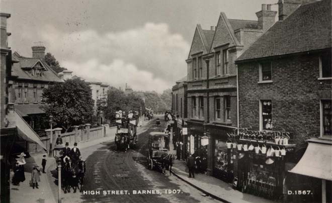
Figure 14: The High Street in 1907
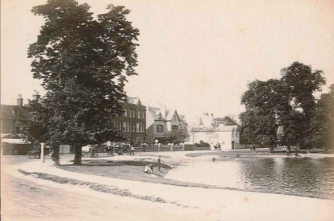
Figure 15: Barnes Pond in the 1880s
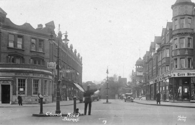
Figure 16: Church Road and Lowther Parade in the 1920s
Part 2: Conservation Area Appraisal
Location, Setting & Topography
Barnes Green Conservation Area is centred along the historic core of Barnes and the main thoroughfares of the High Street, Church Street and Station Road. It also incorporates The Terrace along the riverside, and the later 19th and 20th century residential expansion to the east and west. Barnes is situated within the meander of the Thames in an area of flat, low-lying floodplain. The terrain is almost uniformly flat, with Mill Hill on Barnes Common being the highest point at 27 feet above sea level. The flatness of the topography helps enhance the sense of continuity along Church Road and the High Street, allowing for long views where the road does not bend. The Conservation Area is bounded to the east by the WWT London Wetlands Centre and Barn Elms Playing Fields, to the south by Barnes Common and to the west by the River Thames. It adjoins Castelnau Conservation Area (no.25) to the north, Barnes Common, and Thorne Passage Mortlake Conservation Areas (nos.32 and 16 respectively) to the south and Mortlake Conservation Area (no.33) to the west.
Townscape Overview
Barnes is an area of great diversity of architecture due to its long history and different phases of development. The area contains buildings ranging in date from the 17th to 21st centuries, with great variety in architectural styles. The townscape of Barnes is largely defined along the major roads and the River Thames, which form the central axis and core of the village. The historic core, comprising High Street, Church Road, and Station Road is characterised by a varied mix of styles and dates reflecting the organic and continued development of these streets. Shops and parades of shops generally sit hard up against the pavement, creating a closed-in feel in parts of the High Street where the road narrows. Materials are generally consistent, being either stock brick or red brick, with a varied roofscape in both form and level. At the western end there are few continuous runs of historic buildings, emphasising the piecemeal development of the street, but the central and eastern ends feature longer terraces and parades of shops.
The river frontage is one of the longest and most distinctive townscapes in Barnes, characterised primarily by many fine 18th and 19th century houses. These are largely in stucco or render, often painted white or light pastel colours. Those unpainted are in brown or stock brick. These riverside houses generally sit hard up against the pavement, but a few have small gardens, or are set back from the road, giving greater depth and interest to the townscape. To the north, the more modest terraces result in a much more cohesive streetscape, in a mix of red and painted brick, and are more reflective of the residential areas of Barnes.
It is these residential areas (developed in the late 19th and early 20th century) which have the greatest cohesiveness in style and material amongst their groups. These long terraces or groups create a highly uniform streetscape which reflects the nature of their development as planned urban expansion instead of organic growth. Red, stock, and gault brick are all used, with roofs in either tile or slate. All sit behind small front gardens and uniform boundary treatment, which features regularly across groups and forms an important contributor to the uniformity of the townscape.
A few large landmark buildings dominate the largely two/three storey townscape. These include the substantial Seaforth Lodge on the High Street, the former Zeeta Works on Station Road and Elm Bank Mansions on The Terrace. These isolated buildings create focal points in longer views and provide further architectural and visual interest to the varied townscape.
Throughout the Conservation Area there is a wide variety of buildings representing different periods of architecture, ranging from 17th and 18th century houses to 19th century shopping parades and 20th century mansion blocks. There is some consistency in materials, most often within groups rather than across the area. The wide typology of buildings, from single detached dwellings, shopping parades, ecclesiastical buildings, uniform terraces, and former industrial buildings contribute to the great diversity of Barnes’ architecture and form a townscape which is both of a high quality but also great depth of architecture and history.
Spatial Analysis Overview
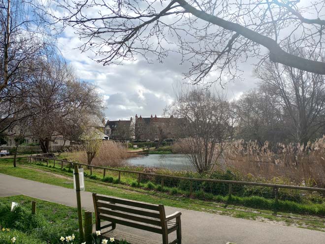
Barnes developed as a linear settlement along the main roads and by the river, with only the later 19th century and 20th century development infilling the gaps, most notably between Church Road, Rocks Lane and the Green. Some remnants of medieval burgage plots are evident in the long, narrow plots of the High Street, although to the rear they are now largely obscured by back-land development and amalgamation of plots. The High Street remains densely developed along what is a fairly narrow street. The Terrace is similarly densely developed, but the river frontage provides a much greater sense of space and openness. A similar openness is experienced on sections of Church Road facing the Green, which is further accentuated by the more generous plot sizes. The residential development follows more of a grid pattern, reflecting its organized development. Plots are largely uniform in size, with small front gardens and generous rear gardens, and infilling has been resisted. The roads are fairly wide in comparison to the main roads, and quieter than the busy central thoroughfares. The Green is the most significant spatial feature in the Conservation Area, with its wide, open space providing relief from both the busy commercial areas and organized layout of the residential areas.
Character Areas
The Conservation Area can be divided in to six sub-areas, each with a distinct character:
- Riverside & The Terrace (blue shaded area)
- Historic Core (pink shaded area)
- The Green (green shaded area)
- Malthouse Passage and Stanton Road (purple shaded area)
- Victorian & Edwardian Residential (orange shaded area)
- Elm Bank Gardens (yellow shaded area)
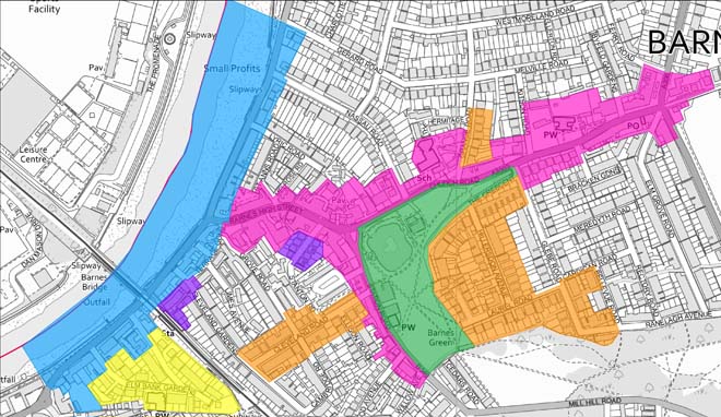
Map showing the character areas
Character Area 1: Riverside & The Terrace
Summary
The Terrace and the Riverside stretches the length of the Conservation Area from the boundary with Mortlake at the southern end to Small Profits Dock at the northern end. The southern end begins with the White Hart public house, forming a gateway into the Conservation Area from Mortlake, while also forming an effective stop to the Terrace. The historic streetscape is divided by the substantial Elm Bank Mansions and then Barnes Bridge, a dominant presence along the riverside. The northern section (from Barnes Bridge to the junction with the High Street) displays a group of good quality 18th and 19th century buildings forming the bulk of Barnes Terrace and establishing the character of this part of the riverside. Now completely residential, the odd disused shopfront is an indicator of the more varied mixed residential and commercial uses. Beyond the old police station, Lonsdale Road to the north is more modest in scale and architecture, formed primarily of late 19th century two storey purpose-built ‘London Flats’ (flats built as two-storey terraces). The variety of building ages and typologies along the riverside lends itself to greater cohesion within groups rather than between groups, with less cohesion along the riverside as a whole. Instead, the character of the area is defined by the visual relationship of the buildings to the riverside and their formation of a long, panoramic view broken only by Barnes Bridge.
Architecture & Townscape
The Terrace (South)
At the southern end of The Terrace is the White Hart, a public house with 17th century origins. The present building dates from 1899 and forms a prominent gateway into the Conservation Area from the south. It is a substantial four-storey red brick building, with a turreted tower facing south, and a three-storey gabled bay, rendered white with timber detailing to the front. The river elevation has balconies to the first three storeys and is more easily appreciated from the river or the Chiswick bank.
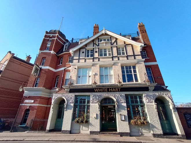
Figure 17: The White Hart public house
Between the White Hart and River House is a varied collection of 18th and 19th century houses, with a couple of modern infills. Constructed in either brown brick or stock brick, common features include multi-pane timber sash windows and metal balconies to the upper floors. Height varies between two and three storeys, and the uneven building line results in some houses sitting hard up against the pavement and some well set back, exposing the flank walls. Several show evidence of alteration and rebuilding, such as no.28. Nos.31, 30 and 28 are all Grade II listed and are well-preserved examples of 18th century houses which make a strong contribution to the overall character of this section of The Terrace. Nos.27 and 28 similarly contribute, with the former the largest and most dominant of the buildings, although less well-preserved. While no.28 integrates visually, it is a new build, constructed 2018-19 after the existing house was demolished. Its three/four storey scale and white-rendered façade effectively terminates this stretch.
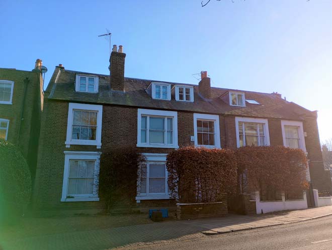
Figure 18: 32 & 33 The Terrace
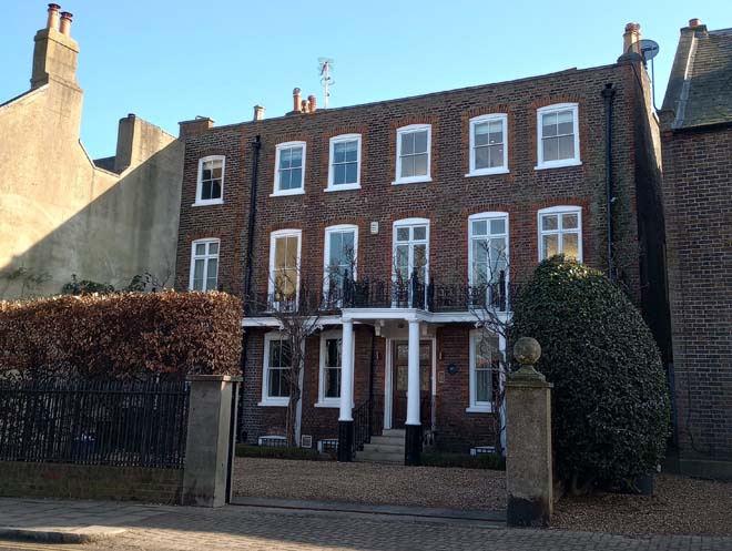
Figure 19: 31 The Terrace
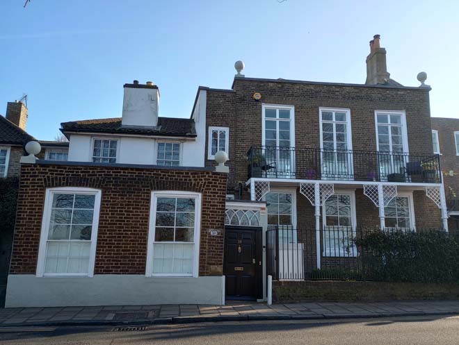
Figure 20: 30 The Terrace
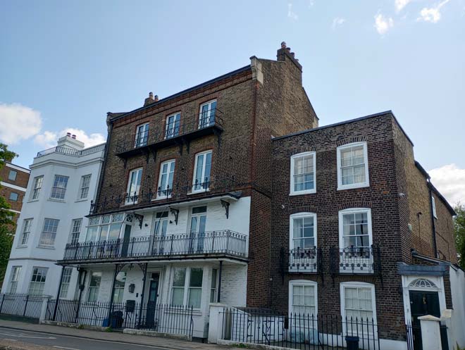
Figure 21: 28-26 The Terrace
The scale of building increases substantially with River House, a 1960s block of flats. The distinctly different architectural style and materials contrasts with both the 18th century houses to the south and the exuberant red brick Elm Bank Mansions to the north. It is nevertheless a good example of its style, albeit appearing somewhat out of place along this historic river frontage.
Elm Bank Mansions complete this section of The Terrace. Comprised of two blocks, one fronting The Terrace and the second tucked behind, these imposing five storey blocks are one of the most distinctive features of The Terrace. The front façade features a series of full height bay windows creating a rhythmic undulating effect. These are simply accentuated by stone banding and lintels above the windows. The main entrance doors to all the blocks are highly decorative, with stained glass panels and fanlights and a simple, classical stone surround.
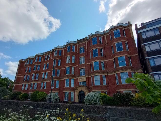
Figure 22: Elm Bank Mansions
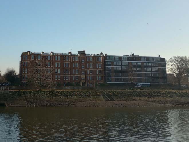
Figure 23: Elm Bank Mansions and River House from the Chiswick bank
The Tower was formerly a folly in the grounds of Elm Bank House and survived the breaking up of the estate and the demolition of the house. Alongside River House and Elm Bank Mansions, it contributes to the more architecturally varied character of this stretch of The Terrace. The white-rendered tower with red brick detail is well set back from the road and visible in direct views, although it is rather overshadowed by Elm Bank Mansions next door. To the front are the remnants of the boundary wall and piers of Elm Bank House, with a decorative urn on each end. These can be seen in historic photographs of The Terrace.
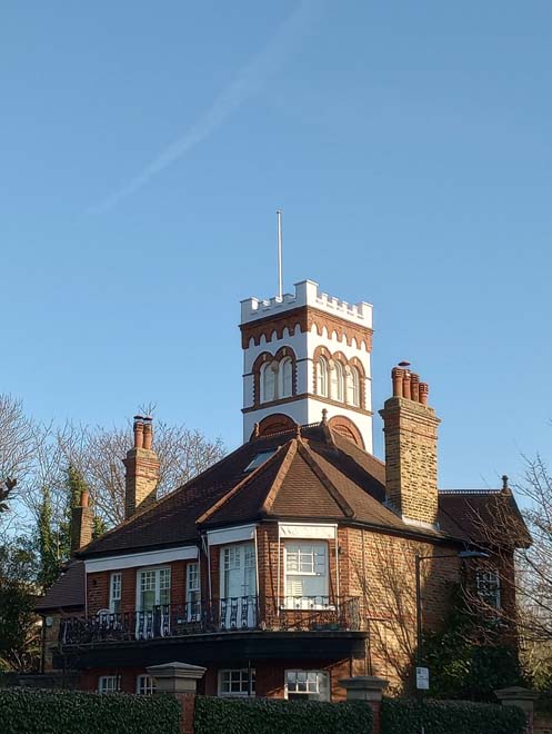
Figure 24: The Tower
Barnes Bridge
Barnes Bridge was built in 1846 – 1849 to a design by South Western Railway’s civil engineer Joseph Locke and his associate John Errington and built by Thomas Brassey. The original bridge consisted of three cast iron arches of 120 feet span with vertical open ribbed spandrils. The bridge structure was widened in 1891-1893 and this arrangement duplicated, with the addition of three wrought iron bow string girders (the three ‘arches’). The original bridge is now no longer used, however there are long-term aspirations to secure a new use for it as a 'garden bridge' across the Thames. It is a dominant presence along The Terrace; views up and down the Terrace are terminated by the bridge, and views from the Chiswick bank are also punctuated by it.
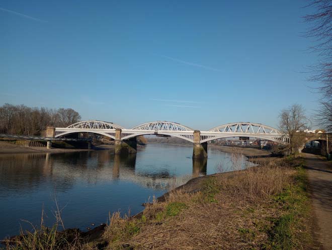
Figure 25: Barnes Bridge
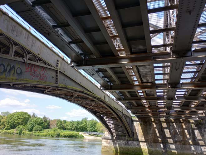
Figure 26: The underside of Barnes Bridge, clearly showing the two separate structures: the original 1849 bridge on the left and the 1890s bridge on the right
The Terrace (North)
On the other side of Barnes Bridge, the Terrace resumes with a small building tucked away to the side of the Bridge. This is the old ticket office, a modest but well detailed building formerly in railway use, but now converted into offices.
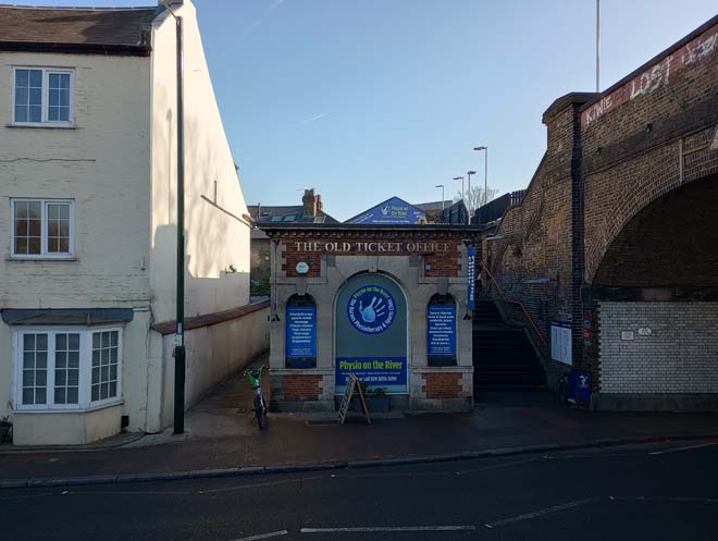
Figure 27: The old ticket office
Beyond the old ticket office is a fairly cohesive run of two and three storey 18th century houses. Some have been subject to unsympathetic alterations, such as the bay window to no.16 and the dormer to no.14 but are consistent in character. Nos.13 & 14 are a listed pair of early 18th century houses, with painted brick facades, small dormers and tiled roof behind a parapet, and a prominent central chimneystack. No.11 is similar in date, with 19th century alterations including the shopfront with the shallow bow window. The balustrade and timber spindles at first floor level are particularly distinctive. All the buildings sit hard up against the pavement and present a continuous building line and height, being of three storey or two with prominent chimneystacks.
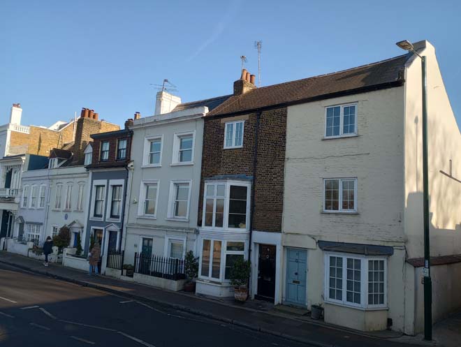
Figure 28: 13-17 The Terrace
To the north is the longer, unbroken façade of the rear of 1-4 Maltings Close, a 1980s development. This is the only modern infill in this section of The Terrace and fits in well, with a decorative iron balcony at first floor level and balustrade to the roof. No11 resumes the 18th century streetscape. The shopfront is a 19th century addition, now with a simple modern form with large plate glass windows.
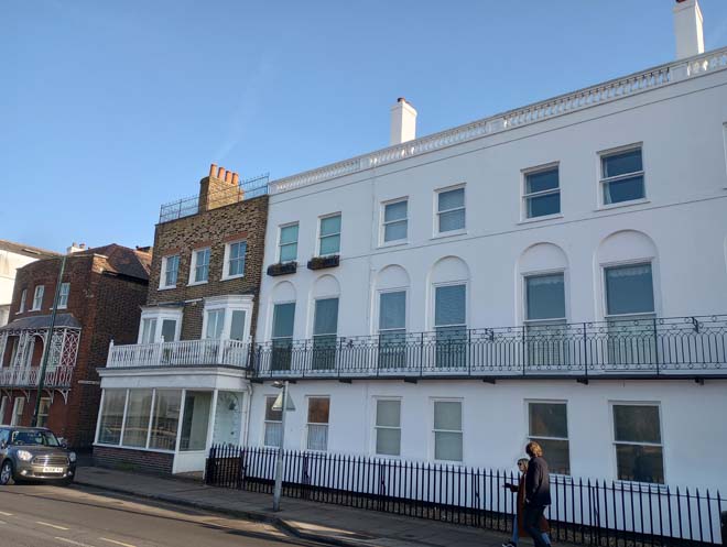
Figure 29: Maltings Close & 11 The Terrace
Nos.10 – 7 The Terrace are all Grade II Listed and form an attractive and distinctive group with a common form and materials and contribute positively to the character and appearance of The Terrace. No.10 sits forward of the group on the building line established by nos.11 – 16. The red-brick front façade is slightly bowed and features an elaborate canopied balcony. The rest are set further back from the street, with planting to the gardens of nos.8 and 7 providing a welcome sense of greening. All feature traditional multi-pane sash windows, doors with decorative fanlights or surrounds, and metal balconies at first floor level. Nos.6a & 6 are similar in date and have been subject to extensive restoration, with both facades being modern additions but contribute to the overall character of The Terrace.
This listed group has a varied building line, with no.10 sitting the furthest forward on the line established by nos.11 – 16. No.9 is set further back, the white stucco contrasting with the red brick of no.10, but with a similarly elaborate canopy with supports carried down to ground level. No.8 is the tallest house at four storeys with its bowed façade to the upper floors siting above the established roof line. The two-storey bow window to no.7 reflects this feature, and together nos.8 & 7 form an elegant pair.
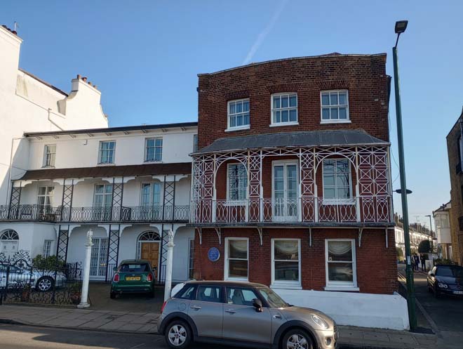
Figure 30: 9 & 10 The Terrace
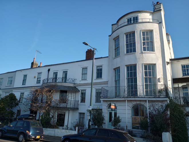
Figure 31: 7 & 8 The Terrace
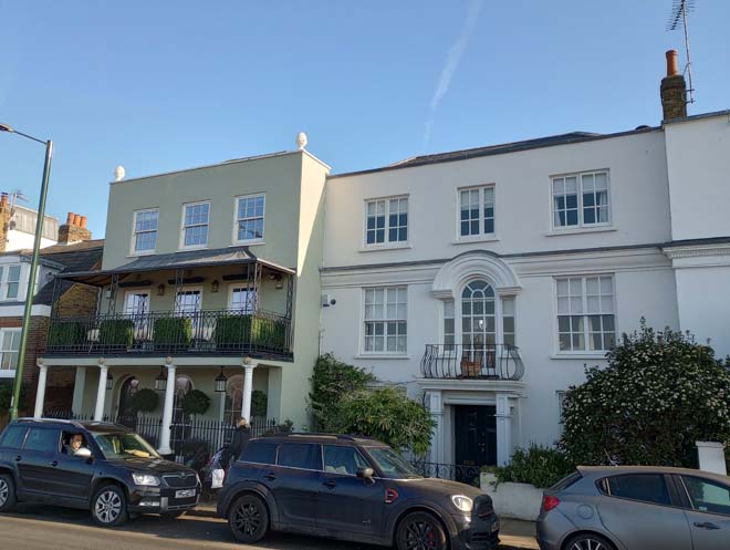
Figure 32: 6a & 6 The Terrace
In contrast to these grand 18th century houses are a pair of smaller mid-19th century cottages at nos.5 and 4. The shopfront to no.4 is a later 19th century addition, but both retain their modest cottage character. No.3a is of a similar date, also with a later 19th century shopfront, an indicator of the former more commercial character of The Terrace which has now been lost. The first and second floor windows have intricately detailed moulded overarches with a zig-zag pattern. No.3 is the largest and most impressive of the 18th century houses on the Terrace, with a classical style porch with first-floor canopy above. It provides a strong end to the main section of The Terrace and a makes a strong positive contribution to the overall character of The Terrace.
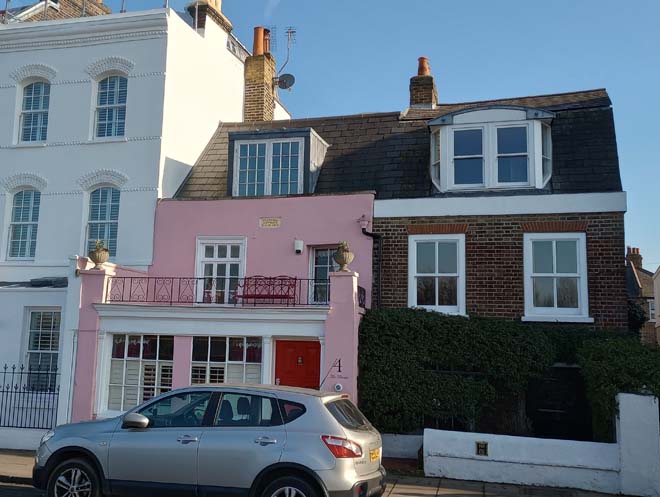
Figure 33: 4 & 5 The Terrace
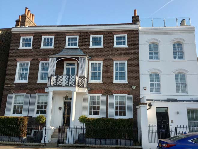
Figure 34: 3 & 3a The Terrace
The entrance to the High Street is flanked on the southern side by a small parade of four shops. These are two storeys, in red brick, with slate mansard roofs and wide dormer windows. No.36a retains a good quality original shopfront, with central recessed door, timber frame, ventilation grille, and tiled stone step. No.35a also retains is original shopfront, of a similar design to no.36a, with an additional central transom to the windows. They provide an effective transition from the grand 18th century buildings, and residential areas of The Terrace to the more commercial centre of Barnes with the 19th and 20th century shops on the High Street.
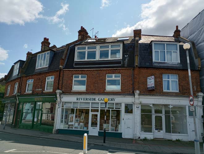
Figure 35: 35a-36a High Street
Opposite are a pair of public houses, the Waterman’s Arms and the Bull’s Head. The Bull’s Head has 17th century origins, but the present building dates from 1846, with the French Renaissance-style tower added in the late 1890s. This is a local landmark and visible in longer views looking north from Barnes Bridge and south from Small Profits dock. The Watermans Arms, in comparison, is slightly later in date and sits prominently on the junction of the High Street and the Terrace. Together they form a distinctive pair of historic public houses.
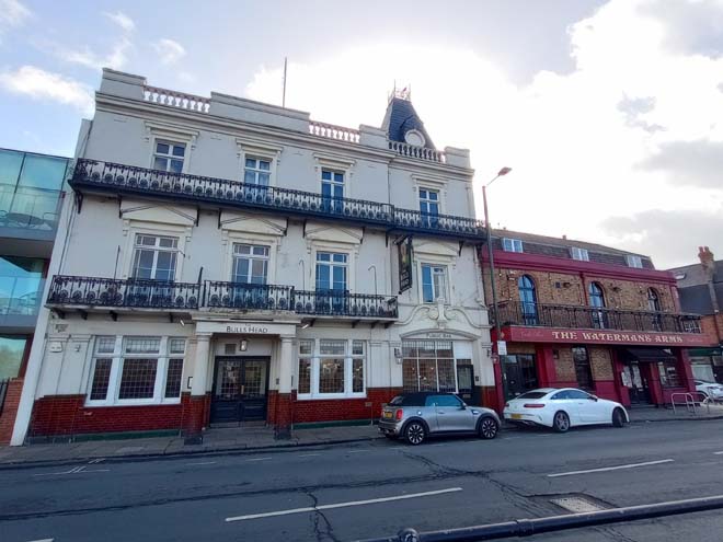
Figure 36: The Bull's Head and The Watermans Arms
Beyond the Bull’s Head is the old police station. This two-storey red brick building dates from the early 1890s and is more similar in scale to the terraced houses stretching away along Lonsdale Road to the north. ‘METROPOLITAN POLICE’ can still be read on the stone door surround.
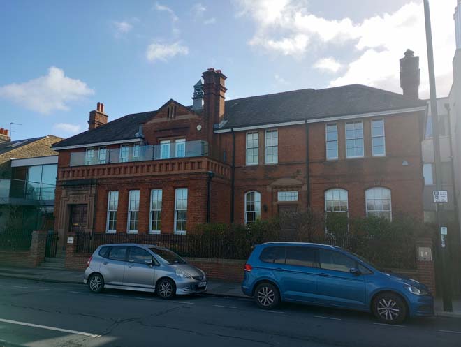
Figure 37: The old police station
Lonsdale Road
The residential properties on Lonsdale Road begin after the Old Police Station and continue up until Small Profits dock. The streetscape becomes more fragmented at the end as early 20th century terraces give way to detached mid-20th century houses in larger plots on the ends of Nassau Road and Gerard Road. This area of the riverside has a distinctly different character to that of The Terrace, dating from the early 20th century and being comprised predominantly of ‘London Flats’ (flats disguised as terraced houses) constructed in several phases. All are similar in form, being two-storeys in red brick with predominantly tiled roofs. Nos.343 – 369 are the most architecturally detailed with tripartite windows with white painted mullions and moulded detail, wrought iron balconies to the first floor above the entrance doors, and decorative finials and roof ridge tiles to the gables. They are also distinguished from the rest by their gabled bays (many of which have been extended into and the gable face glazed) and slate-covered roofs.
Nos.341 – 285 are simpler in design, with single storey box bay windows with tiled roofs, and shared porches with tiled roofs and timber spindles (except for 285 – 297). The gabled bay to no.301 bookends the terrace.
Along the run, a good number of tessellated tile paths remain. Boundary treatment is largely consistent, comprising white-rendered walls with piers.
Figure 38: 343-349 Lonsdale Road
Figure 39: Houses on Lonsdale Road
Beyond the 20th century terraces, the character of Lonsdale Road diversifies, with a modern infill development sitting next to two pairs of 1920s Arts & Crafts style houses. Both developments maintain the overall form, scale and character of the road and contribute to the architectural variety of both Lonsdale Road and the riverside.
Figure 40: Modern infill development at 263a - c Lonsdale Road
After the junction with Nassau Road, the streetscape becomes more open, with the red brick boundary walls of Tideway and 76 Gerard Road providing an abrupt break from the previously densely spaced terraces and houses. Views of the river disappear as the flood wall reduces in height and gives way to trees and shrubs at Small Profits dock. Both these features create a ‘corridor’ effect as views of the river are quickly obscured and the reduction in density of housing gives a more rural feel as one moves out of the core of Barnes centre along Lonsdale Road.
Views
The view from the Terrace from the White Hart to Waterman’s Arms has been identified as a view of local importance in the emerging Local Views Supplementary Planning Document. This comprises a series of sequential views from multiple locations along the Terrace encompassing the sweeping views across the Thames and views of Barnes Bridge from the side, underneath, and from the pedestrian walkway across it. These views allow a full appreciation of the quality and variety of architecture along The Terrace which makes a strong contribution to the character of the Conservation Area. It also reinforces the character of The Terrace as being closely associated with the River Thames.
Figure 41: View from the White Hart looking upstream to Mortlake with the Stag Brewery site visible in the distance
Figure 42: View from The Terrace looking downstream towards Chiswick
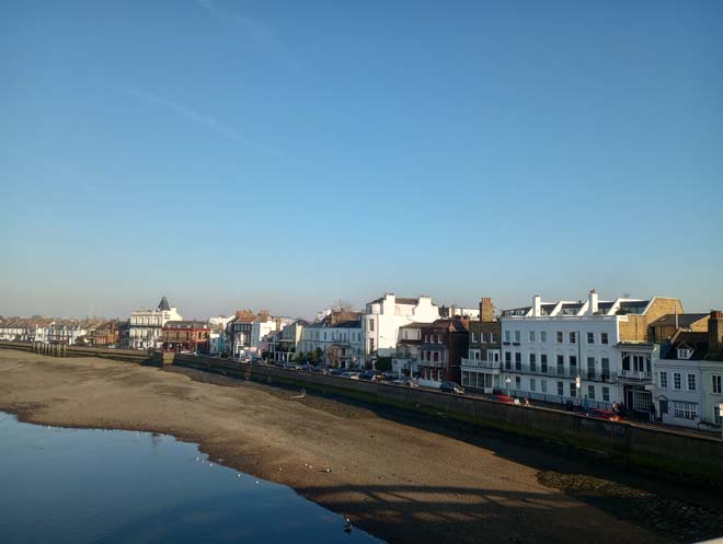
Figure 43: View of the Terrace from Barnes Bridge
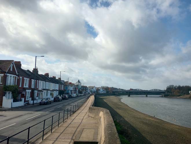
Figure 44: View of Lonsdale Road and the Terrace looking south
Open Spaces
Small Profits Dock is at the southern tip of the Leg o’ Mutton nature reserve. There is an area of hardstanding for car parking, and a few benches and bins before the area gives way to denser trees and planting to the north. The greenery provides a welcome change to the bleak flood wall to the south.
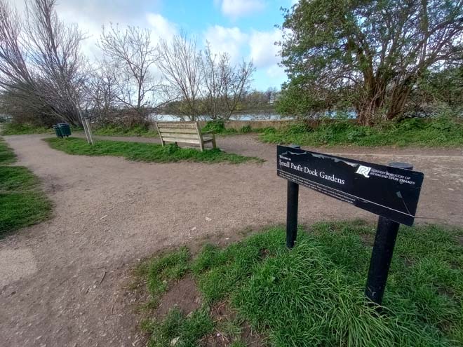
Figure 45: Small Profits Dock Gardens
The only area of the riverside which is easily accessible is the path between the White Hart and Barnes Bridge on the river side of the flood wall. This is a narrow strip elevated above the river, but a remnant of the once close and easy access between the Terrace and the River. Benches are spaced evenly along it. The path passes under the Bridge by means of an elevated walkway.
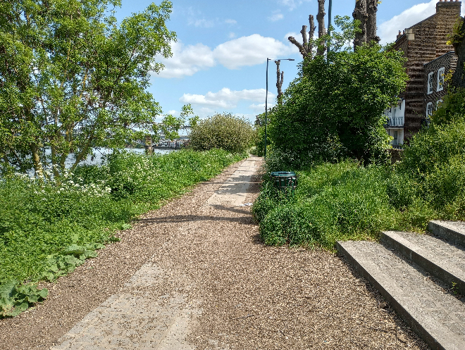
Figure 46: Riverside path between Barnes Bridge and The White Hart
Street Furniture
There is one surviving Victorian sewer vent pipe on the riverbank, opposite the main front entrance to Elm Bank Mansions. Historically part of the Victorian sewer system, vent pipes or ‘stink pipes’ were ventilation pipes which allowed gases from underground sewers to be vented to prevent a build-up of dangerous gases. These were once spaced regularly along the riverbank, but the majority were likely removed when the flood wall was constructed.
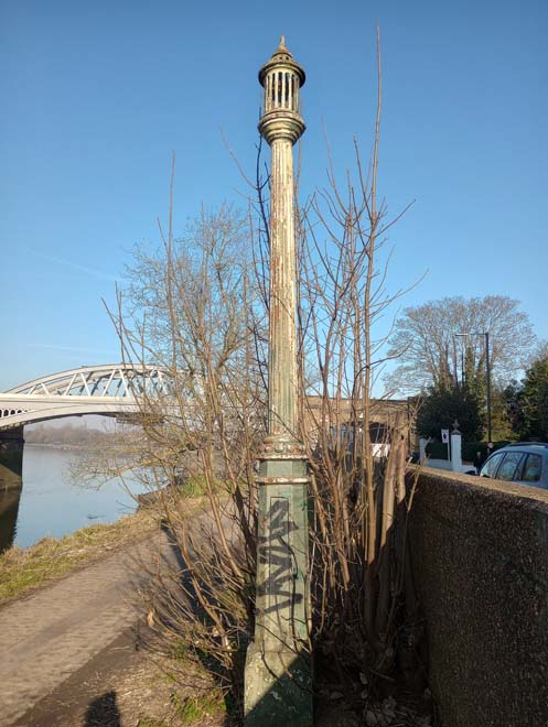
Figure 47: Sewer vent pipe
There is an Edward VII Letter Box at the junction of The Terrace and the eastern branch of Elm Bank Gardens. Together with the sewer vent pipe, these are interesting items of historic street furniture which make a positive contribution to the character of the area and should be retained.
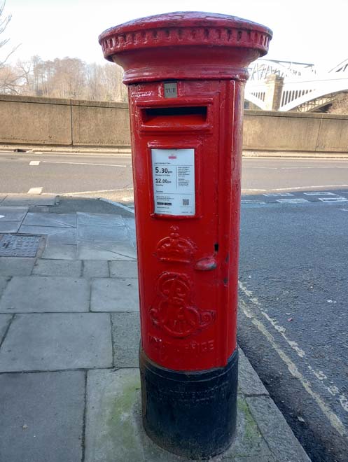
Figure 48: Edward VII Letterbox
The flood wall is a dominant feature of the riverbank, running the length of The Terrace and Lonsdale Road from the White Hart to Small Profits dock. It is a bland feature which enforces a physical and visual divide between The Terrace and the river and is a rather hash and unsympathetic boundary to the river. Historically there was a very close connection between The Terrace and the river, with little more than a single bar fence separating the road from the gently sloping riverbank. The railings to the flood wall provide a safety barrier between pedestrians and road traffic, but further contribute to the divide between The Terrace and the river.
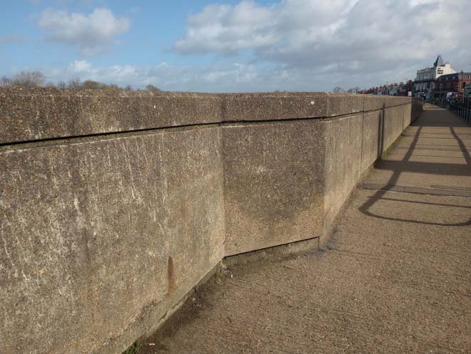
Figure 49: The flood wall on The Terrace
Lampposts are standard style, the majority being LED, with a few older sodium lights.
Bus stop signage is minimal and restricted to standard flags. Street signage often makes use of existing lampposts, except where it is clustered around the junction of The Terrace and the High Street.
There is an accumulation of bins, utility boxes and a telephone kiosk at the entrance to Barnes Bridge station on the south side (platform 2 entrance) which creates clutter around both the entrance to the station and the Long Walk footpath.
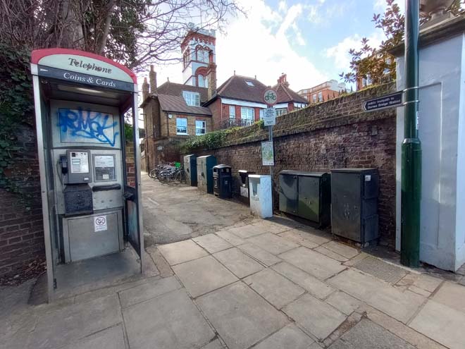
Figure 50: Platform 2 station entrance
Benches are placed at intervals along the river between the White Hart and Barnes Bridge, with picnic benches in front of the public house.
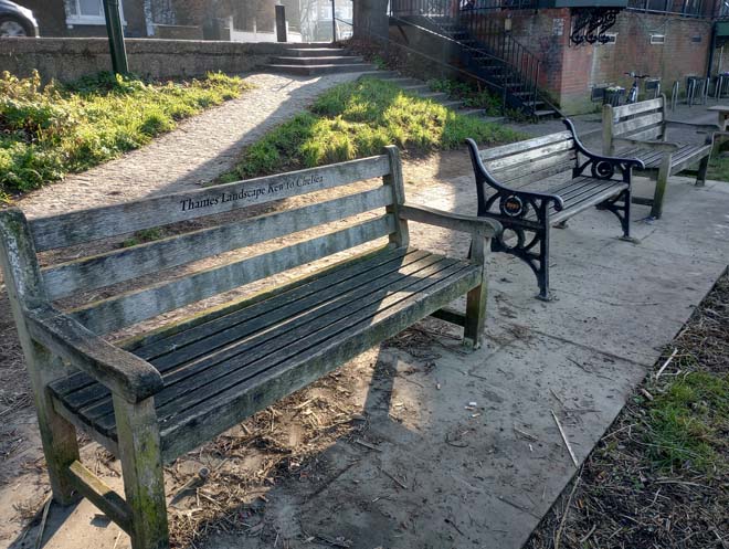
Figure 51: Benches by the White Hart
A good number of historic cast iron street nameplates have been retained. Alongside items of historic street furniture, these make a positive contribution to the character of the area and should be retained.
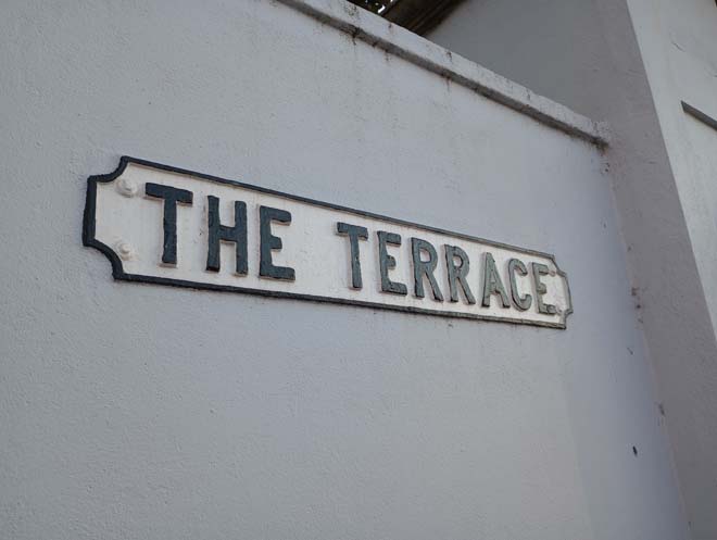
Figure 52: Example of a retained cast iron street sign
Paving
A recent paving renewal scheme along the riverside between the White Hart and Barnes Bridge is good quality and makes a welcome contribution to this area, the only accessible part of the riverside at Barnes.
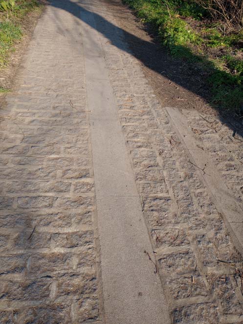
Figure 53: Paving on the riverside
Elsewhere, paving is comprised largely of standard artificial stone slabs with granite kerbs. There is a good section of square setts at the entrance to St John’s Grove, and recently renewed ones at the entrance to the passage to Cleveland Gardens.
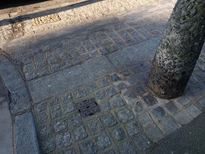
Figure 54: Setts at the entrance to St John's Grove
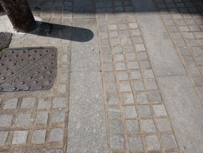
Figure 55: New setts to the top of Cleveland Gardens
Character Area 2: Historic Core
Summary
The historic core character area comprises the three main historic thoroughfares through Barnes. These are the High Street (leading from the riverside to the Green), Church Street (from the Green to Barn Elms) and Station Road (from the Green to Barnes Common). This area contains the major part of the early development of Barnes, with buildings ranging in date from the 17th to 21st centuries. Buildings are predominantly two or three storeys, with larger statement buildings such as Seaforth Lodge, 15 & 17 Church Road, and the former Zeeta Works (now the OSO Arts Centre) punctuating the streetscape. The area is predominantly defined by its retail use, but there are some residential areas along Church Road opposite the Green, and much of Station Road is also in residential use. Today the village core is dominated by the heavy traffic along the roads but retains a vibrant and well-used central retail area.
Architecture & Townscape
High Street
The High Street is relatively undistinguished architecturally, with a mix of traditional and modern building types and the character stemming from a variety of uses. A few good quality original shopfronts remain in their entirety, and a number of shops retain some original features, most commonly corbels and pilasters. The High Street provides a key connection between the Riverside and the Green and is an important route, both historically and today.
The High Street begins at the western end with a physical and visual separation between the historic development on The Terrace and that on the High Street. On the northern side is the modern development constructed in the early 21st century on the site of the 1920s police station complex. It is a long frontage of primarily residential use, in a mix of red brick and cream coloured render. At the end are three red-brick retail units with gabled frontages reflecting those at nos.51 & 52. The modern development echoes, in part, Sussex Court on the opposite side of the street, a 1960s block of flats. Set back from the road at an angle, it gives this part of the street a more open feeling compared to further along, where the two and three storey buildings lining the narrow street make it feel more enclosed.
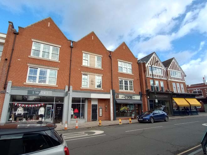
Figure 56: The new development on the High Street, with the gables reflecting those of the existing shops
No.29 High Street, in contrast to this modern development, is one of the oldest surviving buildings on the High Street, with 18th century origins. With a 19th century frontage, and much restored in recent years, it is nevertheless a distinctive building with its double-pitched roof visible in longer views from the junction with The Terrace. The Coach and Horses public house is also 18th century, with records showing it was established by 1766. The frontage, like no.29 is also 19th century. These two 18th century buildings are somewhat isolated in the streetscape at this end, which is fragmented and interspersed with modern development.
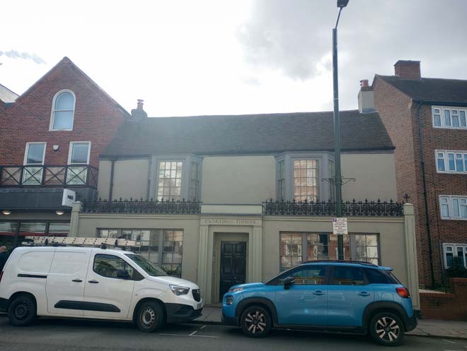
Figure 57: 29 High Street
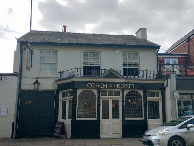
Figure 58: The Coach & Horses public house
Tucked away between nos.23 and 24 is Lifford’s Place, one of the last surviving side alleys and back yards which were a characteristic feature of the High Street in the 19th century. These narrow alleys would have led to yards and small workshops behind the shops, making use of the long, narrow plots which are likely remnants of medieval burgage plots. Over the 20th and 21st centuries, these yards were infilled with larger development stretching across multiple plots. No.2 Lifford’s Place is a surviving mid/late 19th century workshop building, and one of the last remaining remnants of a rear courtyard workshop site.
Figure 59: Lifford's Place
Beyond, as the street begins to curve around, the streetscape becomes more continuous, with buildings of two and three storeys resulting in a more enclosed street. The looming bulk of Seaforth Lodge becomes visible due to the bend in the road, dominating the skyline and towering above the more modest two storey 19th century shops on the northern side of the street. The short parade of four at nos. 53 – 56 are visible in longer views due to their position on the bend in the road. They are generally in good condition, with all four shopfronts in a traditional design, and some retaining original features such as the door and fanlight to no.54, and the leaded transom lights to no.55.
Figure 60: 53 - 56 High Street
The south side generally consists of three storey shops, dating from the 1870s to the 1910s, in a mix of stock brick and red brick, some with gable ends facing the street and others with pitched roofs. Nos.13 – 23 present the most variation, with little continuity in design, very much reflecting the piecemeal development of the High Street. No original shopfronts remain in their entirety, and some feature unsympathetic modern shopfronts with large expanses of plate glass and overly large fascia boards. No.19 has retained its original decorative ventilation grille, and the shopfront to no.18 broadly survives in its original form, with two rows of square transom lights. Beyond the prominent red-brick gables of nos.17 and 18, the height of buildings reduces a little and their form becomes more continuous, as well as being slightly older in date. Nos. 13 – 16 are a small row dating from between 1870 and 1890 and mark this transition in scale. Next is an unremarkable 1970s infill development which nevertheless reflects the form and scale of this section of the High Street. Adjacent at nos.1 – 9 is a mid-19th century three storey stock brick run of shophouses. Along here are some of the best-preserved shopfronts, most notably at nos.1 – 2, which retains the original shopfront in its entirety, albeit heavily painted. No.4 retains its original frame, no.6 its decorative pilasters and angled fascia board, and no.8 its timber frame, cast metal free standing pilasters, and decorative fascia and corbels. Poorly design shopfronts and unsympathetic windows have diluted the quality of this run, but it nevertheless remains one of the best-preserved sections of the High Street and the earliest surviving 19th century buildings.
Figure 61: 18 - 23 High Street
Figure 62: 13 - 16 High Street
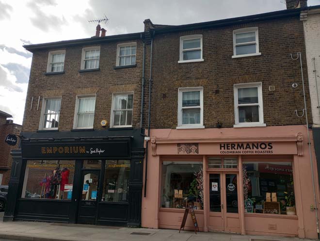
Figure 63: 6 & 7 High Street
Figure 64: 1 - 5 High Street
Figure 65: Shopfront to 1 High Street
However, the three-storey scale of the group is overshadowed by the towering Seaforth Lodge. Seven storeys in all, starting at three at the front and stepping back to the seventh, it is completely out of scale with the two/three storey densely development historic streetscape. Built to a simple, broadly Art Deco design, it is a dominant presence in the streetscape, visible in views looking up and down the High Street, but also in more unexpected views such as from Stanton Road and also in views from the Green. The existing telecoms equipment is a detracting feature of the roofscape, and further installation of such equipment should be resisted. The shopfronts at the bottom are unremarkable, apart from no.66a, which has retained its original simple metal framed shopfront. The shop window is divided by a transom with ridged, opaque glass above. A punch cut metal grille sits above a rendered stallriser.
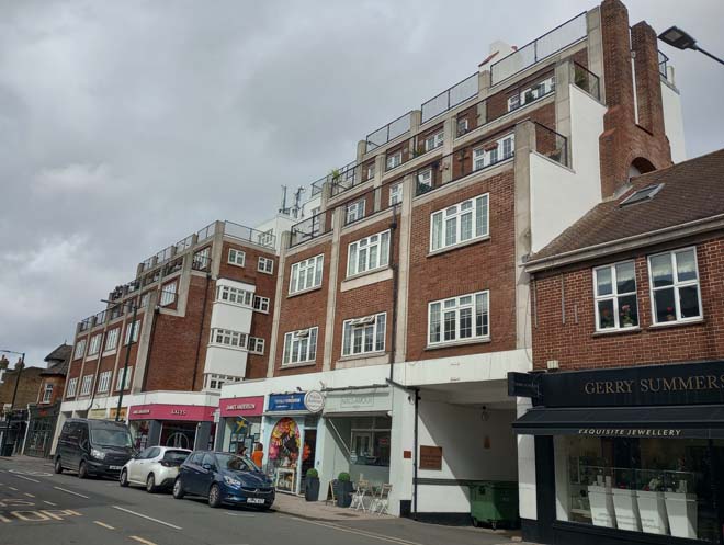
Figure 66: Seaforth Lodge

Figure 67: Shopfront to 66a High Street
Long views of the Green are visible along much of the High Street after the curve in the road, with the tree canopy terminating the view. The street opens out towards the Green and the junction with Station Road, with the height of the buildings quickly dropping to two storeys and set further back from the pavement. At this end is one of the oldest buildings in Barnes, no.70, which has 17th century origins with 19th century alterations. It is surrounded by the 20th century development of nos.67 – 69 High Street, and the 1970s development of Swan Place.
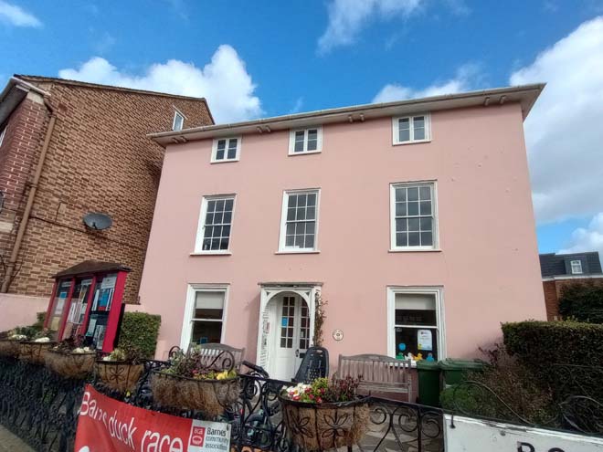
Figure 68: 70 High Street
The openness of the Green is a sudden change from the enclosed nature of the High Street and contributes strongly to the character of this section of the historic core. Much of the 20th century development is also left behind with the transition from High Street to Church Road.
Church Road
Church Road was historically characterised by larger detached buildings and houses, with the historic core of the village ending at what is now the junction with Grange Road, giving way to large houses in their own grounds before the junction with Castelnau and Barn Elms Park. This character remained until the very end of the 19th century and the period of intense development within Barnes, which saw the loss of these big houses and the intense development of Church Road and the land to the south.
It is an important shopping area, characterised by continuous frontages of shops, many retaining a high level of original detail. The western end is more mixed, with residential terraces interspersed with both 19th and 20th century parades. The eastern end is grander and more continuous, with three storey red brick parades.
Nos.1 – 3 Church Street are a small group comprising a pair of mid-19th century houses (nos.2 & 3) alongside a smaller building likely of 18th century origin, with a steeply pitched tiled hipped roof, and the remnants of a shopfront including a decorative corbel.
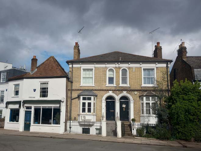
Figure 69: 1a - 5 Church Road
To the east is the Sun Inn, one of the oldest surviving buildings in Barnes, dating from the mid-18th century. It is well set back from the road behind a hedge, a less common boundary treatment in the Conservation Area, but one which reflects the verdant character of the Green opposite.
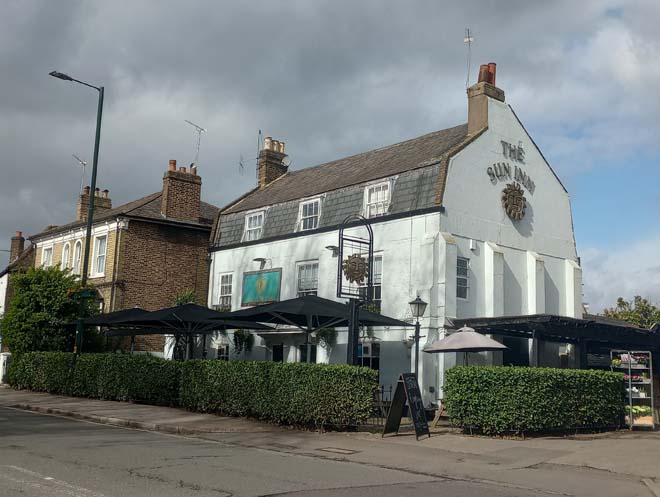
Figure 70: The Sun Inn
By far the tallest building on Church Road is the former bank building (nos.15 & 17). Built in 1905 in the ‘Wrenaissance’ style, it is said that it was supposed to be symmetrical but was never finished, leaving an abrupt gap between it and the Sun Inn. The flank wall shows evidence of a structure having been built up against it, as do old photographs and maps. An impressive building, it is highly prominent in the streetscape and in views across the Green, but somewhat out of place architecturally amid a more modest historic core.
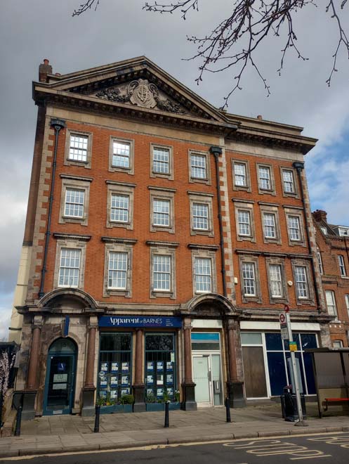
Figure 71: 15 & 17 Church Road
The residential character of Church Road emerges beyond this, with two three storey red brick 19th century terraces. The first, at nos. 19 – 25, is well set back from the road behind generous front gardens, albeit now given over to car parking. They feature two-storey canted bay windows topped by steeply pitched gables, and mansard roofs partly screened by parapets. They are generally well-preserved and their setback from the road contributes to the more open, semi-rural character of this section of Church Road. The parade at nos.31 – 37 is later in date, and architecturally less distinguished, with simple stone window surrounds and mullions. They sit further forward on the pavement, and alongside the tapering end of the Green and the trees edging it, give a slightly more enclosed feeling to the street.
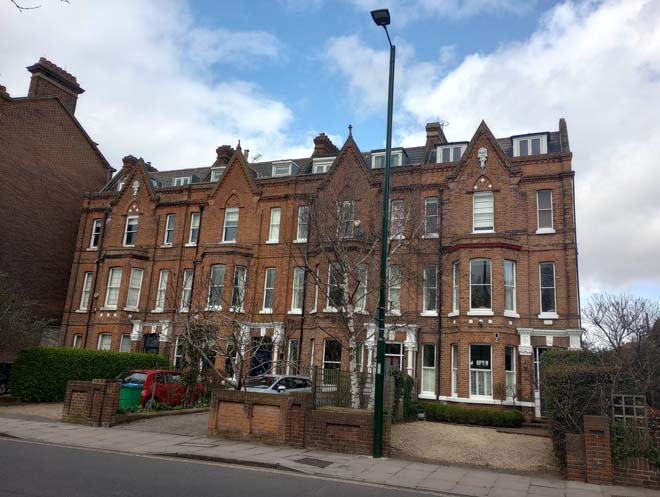
Figure 72: 19 - 25 Church Road
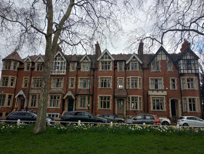
Figure 73: 31 - 35 Church Road
Beyond is the brick boundary wall of St Osmund’s Catholic Primary School, with nos.43 and 45 Church Road visible above it. No.43, the three-storey white stuccoed building with tiled roof visible behind a parapet, is 18th century in date, while no.45, the two-storey pink-stuccoed building with decorative banding and hood moulds, is 19th century. Together they form an interesting and distinctive pair, and alongside The Grange (no.47) form a small group of Listed Buildings. The Grange is also one of the earliest surviving buildings in Barnes, dating from the early 18th century. The boundary railings and gate form an important part of its setting and are early 19th century.
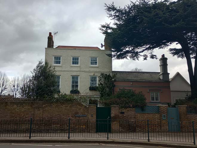
Figure 74: 43 & 45 Church Road
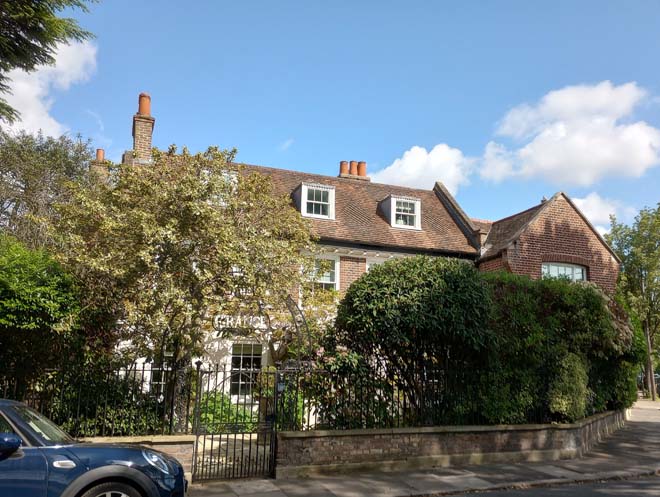
Figure 75: The Grange
After The Grange, the road narrows, with the tapering end of the Green running alongside it, and the Lion Houses on The Crescent visible above the hedge. The modest 1920s parade of shops on the north side sits hard up against the pavement, with awnings projecting out over it. Some outdoor seating has also been established and positioned on the road. The shopfronts are simply designed, and most are well-preserved. Original features include a high-level arched transom, recessed side entrances, and tiled stallrisers. No.59 is a particularly good example. The roofline of pitched roofs and gables is interrupted by the blocky 1960s development at nos.67 – 75. It provides a visual and material break between the two modest parades of shops and is an interesting example of 1960s architecture slotted into a more historic setting. This historic streetscape resumes at nos.77 – 85, some of the oldest non-Listed buildings along Church Street, dating from the first half of the 19th century. They are a row of modest red brick cottage style properties with simple shopfronts, the form of which have all been retained, albeit with small modifications and painting.
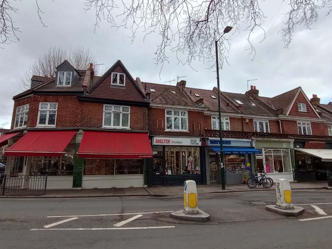
Figure 76: 49 - 57 Church Road
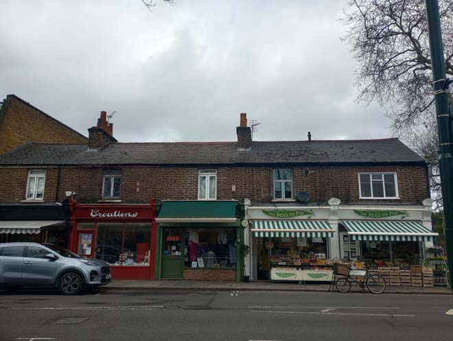
Figure 77: 78 - 85 Church Road
After the junction with Glebe Road, buildings resume on both sides of the road, although a long stretch of the north side is comprised of the boundary wall to Strawberry House, the 18th century former Rectory. The wall and mature trees in the garden effectively screen the house from view. Tucked behind Strawberry House on Kitson Road is the Barnes Church Hall. It was built in 1927 on grounds previously belonging to the Rectory, and is said to have been designed by the then-Rector’s wife Mrs Dott. It is a simple single storey structure with a hipped roof and a large porch to the front with a pair of entrance doors. It has an unaltered built form and is also of social interest as a building relating to the church and the wider community.
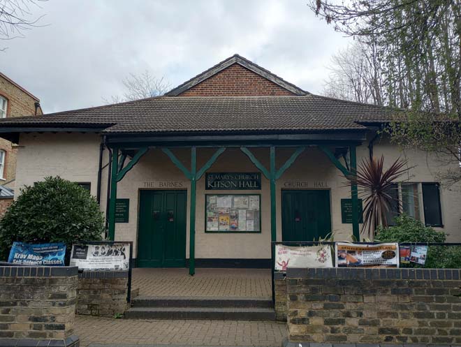
Figure 78: Barnes Church Hall
The southern side of Church Road is comprised of a varied mix of residential dwellings constructed over a 40-year period between 1893 and 1933. Nos.18 and 20 are prominent at the corner of Glebe Road. A late 19th century pair of villas, taller than the neighbouring houses, with a large, red brick dormer window, it is more comparable in design and scale to the Lion Houses behind it.
On a more modest scale are nos.22 – 28, two pairs of late 19th century houses featuring two storey canted bay windows topped with a decorative parapet giving the appearance of crenelations. Nos.30 – 44 are later in date and form part of the development of Bracken Gardens. Each pair is slightly set back from the next and angled towards the road. Distinguishing features include a wide, open porch with timber spindles and arch, casement windows with multi-pane top lights, and a tiled porch at first floor level across the pair. They present a small, cohesive group in the streetscape.
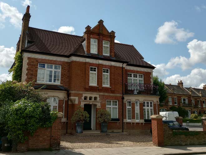
Figure 79: 18 & 20 Church Road
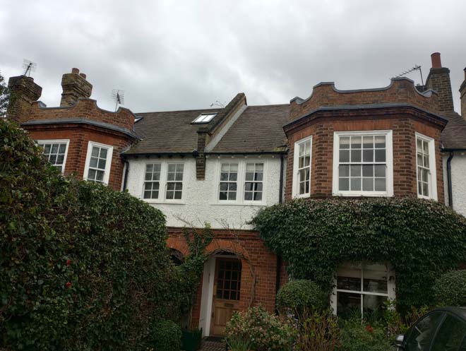
Figure 80: 22 & 24 Church Road
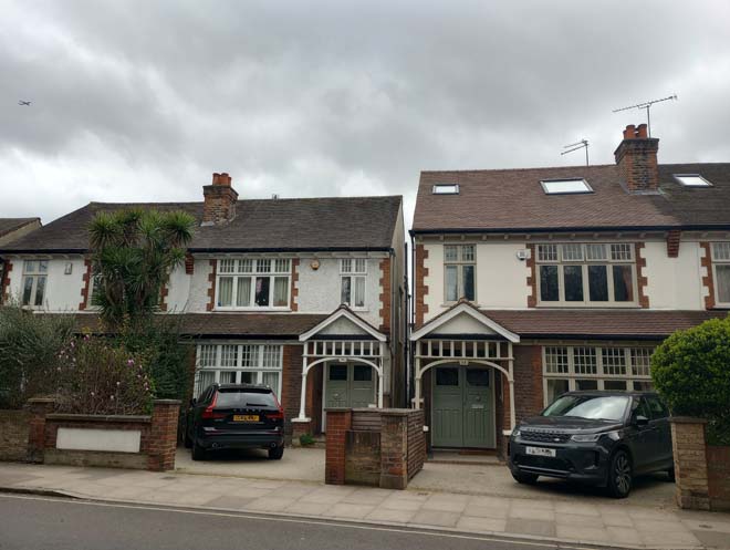
Figure 81: 32 - 36 Church Road
On the northern side, the brick boundary wall of Strawberry House gives way to the churchyard. The lychgate at the entrance gives a rural feel to the churchyard. St Mary’s Church is the oldest and most complex building in Barnes (as set out in the Historic Development section above). The 15th century red brick tower with stair tower is the most prominent feature in the streetscape, surrounded by trees. The 1980s extension is less visible between the trees. When walking through the churchyard, it is a somewhat unexpected structure and a distinctive contrast to the traditional stone and brick of the older parts of the church. Beyond the east end of the church is The Homestead, another fine 18th century house, with a later 1940s weatherboarded extension. Homestead Cottage is a small cottage of similar date to the Homestead, with later alterations including the front dormers. It sits tucked away between the churchyard and the Homestead.
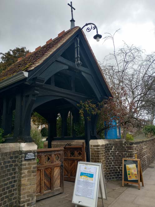
Figure 82: The lychgate
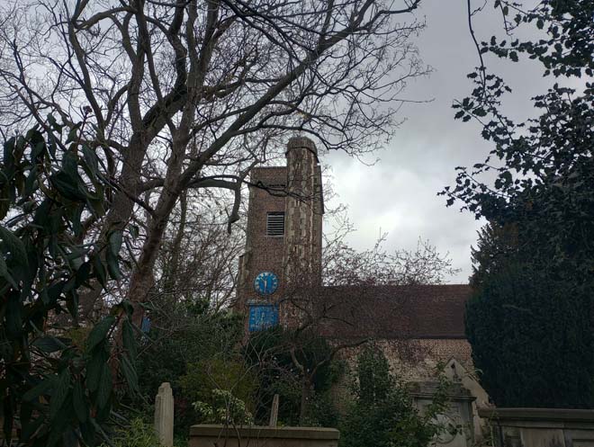
Figure 83: St Mary's Church from Church Road
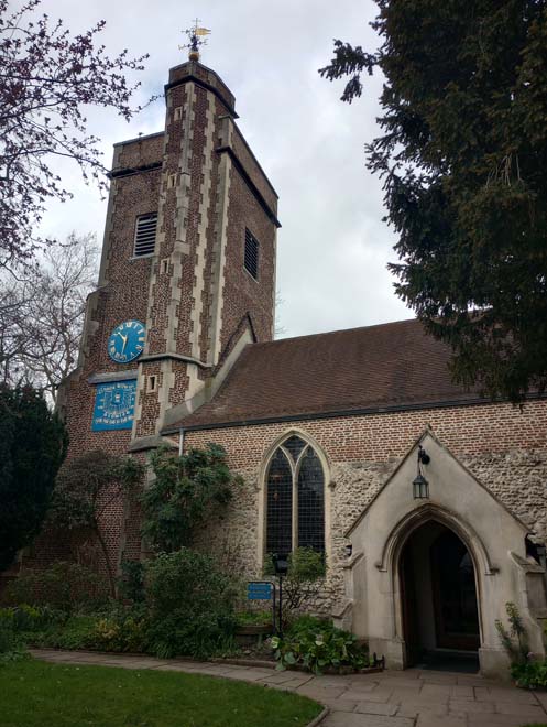
Figure 84: The distinctive red brick church tower and stair tower
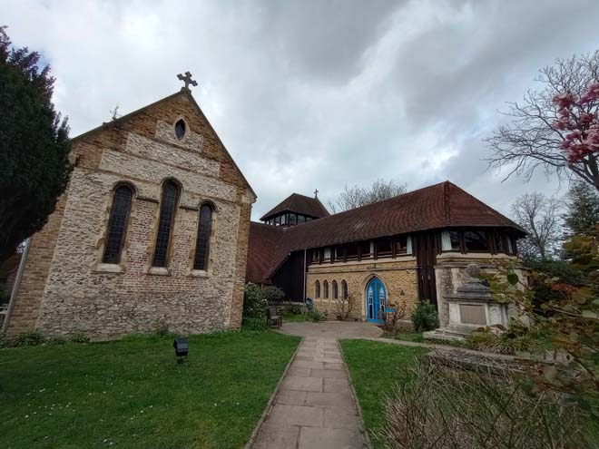
Figure 85: The east end of the church with the 1980s extension by Edward Cullinan on the right
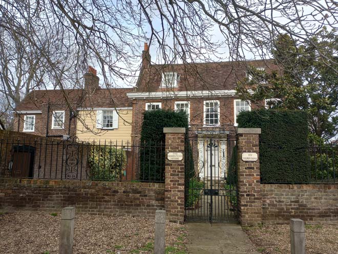
Figure 86: The Homestead
The building height rises abruptly on the north side to meet that on the south with The Olympic Studios. It is a distinctive, large red brick building with a varied roofline including Dutch gables and bay windows.
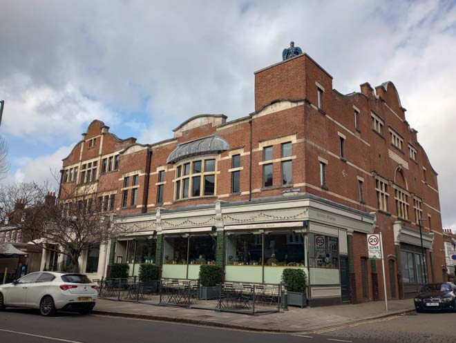
Figure 87: Olympic Studios
Beyond the Church on the southern side is the start of the most cohesive section of the whole historic core with the three storey shopping parades. The first section, opposite the churchyard comprises nos.54 – 64, distinguished by the flattened arches above the second-floor windows with a decorative Dutch-style pediment above. The shopfronts are all traditional style, retaining corbels, pilasters, and fascia with a small dentil cornice. Nos. 60 and 64 are notable examples of surviving original shopfronts.
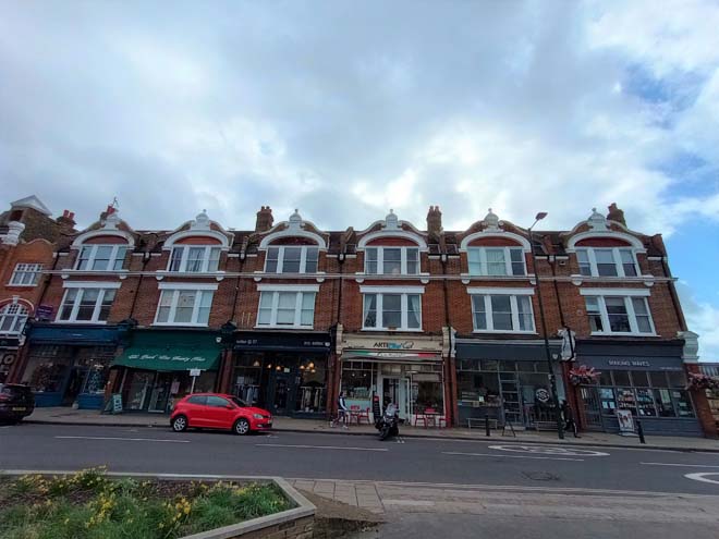
Figure 88: 54 - 64 Church Road
No.66 is a smaller unit in the context of the parade, bridging the gap between the two stretches. Aside from an overly large fascia board, it has a finely detailed surviving shopfront, with tiled stallriser, timber frame, and curved glazing which leads to a recessed entrance door. The different pilasters and corbels emphasise the ‘bridging of the gap’ between the two parades.
Figure 89: 66 Church Road shopfront
Beyond no.66 is the longest, most cohesive shopping parade (nos.68 – 100, and also 102 Church Road & 1 – 9 Rocks Lane). Constructed in stock brick with red brick detailing and pediments, it creates a distinctive roofscape which is visible in long views looking east along Church Road, and also from the junction with Castelnau. The quality of shopfronts varies substantially along the parade, but a distinctive and unifying feature is the polished red and white stone pilasters along the length of the parade. No.86 has a particularly high-quality shopfront, comprising an ornately carved frame incorporating decorative mullions with foliage detail and a medallion over the central entrance door. Large sash windows flank the central entrance door, below the rectangular multi-pane transom lights, with a decorative grille above. It is a rare example of a highly decorative and original shopfront within Barnes. No.90 is another good example of an original shopfront. It has a delicate timber frame with foliage detail, and decorative grille above. The recessed entrance comprises two doors, one to the shop unit, and one to accommodation above. No.100 features a unique (to this parade) metal-framed shopfront with curved glass panels either side of an off-centre entrance door. There is a tiled entrance way with a former occupier’s initials of ‘E & Co’.
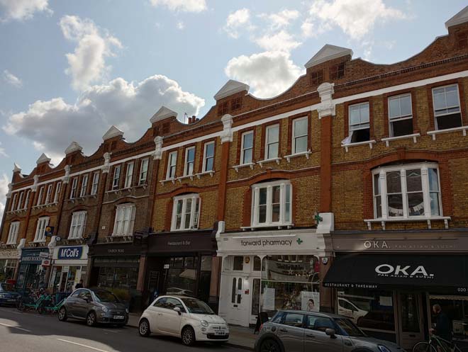
Figure 90: 88 - 100 Church Road
Figure 91: Shopfront to 86 Church Road
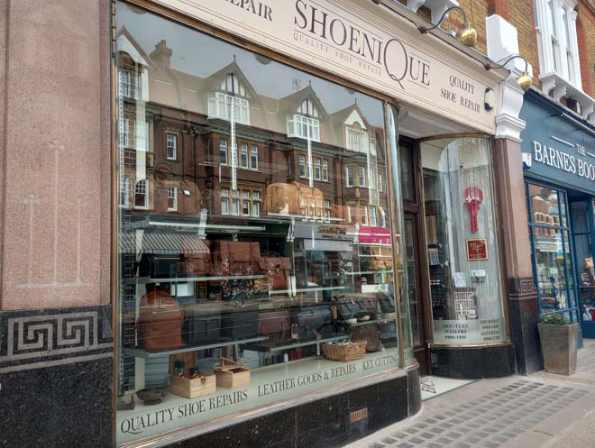
Figure 92: Shopfront to 100 Church Road
At the end of the parade, facing the junction with Castelnau sit nos.102 Church Road and 1 Rocks Lane. Separated by Elm Grove Road (and forming a gateway into the road) they are an imposing pair with a high level of cohesiveness. Built to the same design as the parade behind no.102, they additionally feature curved ground floor front element with off-centre entrance doors and large sash windows. The parade continues for a short stretch along Rocks Lane, with no.2 featuring another well-preserved shopfront with an off-centre recessed entrance door, delicate timber frame, decorative grille below the cornice and also to the stall riser, and simple fascia. Next door, no.4 has retained a decoratively glazed transom, but below is a modern insertion.
Figure 93: 102 Church Road & 1 Rocks Lane
Figure 94: 2 - 9 Rocks Lane
Along the northern side of Church Road and turning the corner up to the base of Castelnau is Lowther Parade. Of similar scale than the parades on the south side, it has more rhythm and depth to its frontage due to the two storey bay windows spanning the first and second floors, surmounted by gabled bays. The subtle variation in the design of the bays gives a pleasing symmetry to the parade. The corner facing the junction is finished with an octagonal bay topped with a turret and finial. A couple of good quality original shopfronts remain, including no.145a, with a timber frame and decorative geometric glazing to the transom, and no.133, with recessed entrances either side of the main glazed area, timber frame and ventilation grille. Along Lowther Parade, most corbels are retained, alongside the pilasters, which are glazed green brick to the top two thirds, and red glazed tiles with green panel to the bottom third.
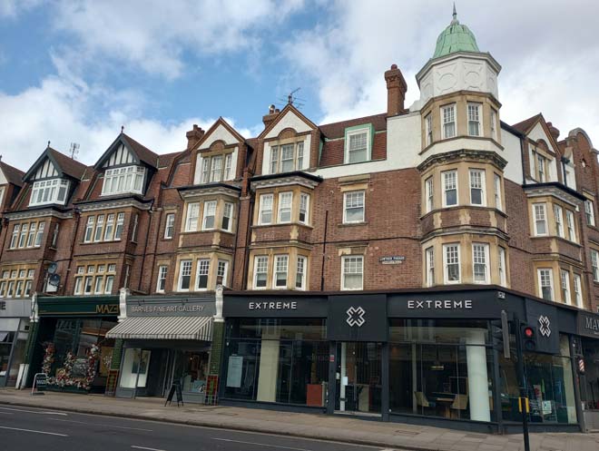
Figure 95: 135 - 145 Church Road
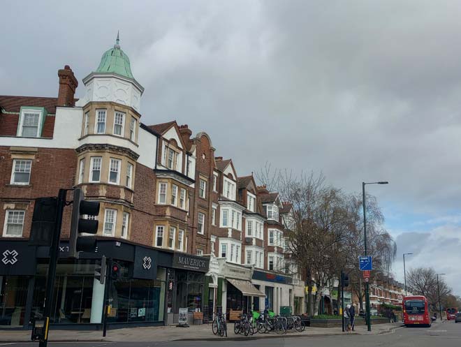
Figure 96: Lowther Parade looking north towards Castelnau
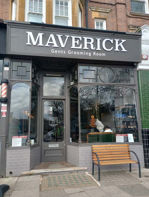
Figure 97: 145a Church Road shopfront
Opposite Lowther Parade at the base of Castelnau is the Red Lion public house, another of the historic pubs of Barnes. It has a distinctive double-fronted façade with a pair of curved two-storey bays and sits at a prominent position angled in towards Church Road.
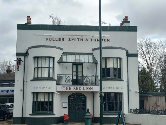
Figure 98: The Red Lion public house
Station Road
Station Road in its entirety links the historic core of Barnes with Barnes station. Before the arrival of the railway, the main street terminated at Beverly Brook, with a small trackway leading off into the Common. The development of Beverley Road and Scarth Road saw the road extended into the Common, but it was not until the mid-20th century that Station Road became an established thoroughfare for motor traffic. The section within the Conservation Area is a continuation of the historic core, with some of the oldest houses in Barnes sitting alongside 18th and 19th century development.
At the top of the road at the junction with the High Street and Church Road is Old Essex House, of late 16th century/early 17th century origins with later remodelling. Set well back from the road, it is now overshadowed by Essex Lodge to the front, a protruding gabled range with a faux-timber framed upper floor. To the left of Old Essex House is Essex House, a substantial early 19th century building in white stucco. Distinctive features include the moulded window and door surrounds, prominent cornice at first floor level, and rusticated quoin detail. It sits behind a prominent white wall with surviving small ‘gatehouse’ and is surrounded by mature trees.
Figure 99: Old Essex House & Essex Lodge
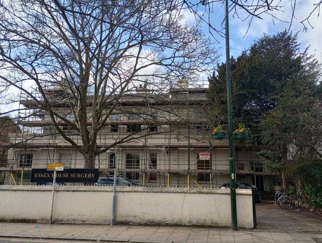
Figure 100: Essex House
Similarly surrounded by mature trees, and largely hidden from view by a brick wall and planting is Milbourne House (18 Station Road), considered to be one of the oldest surviving complete structures in the Conservation Area. Built to an L-shape plan with a distinctive mansard roof and prominent chimneystacks, the frontage dates to the early 18th century, but 17th century features have been identified internally. The best views of the house are from the rear, given the large amount of foliage covering the front elevation. The rear garden of Milbourne House was built on in the late 1940s, forming the development of Essex Court, visible in views down the side of the house.
Figure 101: Milbourne House
Station Road was developed gradually from the 18th century until the early 20th century, with new buildings infilling gaps or building on the gardens of larger properties. Nos.28 – 38 were built on the site of a previous building next to Milbourne House in the mid-1880s. They are a typical terrace of the period, in red brick, with a two-storey canted bay window topped with a gable, and moulded decoration to the mullions and window surrounds. Some original features, including windows, doors, and most tiled paths have been lost. The large dormer to no.28 is a detracting feature in the terrace and unfortunately prominent in views looking south towards the terrace.
Figure 102: 28 - 38 Station Road
Beyond this terrace, the nature of the street suddenly changes as views over the Green are abruptly cut off by the former Zeeta Works building, resulting in a much more enclosed streetscape. This is generally characterised by two-storey 18th and 19th century buildings, with a small amount of later infill development.
The row of cottages at 42 – 48 are late 18th century or early 19th century in date and are some of the more modest dwellings on the street. They have retained their overall architectural form and appearance, with sympathetic doors and windows, and are set back from the road behind small front gardens. No.42 is slightly less well-preserved, having had a shopfront added to the front in the 1890s before being returned to residential use in the late 20th century.
Figure 103: 42 - 48 Station Road
No.50 is of similar date, but more substantial in scale, with a deep cornice above ground floor over an arched secondary entrance alongside a well-proportioned shop frontage. A prominent parapet with dentil cornice terminates at roof level. Sitting forward of the building line established by the cottages, it contributes to the narrower character of the street, with subsequent buildings following this line. A continuous building line extends down the street to Dunmow Hall at no.62. This comprises both 18th century buildings, such as no.52, painted pink, with its traditional sash windows and roof hidden behind a parapet, and nos.54 & 56, similar in style but in fact a 1980s infill/reconstruction of an 18th century house.
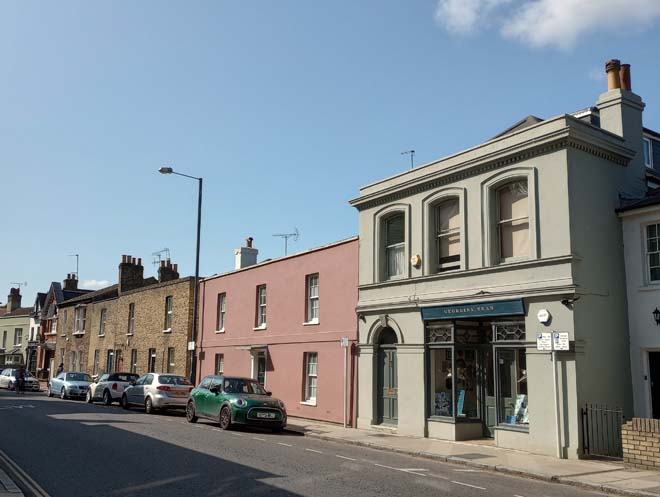
Figure 104: 50 - 56 Station Road
Dunmow Hall provides a change in style and materials, being a late-19th century red brick building. It has a well-detailed front elevation with a large entrance door with shallow canopy flanked by a pair of windows, all with a continuous dentil cornice above, arched hood above the first-floor window, and large dentil course to the gable eaves. Together with no.64 (an early 1990s rebuild of a late 19th century shop), the two form an architecturally interesting pair of Victorian buildings in a streetscape otherwise characterised by modest 18th century buildings.
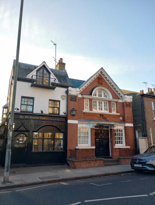
Figure 105: Dunmow Hall & 64 Station Road
Nos.66 and 68 are an attractive pair of 18th century houses, each featuring a long wrought-iron porch, prominent chimneystacks, and roof hidden by a parapet. They look out over the Green, views of which emerge again after the Methodist Church. Next to this pair is no.70 Station Road. Its white-rendered façade, canted bay window topped with a crenelation effect, and arched window to the apex of the gable give echoes of the Strawberry Hill Gothic style. At three storeys and sitting forward of nos.66 and 68 it creates an effective stop to this interesting stretch of 18th and 19th century buildings.
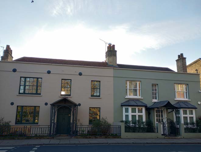
Figure 106: 66 & 68 Station Road
No.2 Brookwood Avenue is an early 20th century house built as part of the development of Brookwood Avenue for James Nichols, who was also responsible for the distinctive Lion Houses (see character area 5 below). The entire street was destroyed during the Second World War, and rebuilt in the late 1940s, with no.2 the only survivor from the original scheme.
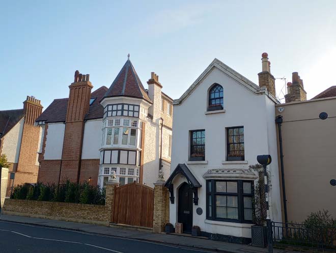
Figure 107: 70 Station Road & 2 Brookwood Avenue
At the end of the street, before Beverly Brook, are nos.72 – 82, a three-storey late 19th century terrace in a distinct shift from the two-storey 18th century buildings. Constructed in red brick, with rendered upper floors and tiled roofs, the houses are grouped in pairs, with prominent full-height gabled bays to the front. Architectural features include decorative panels of buff terracotta, wavy bargeboards to the gables, and timber posts and spindles to the porches. A couple of tessellated tile paths have been retained, and boundary treatment is generally consistent, comprising red brick walls. Beyond the terrace the street crosses Beverly Brook at the southern boundary of the Conservation Area.
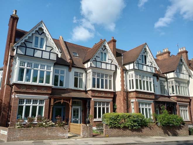
Figure 108: 76 - 80 Station Road
Views
Views within the character area primarily consist of views up and down the main three streets, showing the varied heights and building lines, alongside distinctive roofscape features.
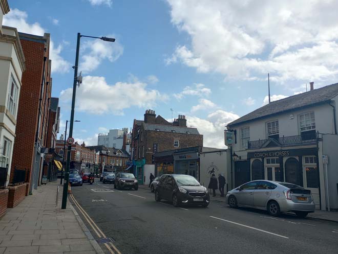
Figure 109: View Looking east along the High Street
Figure 110: View looking west along the High Street at the junction of the three roads
Figure 111: View looking east along Church Road
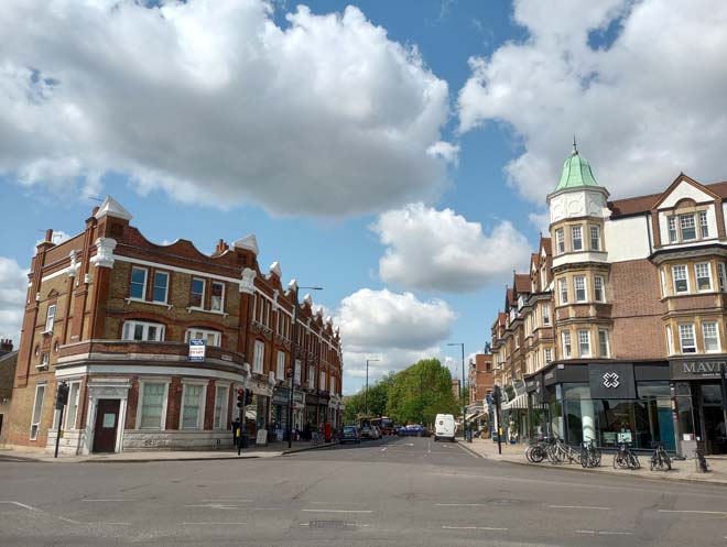
Figure 112: View looking west down Church Road
Figure 113: View looking south down Station Road
Figure 114: View looking north up Station Road
Open Spaces
A small triangular area at the junction of Church Road and Grange Road hosts a single tree and a couple of timber benches. This is a somewhat underutilised area, bounded on all three sides by large expanses of paving.
Figure 115: Area at junction of Church Road and Grange Road
The triangular plot of land adjacent to no.85 Church Road offers a small additional green space opposite the eastern end of the tapering point of the Green. Although small, it features a couple of mature London Plane trees, benches, and Sheffield stands alongside a slightly raised grassed area.
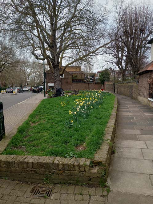
Figure 116: The open space adjacent to 85 Church Road
St Mary’s churchyard is the largest open space within the character area. The western and northern sides are well covered with mature trees, but the southern side is more open and is a pleasant green space set a little way apart from the busy shopping parades of Church Road.
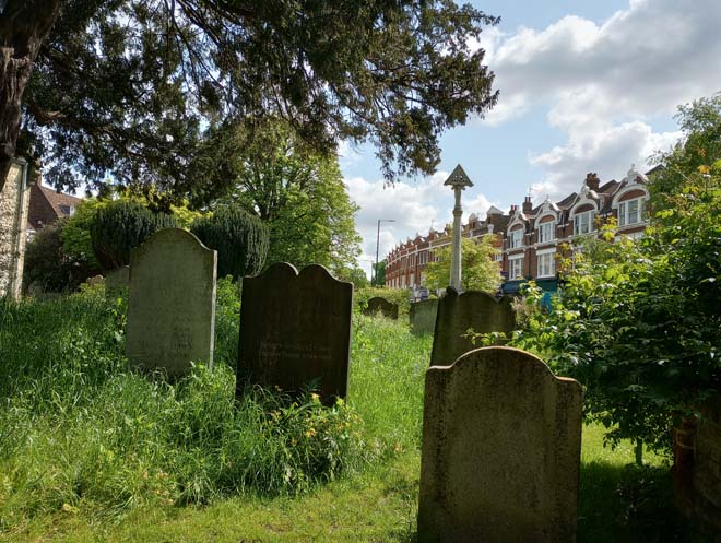
Figure 117: The churchyard with the shopping parades in the background
A further triangular plot of land (the result of an abrupt shift back in plot boundaries) is situated in front of the Homestead. Less verdant in character than the churchyard, it has raised beds with seasonal flowers and trees towards the back by the Homestead boundary wall. Set in one of the raised beds is a memorial stone to Captain Alfred Carpenter VC.
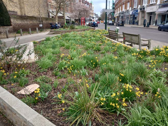
Figure 118: Open space outside The Homestead
The wide pavement in front of 145 – 175 Church Road has allowed for further planting, with trees and raised, grassed beds, alongside benches and assorted street furniture.
Figure 119: Open space outside Lowther Parade
The junction of High Street, Church Road, and Station Road has resulted in an isolated green island. Often difficult to access due to the volumes of traffic, it is nevertheless another valuable area of green space, albeit overlooked due to the proximity of the Green.
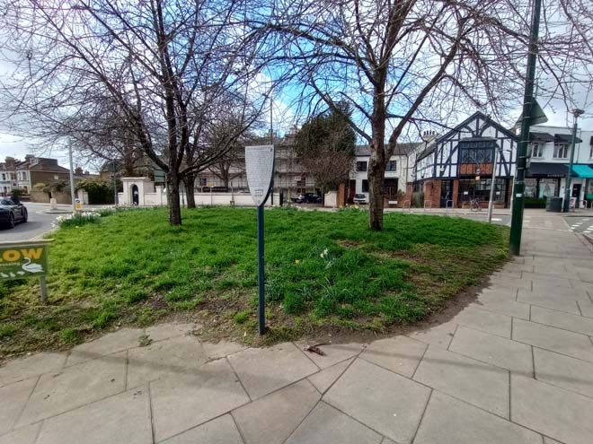
Figure 120: Junction of Station Road and High Street/Church Road
Street Furniture
There is a K6 Telephone Kiosk outside the Olympic Cinema which has been adapted into a defibrillator.
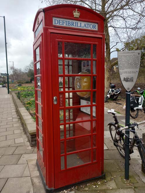
Figure 121: K6 Telephone Kiosk
There are several historic Letter Boxes throughout the character area. There are two George V Letter Boxes, one outside no.96 Church Road, and one on the junction of Church Road and Nassau Road. There is one George VI Letter Box, outside 53 High Street. There is also an unusual Letter Box without a royal cipher on the junction of Station Road and Brookwood Avenue. This is an ‘anonymous post box’ so called as some of the first cylindrical post boxes made between 1879 and 1892 did not have the royal cipher and words ‘Post Office’ on them. Alongside the K6 Telephone Kiosk, such items of historic furniture offer additional interest to the streetscape and contribute positively to the character of the area.
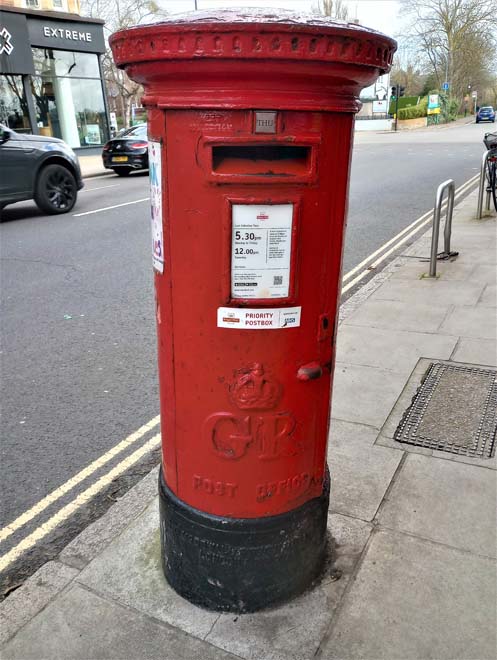
Figure 122: George V Letter Box outside no.96 Church Road, an example of several surviving historic letterboxes across the Conservation Area
The distinctive oar-shaped information signs for The Barnes Trail are located throughout the Conservation Area.
Other standalone items of street furniture include bollards, which are generally cast iron and painted dark green.
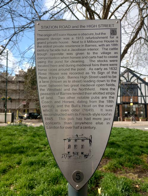
Figure 123: Example of a Barnes Trail oar
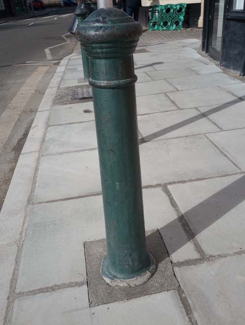
Figure 124: Bollard outside 39b High Street, a typical example of bollards found in the Conservation Area
Sheffield stands are spaced infrequently, and generally in clusters, such as opposite nos.43 and 45 Church Road. Isolated stands are present along the busier shopping parades.
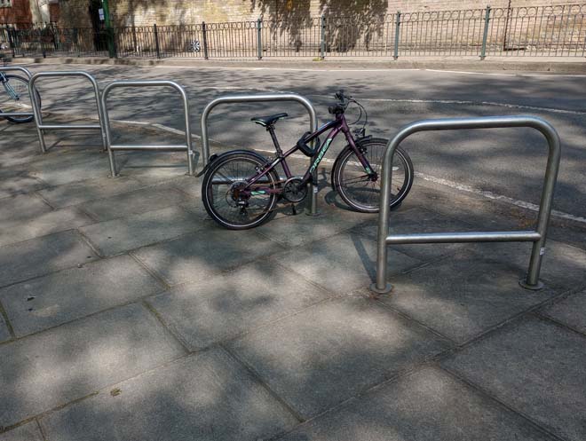
Figure 125: Sheffield stands on Church Road
Bins are interspersed along the roads, often next to lampposts or bus shelters. In some areas there is a risk of accumulated clutter, with bus stops, bins, and lampposts congregated together. Large open areas of pavement also present this risk, such as outside 1a High Street.
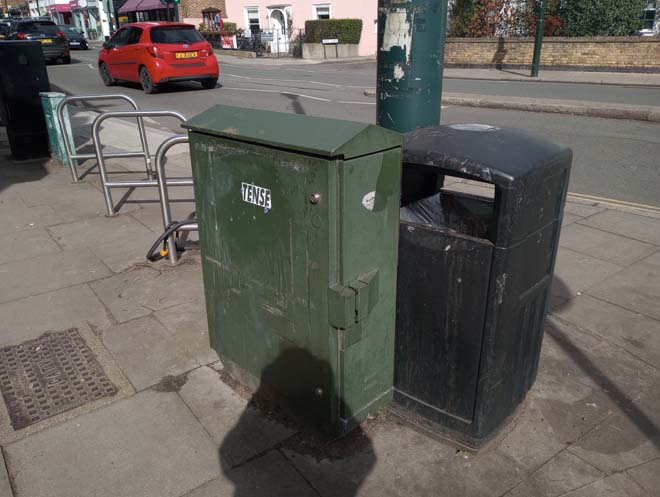
Figure 126: Accumulation of street furniture on the corner of High Street and Station Road
The only railings in the character area are located either side of the junction with Grange Road and are of a good quality and decorative.
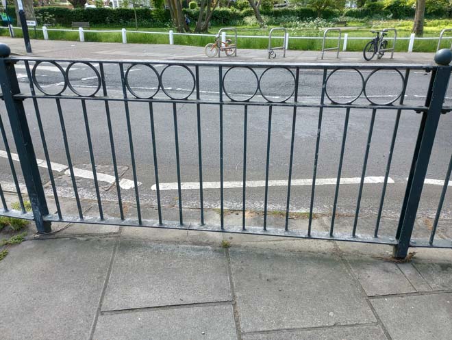
Figure 127: Railings on Church Road
There are a couple of EV charging points at the base of Nassau Road, opposite a parking bay for e-scooters. This corralling of e-scooters is a good attempt to mitigate against the abandonment of scooters in other parts of the area.

Figure 128: E-scooters on Nassau Road
Paving
The majority of paving within the character area is comprised of standard artificial stone slabs with granite kerbs. In some places, such as outside the new development on High Street, these have been renewed, which has resulted in a cleaner, brighter pavement. In some places, where vehicle crossovers have been formed and then altered, or at street corners where street furniture has been removed, the pavement is patchier. Some sections on the south side of Church Road by the Green have a more varied colour scheme of pavers (a mix of old and new), which adds additional interest and is the appropriate scheme for footway repaving in a conservation area. The wider pavements at the end of Church Road are largely divided in two, with a section of concrete pavers and a section of plain concrete, often with lightwells with small square reinforced glass lights. Along the High Street, there are several examples of historic pavers, most often seen at the entrance of an old carriageway onto the street, such as outside the no.39 High Street (formerly the rear entrance to the Watermans Arms) and outside the Coach and Horses. A few granite sett and kerb crossovers at road junctions have also survived, such as at the junction of the High Street and St Ann’s Road.
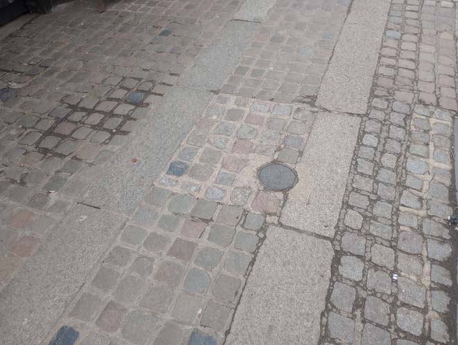
Figure 129: Setts outside the former cart entrance to the Coach and Horses public house, an example of historic setts/paving in the character area
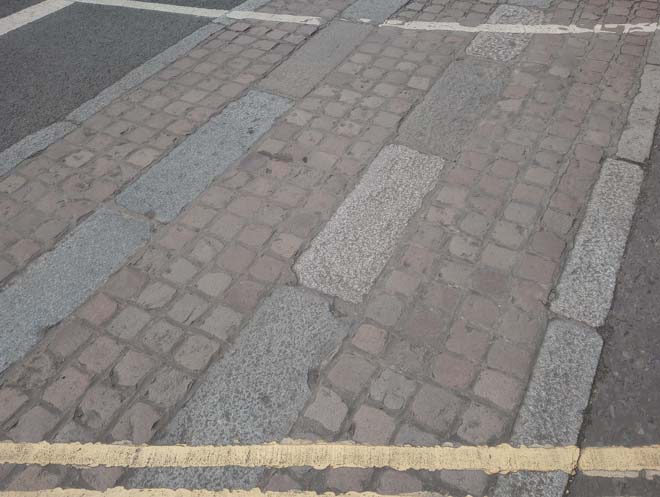
Figure 130: Example of a traditional granite sett and kerb crossover (junction of High Street and St Ann’s Road)
Figure 131: The paving outside the new development on the High Street
Character Area 3: The Green
Summary
This character area comprises Barnes Green in its entirety as a highly prominent and central feature of the Conservation Area. The character of the area is defined by the open space of Barnes Green and the views of the surrounding buildings which form an encircling skyline.
Architecture & Townscape
There are only a handful of buildings on the Green, in two distinct groups.
The first is the small group of the former National School for Boys, Girls and Infants, and Elm Cottage. The school was first established in 1775, being formed of two cottages on the Green for ten boys and ten girls to be educated. The present school building dates from the 1850s. It is comprised of four parallel gabled bays, in stock brick with slate roofs. The gable ends have large windows with stone surrounds, and the gables themselves are finished with decorative bargeboards. It is predominantly single storey and sits comfortably on the Green nestled between trees.
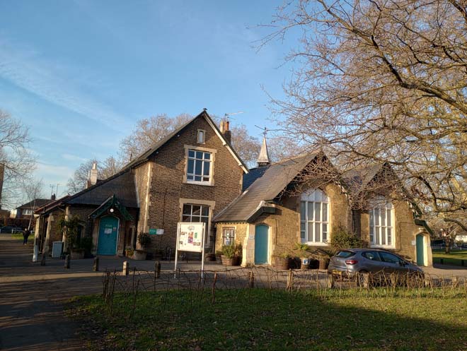
Figure 132: The former school building
Elm Cottage is older in date, likely of 18th century origin, with later extensions. It has a simple, rectangular form, painted cream render, with a tiled roof and prominent chimneystacks. Other notable features include the wavy bargeboard, large finial at the apex of the gable, and decorative arched windows.
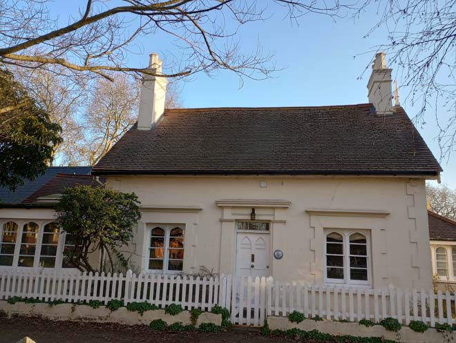
Figure 133: Elm Cottage
The other group of buildings on the Green are later in date and far larger in scale. This comprises the former Zeeta Works (now the OSO Arts Centre), Methodist Chapel, and Sunday School. They sit in a prominent position on the side of the Green, with the former Zeeta Works visible across the Green from Church Road. All three sit on the site of Cleveland House, one of the many large 18th century country houses in Barnes, which was demolished in the early 20th century. This is a monumental three-storey stock brick building, topped with a stone cornice and parapet. The main façade faces Station Road, with the rear block facing the Green added when the building was converted. It is highly prominent in views across the Green from Station Road and is of a scale and style unlike anything else in the Conservation Area, being a reminder of 20th century industry in Barnes.
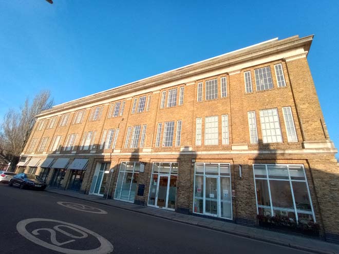
Figure 134: The former Zeeta Works
The red brick Methodist Church was the first building to be constructed on the plot in 1906, while Cleveland House was still standing. It is orientated north-south, with the main entrance facing south down Station Road. The steeply pitched slate roof and scale of the building is more easily appreciated from the Green side, due to the narrowness of Station Road. The red brick Sunday School building sits between the two large structures of the former Zeeta Works and the Methodist Church, with the variation in scale and height again more noticeable from the Green side.
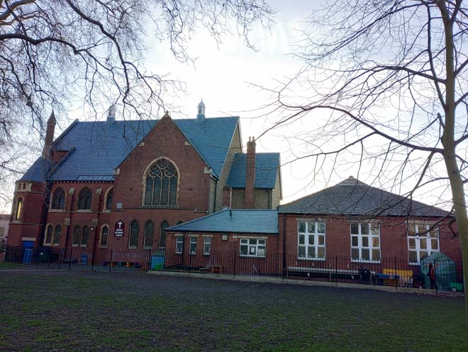
Figure 135: The Methodist Church and Sunday School as seen from the Green
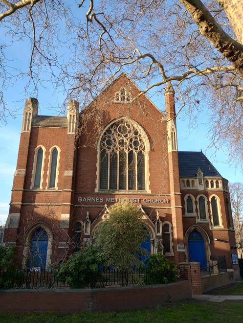
Figure 136: Barnes Methodist Church
Views
Views of the Green consist of longer views across it to the surrounding buildings, which provide a backdrop and encircling skyline.
Figure 137: A view across Barnes Green and the Pond, looking towards houses on The Crescent
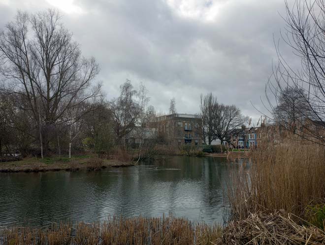
Figure 138: A view across Barnes Green and the Pond, looking towards the former Zeeta Works
Open Space
Barnes Green is an ancient medieval green which has survived largely unaltered in form. Historically the Green would have melded visually and physically with the upper reaches of Barnes Common; today the Edwardian residential development has constricted the relationship, but there is still easy access across Beverley Brook between the Green and the Common, with the former very much defined as a ‘traditional’ village green.
It is a roughly L-shaped plot of land, extending to the east between Church Road and The Crescent and to the south down towards Beverley Brook, which forms its southern boundary. It forms a welcome area of open, green space amongst both the busy shopping thoroughfares of High Street and Church Road, and the densely developed Victorian/Edwardian residential areas to the east. The many mature trees create a more enclosed and greener atmosphere with the character of the Green changing dramatically with the seasons depending on the amount of foliage on the trees and the surrounding greenery. Many views of surrounding buildings can be glimpsed looking across the Green.
The pond is a central feature of the Green, framed by buildings on Station Road and Church Road to the north and west, and the open expanse of the Green to the east and south. It is an important focal point and historic feature of both the Green and the local centre.
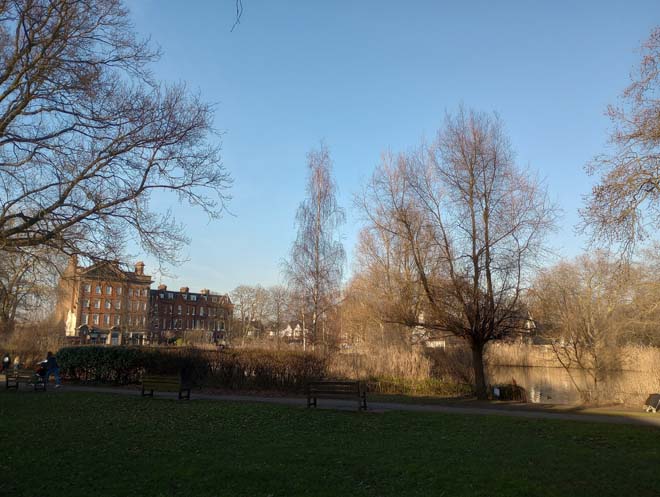
Figure 139: Barnes Green looking east towards the Pond with 15 & 17 and 19 – 25 Church Road visible on the left
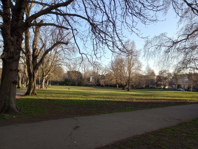
Figure 140: Barnes Green looking southwest towards Station Road
Figure 141: Barnes Green looking west towards Station Road from Laurel Road
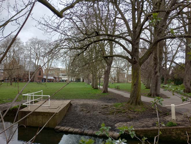
Figure 142: Barnes Green looking north towards Barnes Green from Beverley Brook
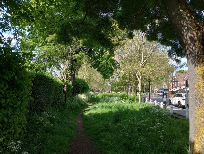
Figure 143: Barnes Green looking west from the easternmost corner (by the junction with Glebe Road)
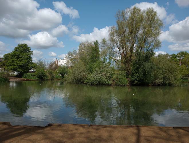
Figure 144: Barnes Pond
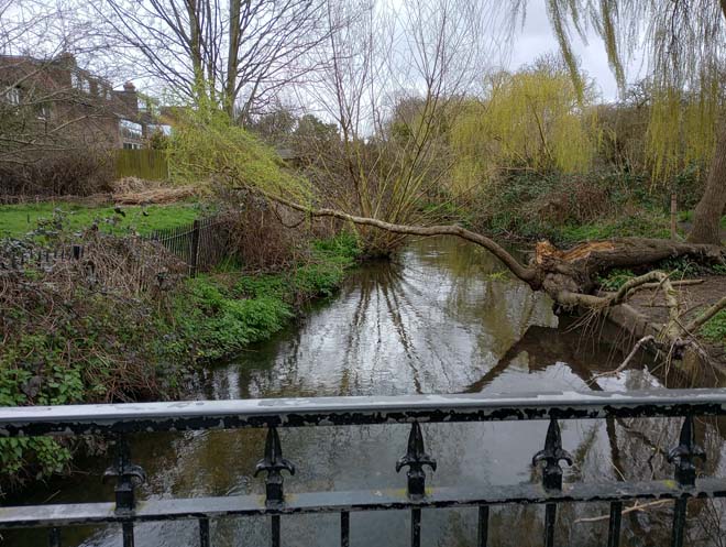
Figure 145: Beverley Brook at the southern boundary of the Conservation Area
Street Furniture
Opposite the entrance to Essex Court is a cattle drinking trough. This was said to have been given to the village as compensation when horses and carts had to stop using the pond for cleaning. It is similar to many elsewhere in the borough provided by the Metropolitan Drinking Fountain and Cattle Trough Association.
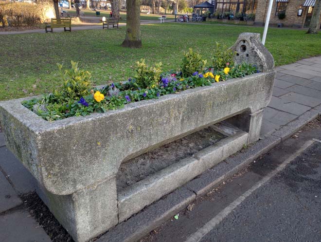
Figure 146: The cattle drinking trough
There are three EV charging points by the former Zeeta Works building. These are simply designed, unobtrusive, and typical of EV charging points found elsewhere in the Conservation Area.
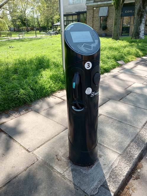
Figure 147: EV charging point
The northern side of the Green is separated from the road and pavement by a low, white-painted post and single rail fence. The western side is bounded by a modern black fence, which creates a more effective barrier between the Green and the road, a practical necessity due to the proximity of the road.
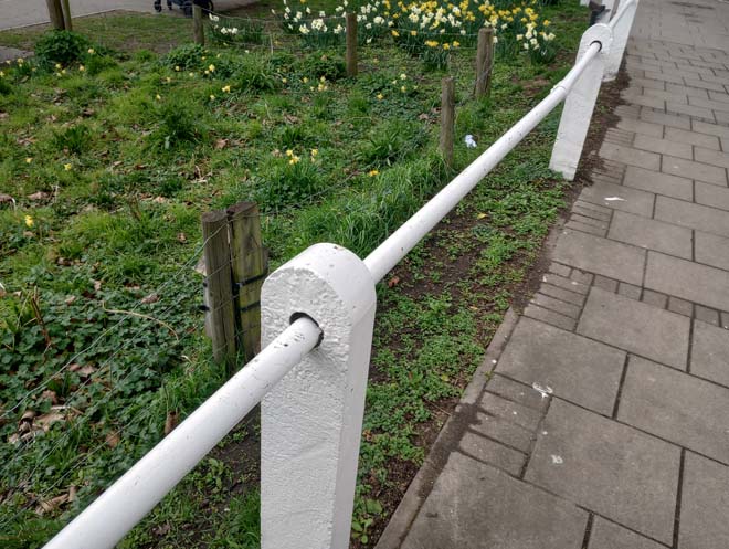
Figure 148: Post and rail fence around the Green
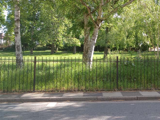
Figure 149: Black railings to the Green along Station Road
There is a variety of bench designs on the Green, including standard timber benches, and more modern raised benches, installed as part of the Friendly Parks for All Project. They are generally in good condition, and some are dedicated to local people.
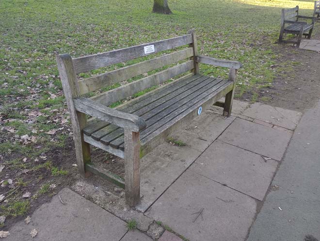
Figure 150: Example of a bench on the Green
Some low, white painted bollards opposite Elm Cottage define the vehicle access route to the buildings and are unobtrusive.
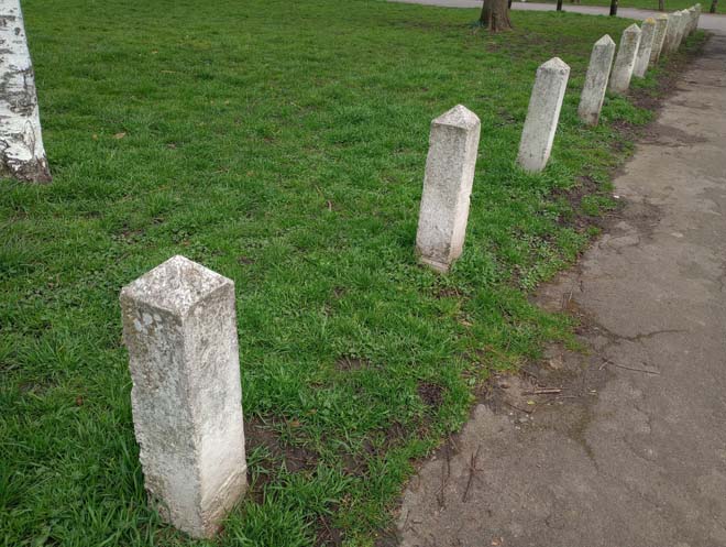
Figure 151: Low white bollards on the Green
Bins are well-spaced around the Green. They are predominantly cylindrical in design and formed of a metal holder and green plastic container. They are placed well in relation to benches, paths, and exits, and form unobtrusive features in the street scene.

Figure 152: Bins on the Green
Street furniture accrues more on the south side of Church Road (bounding the Green), with bus stops and flags alongside the occasional bench, bin, parking meter, and errant plastic bollard. There is a risk of accumulated street clutter in these areas, and further additions, including plastic bollards, should be resisted.
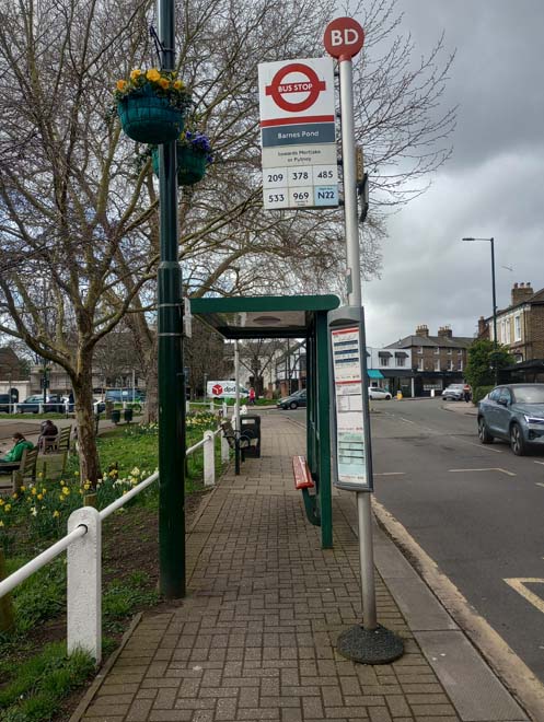
Figure 153: Bus stop by the Green, a typical example of bus stops throughout the Conservation Area
Paving
The paths across the Green are paved largely in tarmac, which creates an abrupt contrast between hard and soft surfaces. In some places the surfacing is cracked, largely due to tree roots.
Figure 154: Example of a path across the Green
Character Area 4: Malthouse Passage & Stanton Road
Summary
Although differing slightly in age and typology, both Malthouse Passage and Stanton Road represent small residential enclaves with a distinct character, tucked away from the busy main streets of Barnes. Situated behind The Terrace and overshadowed by the railway embankment is Malthouse Passage, a small enclave of late 19th century workers’ cottages. Stanton Road dates from earlier in the 19th century (1860s) and are larger, semi-detached villas. Although different in date and situation, both share a similar architecture and materials and are both distinctive residential groups developed before the rapid expansion of the late 19th century and early 20th century.
Architecture & Townscape
Malthouse Passage
They are all built to a simple, modest design, in stock brick with pitched slate roofs. Each has one sash window to ground floor alongside the entrance door, and one sash window to the first floor. Simple red brick window and door overarches are the only architectural features, and some of these have now been painted white.
Such buildings are characteristic of backland development in Barnes in the late 19th century, with narrow terraces of small cottages built to house workers. They were not long-lasting with the majority gone by the 1930s when Terrace Gardens and Limes Avenue had been established. These buildings are largely unaltered and form a dense group of great character and historic and social interest. Their secluded location holds a distinctly different character to the grand houses of The Terrace.
By the entrance to Malthouse Passage are a small group of houses of similar date although slightly larger. These are nos. 1 – 5 Cleveland Gardens and, similarly to Malthouse Passage are tucked away just behind the grander 18th century buildings of The Terrace. Nos.1 – 4 form a short, two-storey terrace, similar to Malthouse Passage in design and scale. Due to the curve in the road, nos.3a and 4 are set back from each other to create a short, stepped effect. Opposite are nos.3 & 5, a pair of larger double-fronted houses, both painted white with pitched slate roofs. Alongside the houses on Malthouse Passage, they form a small, dense group of modest dwellings in a marked transition from the larger houses on The Terrace.
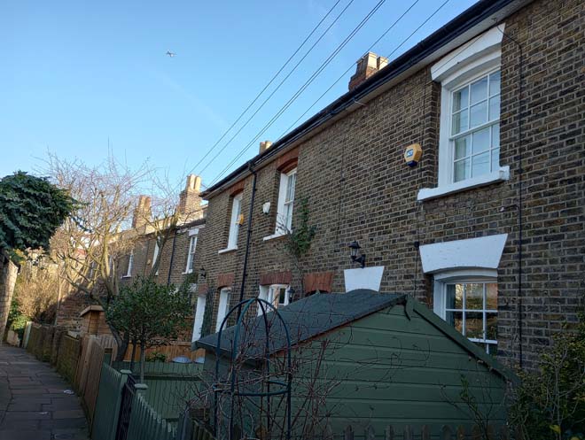
Figure 155: Houses in Malthouse Passage
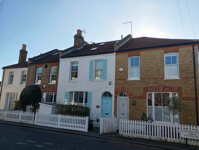
Figure 156: 1 - 4 Cleveland Gardens
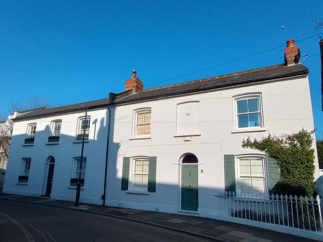
Figure 157: 3 & 5 Cleveland Gardens
Stanton Road
Stanton Road is some of the earliest 19th century residential development in Barnes, which started to branch out away from the main streets, yet it is still very much tucked in behind the long plots of buildings on the High Street and the large gardens of Essex House and Milbourne House. Dating from the mid-1860s, it originally comprised eight pairs of houses alongside a single detached house, Baptist Chapel, and Sunday School Building. The Chapel, Sunday School, and five houses (including one and a half of the original pairs) were destroyed during World War Two on the 25th August 1940.
Today seven and a half pairs remain, alongside a single detached house at no.14. The pairs are two storeys, in stock brick with hipped slate roofs. They are simple in design, with a single storey canted bay window to the front, and a single or pair of windows to the first floor. Prominent chimneystacks sit in the centre of the roof. No.14 is distinctive as a detached, double fronted house in white painted brick, again with prominent chimneystacks either side of its hipped slate roof. The street is a sudden change in character from the busy high street to a residential road and is a good example of mid-19th century development before the intense building of the later 19th and 20th centuries. However, the views to the north are dominated by Seaforth Lodge rising above the roofscape, and to the south by the post-war flats at the curve in the road.
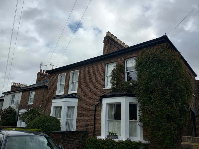
Figure 158: Example of houses in Stanton Road
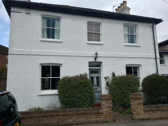
Figure 159: 14 Stanton Road
Views
Views of Stanton Road are overshadowed by Seaforth Lodge to the north and effectively terminated by builldings on the High Street, emphasising the proximity of the busy shopping road and the distinct difference in character.
The narrow lane of Malthouse Passage limits views along it. A more exapnsive view can be found from Barnes Bridge and similarly shows the houses on the Passage surrounded by larger scale development.
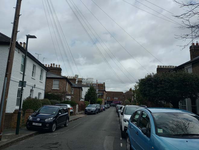
Figure 160: View of Stanton Road looking north towards the High Street. The top of Seaforth Lodge is visible on the left
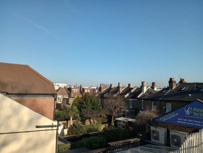
Figure 161: View of Malthouse Passage from Barnes Bridge
Character Area 5: Victorian and Edwardian Residential
Summary
The Victorian and Edwardian Residential character area comprises the bulk of the built environment of the Conservation Area outside of the historic core. Barnes underwent a small amount of residential development between 1850 and 1880, but it was the last decades of the 19th century and into the 20th century which saw massive development. This primarily occurred in the fields between Church Road, Rocks Lane and Station Road, with the loss of the big houses which previously dominated this area. The Lion Houses, built between 1899 and 1903 are the most distinctive of this development.
Architecture & Townscape
Cleveland Road
The majority of Cleveland Road was developed between 1870 and 1893 on previously open land. It contains a varied mix of style, scale and materials which create a varied and interesting streetscape as opposed to the more uniform streetscape of the development in the rest of the character area.
Nos.1 – 9 form a two-storey stock brick terrace with prominent canted bay windows in red brick with turret roofs. The entrance doors are paired under slate roofs with long decorative brackets, and most have retained the original doors with multi-pane fanlights. The windows are particularly distinctive, featuring coloured glass lights to the top row of the multi-paned top sash. Most houses retain the decorative roof ridge tiles and cast-iron finials to the top of the turrets, although there is some variation in the colour and texture of the roofing material. A few retain tessellated tiled paths, and boundary treatment varies with brick walls, railings, and fences all present in the short terrace. It is, however, a good quality terrace retaining many original features.
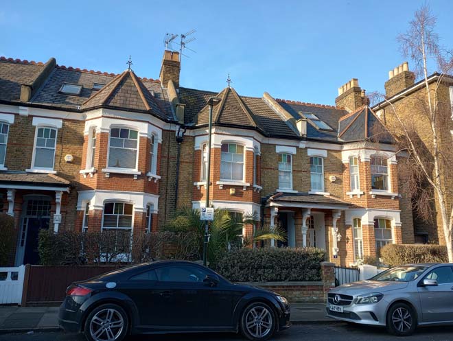
Figure 162: 5 - 9 Cleveland Road
Opposite is a short terrace of Lion Houses, which are included in the section on Lion Houses below.
Adjacent to the Lion Houses and similar in scale and materials are nos.12 – 22, a two-storey red-brick terrace with three ‘pairs’ of houses. To the front of each house is a gabled bay with a decorative rendered panel (painted over to nos.12 – 16). Segmented arches above the ground floor window, a dentil course and decorative finials and roof ridge tiles add additional interest. Several retain the original red and black tessellated tile paths, and boundary treatment of low brick walls is generally consistent, albeit with variation in colour.
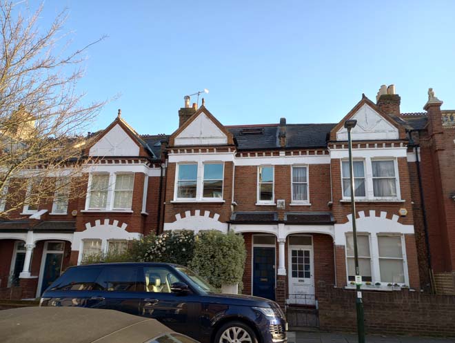
Figure 163: 12 - 16 Cleveland Road
The northern side between no.9 and Grove Road is comprised of three storey semi-detached houses. These are simply designed, in stock brick, with white door and window surrounds with bracketed lintels. Nos.11 and 13 share a classical style porch and are the largest and most elaborate of the group. Nos.23 and 25 are two storeys but follow the same materials and design. Boundary treatment is consistent, with low brick walls either in stock brick or rendered white.
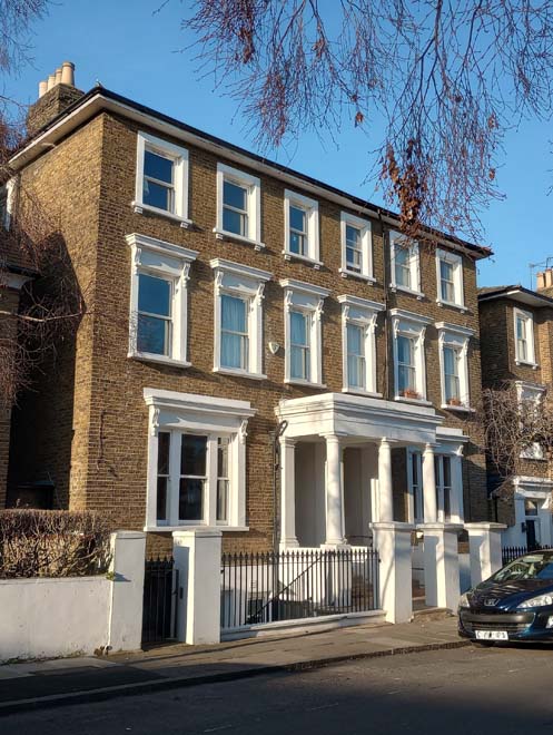
Figure 164: 11 - 13 Cleveland Road
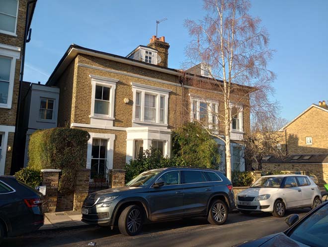
Figure 165: 23 - 25 Cleveland Road
Opposite, nos.24 – 30 continue the scale and design. Nos.24 and 26 additionally feature white-painted quoins and thick moulded window and door surrounds with classical pediments to the ground floor windows and arched windows to the first floor. Nos.32 – 36 complete the northern side with a simply-designed three storey stock-brick terrace with red brick detailing. There is then an abrupt ‘drop’ in building height and break in the streetscape, with the long boundary wall to no.2 Ellison Road.
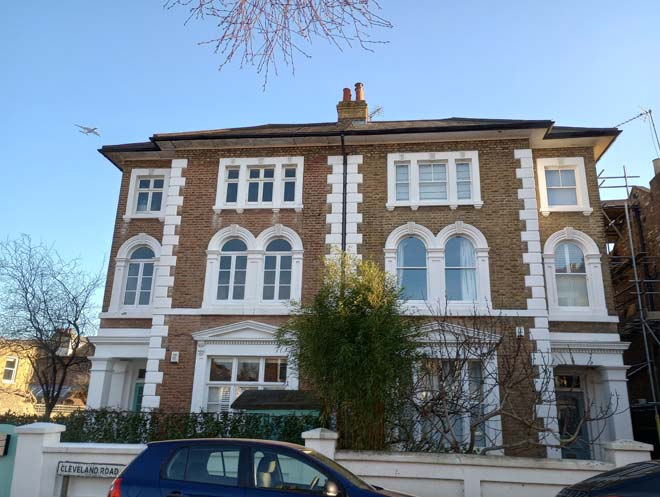
Figure 166: 24 & 26 Cleveland Road
Figure 167: 28 - 34 Cleveland Road
After the junction with Grove Road, the building height on the northern side remains at two storeys and the typology is consistent, comprising pairs and a terrace of two storey houses. The pairs feature single storey canted bay windows, simple door surrounds with keystone detail, bracketed eaves, and prominent central chimneystacks. All have front facing dormers of varying sizes and designs which creates a somewhat uneven and discordant roofscape. Between the two stretches of late 19th century houses is a small 1970s development. Comprised of three houses, they are positioned at a slight angle facing the road and set back from each other to create a stepped frontage. Although overtly modern in a Victorian streetscape, their size, form, and materials has integrated well and provide an interesting architectural addition and variation to the street.
Figure 168: 27 - 33 Cleveland Road
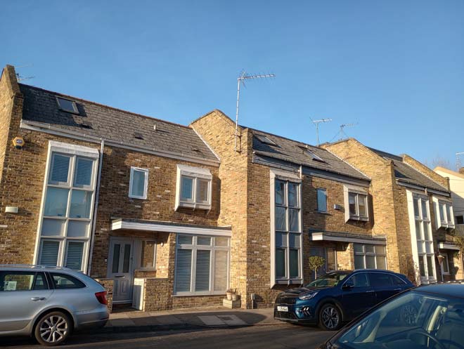
Figure 169: 39 - 43 Cleveland Road
Beyond is a typical late 19th century terrace, in stock brick with two storey canted bay windows topped with a turret roof. They are modest in design with a small amount of moulding to the window mullions and door surrounds. Some have been painted which disrupts the cohesiveness of the terrace, and many of the recessed doorways have been infilled. A few retain their original tiled entrances and rope edging. Boundary treatment consists of low brick walls, some painted white. The smaller scale of these houses is notable in comparison to the larger two and three storey terraces at the western end of Cleveland Road, with this terrace sitting tight in the plot and hard up against the pavement, creating a more closed-in feel to the street.
Figure 170: Terrace on Cleveland Road
No.1 Ellison Road is contemporary with the rest of the development along Cleveland Road and was built as a ‘Workmen’s Institute’, later becoming a Library by 1951. It is comprised of a central range, with two smaller wings to the north side, in stock brick with red brick detailing under a half-hipped slate roof.
Figure 171: 1 Ellison Road
40 & 42 Cleveland Road and 2 - 8 Ellison Road form a small group of mid 19th century semi-detached houses. Built in stock brick with slate roofs and single storey canted bay windows, they are of a simple but elegant design compared to the more richly detailed later 19th century houses. All have a prominent central chimneystack and nos.2 – 8 additionally feature white-painted mullions to the bay windows. They contribute to the varied architectural character of Cleveland Road.
Figure 172: 40 & 42 Cleveland Road
igure 173: 2 & 4 Ellison Road
Grange Road
Grange Road was first laid out in 1905 along an old trackway called ‘Goodenough Lane’. Only the east side was developed, with a pair of large mid-19th century houses in their own grounds remaining on the west side: The Hermitage and Orchard House. The Hermitage was demolished in the 1960s, but Orchard House survives, albeit heavily altered and partly rebuilt. The houses were built in two phases over a period of ten years between 1905 and 1915 to the designs of two local architects, George W. Smith of 64 Station Road, Barnes, and John Pacey of 47 Erpingham Road, Putney. Together they are two high quality terraces of designs unique within Barnes and make a strong positive contribution to the character and appearance of the Conservation Area.
The first phase comprised four pairs of houses (nos.14 – 28) designed by Pacey and built 1906 – 7. They are substantial three-storey houses finished to a high quality and are very well preserved, retaining many original features. The most distinctive feature is the two-storey canted bay window topped with a projecting gabled bay with decorative brackets. These emphasise the height of the houses and their prominence in the streetscape. The entrance doors are set under tiled porches with rows of scalloped tiles, with an open porch and geometric timber spindle panel. All have either original doors or sympathetic replacement, with a panel of small square lights to the top half. The windows to the ground and first floor have multi-pane top sashes and single pane bottom sashes, and the gabled bays have simple casements. Other architectural features include the fine dentil course to the bay windows, roof ridge tiles, and finials to the apexes of the gables. Constructed in red brick with stock brick sides, the exterior finishes to the first and second floors are either hanging tiles, or white render with timber detailing to the gable; the exception is nos. 26 and 28 which feature both. The majority retain their original tessellated tile paths, and all have original or replica red brick walls with panels of random rubble, and timber gates.
Figure 174: 22 - 28 Grange Road
The second phase of development comprised three pairs of houses (nos.2 – 12) designed by Smith and built 1913 – 14. They are on smaller scale than those by Pacey, and in a contrasting materials and style, being two storeys, in white render in the broad Arts and Crafts style. All feature prominent full-height octagonal bay windows, with some variation in their placement and overall composition of the front elevation. The placement and design of the tiled porches above the doors also varies across the group. The windows are all leaded casements, with a small octagonal window to the first floor. The roof forms vary, with the majority being simple pitched roofs. No.4, however, has an unusual roof form of a half-hipped roof with a small projection connected to the chimney. Boundary treatment varies, with red brick walls, fence, and hedge all present.
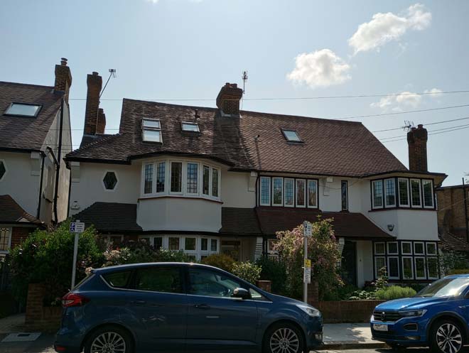
Figure 175: 2 & 4 Grange Road
The Lion Houses
The Lion House are some of the most distinctive buildings in Barnes and make a strong positive contribution to the character of the area. They are two storeys high, built as mirrored detached pairs, straight terraces, or terraces of pairs in echelon (set back from the previous pair). They are in red brick to the front elevation and stock brick to the sides and rear, with either slate or tiled roofs. The front elevations are richly decorated, with bands of ornate tiles in buff terracotta running below eaves, parapets, and windowsills, between window arches and across pediments. The windows have intricately moulded gault-brick arches. Buff stone is used for balustrades and coping on both the houses and front boundary treatments and for the caps to the red-brick gate piers.
On pediments and piers squat the small creatures, which give their name to the group. Door design is the same across the group: a four panelled door with two central glazed vertical panels etched with a simple foliage design, and a horizonal panel above and below. The door is flanked by glazed margin panels and surmounted by a rectangular fanlight. All have tessellated tiled paths, of varying design. The walls which separate the Lion Houses from the pavement are an integral part of the design of the houses and are attractive features in their own right. The most common boundary treatment consists of a low red brick wall with buff stone balustrade and coping, and red brick piers with a lion, orb, or scallop cap.
All Lion Houses (except for those on Cleveland Road) are subject to an Article 4 Direction, further details of which can be found in the Management Strategy below.
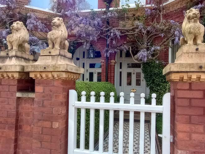
Figure 176: Typical example of the entrance to a Lion House, with Lion statues on the gate piers, white-painted timber gate, tessellated tile path, and original door
The majority Lion Houses can be divided into distinct styles. Others combine features of more than one style or are built in a different form.
Type A (nos.1 – 14 The Crescent and nos.19 – 28 Ranelagh Avenue) are built as terraces of pairs set back from the next, with a single storey rectangular bay carrying a balustraded balcony, and a pitched roof covered in slate with roof ridge tiles. The windows are particularly distinctive, with the tripartite windows having fixed margin lights either side of the main sash. The ground floor windows have an arched glazing bar to the upper sash, with spandrel infills of coloured glass, reflected in the top third of the margin light. The boundary treatment to nos.1 – 14 is the least cohesive of the whole group, consisting of low brick walls in varying finishes, and some with railings. A couple of gardens have also been given over to hardstanding for cars. Despite this, all tessellated tile paths survive.
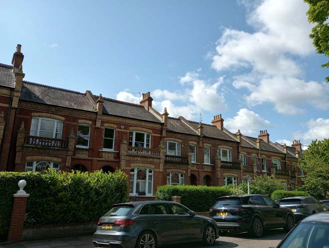
Figure 177: Type A Lion Houses on The Crescent
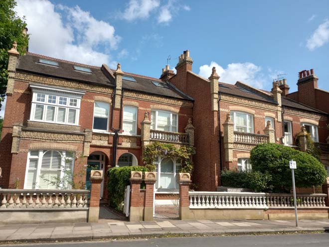
Figure 178: Type A Lion Houses on Ranelagh Avenue
Type B (nos.20 – 42 Hillersdon Avenue, nos.1 – 11 Laurel Road, and nos.44 – 54 Glebe Road) are built as detached pairs, with a two-storey canted bay window surmounted by a gable, and a connecting parapet. The slate roofs are only visible in glimpsed views of the sides of the houses, being largely screened by the prominent chimneystacks. The unbroken rhythm of the gables creates a highly distinctive streetscape, and this type forms the longest runs of Lion Houses. The windows are simple one-over-one sash windows. Boundary treatment survives intact, with many white-painted timber gates. All tessellated tile paths survive.
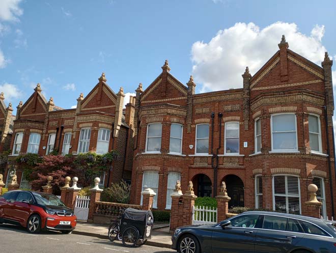
Figure 179: Type B Lion Houses on Hillersdon Avenue
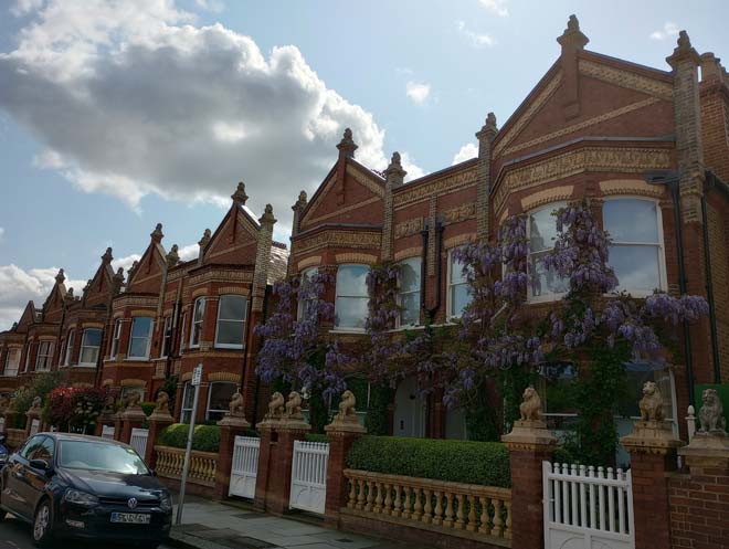
Figure 180: Type B Lion Houses on Laurel Road
Type C (nos.41 – 59 Glebe Road and nos.13 – 23 Bellevue Road) are built as straight terraces with two-storey rectangular bays surmounted by a shared pediment on central pairs and a balustraded parapet on end-terrace houses. Pitched slate roofs with roof ridge tiles are hidden behind the pediments and parapets. The windows are the same as Type A. Boundary treatment survives intact, with many white-painted timber gates. The majority of tessellated tile paths survive.
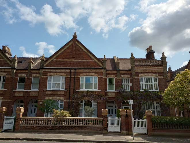
Figure 181: Type C Lion Houses on Glebe Road
Type O: Nos.26, 27, and 28 The Crescent are a separate and distinct group of Lion Houses and are larger in scale at three storeys. Nos.26 and 28 have a two-storey bay surmounted by a tall gable in front of a pitched, tiled roof with roof ridge tiles. The windows are simple one-over-one sashes No.27 is the largest of all the Lion Houses, being double-fronted with a pair of two-storey canted bay windows. The windows are the same as Type A, albeit with slimmer margin lights. All retain their tessellated tile paths, but the boundary walls have been rebuilt in red brick, with blue engineering brick coping to nos.26 and 27.
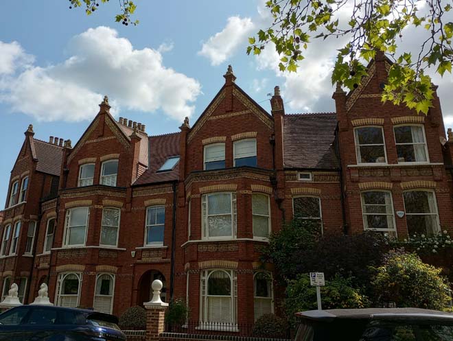
Figure 182: 26 - 28 The Crescent
Nos.29, 30, and 31 Ranelagh Avenue are also three storeys but are comparatively plain, with simple casement windows with stone surrounds. As a group, they have undergone substantial alteration and expansion, with a further gabled bay added to each side of the short terrace. Although some features of Lion Houses remain, including lions to the original piers at roof level, some terracotta detailing, and some original boundary treatment, they are much less well preserved and cohesive than the majority.
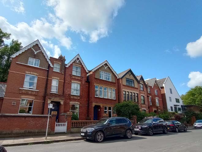
Figure 183: 29 - 31 Ranelagh Avenue
Nos.31 and 33 Hillersdon Avenue present as a single, double fronted house as a variant of Type A with a pair of single storey rectangular bays with balustraded balconies.
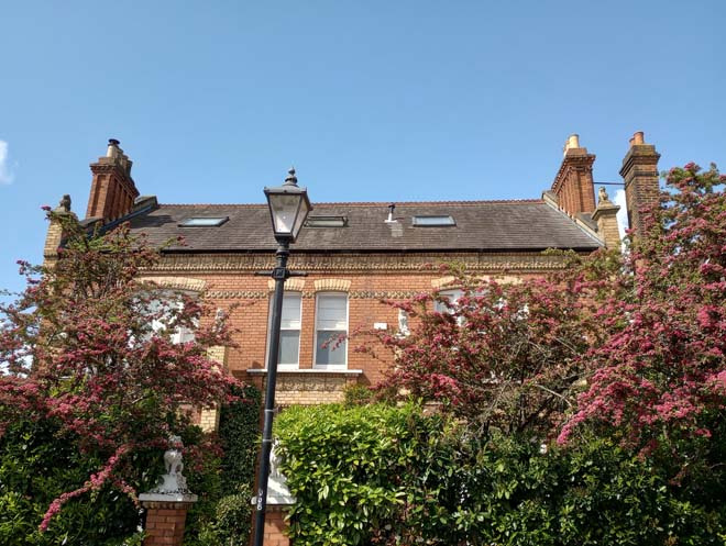
Figure 184: 31 & 33 Hillersdon Avenue
The Cleveland Road Lion Houses (nos.2 – 10a and nos.57 & 59 Cleveland Gardens) are a terrace comprised of three pairs, and a detached pair slotted in behind. Nos.2 & 4 and 10 & 10a fit broadly into Type C, being two storeys with rectangular bays surmounted by a balustraded parapet, and windows matching Type C. Nos.6 & 8 have two storey canted bay windows with a tiled roof and gable behind, a design not seen on any other Lion House. While they have lost their Lions, they feature all the decorative brick and terracotta work, albeit painted white. Nos.57 & 59 Cleveland Gardens are in the design of Type C, but the style of Type A: a pair in echelon, but with two storey rectangular bays surmounted by a balustraded parapet, and windows as Types A and C. The decorative brick and terracotta work has been painted white, and they have open brick balustrading above the bays as opposed to stone. All retain the original structure of the boundary walls, including piers, but instead of stone balustrading, the walls are simply infilled with red brick. Although slightly less well-preserved than the majority, they nevertheless retain key, distinct features which clearly identify them as Lion Houses.
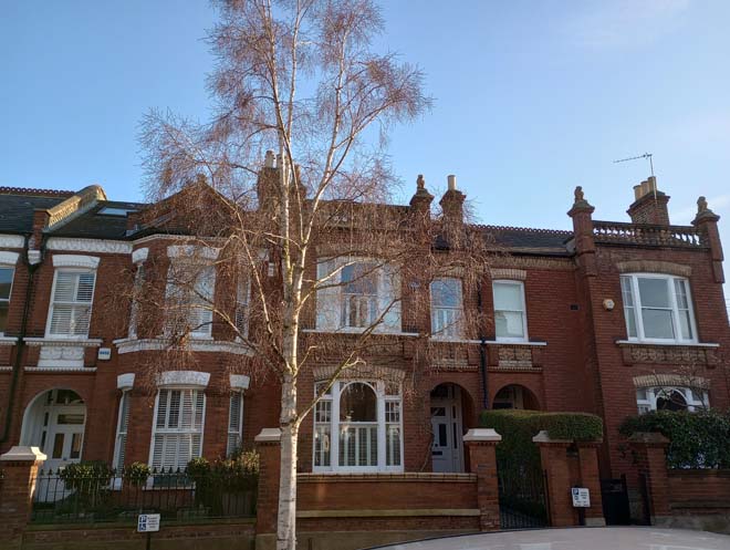
Figure 185: 2 - 6 Cleveland Road
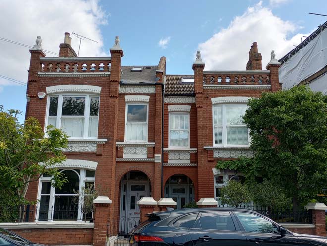
Figure 186: 57 & 59 Cleveland Road
The Crescent (nos.15 & 16, 17 – 25 and 29 – 34)
The Crescent forms the eastern boundary of the Green, with the houses along it looking out across the open space. They in turn form a backdrop and encircling skyline to the Green in longer views from Church Road. It is a fairly narrow road, with houses set back behind front gardens. The outlook to the Green and the mature trees along it gives it a rural feel not found elsewhere in the Conservation Area.
The non-Lion House properties on The Crescent comprise terraces and pairs of late 19th century houses in two distinct styles, and one semi-detached pair.
Nos.17 – 21, are a two-storey red brick terrace with the houses grouped in pairs. Each has a gabled front bay with decorative features including a red and white segmented arch over the first-floor window, hanging tiles to the gable face, and a decorative finial to the apex of the gable. The paired entrance doors are covered by open porches with fishscale-tile roofs and timber spindles with an arched frame beneath. The roofs are slate and originally had two bands of decorative diamond-shaped slates, alongside pointed roof ridge tiles. There is some variation in the design of the tessellated tile paths, but boundary treatment is largely consistent, comprising brick walls and pilasters. Original gates and railings are present at nos.17 and 18.
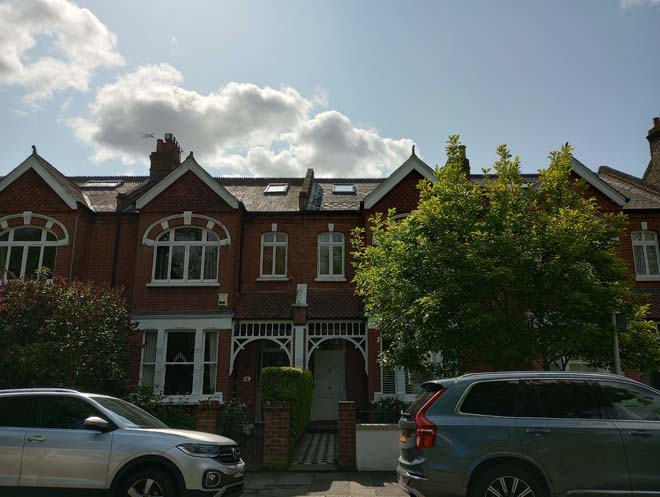
Figure 187: 19 & 20 The Crescent
Next are nos.22 – 25, two semi-detached pairs, on a similar scale and form to 17 – 21. They have canted bay windows to the ground floor of the gabled bay, the white render of which contrasts with the red brick frontage and quoin detail. The paired entrance doors are flanked by white columns and the arches have a keystone detail picked out in white. All have decorative wrought iron balconies above the doors. The front gardens have seen some unsympathetic paving in plain grey stone, and boundary treatment varies markedly between the four.
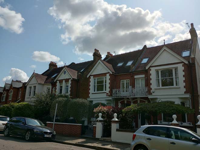
Figure 188: 22 - 25 The Crescent
The red-brick terrace at 29 – 34 completes the curve of The Crescent, facing directly out over the Green. Grouped in pairs, they feature gabled bays with a pair of windows to each floor and a small window to the gable face. The entrance doors are flanked by white columns and the arches have a keystone detail picked out in white. All retain their original doors with stained glass panels and fanlights above. Above the doors are decorative wrought iron balconies. Although the houses are generally well-preserved, all have lost their tessellated tile paths. Boundary treatment is consistent in scale, with some variation in materials. The most detracting feature is the large front dormer to no.29, which has resulted in the loss of the gable end and disrupts the cohesiveness of the terrace and the rhythm of the gables.
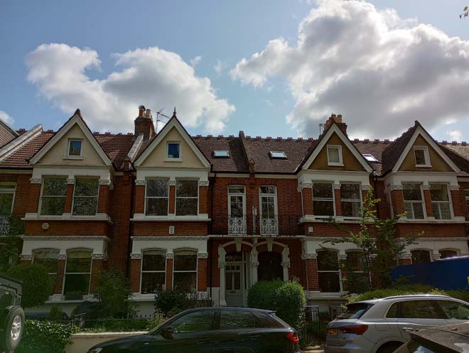
Figure 189: 30 - 33 The Crescent
Beverley Close
Beverley Close is an early 1930s development on the site of The Laurels, an 18th century house which became Beverley School in the early 20th century following the sale of the estate in 1897 and was demolished in 1930. It is a quiet residential enclave with a distinct rural character in comparison to the grand Victorian/Edwardian red brick houses surrounding it. The houses are in the Arts & Crafts/Cottage vernacular style, with red brick ground floors and rendered or faux-timber upper floors under clay-tiled hipped or half-hipped roofs. Bay windows (including a couple of rounded bay windows) and prominent chimneystacks are also distinctive features. No.7 is particularly well-preserved, retaining its original door, windows, and garage. Where present, low rubble walls are the original common form of boundary treatment. The addition of dormers, rooflights, and garage conversions are the most common alterations.
Figure 190: Houses in Beverley Close
Laurel Road (nos.12 – 20)
Laurel Road is situated on the southern boundary of the character area, with houses backing on to Barnes Common. Views looking towards the east terminate in the Lion Houses on Glebe Road, and to the west is the verdant aspect of the Green. The eastern end is much more cohesive, with the distinctive gabled ends of the Lion Houses comprising the roofscape. To the west is less cohesive and smaller in scale as the grand Lion Houses give way to more modest two storey mid – late 20th century houses.
After the Lion Houses, nos.12 – 14 are of similar scale, being three storeys, in red brick with steeply pitched gabled bays. The gables feature decorative wavy bargeboards, timber detailing, and terracotta finials and roof ridge tiles. This decoration is reflected on both the small dormers and the porches, with the latter also featuring timber spindles.
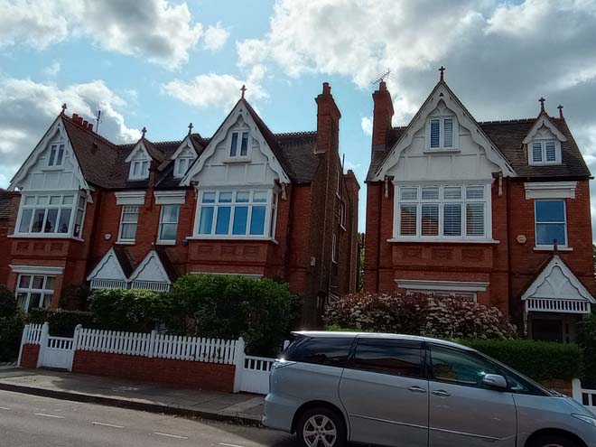
Figure 191: 12 - 14 Laurel Road
The building height decreases further towards the Green, with the three-storey gabled houses giving way to more modest two-storey hipped roofed properties. These are nos.16 – 20, a run of 1980s semi-detached houses. Their simple design is in stark contrast to the exuberant Lion Houses, but they sit well on the street and create a softer transition into the trees, greenery, and open space of the Green.
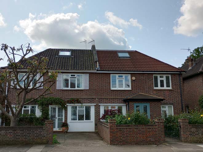
Figure 192: 18 & 19 Laurel Road
Hillersdon Avenue (nos. 2 – 18, 1 – 15, 17, 19, 29)
There is substantial variation in the architectural quality of buildings along Hillersdon Avenue. The east side is dominated by two high quality late 19th century terraces, with the gables of the Lion Houses highly prominent in the streetscape. The west side is less cohesive, comprising a mix of late 19th century, early 20th century, and later 20th century buildings.
Nos.2 – 18 Hillersdon Avenue comprise a two-storey red brick terrace with the houses grouped in pairs. To the front of each is a full height canted bay window with a turret roof and finial. Almost all the houses retain their original doors with stained glass lights and large stained-glass fanlight beneath a prominent moulded pediment. Tessellated tile paths have largely been retained, and boundary treatment is generally consistent, being of low brick walls, generally with hedges.
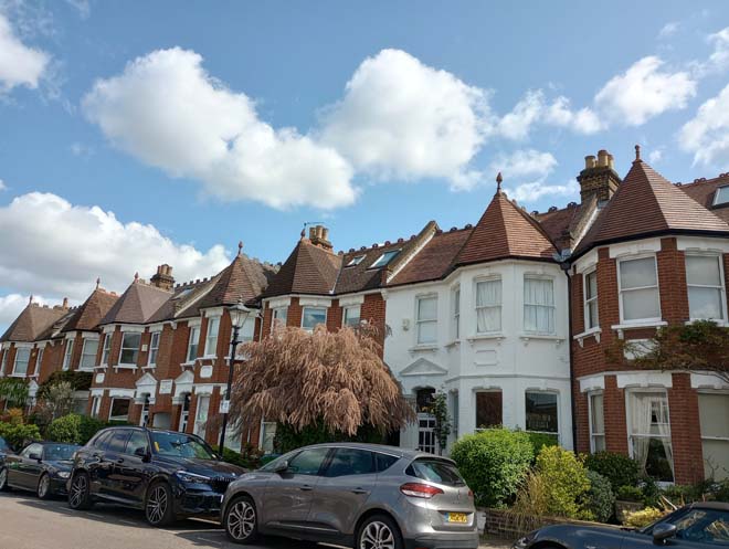
Figure 193: Part of the terrace on Hillersdon Avenue
Opposite, nos.1 – 15 comprise four pairs of houses. These are set back further from the pavement, and the gaps between the pairs serve to break up the streetscape and create a more open feeling. Each pair differs in design and finishing, but are consistent in form, being two storeys, with gabled bays to the front, and hipped roofs. Nos.1 & 3 are finished in brick, with hanging tiles to the gable face, but the rest are finished in white render.
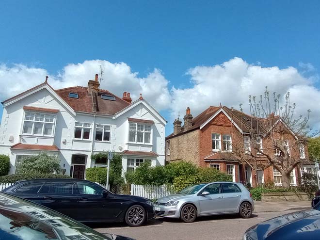
Figure 194: 1 - 7 Hillersdon Avenue
The streetscape becomes more fragmented and open on the eastern side with a varied building line and typology of building. No.17 is a 1920s bungalow, finished in pebbledash, with a slate roof, small gabled bay, and open porch. It is set back behind two mature trees and has a rural feel, despite being mid-street. Next, no.19 is a blocky, three-storey set of 1960s flats in yellow brick with red hanging tiles. While of a distinctive architectural style, it is somewhat out of place amongst late 19th century suburban terraces.
Views
The views in this character area consist primarily of long views up and down each road, often characterised by distinctive and cohesive roofscapes.
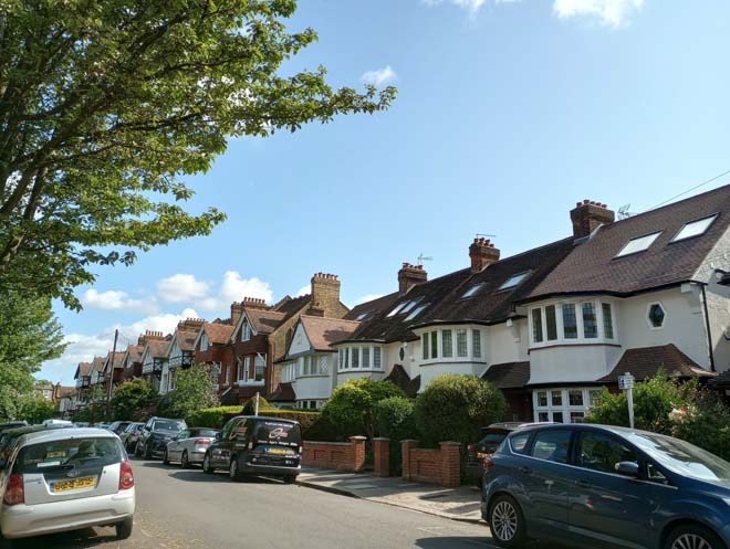
Figure 195: View looking north-east up Grange Road
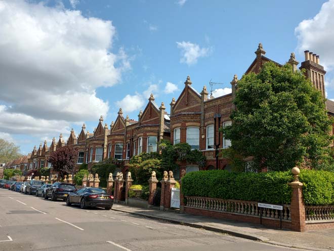
Figure 196: View looking north-east up Hillersdon Avenue with the distinctive gables of the Lion Houses
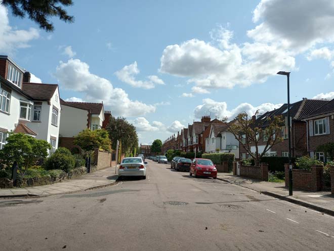
Figure 197: View looking east along Laurel Road with the gables of the Lion Houses visible in the distance
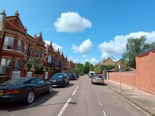
Figure 198: View looking west along Laurel Road towards the Green
Figure 199: View of houses on The Crescent from the Green
Open Spaces
This area is characterised by its densely developed residential streets with no open spaces. The only relatively ‘open’ area is where the course of Beverley Brook passes through the area, between the back of 1 Laurel Road and 44 Glebe Road, 51 and 53 Glebe Road, and to the side of 17 Bellevue Road. The brook is spanned by short sections of wrought iron fence with an interlocking circle pattern and flanked by red brick piers with ball finials. The brook creates a few gaps in the street scene and allows for unexpected views of both the houses and a waterway in what is an otherwise densely developed residential area.
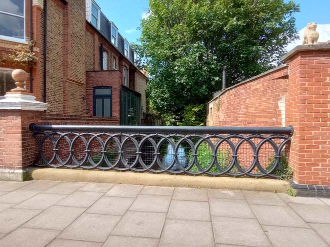
Figure 200: Beverley Brook by the side of 44 Glebe Road
Street Furniture
There is one surviving Victorian sewer vent pipe at the junction of Cleveland Road and Cleveland Gardens. These would once have been more common across the Conservation Area, and indeed the Borough, located along the courses of underground rivers or sewers and often features of street corners.
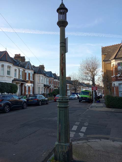
Figure 201: Sewer vent pipe on Cleveland Road
There is a George VI Letter Box on Cleveland Road outside no.10a. As with other historic street furniture across the Conservation Area, the Letter Box and Vent Pipe make a positive contribution to the area and should be retained.
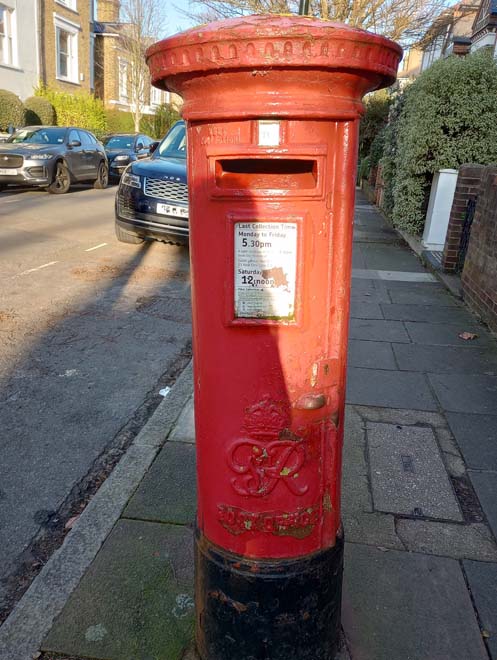
Figure 202: George VI Letter Box on Cleveland Road
A few streets have heritage-style lampposts, but most have standard modern LED lampposts.
Car parking signs are placed at regular intervals along the residential streets and are fairly unobtrusive, albeit ubiquitous.
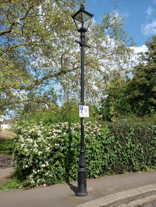
Figure 203: Example of a heritage-style lamppost on The Crescent
Some cast-iron street nameplates have been retained. As with other cast iron nameplates across the Conservation Area these make a positive contribution to the character of the area and should be retained.
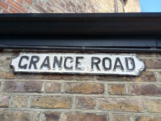
Figure 204: Example of a cast iron street nameplate
Paving
Paving generally consists of standard artificial stone slabs with granite kerbs. Variation in colour reflects a mix of old and new slabs being used which is the appropriate scheme for footway repaving in a conservation area. However, in some areas it is of poorer quality, such as on street corners or where vehicle crossovers have been formed.
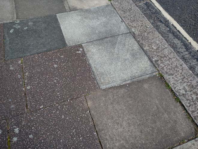
Figure 205: Example of paving on Hillersdon Avenue
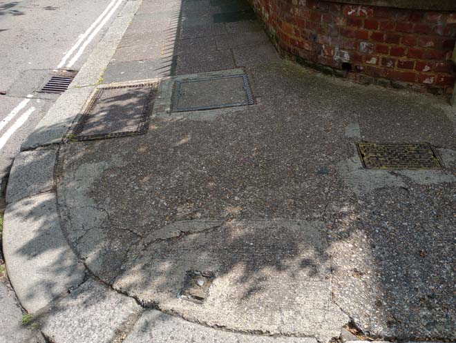
Figure 206: Example of paving on a street corner
Character Area 6: Elm Bank Gardens
Summary
Elm Bank Gardens is a small triangular wedge of residential development between the grand 18th century houses, and large mansions blocks which overlook the Thames to the west, Thorne Passage to the south, and the railway line to the east. It was developed on the site of the gardens and grounds of Elm Bank House, starting in the 1880s. The majority of the Victorian development was designed by the architect W. Newton Dunn and are of a high quality, with many retain original features and materials. Later 1920s and 30s dwellings have more of an Arts and Crafts influence and add architectural variety. Elm Bank Gardens has a sense of enclosure and a distinct shift away from the grand houses on The Terrace to a more residential scale and design. Although there is variance in use and styles, Elm Bank Gardens maintains a homogenous collection of buildings which presents a strong character and appearance.
Architecture & Townscape
Across Elm Bank Gardens, the majority of the residential properties can be separated into distinct groups.
Type A (nos.2 – 40 (even) and 21 – 27 (odd)) houses are two storeys, constructed in gault brick with red brick banding and slate roofs. They all feature prominent two-storey canted bay windows topped either with a turret or gable. These bay windows are richly detailed with small dentil courses and moulded decoration to the mullions. The doorcases are similarly detailed, with slim white columns with moulded capitals and overarch with prominent keystone detail. Many original doors have been retained, some with their original stained glass lights and fanlights with ceramic number, alongside tiled panels in the porch. The eaves level is accentuated by a prominent dentil cornice with white dentils on a dark red brick. A high proportion of tessellated tiled paths have been retained, and there is consistent boundary treatment of low stock brick walls with white-painted coping. Some gardens have been given over to hardstanding for car parking, but a good number remain, particularly where they are too small for parking. These are some of the most well-preserved houses in this character area.
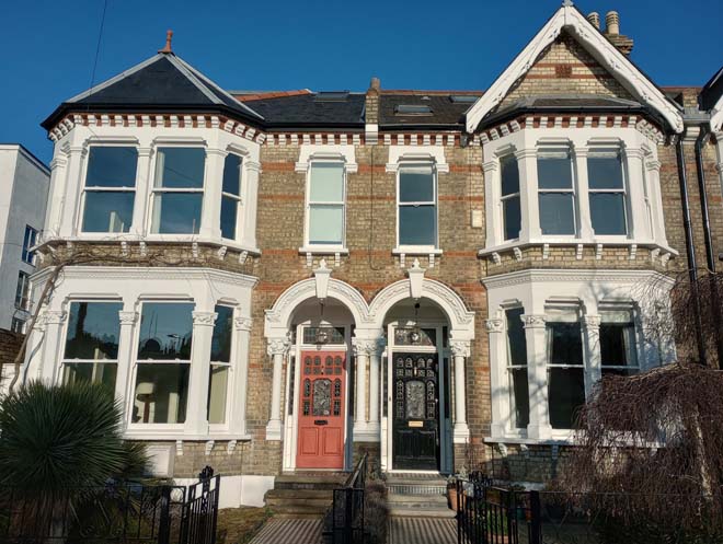
Figure 207: 2 & 4 Elm Bank Gardens
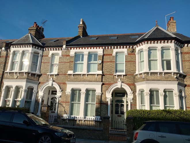
Figure 208: 18 & 20 Elm Bank Gardens
Type B (nos.5 – 19 (odd)) houses comprise two terraces of four which give the appearance of pairs of semi-detached houses due to recesses between the pairs. Built to a similar design, nos.5 – 11 are constructed in red brick and nos.13 – 19 in stock brick with red brick detailing. All have a prominent gabled bay to the front, with slight variation in window design and style. Many original doors with stained glass have been retained. Other notable features include a prominent dentil cornice with white dentils on a dark red brick (similar to Type A), terracotta finials to the apex of the gables, and decorative roof ridge tiles. Only a few tessellated tile paths remain, and boundary treatment is fragmented, with stock brick walls, red brick walls, and fences all present. Only a couple of gardens have been given over to hardstanding. While they are less architecturally elaborate than the Type A houses, they are still of high architectural quality and are generally well-preserved.
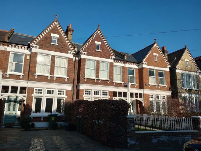
Figure 209: 7 -11 Elm Bank Gardens
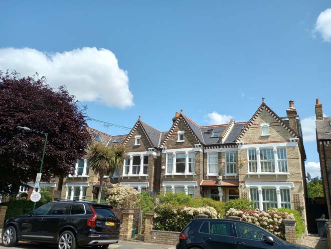
Figure 210: 13 - 19 Elm Bank Gardens
Type C (nos.59 – 69) are short terrace of six houses adjacent to St Michael and All Angels. They are two storeys, in red brick, or painted brick, with steeply pitched gabled bays which relate well to the adjacent church. All feature casement windows with a rectangular bottom light and a smaller six-pane light above. A shallow tiled roof runs the length of the terrace at first floor level and forms open porches with a decorative timber screen. Other notable features include a fine decorative dentil course at eaves level, brick arches with white-rendered infill to the gable, terracotta finials to the apex of the gable, and roof ridge tiles. Many have retained their original front doors and tessellated tiled paths. Boundary treatment is split between either red brick walls or palisade fencing.
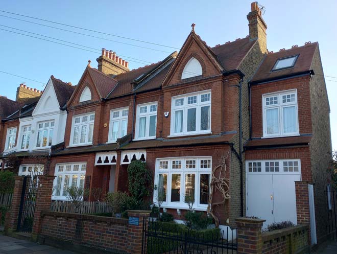
Figure 211: 63 - 69 Elm Bank Gardens
Type D (nos.29 – 37 (odd) and 71 - 93) houses are later in date and comprise the second phase of development of Elm Bank Gardens in the 1920s and 30s. All are built to a similar design, but with some variation between the groups. All are two storeys with a red brick ground floor and white roughcast-rendered upper floor under a plain clay tiled roof. Nos.29 – 37 are well-detailed and some of the best-preserved, featuring a tiled roof at first floor level with rows of scalloped tiles, open porch with timber spindles, and small gables with two courses of red brick. Nos.31 & 33 retain their original doors with six square glazed panes and three vertical panels. Boundary treatment consists of red brick walls with no gates or railings.
The quality of nos.71 – 93 varies, and while some retain a good level of original features, others have been subject to more unsympathetic alterations. Common features include two-storey canted bay windows, first-floor oriel windows above wide clay-tiled porch roofs, and decorative finials to the gable ends. A good number of original doors remain, as do some tessellated tile paths. Boundary treatment varies between brick walls and close boarded fences, some of which are in poor condition. A couple of front gardens have been given over to hardstanding for car parking, but most remain intact. There is an interesting variation in roof form, with nos.71-81 formed of short terraces or pairs with pitched roofs, and nos.87-93 featuring front facing gables. This has, however, led to many unsympathetic dormers to the latter which have infilled the roof valleys and has a negative impact on the rhythm of the gables.
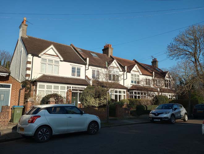
Figure 212: 31 - 37 Elm Bank Gardens
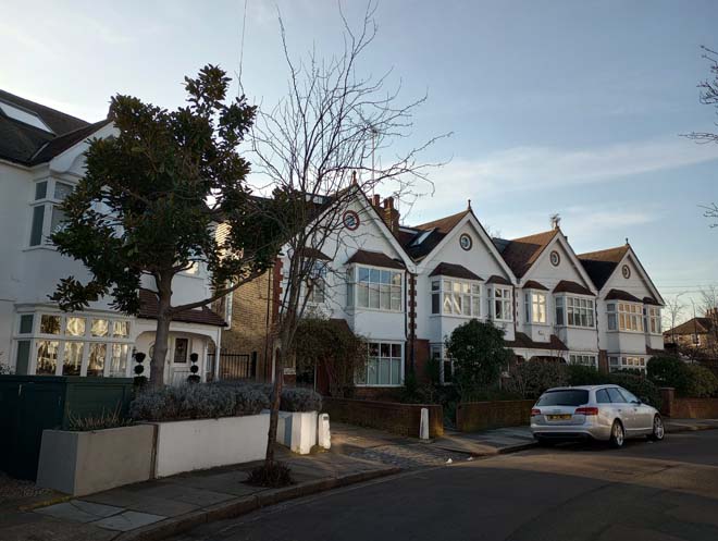
Figure 213: 85 - 91 Elm Bank Gardens
Nos.1 & 3 are the oldest residential properties on Elm Bank Gardens. They are two storeys, in stock brick with red brick dressing under a hipped clay tiled roof. To the front is a gabled bay with canted bay window divided by a clay tiled roof at first floor level. Both retain original front doors with fanlight with geometric design. They are situated in generous plots with high stock brick boundary walls and red brick gate piers with stone caps. They are distinctly different to the later development along Elm Bank Gardens but complement the overall character of a quiet residential enclave of good-quality 19>th and 20th century houses.
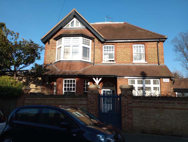
Figure 214: 1 Elm Bank Gardens
St Michael and All Angels Church is a substantial church in the French Romanesque style, designed by Charles Innes and built in 1892. It is in red brick, with stone dressing, under a clay tiled roof, and decorative terracotta tiles to the apexes of the gables facing Elm Bank Gardens. It is dominant in the streetscape but largely screened in views looking up and down Elm Bank Gardens as it sits in-line with the common building line and is screened by surrounding greenery. The Thorne Passage side is more active, with the main entrance door and modern community centre/choir room and boundary wall. It is on a larger scale compared to the surrounding buildings and is an unexpected find in its suburban setting.
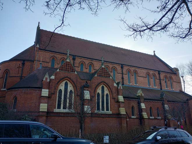
Figure 215: St Michael and All Angels from Elm Bank Gardens
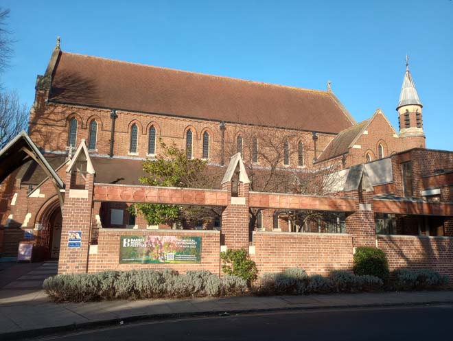
Figure 216: St Michael and All Angels from Thorne Passage
St Michael’s Vicarage is located at the eastern end of Elm Bank Gardens and is distinct from the other 1920s & 30s houses. It is in cream-coloured render with a double-gabled frontage and is set slightly at an angle looking up the southern branch of Elm Bank Gardens towards the church. Its distinctive double-gabled frontage and prominent position contribute to the character of Elm Bank Gardens and provides an effective terminus of views looking east.
Figure 217: St Michael's Vicarage
St Michael’s Church Hall was built in 1922 and is of simple prefabricated ‘pier and panel’ construction. The rear elevation is visible from Thorne Passage and incorporates part of the southern boundary wall of Elm Bank Gardens.
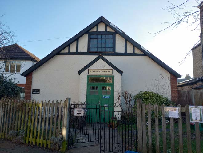
Figure 218: St Michael's Church Hall
Street Furniture
Street furniture is generally restricted to lampposts and timber telegraph poles, the former of which are utilised for further signage. These are unobtrusive in the street scene and sit well alongside the many street trees.
The original boundary wall to Elm Grove House has survived and forms a distinctive boundary to Elm Bank Gardens along the Long Walk and Thorne Passage.
Paving
Paving is generally standard artificial stone slabs with granite kerbs. It has become more fragmented where vehicle crossovers have been formed, some of which are well-formed with square pavers. Some tarmac infilling, especially around tree roots, has diluted the quality. There is a good section of stable pavers at the entrance to the garage court between nos.85 and 87.
Figure 219: Pavers between 85 & 87 Elm Bank Gardens
Part 3: Management Strategy
Summary
This Appraisal has assessed the quality and condition of the Barnes Green Conservation Area. Several site visits were undertaken between February and May 2023, where the area was observed and photographed.
The Appraisal has summarised the strengths and weaknesses of the Conservation Area, and this management plan sets out a strategy to consolidate and enhance these strengths and prevent further erosion of the area’s special architectural and historic character.
In specific areas, modern development has diluted the historic character of Barnes and reduced the cohesiveness of the historic streetscape. The busy roads are a dominant and harmful feature through the centre of Barnes, but away from these, the residential roads are quieter and more tranquil. The historic close relationship with the river has been eroded through the construction of the flood wall and the traffic along the river frontage.
However, the historic character along both the main roads, and especially in the residential areas continues to display a sense of historic identity and depth, as well as maintaining high quality architecture and many elements of interest. There is strong diversity in the quality of architecture, with some fine Listed 18th and 19th century buildings, alongside the swathes of later 19th century and early 20th century residential development. The Green remains the centre of Barnes, with its open, verdant space providing a welcome green area. The historic character of Barnes remains strong, with the development of the area clearly in evidence due to the variety and quantity of buildings of different ages and architectural styles.
The overall conclusion of the Appraisal is that all areas of the Conservation Area, aside from a few individual buildings, are worthy of inclusion. It is hoped that this clearer, more extensively illustrated Appraisal will assist the Development Management process in making more informed planning decisions in respect of the area’s character.
Furthermore, it is apparent that any further deterioration would endanger the character and appearance of the Conservation Area. An Article 4(2) Direction is in place comprising specific properties on Bellevue Road, The Crescent, Hillersdon Avenue, Laurel Road, Glebe Road, and Ranelagh Avenue, which are all Lion Houses.
Under Section 71 of the Planning (Listed Buildings and Conservation Areas) Act 1990, local planning authorities have a statutory duty to draw up and publish proposals for the preservation and enhancement of conservation areas in their area, from time to time. Regularly reviewed appraisals, or shorter condition surveys, identifying threats and opportunities can be developed into a management plan that is specific to the area’s needs.
Existing Article 4(2) Direction
Conservation Area designation does not in itself introduce any greater level of statutory control over minor works to properties, such as the demolition of original features, the replacement of windows and doors, the loss of garden fences, or other boundary treatment. Such works are normally ‘permitted development’ for homeowners and no application for planning permission is normally required, despite the impact these works can often have on the appearance of an individual property and consequently the impact on the overall character of the Conservation Area.
Local Planning Authorities, however, have power to control these changes by removing certain permitted development rights by making an Article 4 Direction. Once a direction has been made, planning permission is required for those classes of development listed. Such directions only affect unlisted dwelling houses in single occupation (i.e. not subdivided into flats, or with individual rooms let to tenants) and only those elevations that front a highway, waterway, private street, or other publicly accessible space (including side elevations of corner properties). Flats, shops, offices and other commercial buildings and houses in multiple occupation do not have the benefit of permitted development rights and so planning permission for changes is required.
There is one existing Article 4(2) direction within the Conservation Area. It was made on the 2nd February 1990.
Article 4(2) Restrictions Schedule
DEVELOPMENT WITHIN THE CURTILAGE OF A DWELLINGHOUSE
| Class A | The enlargement, improvement or other alteration of a dwellinghouse |
| Class B | The enlargement of a dwellinghouse consisting of an addition or alteration to its roof |
| Class C | Any other alteration to the roof of a dwellinghouse |
| Class D | The erection or construction of a porch outside any external door of a dwellinghouse where seen from a place to which the public has access |
| Class E | The provision within the curtilage of a dwellinghouse of any building or enclosure, swimming or other pool required for a purpose incidental to the enjoyment of the dwellinghouse, or the maintenance, improvement or other alteration of a such a building or enclosure where seen from a place to which the public has access |
| Class F | The provision within the curtilage of a dwellinghouse of a hard surface for any purpose incidental to the enjoyment of the dwellinghouse where seen from a place to which the public has access |
| Class H | The installation, alteration or replacement of a satellite antenna on a dwellinghouse or within the curtilage of a dwellinghouse |
MINOR OPERATIONS
| Class A | The erection, construction, maintenance, improvement or alteration of a gate, fence, wall or other means of enclosure where seen from a place to which the public has access |
| Class C | The painting of the exterior of any building or work |
Applies to the following addresses:
- Nos 13 - 23 (odd) Bellevue Road
- Nos 1 - 4 (consecutive), Nos 26, 27, + 28 The Crescent
- Nos 20 - 42 (even), Nos 31, 33 Hillersdon Avenue
- Nos 1 - 11 (consecutive), No 22 Laurel Road
- Nos 41 - 59 (odd), Nos 44 - 54 (even) Glebe Road
- Nos 19 - 28 (consecutive), Nos 29, 30, 31 Ranelagh Avenue
Problems and Pressures
- Loss of traditional architectural features and materials due to unsympathetic alterations.
- Loss of original windows and replacement with unsympathetic styles and materials.
- Good quality original shopfronts have been altered by the removal of historic features or additions of new poor-quality ones, addition of inappropriate features such as disproportionate signage, and loss of detailing such as plinths, stall risers, pilasters, and inset doorways.
- Large dormers and roof extensions have a negative impact on the roofscape and can detract from the cohesiveness of a terrace or group of buildings.
- Heavy traffic through the local centre, especially along High Street and Church Street.
- Traffic volume and its associated noise, danger, and pollution creates a relatively poor pedestrian environment.
- Parking pressure in residential areas. Pressure on kerb space for car parking results in forecourt parking areas replacing front gardens. This is detrimental to the character of the urban street as it removes the traditional setting of the house, its 'transitional' space and mature planting, as well as removing front walls and paths which contribute to the street's architectural character.
- Localised areas of poor-quality paving which detract from the overall quality of the public realm.
- Accumulation of street furniture and clutter in certain areas such as by bus stops or on wide street corners.
- Further installation of telecoms equipment to the roof of Seaforth Lodge.
- Ongoing issues with tall developments outside the Borough/across the River Thames, impacting in the setting of the Conservation Area and listed building and other heritage assets within it.
- Increased risk of flooding brought about by climate change. Flooding is one of the most significant risks to historic buildings from climate change.
Opportunities for Enhancement
- Preservation, enhancement, and reinstatement of architectural quality and unity.
- Encourage the replacement of unsympathetic windows with sympathetic windows in both material and form.
- Encourage the restoration of painted and rendered brick facades to their original appearance.
- Encourage the retention of common boundary treatment and the replacement/installation where appropriate of lost boundary treatments.
- Encourage improvements to the quality and design of shopfronts.
- Retention and maintenance of areas of historic setts and pavers.
- Retention of cast iron street nameplates.
- Retention and maintenance of historic items of street furniture to ensure their retention and contribution to the street scene.
- Rationalisation of existing street furniture and signage where opportunities arise, including the removal of redundant signposts. Introduction of high-quality street furniture when opportunities arise.
- Improvements to the materiality and quality of the paths across the Green.
- Localised improvements to the quality of paving to improve areas of poor-quality paving.
- Increase street tree planting and planters to soften the area’s character and better connect the High Street to Barnes Green.
- Public realm improvements to triangle at junction Station Road Church Road including removal of redundant signage and improvements to pedestrian crossings.
- Development opportunities exist along the High Street and to the rear. These should be sensitive to the local context and historic environment (including scale), to protect and enhance the character of the Conservation Area and the functionality of the High Street.
- Improve and protect the river and landscape setting through improvements to the river wall as a key feature of the river context.
- Enhance the connectivity between the river and the Green as an important historic and functional route, particularly through improvements to the public realm and materials. Opportunities to better manage the road space should be explored.
- Encourage continued engagement and development of projects to find a new use for the original part of Barnes Railway Bridge.
Design Guidance
This Appraisal is also a source of guidance for applicants seeking to make changes that require planning permission, helping to make successful planning applications.
The advice below sets out guidance which encourages good quality of design which will help to both preserve and enhance the character of the Conservation Area.
Dwellings within Conservation Areas which have been divided into flats do not benefit from Permitted Development Rights, requiring planning permission to carry out alterations and extensions.
It is worth noting that full planning permission for any alteration to a shopfront that would change the shop’s appearance must be applied for. This includes replacement shopfronts, installation or replacement of doors and windows, and installation or replacement of external security measures. The installation of a new shopfront, or the significant altering of an existing shopfront is also development which requires planning permission.
Separate detailed Design Guidance for the Lion Houses has previously been produced.
Shopfronts
The quality of shopfronts in the Conservation Area varies considerably. The majority have non-original shopfronts, some in a traditional style, some in a less sympathetic contemporary style with large expanses of plate glass. The most common features retained are corbels and tiled pilasters. There are some good surviving examples of historic shopfronts, mainly on Church Road, but a few survive on the High Street.
Traditional (and traditionally designed) shopfronts make an important contribution to the character and appearance of the historic environment. Any existing historic shopfronts, or components of historic shopfronts, should be maintained and repaired in the first instance. Where traditional forms have been replicated, or contemporary shopfronts inserted, these should continue to follow traditional designs if they need to be altered or replaced. Any new or replacement shopfronts will need to maintain or improve the appearance of the existing shopfront. Guidance on the design of new shopfronts can be found in the Shopfronts Supplementary Planning Document.
Signage should replicate traditional styles with painted or applied letters to the fascia and simple hanging signs. Modern signage, including corporate branding, internally illuminated projecting box signs, and box fascias are discouraged. Projecting/hanging bars should be sympathetically placed and attached to the fascia or building face. Where hanging signs are proposed, these should use a traditional bracket and be of a simple design.
Shopfront Security
Projecting shutter boxes have a negative impact on the appearance of shopfronts and are not acceptable in conservation areas, nor are solid or perforated shutters. Unless they are continuously back-lit, the perforation is only really apparent directly in front of the shopfront itself – from other angles and from further away they seem solid, and solid shutters create an unwelcoming, unattractive environment. By blocking the interior, they also prohibit passive surveillance and are more likely to be graffitied, which would cause further harm to the character and appearance of the Conservation Area.
Instead, there are other solutions which would be more suitable, and these are outlined in the Design Guidelines for Shopfront Security Supplementary Planning Guidance. For contemporary shopfronts, more passive security measures can be effective, such as laminated glass, which is not readily apparent and therefore mitigates detracting from the appearance of the shopfront. Lattice brick-bond grilles can be installed internally behind the windows, with the box inserted into the ceiling – this prevents an external projecting box and the internal box from being visible through the shop window. This would allow for an appropriate level of security, while minimising the visual impact of shutters on the external appearance of the shopfront, and therefore of the conservation area. It also allows for passive observation by keeping the inside of the shop visible.
Windows
The age and quality of windows varies significantly throughout the Conservation Area. Many of the 18th century Listed buildings on The Terrace have been subject to alteration over the years which has seen the loss of original windows and doors. Similarly, many of the shops on the High Street have lost their original windows and even had the original apertures widened to fit larger less sympathetic casement windows. The later Victorian and Edwardian commercial and residential developments, in comparison have retained a good proportion of original windows, or have sympathetic replacements, which have preserved the overall appearance. Due to this, the use of uPVC windows is particularly noticeable and harmful.
Windows make a significant contribution to the appearance of an individual building and can enhance or interrupt the unity of a terrace, so it is important that a single pattern of glazing bars should be retained within any uniform composition. Generally, windows follow standard patterns and styles. In Georgian and early- to mid-Victorian terraces, each half of the sash is usually wider than it is high and divided into six or more panes. Later Victorian, and Edwardian buildings often employ a simpler pattern, with the sashes either having one large pane, or a single central glazing bar.
It is encouraged that residents, in the first instance, retain and repair existing original timber windows. If replacement is required, all aspects of the window should be considered, including opening type, glazing bar patterns, horns to sashes, and depth. Windows should be timber sash and replicate the original glazing pattern. Timber frames are not only the most appropriate option but are more sustainable being a natural material which helps reduce the use of single-use plastics, often found in other windows. Timber windows also have the benefit of being more cost effective, being much more durable and repairable than alternatives, and there are options to maintain their appearance while introducing energy saving and noise reducing features.
Single glazing is the most common approach and would be the most acceptable replacement to maintain the existing character and appearance of the area. Secondary glazing is an unobtrusive option to increase efficiency, reduce noise, and avoid intervention to existing fabric, often performing as well, and lasting longer than double glazing. Double and triple glazing can be inserted into timber frames and help maintain a consistent appearance with similar benefits to secondary glazing and may be appropriate where there is justification for full replacement. Where double/triple glazing is accepted, black spacing bars and seals should be avoided – these should instead be white to blend with the frame. Trickle vents should be avoided or well concealed within the frame to maintain consistency with historic appearance.
Doors
Similarly to windows, the earlier 18th and 19th century buildings have largely lost their original doors due to restoration and/or alteration works. Good quality examples of original doors exist across the groups of residential buildings alongside sympathetic replacements. Again, unsympathetic replacements are particularly noticeable and harmful.
Doors, like windows, make a substantial contribution to the appearance of an individual building and can enhance or interrupt the unity of a terrace.
It is encouraged that in the first instance, any surviving original timber doors are retained and repaired. This is best for the environment, for the character and appearance of the area, and is often a more inexpensive solution than complete replacement. Simple modifications can often be carried out internally which improves the weatherproofing of the door without impacting its external appearance.
If a replacement door is required, it should match the original door for the host building’s typology in terms of design and material.
Boundary Treatment
Within residential groups, there is a high uniformity of boundary treatment. Brick walls are most common, sometimes with railings. Fences are not particularly common within the Conservation Area at all. Uniformity of boundary treatment can be achieved by replicating common or surviving original examples evident within the same terrace groups, which would enhance the uniformity of the terrace as well as the character of the area.
Painting and External Finishes
Painting and external finishes are recommended only when it forms part of the original design of the building. This should be regularly maintained and refreshed to prevent deterioration and water damage and to maintain the character of the building. Where non-original painting has been applied, it risks damaging the original brick beneath.
Energy Efficiency
Introducing energy efficient measures can reduce carbon emissions, fuel bills, and improve comfort levels. It is important that the appropriate course taken should be informed by the context of the building being improved, with each building having different opportunities and restrictions. Not all solutions will be appropriate across the Conservation Area, and the ‘Whole Building Approach’ advocated by Historic England encourages a case-by-case approach, which fundamentally considers the context, construction, and condition of a building to determine which solutions would be the most suitable and effective. A wide range of guidance and advice on many aspects of improving energy efficiency in historic buildings can be found on the Retrofit and Energy Efficiency in Historic Buildings pages of the Historic England website.
Solar Panels
Solar Panels and equivalent technology are most suitably placed on rear or side elevations where they are hidden from the public realm – principal elevations and roof slopes facing the public realm are less appropriate as they generally make the most substantial contribution to the character and appearance of the Conservation Area. New technologies, such as PV panels disguised as slates and sitting flush with roof materials, may be suitable in the appropriate context, and will be considered on a case-by-case basis. Historic England has produced guidance on the installation of solar panels in the historic environment.
Streetscene and Public Realm
The public realm is an important part of the historic environment as it makes a significant contribution to the setting of buildings. Public spaces which are cluttered with unrelated elements can detract from the appearance of the area. It is therefore important that high quality materials and workmanship are used to develop good streetscapes and public spaces, which can contribute positively to the historic environment.
The pavements within the Conservation Area are relatively free of clutter, which is a positive aspect considering that many are narrow, with buildings sitting hard up against the pavement. Where present, street furniture is spaced evenly and does not dominate the pavements.
Good streetscape and public realm can be achieved through the use of high-quality additions, which reflect the character of the area and contribute to the character and appearance of the Conservation Area. The positioning of street furniture should be rationalised to ensure they are in the best possible locations and of appropriate design. Lamp and signpost columns should be green or black in colour and appropriate for the scale and character of the Conservation Area. Surviving cast-iron street name plates should be identified and retained, and historic street furniture should be refurbished and retained. The use of traditional paving slabs and granite kerbs should be promoted to improve the quality of the pavement throughout the Conservation Area. Elsewhere a sealed gravel finish to existing bitmac surfaces would improve the appearance of pavements in the historic core. Any opportunities for street tree planting should be explored. Further guidance on the public realm can be found within the Council’s Public Space Design Guide.
Part 4: Appendix
References
National Library of Scotland Maps
Richmond Local Studies Library and Archive
Barnes and Mortlake Historical Society Archive of Pictures
'A History of the Count of Surrey: Volume 4' (British History Online)
'The Environs of London: Volume 1, County of Surrey' (British History Online)
History and Architecture - St Mary, Barnes (stmarybarnes.org)
History of Saint Michaels (stmichaelbarnes.org)
History - Elm Bank Mansions (elmbankmansions.org)
History - Olympic Studios (olympiccinema.com)
Public Houses, Inns & Taverns of Barnes, Surrey (pubshistory.com)
Up to: Conservation areas
Updated: 02 July 2026
