
High Street, Teddington
Conservation Area Appraisal
Conservation area no.37
Contents
- Introduction
- Statement of Significance
- Location and Setting
- Historical Development
- Architectural Quality and Built Form
- Architectural Details
- Key Strengths
- Open Space, Parks, Gardens and Trees
- Management Plan
- References
1. Introduction
1.1 Purpose of this document
The principal aims of conservation area appraisals are to:
- Describe the historic and architectural character and appearance of the area which will assist applicants in making successful planning applications and decision makers in assessing planning applications.
- Raise public interest and awareness of the special character of their area
- Identify the positive features which should be conserved, as well as negative features which indicate scope for future enhancements.
This document has been produced using the guidance set out by Historic England in the 2019 publication titled Understanding Place: Conservation Area Designation, Appraisal and Management, Historic England Advice Note 1 (Second Edition). This document will be a material consideration when assessing planning applications.
1.2 What is a conservation area?
The statutory definition of a conservation area is an ‘area of special architectural or historic interest, the character or appearance of which it is desirable to preserve or enhance’.
The power to designate conservation areas is given to local authorities through the Planning (Listed Buildings and Conservations Areas) Act, 1990 (Sections 69 to 78).
Once designated, proposals within a conservation area become subject to local conservation policies set out in our Local Plan, the London Plan, and national policies of the National Planning Policy Framework (NPPF).
Our overarching duty which is set out in the Act is to preserve and/or enhance the historic or architectural character or appearance of the conservation area.
1.3 Buildings of Townscape Merit
Buildings of Townscape Merit (BTMs) are buildings, groups of buildings or structures of historic or architectural interest, which are locally listed due to their considerable local importance. The policy, as outlined in our Local Plan, sets out a presumption against the demolition of BTMs unless structural evidence has been submitted by the applicant, and independently verified at the cost of the applicant. Locally specific guidance on design and character is set out in the Council’s Buildings of Townscape Merit Supplementary Planning Document (2015), which applicants are expected to follow for any alterations and extensions to existing BTMs, or for any replacement structures.
1.4 What is an Article 4 Direction?
An Article 4 Direction is made by the local planning authority. It restricts the scope of permitted development rights either in relation to a particular area or site, or a particular type of
development anywhere in the authority's area. We have powers under Article 4 of the Town and Country Planning (General Permitted Development) Order 2015 to remove permitted development rights.
Article 4 Directions are used to remove national permitted development rights only in certain limited situations where it is necessary to protect local amenity or the well being of an area. An Article 4 Direction does not prevent the development to which it applies, but instead requires that planning permission is first obtained from us for that development.
For further information about Article 4 Directions, to check if any permitted developments rights in relation to a particular area/site or type of development apply in your area, visit Article 4 Directions.
1.5 What is a Conservation Area Appraisal?
A conservation area appraisal aims to describe the special historic and architectural character of an area. A conservation area’s character is defined by a combination of elements such as architecture, uses, materials and detailing as well as the relationship between buildings and their settings including landscape.
Many other elements contribute to character and appearance such as the placement of buildings within their plots; views and vistas; the relationship between the street and the buildings and the presence of trees and green space.
The Conservation Area Appraisal is an evidence base rather than a planning policy document. This means that it is the main document for recording what is of principal importance in terms of character and appearance of each conservation area.
However, the relevant policies are contained within the borough’s Local Plan.
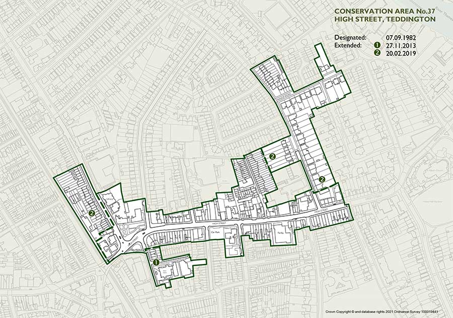
Designation and Adoption Dates
High Street Teddington Conservation Area was designated on the 7th September 1982.
It was subsequently extended on the 27th November 2013, and the 20th February 2019.
Following approval given by the Environment, Sustainability, Culture and Sports Committee on the 5th April 2022, a public consultation on the draft Appraisal was carried out between 20th June and 14th July 2022.
This Appraisal was adopted on the 30th March 2023.
View an interactive map of the conservation area
2. Statement of Significance
Summary of special architectural, historic interest of conservation area.
This conservation area forms part of the varied busy commercial centre of Teddington and includes several residential areas extending from the High Street.
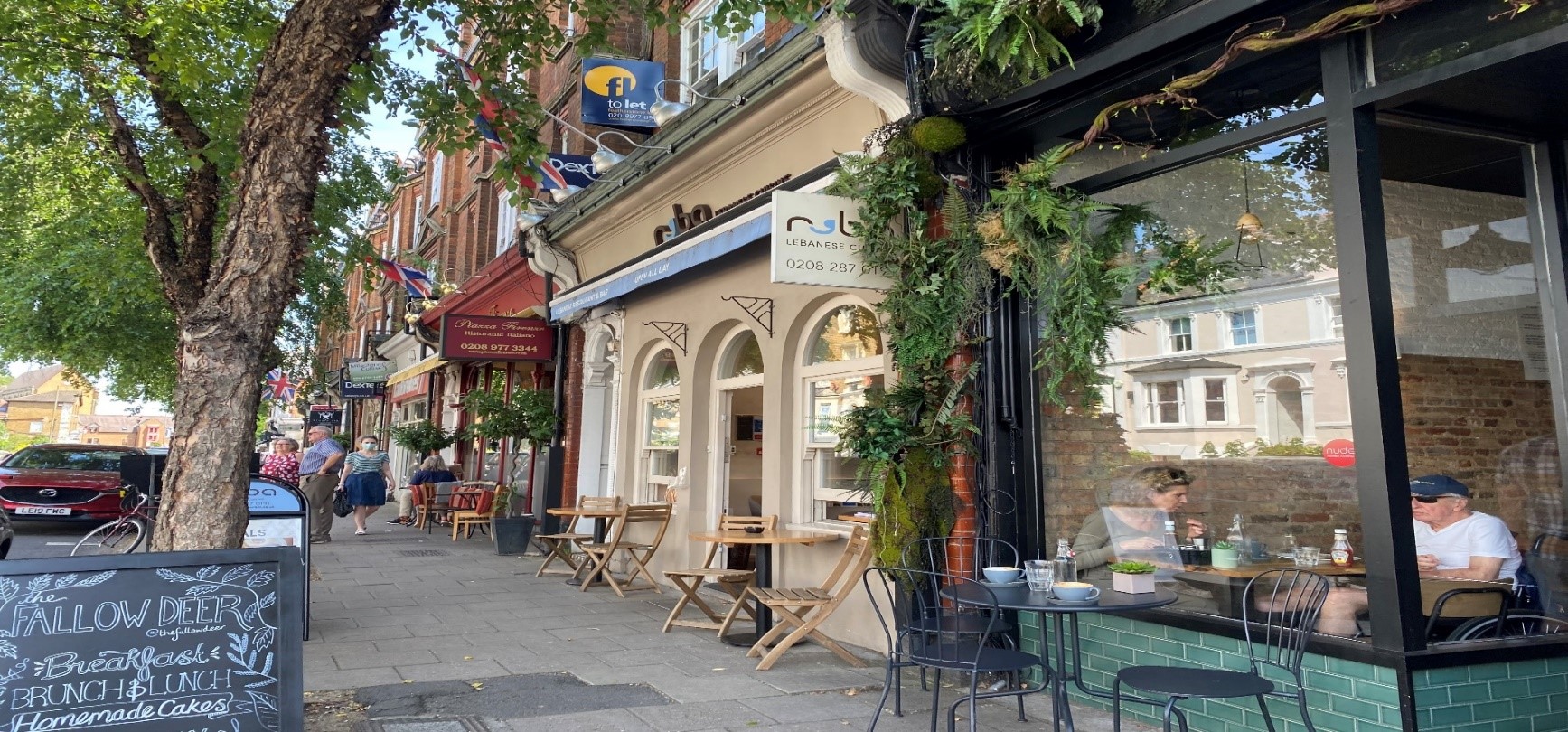
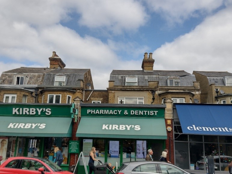
The traditional, predominantly Victorian and Edwardian High Street retains much of its original character, boasting an impressive number of fine, original shopfronts.
The quality of Teddington's shopfronts has been identified as a major factor in its special character.
The shops themselves vary from purpose-built shopping parades to single-storey shop units built on the frontage of older houses.
The variety of shops, the presence of many independent shops and the preservation of many original shopfronts all contribute to the authentic character of this High Street.
The broad range of building forms, facades and roofscape provides great visual interest and diversity to the street scene.
The quality of the domestic architecture is equally notable, with good quality Victorian and Edwardian housing as well as some surviving older examples mainly fronting the High Street.
3. Location and Setting
General character and plan form, e.g. linear, compact, dense or dispersed; important views, landmarks, open spaces, uniformity.
Teddington is located midway between Twickenham and Hampton, with Bushy Park to the south and Ham to the east.
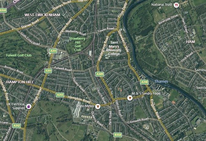
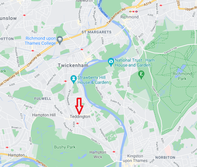
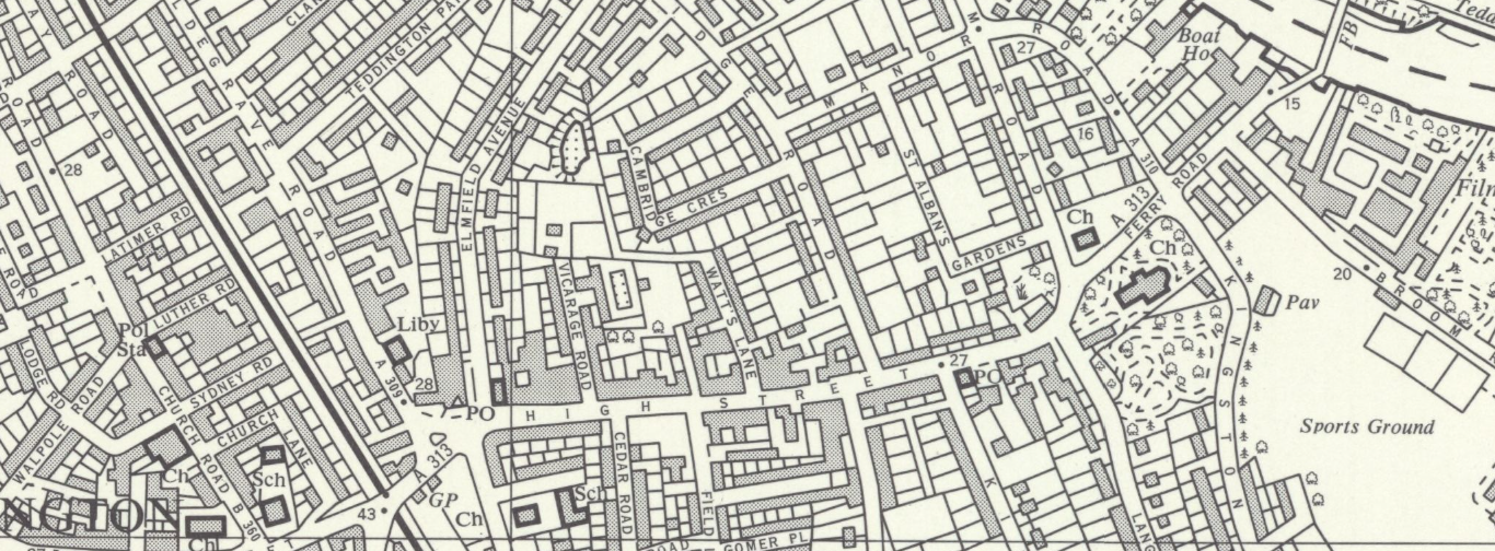
The High Street, Teddington conservation area lies in the centre of Teddington and incorporates the length of the high street between the railway line to the west and Kingston Lane to the east. The High Street runs in a linear fashion east to west and the conservation area includes the residential streets of Manor Road, Cambridge Road, Watts Lane and Waldegrave Road.
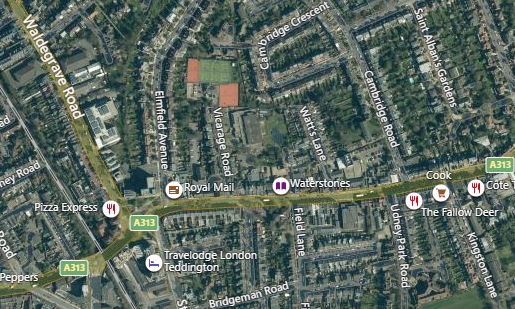
Watts Lane and Cambridge Road perpendicularly diverge from the High Street, running north.
Manor Road diverges from Cambridge Road at a right angle to the east and eventually becomes Twickenham Road.
Waldegrave Road, at the most westernmost point of the area, diverges from the A313 junction between Broad Street and the High Street and also runs north.
This conservation area adjoins Teddington Lock (27) Conservation Area to the east and Broad Street (84) conservation area to the west and The Grove Teddington (26) to the north.
Topographically, the area is quite flat, with no noticeable inclines. There is a gentle incline towards the railways bridge to the west.
The built form in this area is quite dense with most buildings on the high street adjoining one another or being built in long parades.
The residential streets also feature a high number of terraces – affording no views between buildings, aside from the breaks between the terraces.
The semi-detached houses of Cambridge and Manor Roads are quite wide and leave minimal space between the pairs, leading to an overall impression of continuous built form with limited views through to gardens behind.
Location OS Sheets: 1671
4. Historical Development
The evolution of the historical development of the area, including archaeology and plot morphology, that contribute to its special character.
Some prehistoric finds have been recorded within the settlement area of Teddington, albeit closer to the river rather than in the High Street area. There is little evidence of Roman activity, although it is possible there was a riverside route from Twickenham to Kingston of Roman origin.
While there is evidence for settlement in this area dating from the Anglo-Saxon period, with its associated name ‘Tudas Farm’, it was the Medieval period which witnessed the first significant development of Teddington, seeing it expand westwards from the riverside.
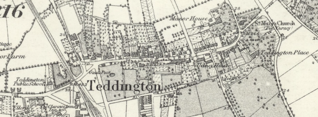
Teddington belonged to Westminster Abbey in the later 13th century, when the parish church of St Mary was first recorded. The earliest medieval settlement may have formed around this church, located at the corner of the Twickenham to Kingston road and at the eastern end of the High Street. The settlement became part of Henry Vlll's hunting estate in the 16th century. The land returned to use as an independent manor in the years following Henry’s reign and was long dependant on agriculture as its economic base.
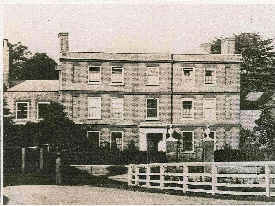
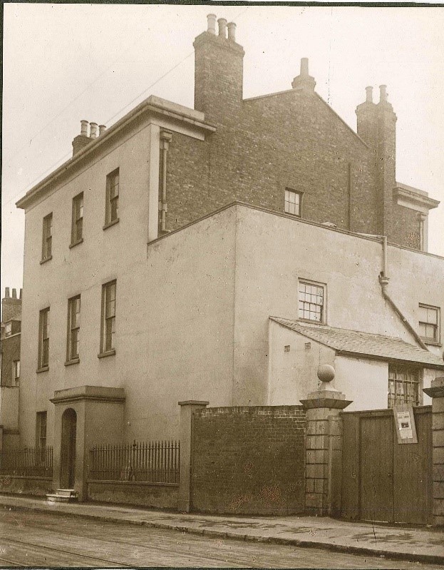
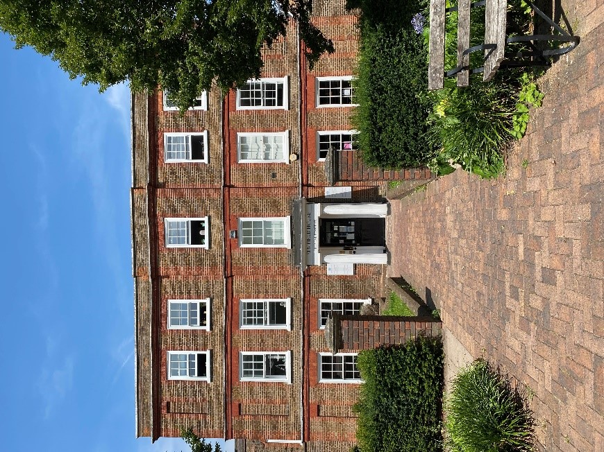
Teddington’s rural, riverside setting and proximity to the Royal Parks attracted wealthy residents and many large houses were built during the 17th and 18th centuries. All of these houses, such as The Grove, Teddington Place, Elmfield House and Udney House stood in their own grounds. Todau only Elmfield House survives.
The arrival of the railway in 1863, which cut through the village pond, resulted in Teddington becoming a viable commuter area for London.
This resulted in intensified redevelopment of the High Street, with many older buildings being remodelled or replaced.
Traces of the older village are evident in the survival of 18th century villas behind 19th century shop fronts along the north side of the High Street.
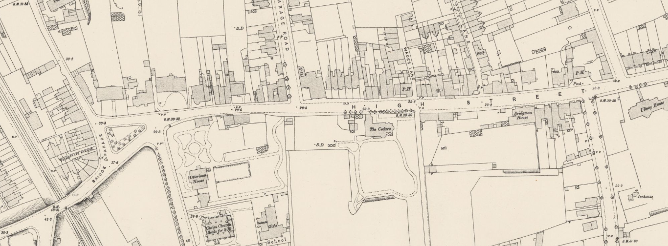
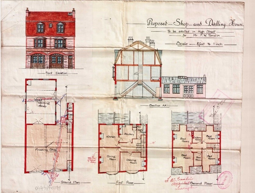
The south side of the High Street was still relatively undeveloped at the end of the 19th century, the land belonging for the most part to various private houses such as Otterham House, The Cedars, Bridgman House and Udney House, all of which had substantial gardens. In 1903 the High Street was widened to accommodate a tramway. The south side of the High Street was redeveloped as a series of shopping parades, thus changing the character of the high street significantly. The Cedars was the only house to survive this stage of redevelopment.
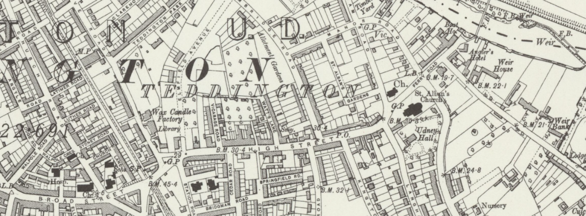
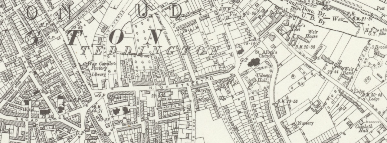
Waldegrave Road which lies at the westernmost point of this conservation area is linked to Teddington’s industrial history, specifically the wax factory belonging to Alexander Barclay, established in 1800.
This factory has since been demolished and more recently replaced with an office building in the mid 2000s.
This is an example of a regrettable loss of Teddington’s industrial architecture. The Victorian terrace of 55-69 Waldegrave Road which sits opposite the site of the old wax factory may have had some association with the factory. Along with the workers' cottages, they are all that remain of the industrial history of the western end of High Street Teddington.
In the early 20th century a similar level of redevelopment also occurred in the surrounding residential streets, with Manor House being demolished to make way for new Edwardian housing on Cambridge and Manor Roads.
The mid-20th century also saw the loss of The Cedars on the south side of the High Street. The site of the former house is now a car park.
There are examples of later 20th century infill and redevelopment in almost all areas of this conservation area, including the High Street.
As the main commercial centre serving everyday needs has now shifted to Broad Street the High Street has escaped significant modernisation.
The High Street has a notably high proportion of specialised shops such as boutiques and antique shops as well as independent cafés and restaurants.
5. Architectural Quality and Built Form
A description of the dominant architectural styles in the area, the types and periods of buildings, their status and essential characteristics, and their relationship to the topography, street pattern and skyline. Also important is their authenticity, distinctiveness and materiality.
The architecture in High Street, Teddington is predominantly of a high quality, and in a good state of preservation. This contributes greatly to its character.
There are a number of listed buildings in this conservation area.
5.1 Listed Buildings
A listed building is a building that has been placed on the Statutory List of Special Architectural or Historic Interest. Buildings on this list may not be demolished, extended or altered without Listed Building Consent.
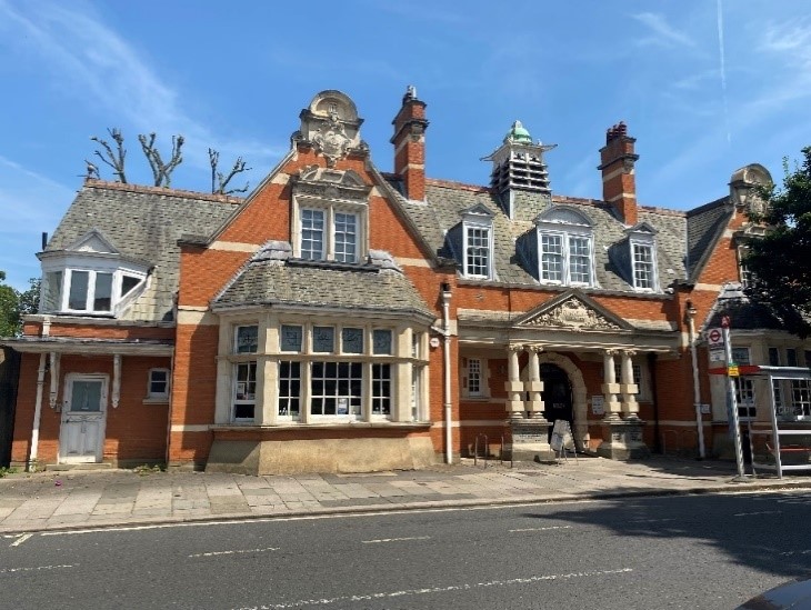
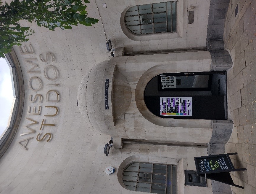
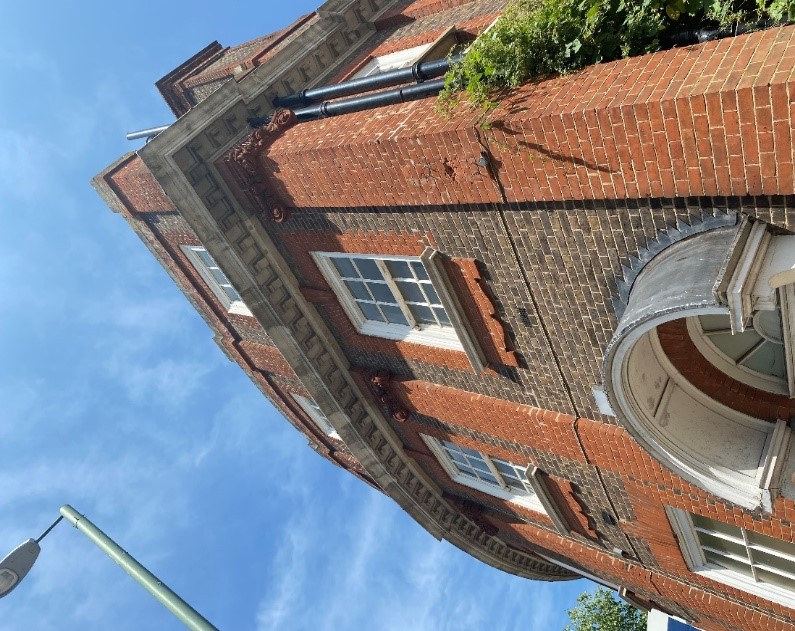
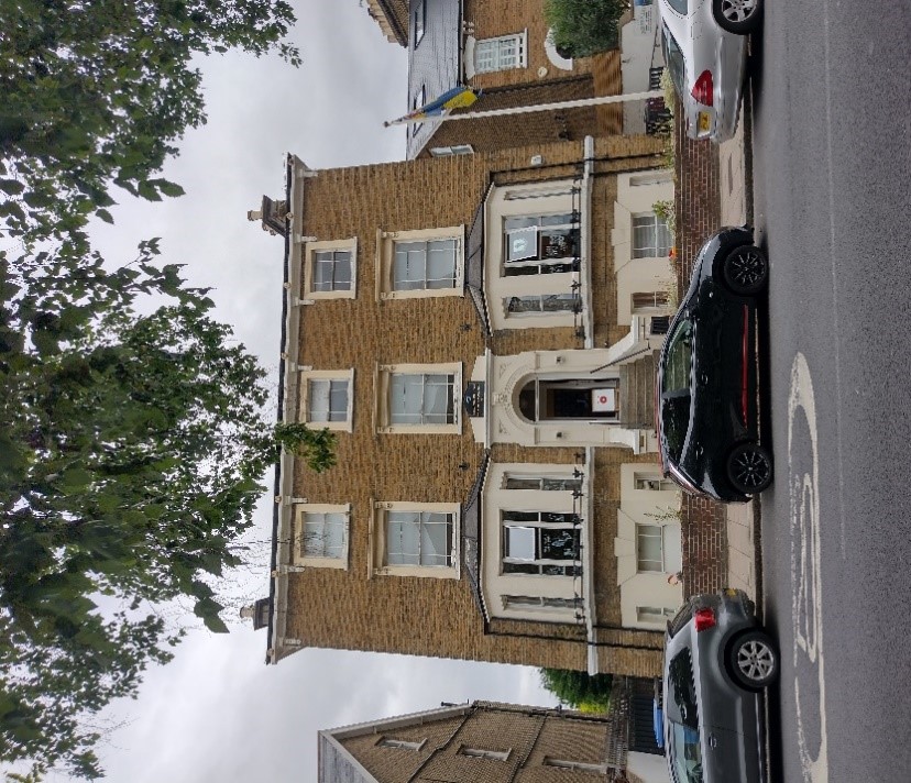
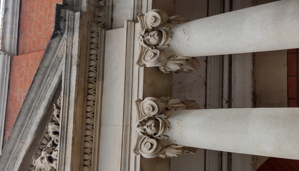
Teddington Library (Grade II)
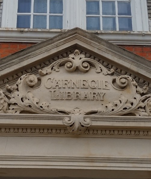
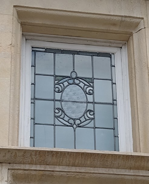
A listed public Carnegie library dating from 1906, this impressive, wide symmetrical building was designed in the Edwardian Baroque style and built with red brick and Portland stone dressings. Cherub heads sit atop the Portland stone columns. The windows are generally timber sashes but the top lights of the ground floor windows have decorative leadwork. The central pediment has the inscription 'Carnegie Library' displayed in a decorative stone cartouche.
Elmfield House (Grade II)
An elegant three storey 18th century house built of reddish-brown brick with red dressings. String cornices separate each floor, the final projecting cornice sitting below the parapet. The porch with Doric columns is possibly a later addition.
23 High Street (Grade II)
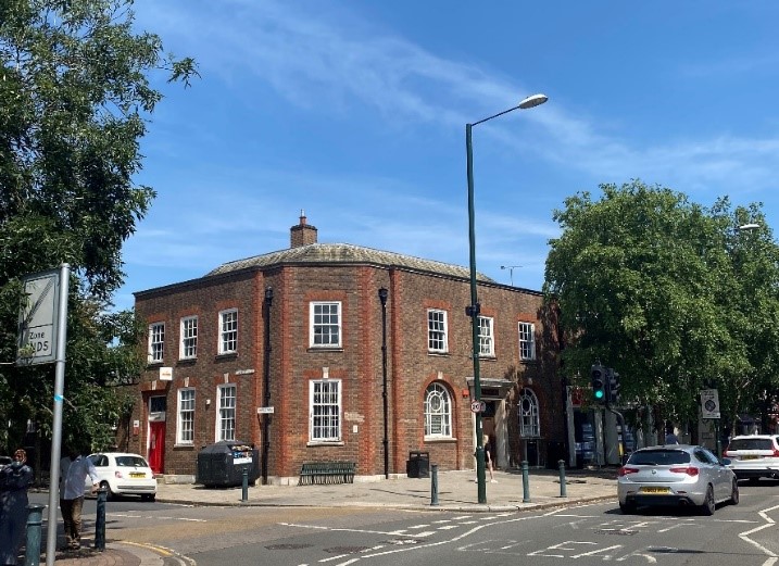
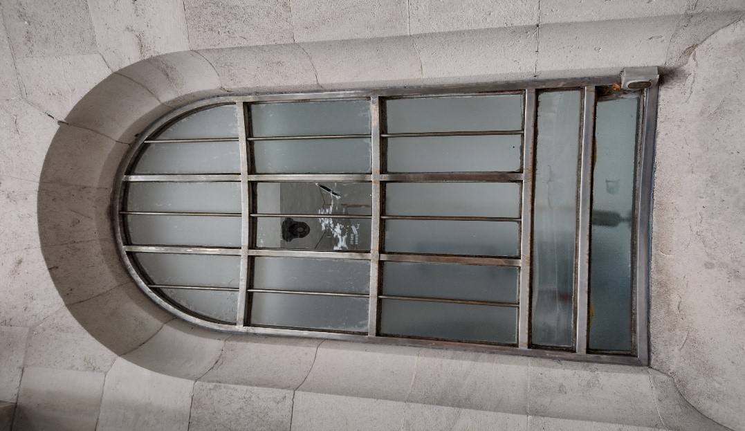
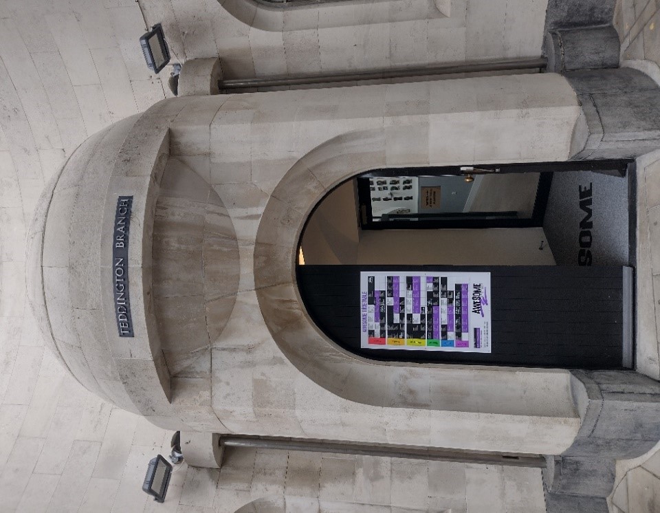
A highly unusual 1929, Portland stone building with striking concave design and domed porch, this building is a very valuable asset to the high street. The entrance doorway is arched, as are the steel windows on either side of the porch. This building was formerly Lloyds Bank and is referred to as such on the Historic England website.
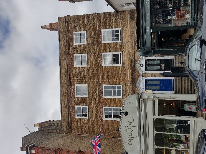
79 & 81 High Street (Grade II)
An 18th century brick building with parapet roof, comprising of two houses with two later projecting single storey shops.
83 & 85 High Street (Grade II)
An 18th century vernacular building which provides an important link to the High Street's more rural past. The building has timber sash windows of various designs and a clay tiled roof. This has had a canopy added at some time in its history which extends across the width of the pavement.
93 & 95 High Street (Grade II)
Number 93 is a two-storey 16th century timber framed building, remodelled in the 17th and 18th centuries.
Number 95 is a late 19th century single storey side addition with shopfront.
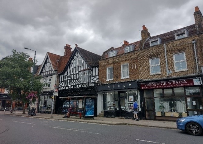
5.2 High Street - overview
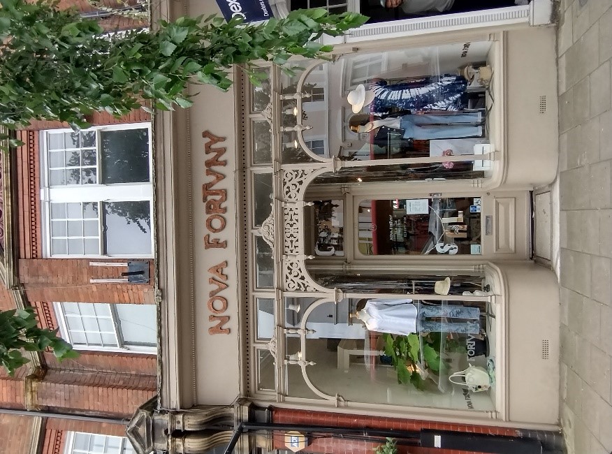
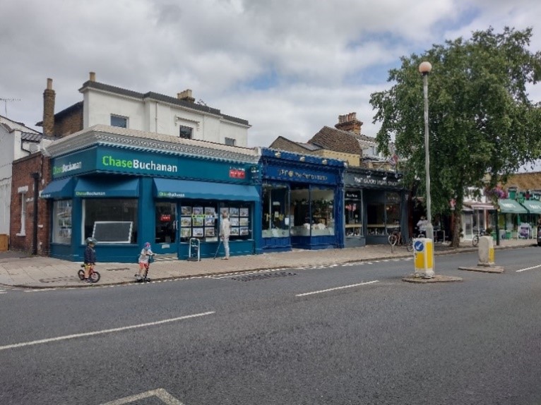
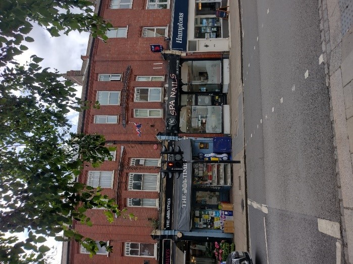
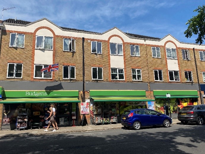
The High Street is of mixed character, with an extensive number of original high quality shop fronts but also several less successful, modern buildings.
It varies from west to east, becoming more residential in character towards the eastern end where it adjoins Teddington Lock Conservation Area.
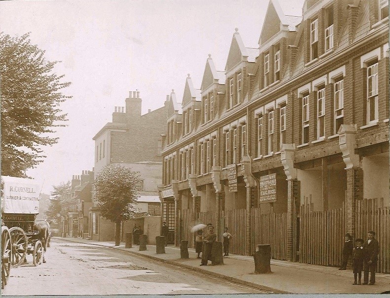
The High Street generally comprises of red brick Edwardian shopping parades to the south with well-preserved original shop fronts of varying designs.
Their upper floors retain a very high proportion of original timber windows. The brickwork and brick detailing are also in good condition.
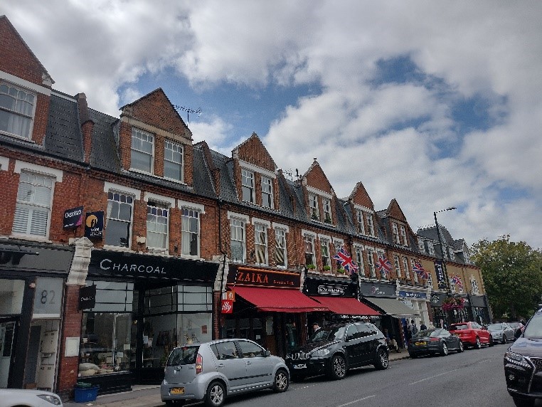
The plot sizes of the properties within the parades are narrow, regular and three or four storeys in height; these parades create a much more unified and imposing streetscape than the varied architectural landscape of the north side of the high street.
There is also little variation in their material palette, with red brick being the dominant building material.
The older, north side of the high street is home to a more diverse range of buildings, generally sitting on individual plots of varying sizes. The buildings range in date from the 17th through to the early 21st century.
This side of the High Street also provides a visual, tangible link to the earlier development of Teddington – defining the way in which buildings were remodelled, added to, and replaced over time.
The existence of a timber framed 17th century building alongside much more modern shopfronts shows the slow, natural development of this street in direct contrast to the purpose-built shopping parades opposite.
This north side of the High Street has a variety of red brick, mixed stock brick, mixed stock brick with red dressings, rendered and stone facades.
5.3 High Street – western section
The westernmost area of the conservation area, around Jubilee and Elmfield House Gardens sees the land rising towards the railway bridge. Due to this incline, the railway bridge is a focal point though it is in the adjoining Broad Street conservation area.
This intersection between Broad Street and the High Street is quite a wide, open space with roundabouts and junctions.
The tallest buildings in the conservation area can be found here; large later 20th century apartment or office developments with some additional 21st century redevelopments.
Though Park House borders the conservation area, its 5-storey height has a negative effect on the area.
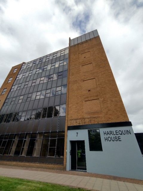
Harlequin House is a good example of 1980s architecture with its central glazed sections and robust brick extremities. It is an impressive, imposing structure. However, at 6 storeys, it is out of scale with the surrounding more traditional scale buildings and with the wider conservation area. This is particularly marked due to its proximity to the listed Elmfield House.
Marvan Court, on the junction of the A313 and Waldegrave Road is not of any particular architectural merit and does not make a positive contribution to the character of the conservation area. This is unfortunate considering its prominent position. As a result, any future redevelopment of this site must be very carefully considered. It is included in a proposed mid-rise development zone in the Urban Design Study.
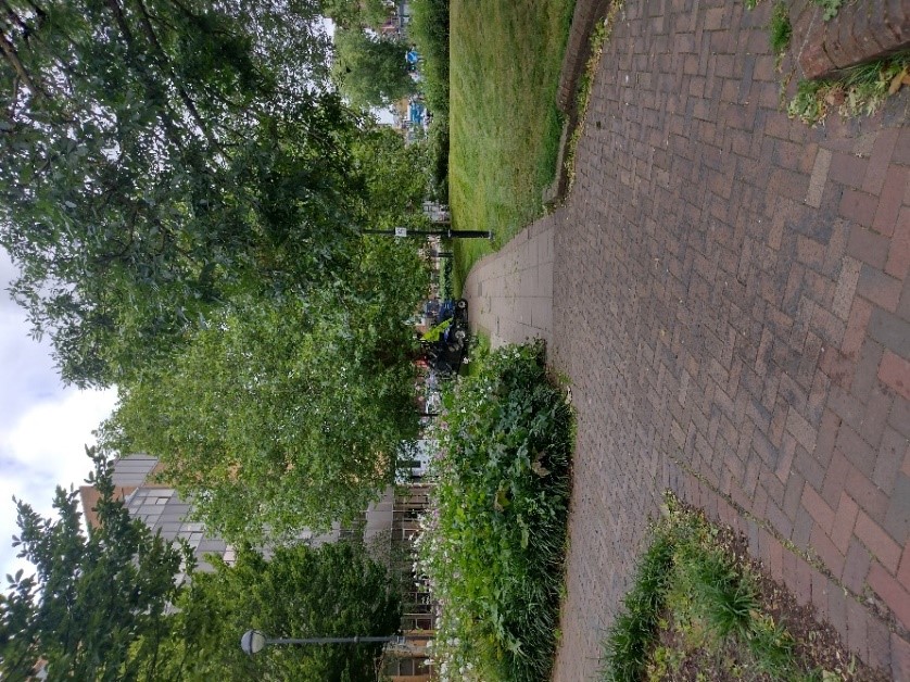
Despite the bustling character of this part of the conservation area, it benefits from the contrasting green space of Elmfield House Gardens. This space incorporates what was once the front garden and entrance gates to Elmfield House and is now public realm. Jubilee Gardens opposite further helps to soften this built-up part of the conservation area.
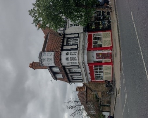
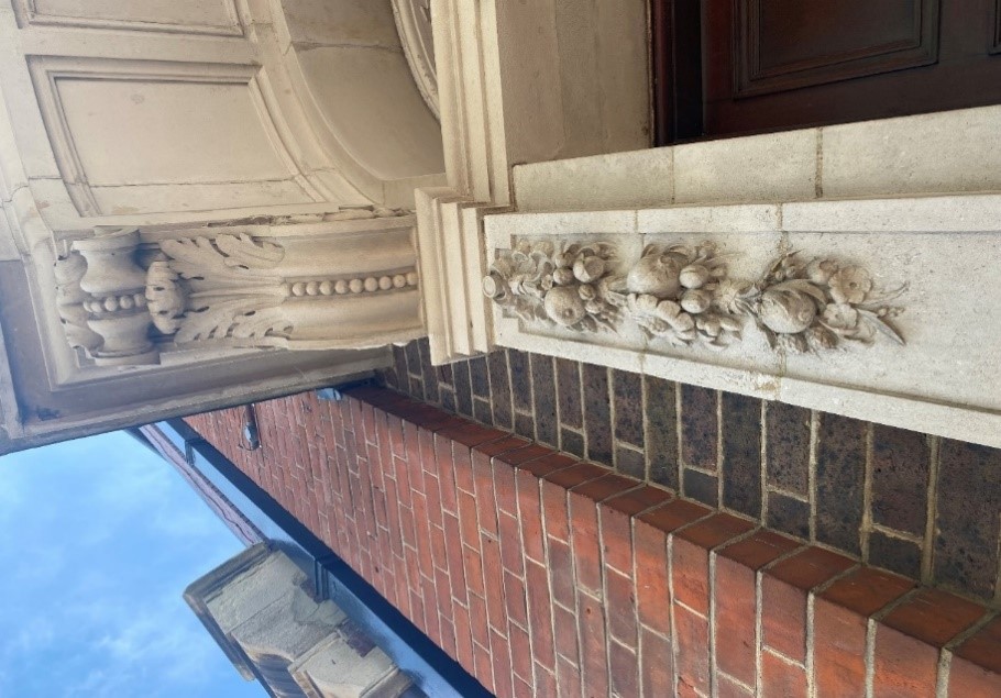
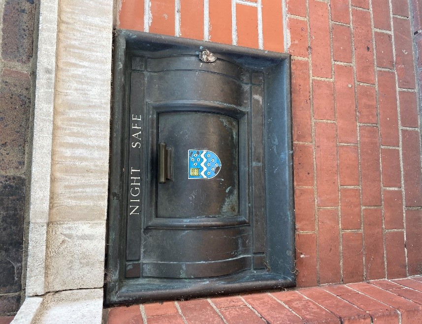
The early 20th century former bank building (6 High Street) on the corner of Station Road and the High Street occupies a prominent round corner site. This curved building is of high-quality design. It features rounded timber and stone canopies, fine classical stone door surrounds with grape and vine motifs, red brick pilasters and flat arches over the window openings. It also retains its night safe which may be original.
19 High Street (Royal Mail) is a pleasant early 20th century splayed corner building on the corner of Elmfield Avenue. It is built of stock brick with red dressings and has traditional sash windows with two arched windows either side of the main door. These arches are echoed in the arched openings of former Lloyds Bank building just two doors away. This building is currently site allocation 6 in the Local Plan (pdf, 5.7 MB). Both on prominent corner plots, 6 and 19 High Street form a distinctive pair of early 20th century neo classical buildings.
5.4 High Street – central section
The westernmost shopping parade, numbers 8-36 (even) is three storeys high and built of red brick. It features first floor canted oriel bay windows with decorative metal railings.
The eaves and window heads feature egg and dart detailing. They have shallow pitched roofs but these are not visible from street level.
Adjoining this parade is a building of similar proportions. It is rendered and painted and features more simple detailing. It features an oriel bay window at first floor level and has painted timber casement windows.
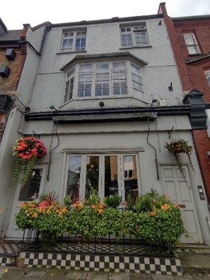
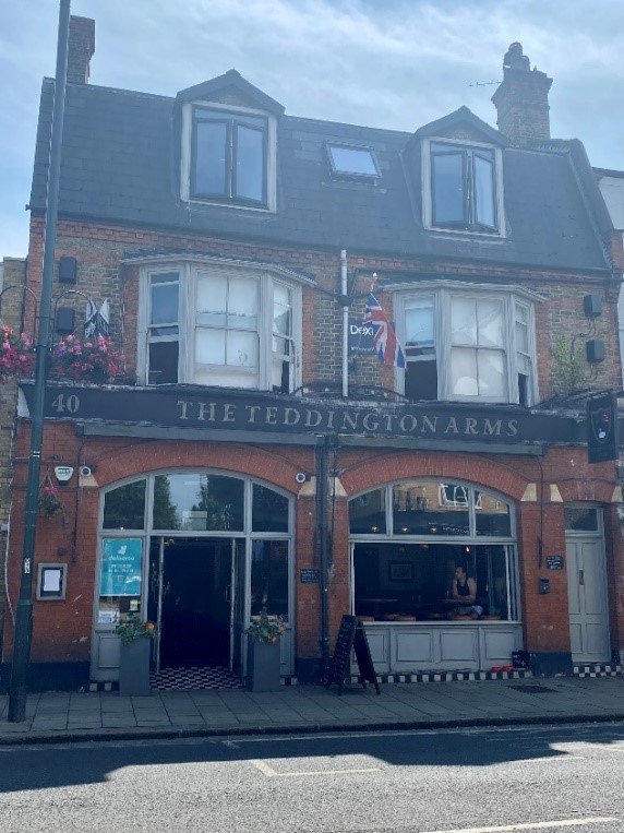
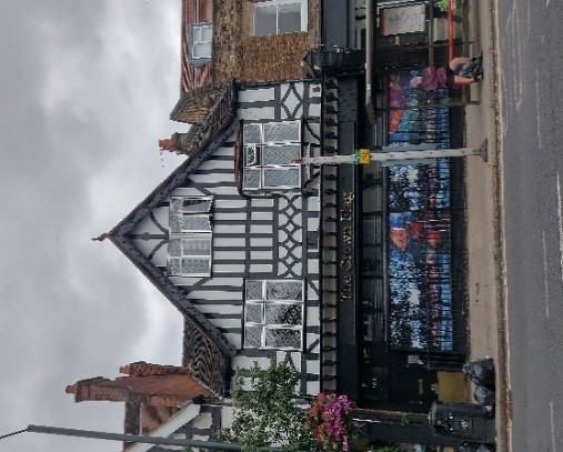
Next door is the characterful Teddington Arms, a mixed stock and red brick building with wide brick arches over the openings at ground floor level, two first floor canted bay windows and a mansard roof with two modern dormers.
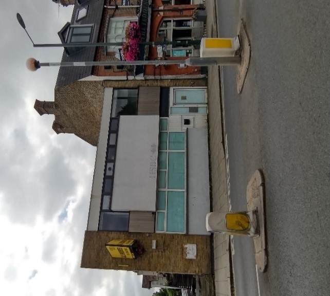
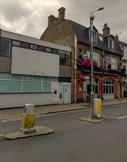
East of this is the dilapidated former HSBC building, a two storey mid-20th century flat roofed structure which does not contribute to the conservation area. Due to its prominent corner plot, any redevelopment of this site should be carefully considered.
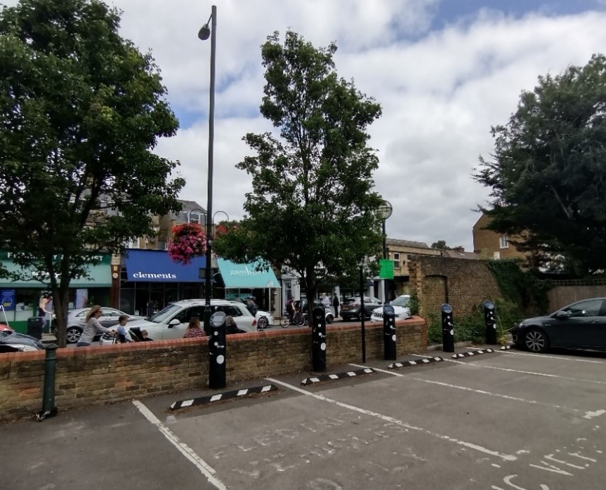
The Cedar Road car park features a good number of mature trees, a well detailed stock brick wall with red dressings and several electric car charging points.
It seems to be well maintained but the presence of public bins and bottle banks is unsightly, however these are a public resource.
The car park seems to be well used and as such contributes to the vitality of the high street.
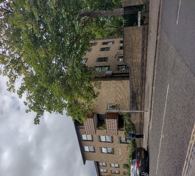
Hales Court, which sits on the corner of the high street and Field Lane, is a late 20th century block of flats and has a neutral effect on the character of the conservation area. It is not of any particular architectural merit but it is well screened by planting and is not clearly visible from the high street.
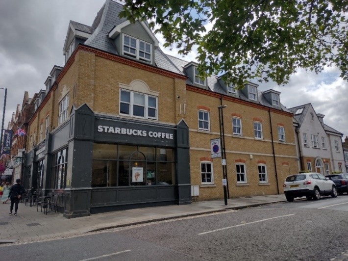
68-70 High Street, presently occupied by a Starbucks on the ground floor, is an early 21st century development, opposite Hale Court. It is respectful of its setting in terms of its scale. It is built of stock brick with red dressings, and features well detailed cogged eaves.
The sash windows with their red brick arches and the shop frontages are of a relatively traditional design.
This modern development directly adjoins the central Edwardian parade of shops at 72 – 86 High Street, which are three storey, built of red brick, and with mansard roofs and gabled dormers.
Their decorative painted timber sash windows are in a good condition and feature painted masonry lintels and cogged eaves.
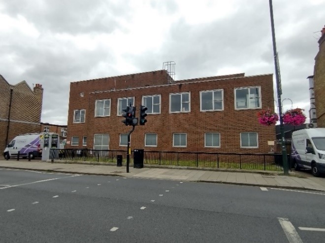
Sitting on a significant site at 88-98 High Street is the old telephone exchange, presently used by Openreach.
The mid-20th century two and three storey flat roofed brick building is quite plain, and its design is unsuited to its setting. As such it does not contribute much to the character of the conservation area. The site is an allocated site in the Council’s adopted Local Plan.
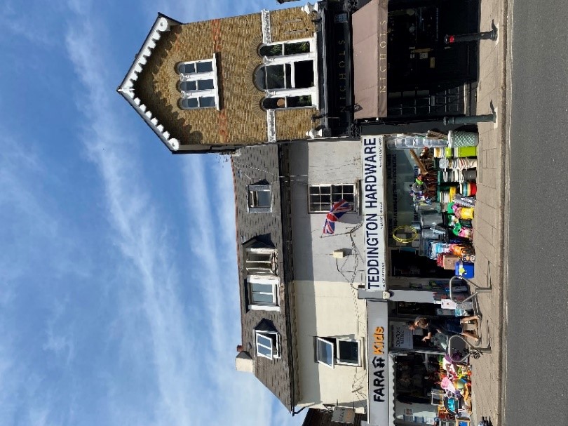
100-104 High Street are a set of three rather plain Victorian stock brick properties with shops at ground floor level. They terminate in a simple brick parapet with a mansard roof and dormers set back behind. They predate the more stylistically elaborate Edwardian red brick parades and adjoin a series of three mock Tudor buildings (106-112) with timber framing detailing, prominent gables, leaded light casement windows, clay tiles, pitched roofs and a turret at the end of number 112.
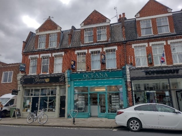
The easternmost shopping parade of 114-162 High Street is an impressive, long, red brick parade of four storeys including an original attic storey with decorative pedimented dormers.
The terracotta design within the pediment is repeated over the first-floor windows. The original timber sash windows are in good condition and retain their brick dentil detail above their openings.
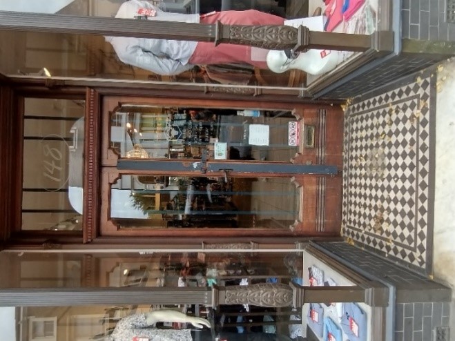
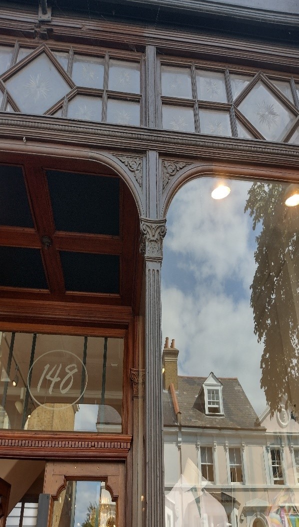
This parade features very good quality shopfronts, particularly those at numbers 148 and 150.
The doorways to the flats above are in good original condition.

The Teddington Royal British Legion Club (135 High Street) is a detached four storey building which was formerly a residential property. It stands quite proudly at the easternmost end of the conservation area.
It is built of stock brick with bracketed eaves and has double height canted bays on basement and ground floor levels.
The good quality of design and materiality make it a positive contribution to the conservation area. However, it is regrettable that the original windows of the ground floor bays have been replaced.
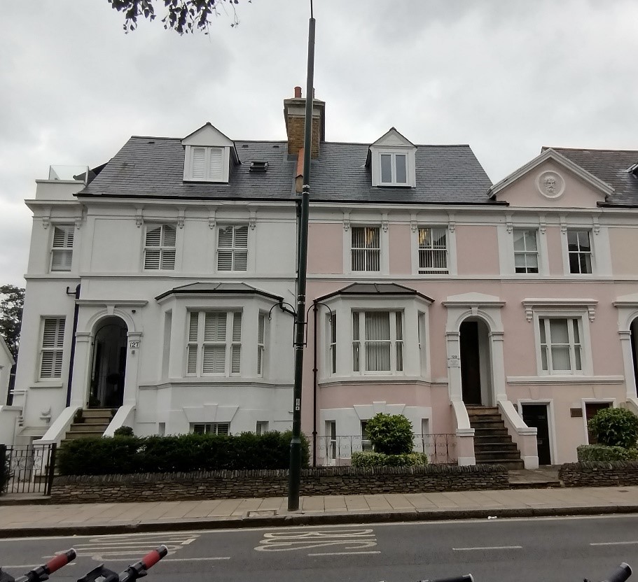
127-133 High Street is a row of Victorian houses which currently displays a muted pastel colour palette of whites, pinks and yellows.
The three-storey group has an interesting roofscape in that the pitched roofs are interrupted by the central pediment, behind which lies a flat roof. This pediment features a classical roundel very similar to that at 3 Cambridge Road situated just around the corner.
These houses feature double height bays at ground and half basement level with a simpler, restrained fenestration pattern at first floor level. The recessed integral porches benefit from nicely detailed door surrounds.
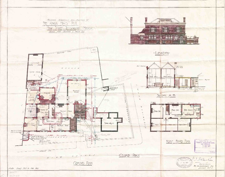
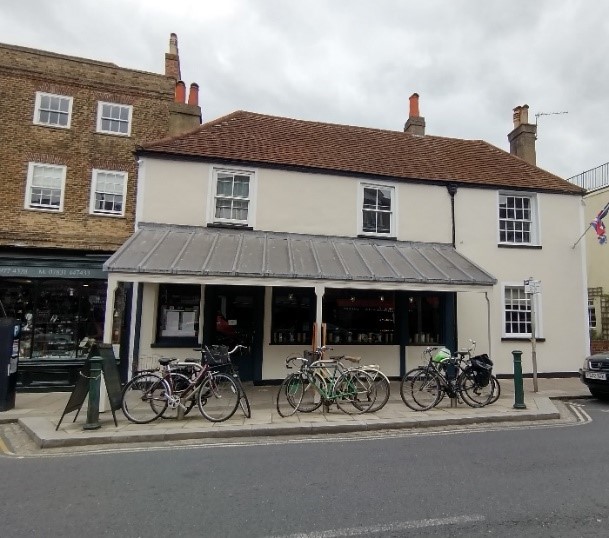
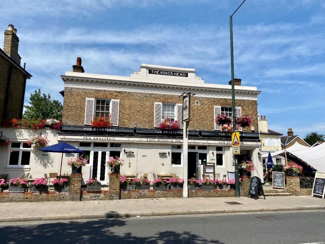
The Kings Head – this mid-19th century two storey stock brick and rendered public house sits comfortably within its plot with a car park to its right. The car park could benefit from more tree planting and perhaps a more substantial traditional boundary wall.
The pub is rendered at ground floor level, with stock brick at first floor level and has a rendered dentil cornice beneath the parapet.
The timber sash windows at first floor have unoriginal external plantation-style shutters, which do not make a positive contribution to the character of the building.
121 High Street is a tall and narrow three storey gabled stock brick building which adjoins and contrasts with a lower two storey building, currently with a pair of shops on the ground floor.
It is highly decorative with arcaded windows and decorative mullions, a decorative fascia and brick arches over the rounded window openings.
It has a good quality shop front with decorative corbels on each side of the fascia board.
The two-storey slate roofed building next door (117-119) is plain rendered with minimal fenestration on the front façade and poor-quality shop fronts.
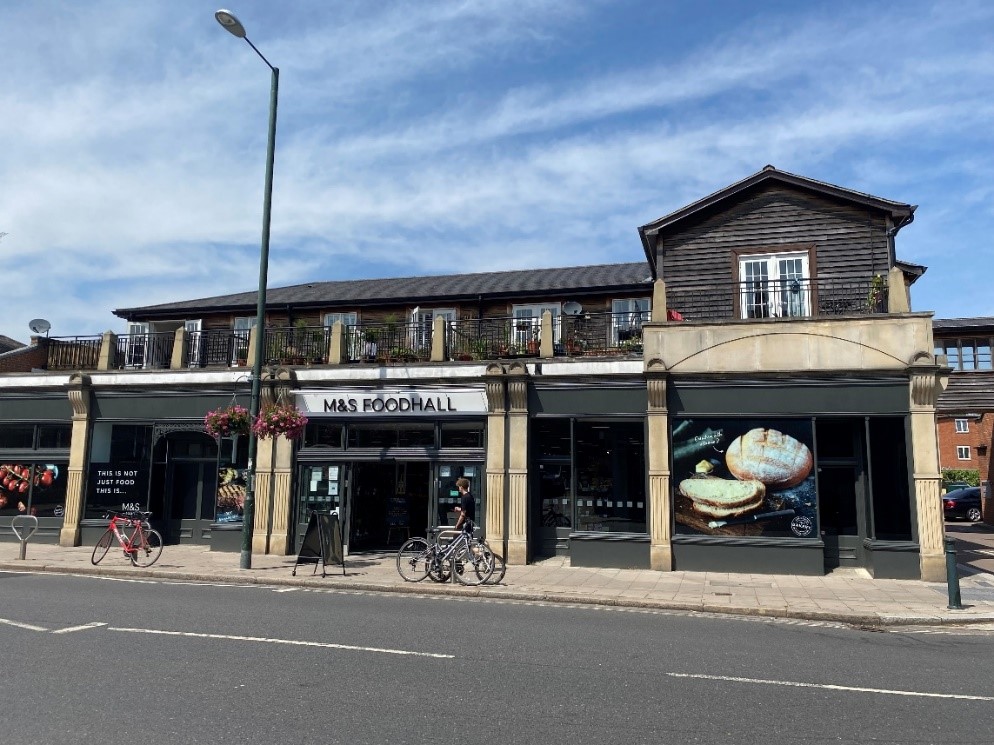
99-115 High Street, currently a Marks and Spencer food hall built within the last 20 years has a long, classically detailed stone shopfront with grey timber fenestration. It also has a weatherboarded first floor set back from the shop front below. These two elements are somewhat incongruous but creates visual interest.
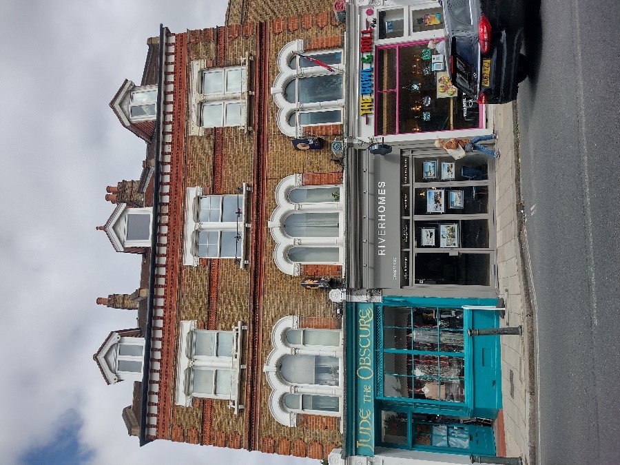
73-77 High Street is a detached three storey stock brick building with red dressings.
It is quite elaborately decorated with red brick quoins, decorative red brick banding, arcaded tripartite windows at first floor level and painted masonry lintels.
It has reddish brown clay roof tiles which is unusual for the High Street.
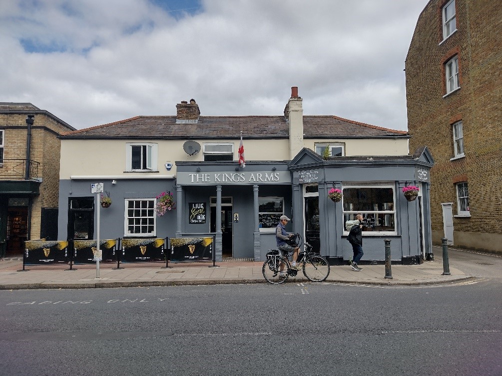
69-71 High Street, currently the Kings Arms public house, is a low two-storey building with a slate tiled pitched roof.
It has been extended forward on the right-hand side.
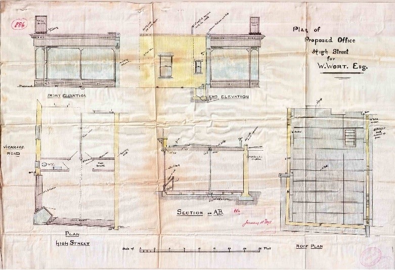
43-59 High Street are a series of single storey shops built in front of earlier houses.
These shop extensions seem to have been built between the mid 1890’s and 1911.
They are an excellent example of the redevelopment of the High Street, repurposing land without the demolition of older buildings.
The houses behind have suffered unsympathetic alterations particularly to their fenestration.
29-39 High Street (Troon Court) is a late 20th century development of no particular architectural merit. It has a neutral effect on the character of the conservation area.
It is faced in stock brick with red dressings but is very flat, with plain windows which are flush with the brickwork.
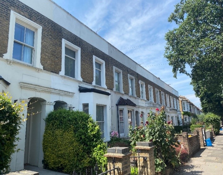
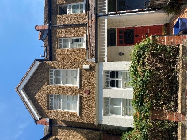
5.5 Cambridge Road
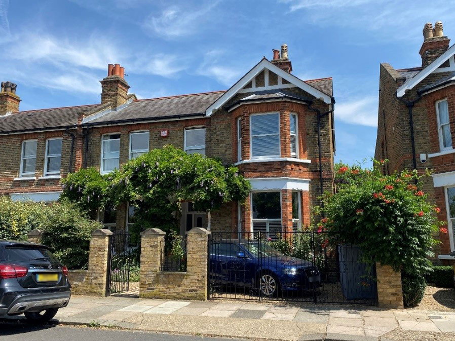
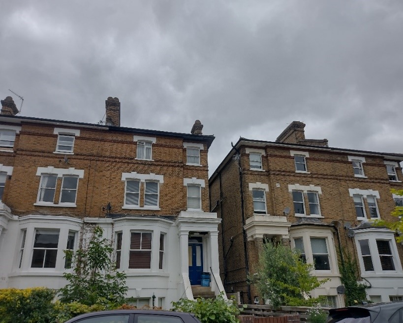
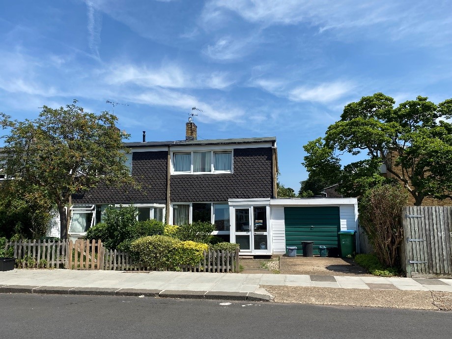
Cambridge Road and Manor Road became part of the conservation area in 2019. Lying to the north of the High Street, this pair of quiet residential streets share an Edwardian house style, one blending seamlessly into the other. Predominantly comprising Edwardian semi-detached housing, these streets have a pleasant, leafy character despite the lack of street trees.
The Edwardian houses of Cambridge and Manor Road comprise two storeys with an attic which is often converted. They are all designated as Buildings of Townscape Merit.
They are built of mixed stock brick with red brick dressings.
They feature a gabled frontage with a double height canted bay, timber sash windows, timber door canopies, white painted masonry lintels, and terracotta finials on the front gables.
Many front doors seem to be original and in excellent condition with the stained glass intact.
These houses sit on generous plots, but the width of the houses means that there is a limited gap between the semi-detached pairs through to gardens beyond.
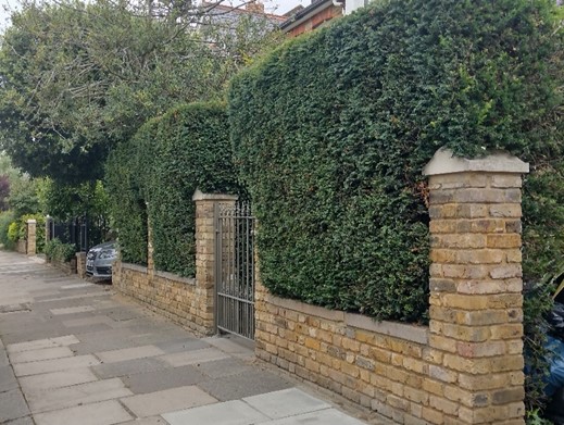
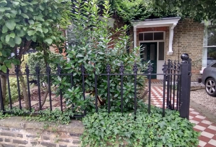
Well-proportioned front gardens sit behind low brick boundary walls often with metal railings incorporated. A high proportion of trees, shrubs and hedges positively contributes to the character of the street, offsetting the lack of street trees.
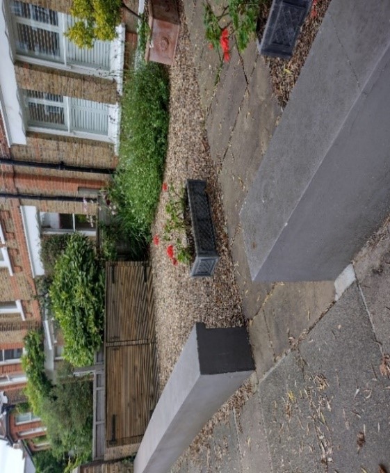
In some instances, boundary walls have been removed to facilitate car parking. This loss of the front boundary separating the road from the building compromises the setting of the building and in turn its character. The loss of planting also has a detrimental effect on the character of the building and overall street scene. Loss of greenery is also damaging from an environmental point of view.
Guidance on the use of front gardens for car parking can be found in the Transport SPD. We will normally resist replacement of gardens with hard standings for car parking, where planning consent is required. However, in the limited cases where it would be acceptable (for example, where the removal of kerbside parking would enable the widening of a pavement, the provision of a cycle lane or relieve traffic congestion) it is very important that off street parking, should be designed to cause minimum intrusion and harm.
Opposite, on the western side of the road lies a group of Victorian villa style houses of numbers 17-27 which are also Buildings of Townscape Merit.
They are built of stock brick with painted rendered canted bays.
Their porches with stone steps and plain brick columns are quite substantial in appearance with deep cornices. The windows sit quite plainly within the brick with no window surrounds, just white panted masonry lintels.
They comprise 4 storeys including a basement level and have enough space between the pairs to lend a sense of airiness and views through to the gardens at the rear.
They have deep front gardens with low brick boundary walls, some of which have been rendered. Some have been lost to facilitate car parking.
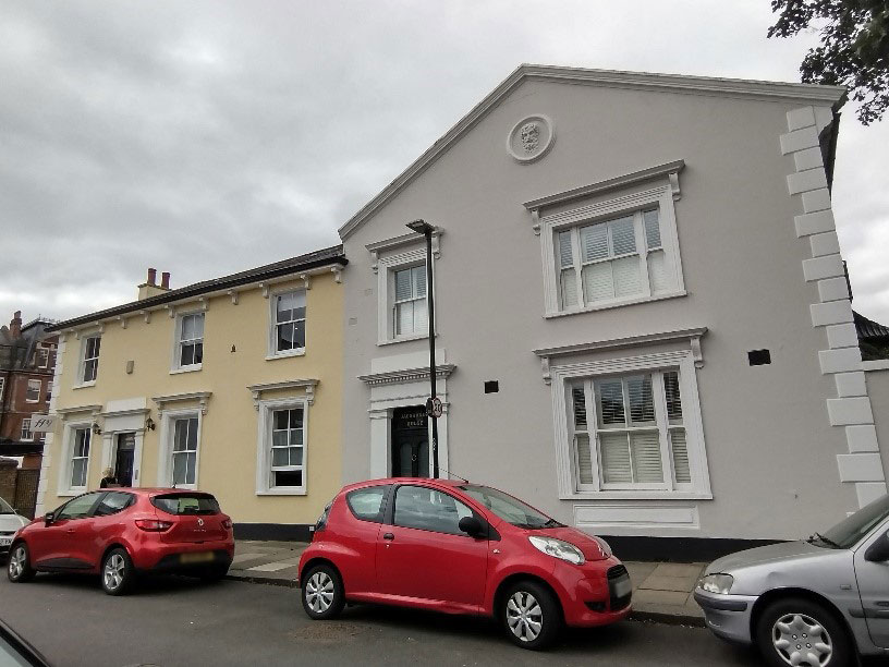
The Victorian houses at 1-3 Cambridge Road are masonry built, presently painted in pastel colours, with white classical door and window surrounds. They front directly onto the pavement.
Number 1 has bracketed eaves while number 3 has a gabled frontage with a classical roundel sitting centrally in the gable. Both houses have their original timber sash windows with central vertical glazing bars.
On the northern junction between Cambridge and Manor Road sits a series of late 1950s houses (36-54 (even) Cambridge Road and 50-56 (Even) Manor Road, designed by renowned British architect Eric Lyons who went on to establish Span Housing Developments Ltd.
These houses provide a contrast to the predominant Victorian and Edwardian styles. They feature plain casement windows, shallow pitched roofs and glazed porches. The varied palette of materials adds further interest to the character of the area.
Modest front gardens sit behind low picket fences. Generally, the front gardens remain but some have been lost to car parking.
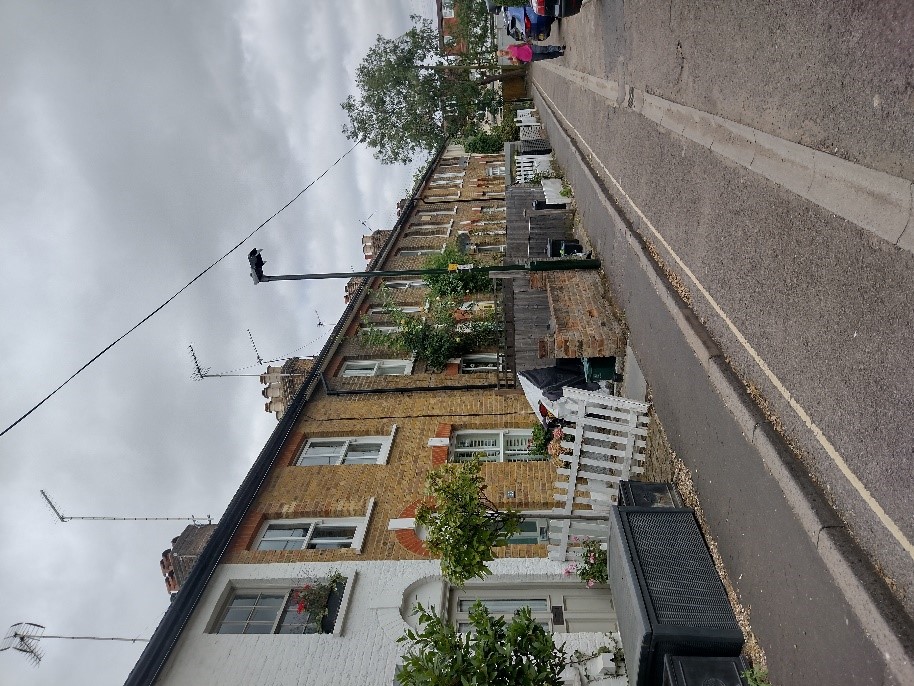
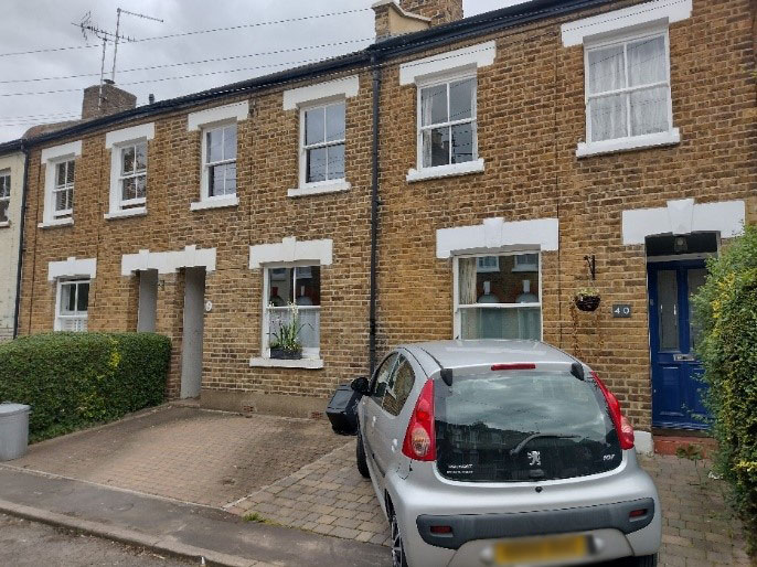
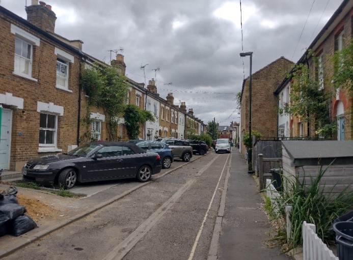
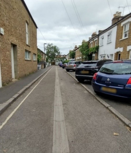
5.6 Watts Lane
At a right angle to the High Street, Watts Lane forms an intimate, compact group of two storey 19th century stock brick terraced cottages. Some cottages have been painted. They are built on narrow plots and set slightly back from the pavement behind small front gardens with picket and closed boarded fencing.
At present, the lane is industrial in character at its intersection with the High Street, with a large garage site occupying the site of the old smithy. The cottages were possibly built in connection with the adjacent works buildings.
Watts Lane is indicated on the Ordnance Survey map of 1863 as an established route from the High Street to the then agricultural land beyond.
This quaint lane provides glimpses through to a traditional residential street from the High Street and adds further interest to the street scene.
Most front gardens on this narrow lane have been lost to car parking, adding to its cramped character. Forecourt parking in Watts Lane compromises the visual appearance of the lane through the removal of boundary walls and soft landscaping and so detracts from the setting of the cottages
5.7 Waldegrave Road
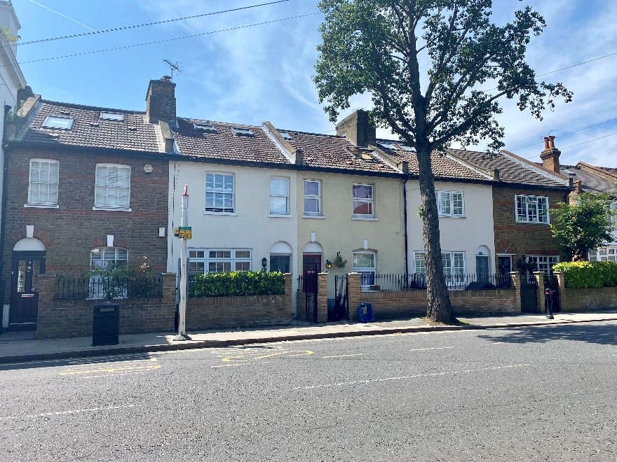
An architecturally varied road with a partly industrial history. Waldegrave Road has unfortunately lost its 19th century wax factory and the site was redeveloped again in the early 2000s. The conservation area was extended in 2019 to include the three sets of terraces and a small former industrial building set back behind the houses fronting Waldegrave Road.
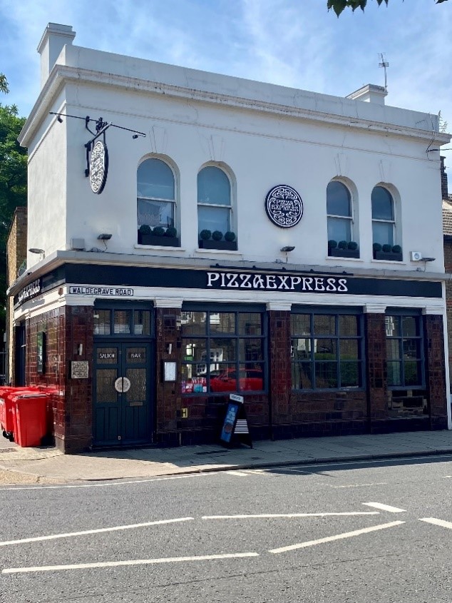
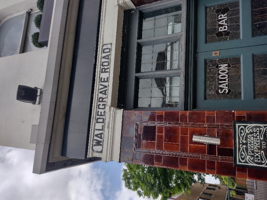
Still remaining are old workers cottages, a terrace of simple Edwardian houses, a terrace of 19th century Victorian houses, the Grade II listed Teddington Library and a burgundy glazed tiled former public house, presently a Pizza Express. This building was well restored and won a borough conservation award. This building sports an old cast street nameplate. This detail, along with the distinctive glazed tiles contribute to the character of the building and wider area. Meadow Cottages lie behind Waldegrave Road, accessed by a lane between numbers 51 and 55.
The short terrace of cottages at numbers 13-21 Waldegrave Road comprises five two storey cottages of varied design.
The central three cottages have been rendered, whereas the end of terrace houses have stock brick facades with red brick banding and dressings. They have soldier courses over the window openings and brick arches over the doorway.
There is considerable variety in the fenestration with a mixture of sash and casement windows.
These cottages have modest front gardens behind brick boundary walls with metal railings.
The Meadow Cottages are a terrace of four brick built, slate roofed Victorian cottages at right angles to Waldegrave Road. They feature rounded bay windows at ground floor level and have rounded arched doorways.
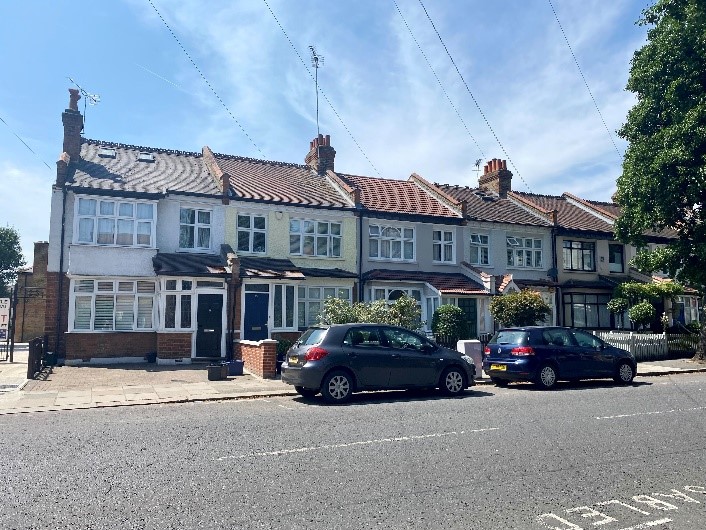
The Edwardian terrace of numbers 25-51 Waldegrave Road comprises two storey red and stock brick houses with square bay windows with pitched roofs, casement windows, cogged eaves and pitched roofed porches. Many of the houses have been rendered, losing their brick detailing. There is a variety of boundary treatments with picket fencing, brick boundary walls and some total absences of boundaries facilitating car parking.
The stock brick and render Victorian terrace at numbers 55-69 has a very different character to the aforementioned terraces.
The houses feature ground floor canted bay windows with a cornice line, classical door surrounds and a simple rendered parapet roof. Some bay windows seem to have been rebuilt with hipped roofs. Modest front gardens sit behind low brick boundary walls with metal railings.
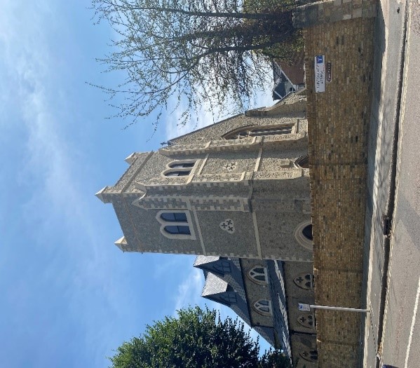
5.8 Station Road & Christchurch Road
This conservation area includes a very small section of Station Road (numbers 1-11 odd), Christ Church itself and the old school. These were part of the extension to the conservation area in 2013.
Numbers 1-9 Station Road are good examples of Edwardian unpainted roughcast render houses. These two storey terraced houses have decorative timber sash windows and decorative timber openwork porches. Two of the houses retain their original windows.
Christ Church is a mid-19th century church with rubble walling and Portland stone dressings and window surrounds.
The church has recently been altered and extended to facilitate a conversion into six flats. As part of the work, towers were added and extended and several dormers and rooflights were added to the north and south elevations. The work has been carried out to a high standard and the alterations blend in very well with the original building.
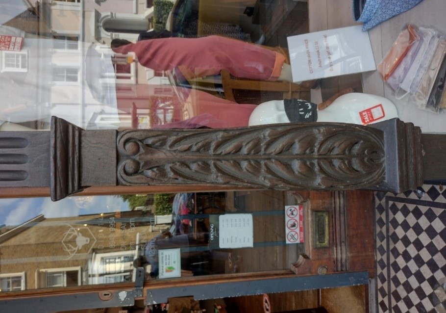
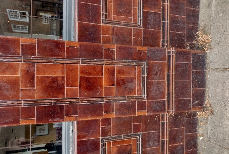
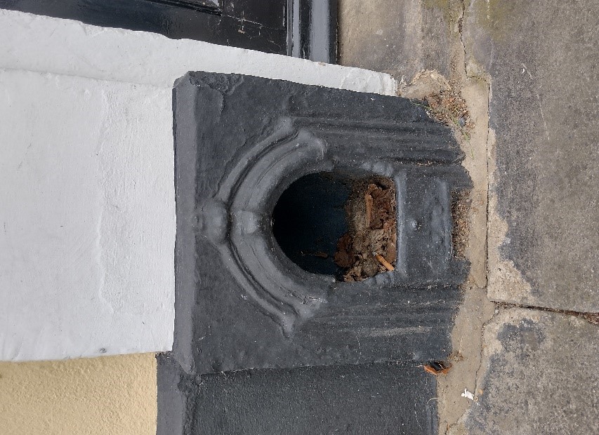
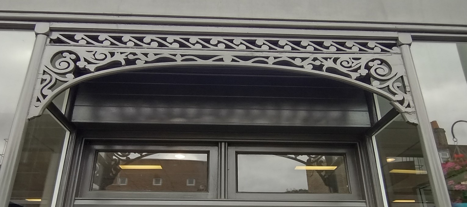
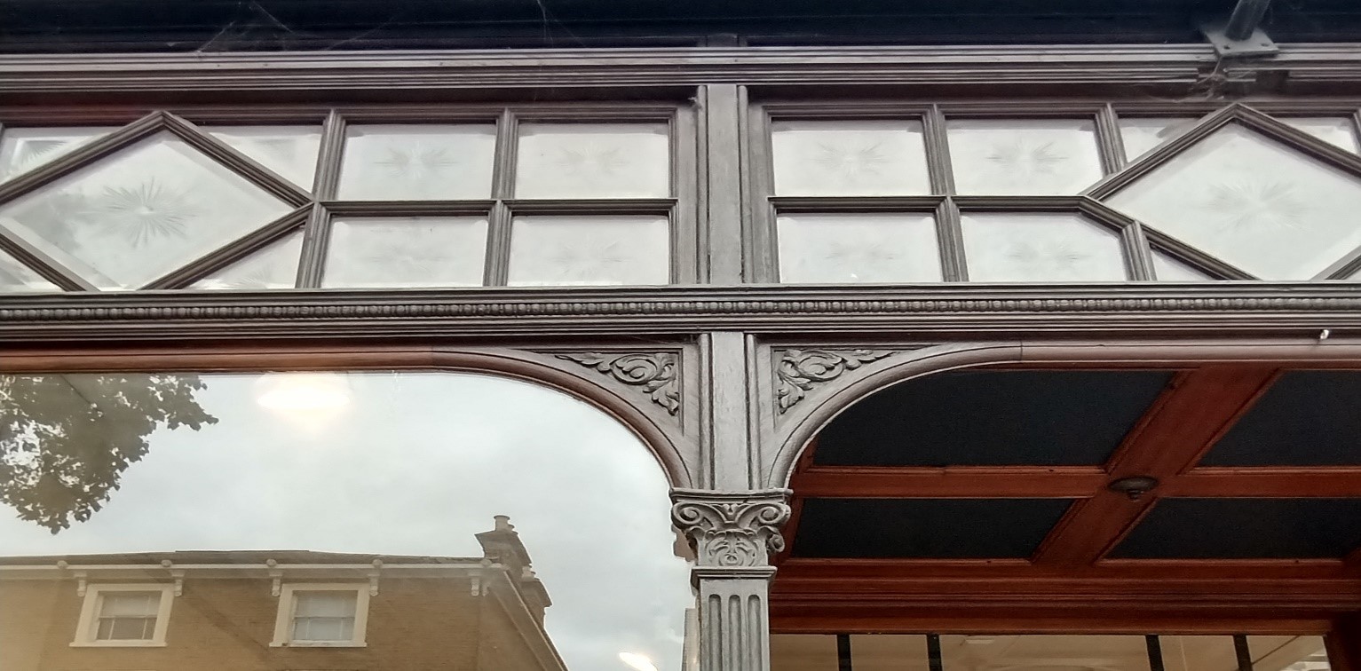
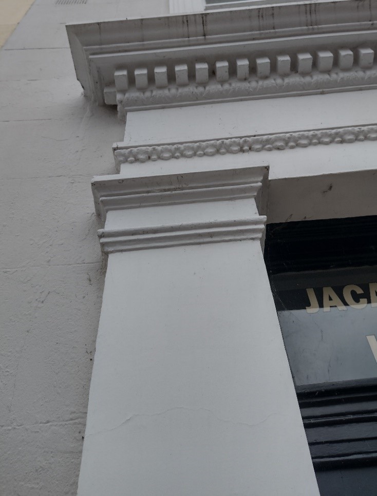
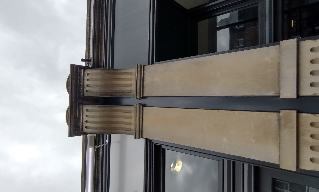
6. Architectural Details
7. Key Strengths
The quality of the architecture in this conservation area is very high with excellent examples of Georgian, Victorian and Edwardian architecture, particularly on the High Street itself.
The abundance of original shop fronts gives the High Street a distinctive character and continues to aid the vitality of the High Street as a commercial centre.
The residential streets also boast a considerable number of buildings in excellent states of original repair; particularly notable are the original doors and windows.
The presence of street trees is a very positive factor but this could be encouraged further.
The variety in building heights along the High Street contributes to the character of the area and helps to highlight the differing ages of the buildings which make up the current streetscape.
The strong material palette of red and stock bricks, mixed with rendered buildings of differing ages, contributes to the richness of the character.
8. Open Space, Parks, Gardens and Trees
An overview of private and public spaces; front gardens, trees, hedges, street planting, historic parks and gardens, civic spaces and their contribution to the character and experience of an area.
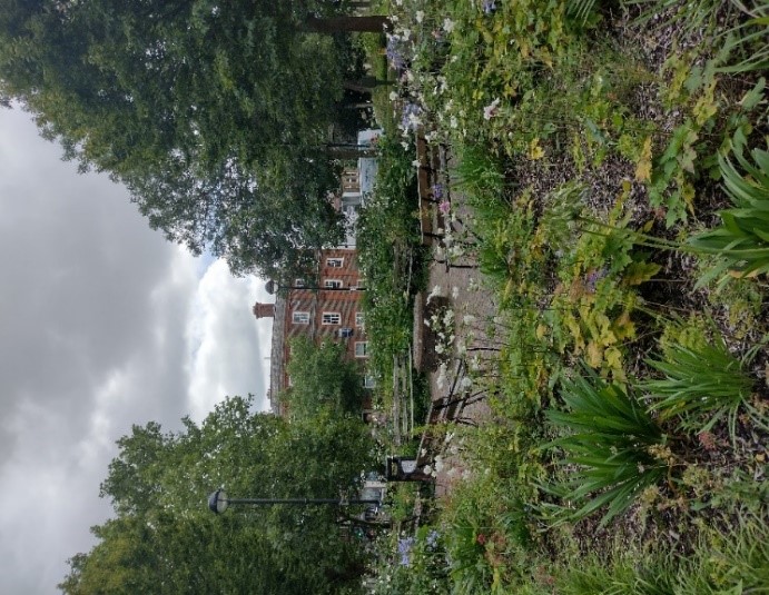
As the conservation area is located in a predominantly commercial High Street, there is not a significant amount of green space. However, there are a couple of important green spaces which lend a welcome contrast to the built character of shopping parades and large commercial buildings at the western end of the High Street.
Elmfield House Gardens is a small public garden in front of Elmfield House and Harlequin House with benches, sections of lawn, trees, and flower beds
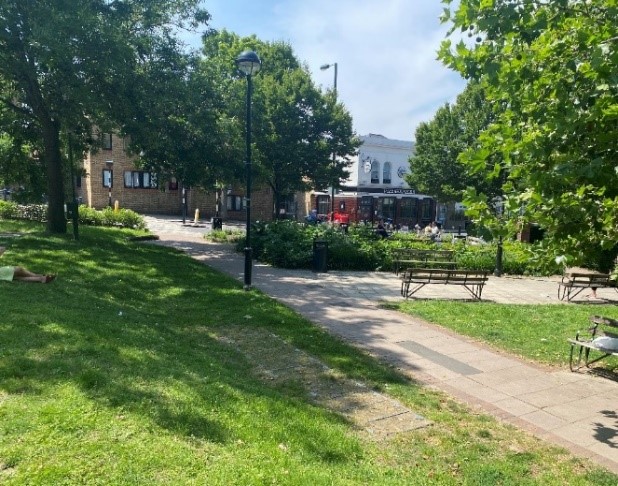
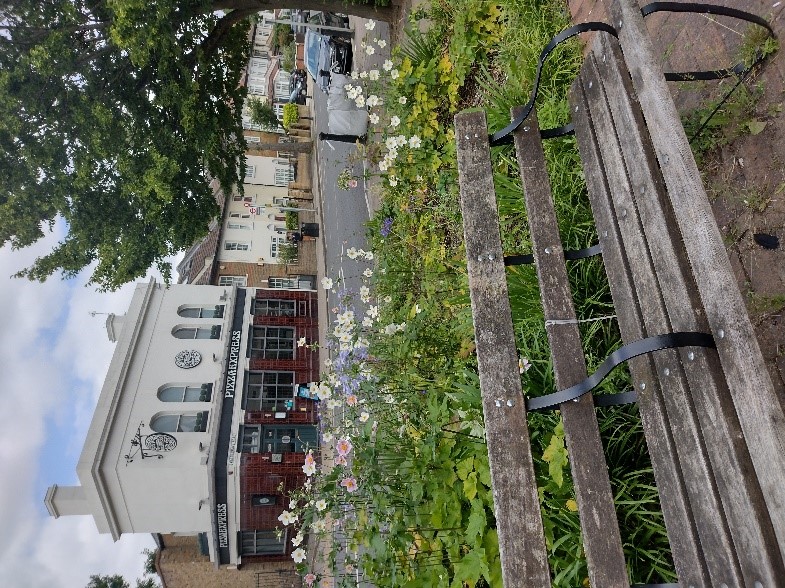
Jubilee Gardens lies in front of Park House which is not included in the conservation area. It is a very small garden which is likely to mostly serve Park House. It does not seem to be particularly well used. This is likely to be as a result of its location at a busy junction between High Street Teddington and Station Road.
There are a small number (11) of street trees on the High Street itself, mainly towards the western end.
There are also a good number of street trees on Waldegrave Road.
There is a complete absence of street trees on Cambridge Road which is striking.
However, the high proportion of trees and shrubs in front gardens does lead to an overall leafy, green appearance.
Watts Lane also features an absence of street trees, only one boundary hedge and no other greenery.
8.1 Street furniture and paving
The street furniture in this conservation area is not particularly coordinated.
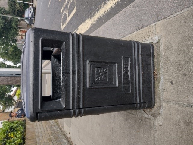
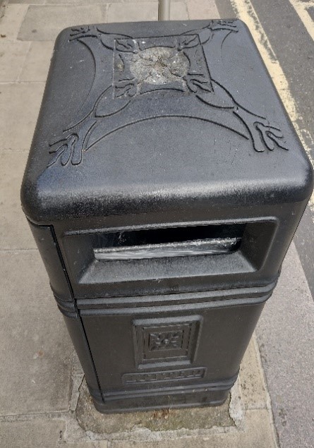
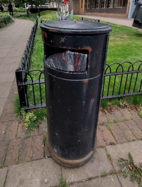
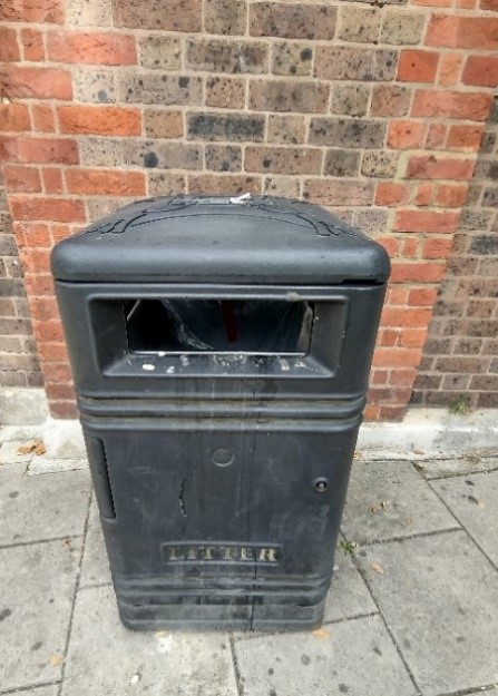
Bins
There are multiple styles of bins of varying degrees of attractiveness. They are all black in colour but seem to vary in terms of material from metal to plastic.
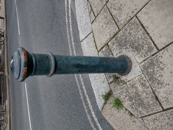
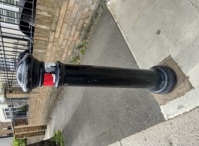
Bollards
There is one main style of bollard in this conservation area, the Manchester style. Some are painted dark green and others black.
Streetlights
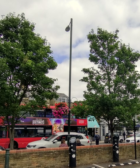
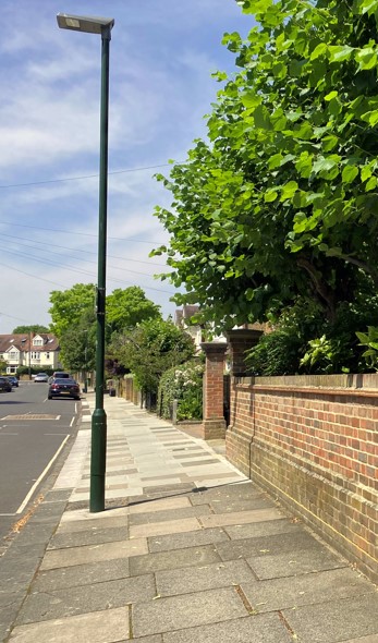
Generally, the streetlights in this area are not of a traditional style, they are very tall and modern. However, they are painted dark green and blend in quite nicely. They angle the light directly downwards.
There are different streetlights on the residential streets which are less tall and have less of a projecting lamp but still direct the light downwards. These are not particularly attractive and look quite industrial.
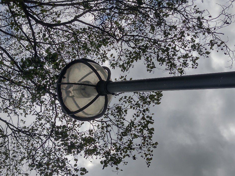
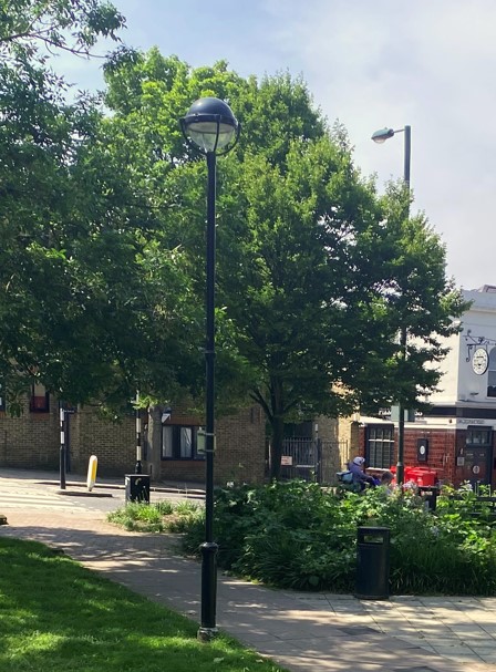
There are also a small number of shorter Globus streetlights. These are painted black.
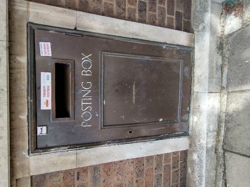
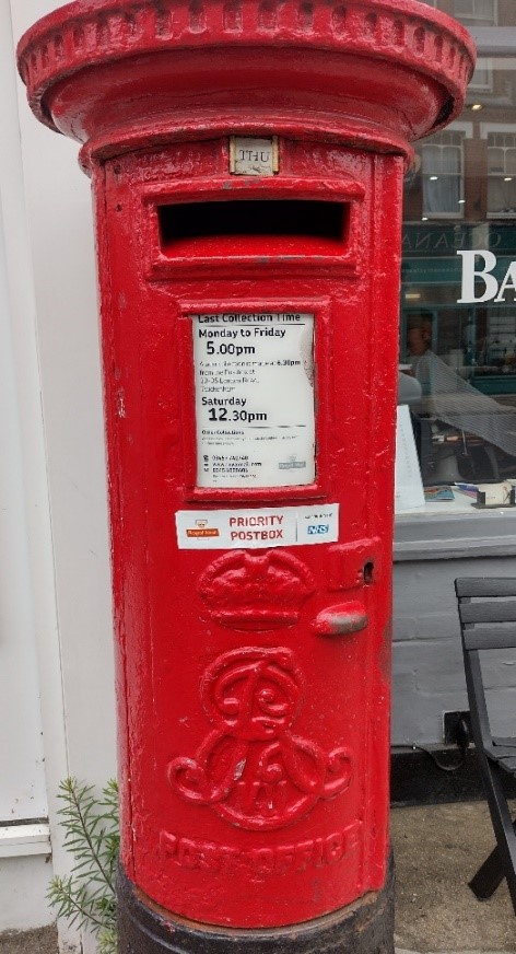
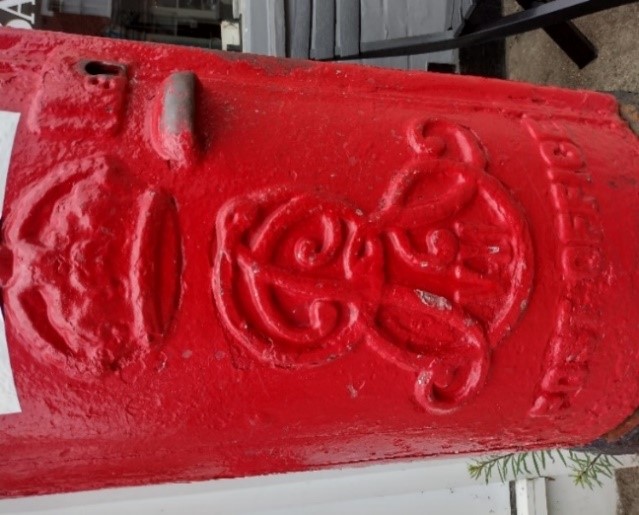
Post boxes
There is just one post box in this conservation area. It is a 20th century Edward VII post box on the High Street.
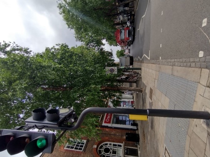
Pedestrian crossings
There are not many pedestrian crossings in this conservation area with just one zebra crossing, 2 sets of traffic lights and 3 sets of crossing islands.
They feature unsightly white plastic bollards with reflective strips. The light colour of these means that they show up the dust and dirt from the road very easily.
The poles for the flashing lights are stainless steel as opposed to dark green which is not coordinated with the general street furniture.
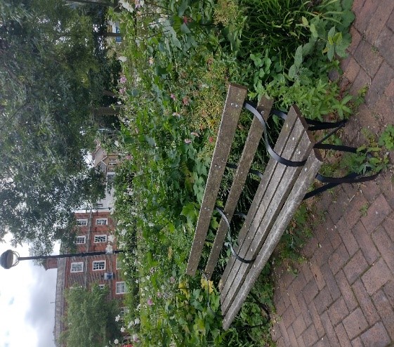
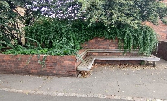
Benches
There are several good quality timber and metal benches in Jubilee Garden, and a number in a similar style in Elmfield House Gardens. However, aside from these there are very few in the wider area.
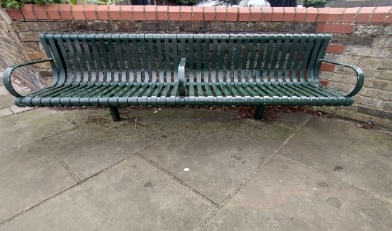
There is a metal bench outside the car park which is painted dark green to blend in with the streetlights and bollards.
There is also a timber bench on Waldegrave Road just around the corner of Elmfield House.
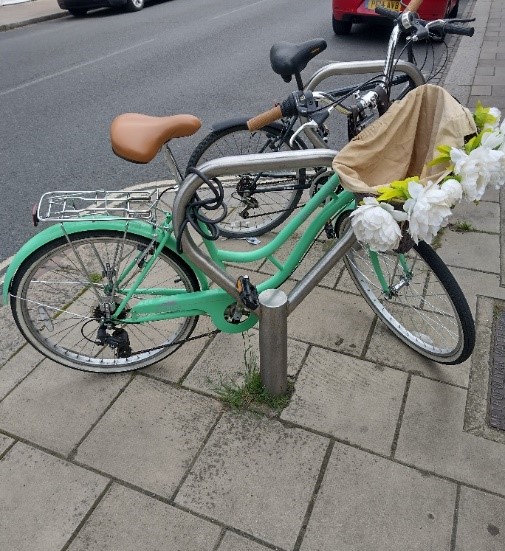
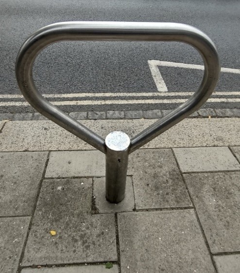
Cycle stands
The cycle stands on the high street are of a simple curved design and made of stainless steel. While the finish is clearly of high quality, they do not match the predominant dark green colour palette of the street furniture in the area.
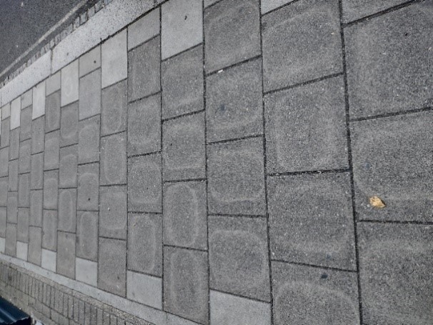
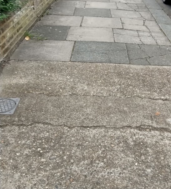
Paving
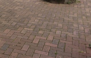
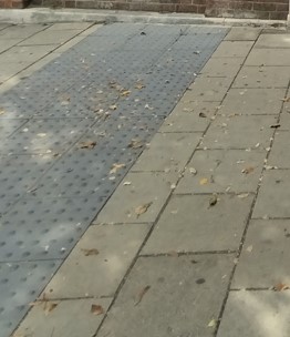
The paving in this conservation area is not of particularly good quality.
The High Street is generally paved with high load plain concrete slabs, many of which are cracked.
There are also sporadic smaller sections of tarmacadam and poured concrete.
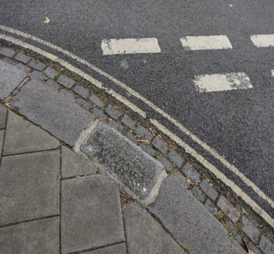
The pavements are generally edged in stone kerbs and also feature cobbled edging at road level.
Elmfield House Gardens features red brick paving.
The pavement between the gardens and Waldegrave Road also has this brick paving with granite kerbs.
At pedestrian crossings, there is generally a strip of textured paving to alert the visually impaired to the presence of a crossing.
9. Management Plan
This Management Plan outlines how we intend to preserve and enhance the character and appearance of the conservation area in future. We have a duty to formulate and publish these proposals under the Planning (Listed Buildings and Conservation Areas) Act 1990.
The existing original layout of the High Street and surrounding residential streets are important features of the conservation area and are key to defining its overall special character.
However, the commercial aspect of the area makes it particularly vulnerable to unsympathetic development, particularly with regard to shop fronts, signage etc. With any change in proprietor, it is important that any changes to the shop fronts are minimal and sensitive to the building.
Please note that the following proposals include suggested environmental improvements, some of which may fall outside of our control. Limits on the Council’s resources may also mean that proposals for which it is responsible may take longer than is desirable to implement.
9.1 Problems and pressures
- Loss of traditional architectural features and materials due to unsympathetic alterations and extensions
- Pressure for development which may include taller buildings which would be out of scale and out of character with the conservation area
- Pressure for the conversion of shops into residential dwellings
- Lack of coordination and poor quality of street furniture and pavements
- Lack of street trees and planting
- Domination of traffic and poor pedestrian safety leading to clutter of signage and street furniture
- Loss of original or quality shopfronts and unsympathetic alterations and advertisements such as disproportionate signage, excessive illumination, loss of detailing such as plinths, pilasters etc
- Use of poor-quality materials in building works such as UPVC, roofing felt and GRP (Glass fibre reinforced polymers) products
- Loss of historic outbuildings and rear alterations which remove historic interest of the rear of properties
- Loss of boundary walls and garden space in residential areas for hard standing, lightwells and vehicle parking
- Unused, dilapidated properties with dead frontages such as the old bank building at the corner of the High Street and Station Road would benefit from renewed use and subsequent maintenance
Paving and street furniture changes should accord with guidance in the Public Space Design Guide.
9.2 Opportunities for enhancement
- Preservation, enhancement and reinstatement of architectural quality and unity that is preferably based upon historic evidence
- Coordination of colour (RAL6012) and design of street furniture and an improvement in the quality of pavements
- Improvement of highways conditions and pedestrian convenience, and rationalisation of existing signage and street furniture
- Plant more street trees and introduce planters along wider sections of pavement
- Retain and refurbish where necessary cast street nameplates
- Retain and improve the quality of shopfronts and advertisements, seeking that illumination is minimised and justified
- Retain the original use of shop units rather than a change of use to residential.
- Seek the reinstallation of boundary treatment and front garden planting alongside planning applications for refurbishment or development where appropriate and feasible
- Seek that any lightwells are placed to the side and rear of properties and that they are of modest proportions
- Seek that hard standing is reduced
- Seek good quality and proportionate design and quality materials that are sympathetic to the period and style of the building
9.3 Recommendations
Streetscene
- Instate better quality, traditional paving slabs and kerbs
- Retain granite kerbs and drainage channels
- Lamp posts, traffic related columns, bollards and cycle stands to be green-black finish (RAL 6012)
- There are opportunities to regularise and improve parking signage
- More street trees to be planted along the eastern end of the High Street
- Tree surrounds to be permeable bonded gravel
Boundary treatment
The demolition of original boundary walls/removal of boundary hedges etc should be strictly prohibited. The loss of boundaries and front gardens greatly detracts from the character and setting of the houses and from the harmony of the streetscape.
Materials
Any replacement materials to be carefully matched to original for example bricks, tiles, paving slabs.
Fenestration
New or replacement windows and doors to match the original style, profile and material. Slimline double-glazed windows are likely to be acceptable providing they match the originals in terms of style, profile and material.
References
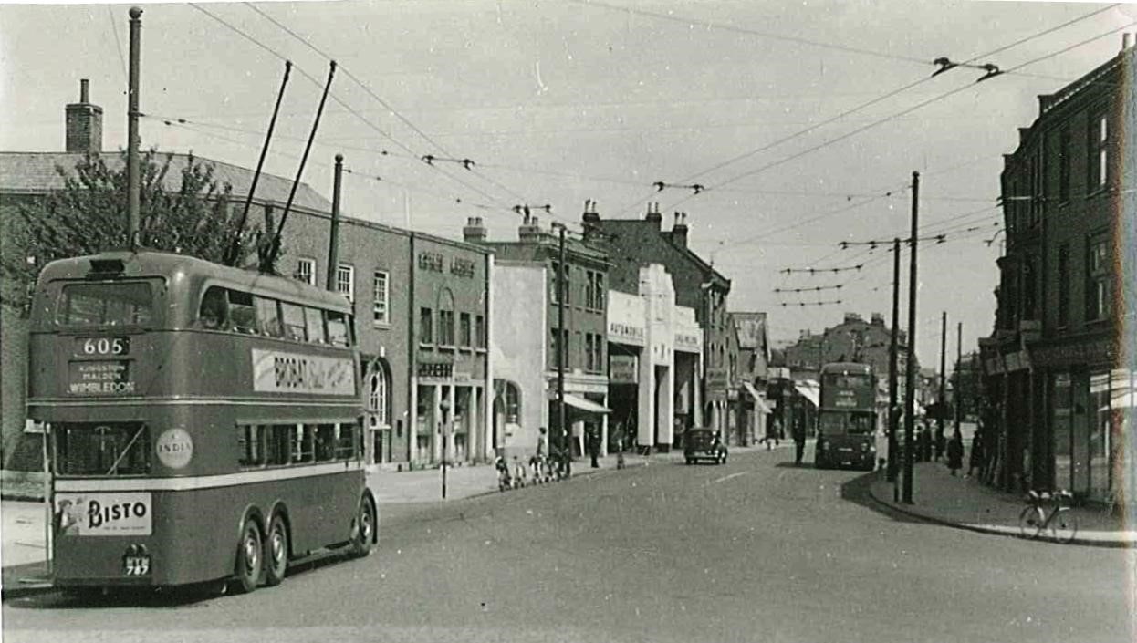
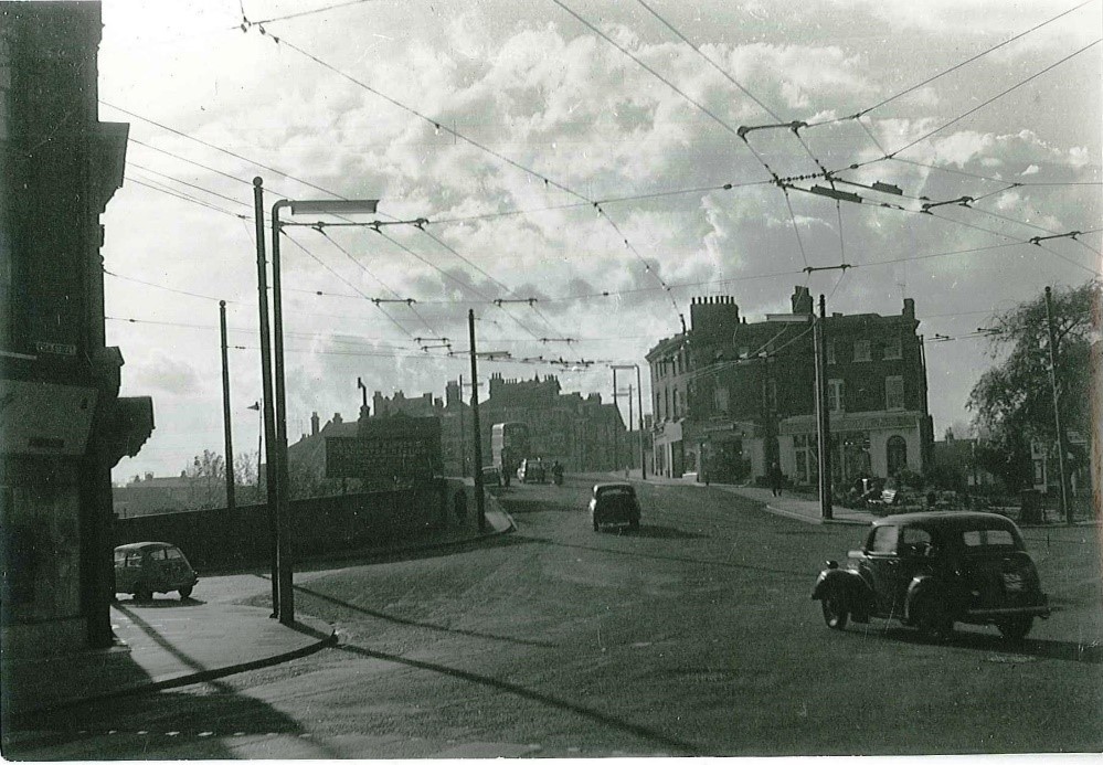
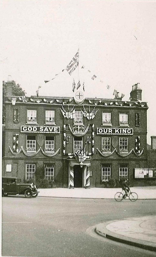
Archive photographs: Richmond Local Studies Library
Historic Maps: National Library of Scotland National Library of Scotland - Map Images
Listed building information: Historic England
Up to: Conservation areas
Updated: 02 July 2026
