
High Street, Hampton Hill
Conservation Area Appraisal
Conservation area no.38
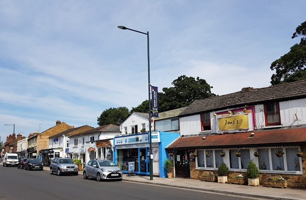
Figure 1
Contents
- Introduction
- Statement of Significance
- Location and Setting
- Historical Development
- Architectural Quality and Built Form
- Architectural Details
- Open Space, Parks, Gardens and Trees
- Management Plan
1. Introduction
1.1 Purpose of this document
The principal aims of conservation area appraisals are to:
- Describe the historic and architectural character and appearance of the area which will assist applicants in making successful planning applications and decision makers in assessing planning applications.
- Raise public interest and awareness of the special character of their area
- Identify the positive features which should be conserved, as well as negative features which indicate scope for future enhancements.
This document has been produced using the guidance set out by Historic England in the 2019 publication titled Understanding Place: Conservation Area Designation, Appraisal and Management, Historic England Advice Note 1 (Second Edition). This document will be a material consideration when assessing planning applications.
1.2 What is a conservation area?
The statutory definition of a conservation area is an ‘area of special architectural or historic interest, the character or appearance of which it is desirable to preserve or enhance’.
The power to designate conservation areas is given to local authorities through the Planning (Listed Buildings and Conservations Areas) Act, 1990 (Sections 69 to 78).
Once designated, proposals within a conservation area become subject to local conservation policies set out in our Local Plan and national policies of the National Planning Policy Framework (NPPF) and the London Plan.
Our overarching duty which is set out in the Act is to preserve and/or enhance the historic or architectural character or appearance of the conservation area.
1.3 Buildings of Townscape Merit
Buildings of Townscape Merit (BTMs) are buildings, groups of buildings or structures of historic or architectural interest, which are locally listed due to their considerable local importance. The policy, as outlined in our Local Plan, sets out a presumption against the demolition of BTMs unless structural evidence has been submitted by the applicant, and independently verified at the cost of the applicant. Locally specific guidance on design and character is set out in the Council’s Buildings of Townscape Merit Supplementary Planning Document (2015), which applicants are expected to follow for any alterations and extensions to existing BTMs, or for any replacement structures.
1.4 What is an Article 4 Direction?
An Article 4 Direction is made by the local planning authority. It restricts the scope of permitted development rights either in relation to a particular area or site, or a particular type of
development anywhere in the authority's area. We have powers under Article 4 of the Town and Country Planning (General Permitted Development) Order 2015 to remove permitted development rights.
Article 4 Directions are used to remove national permitted development rights only in certain limited situations where it is necessary to protect local amenity or the well being of an area. An Article 4 Direction does not prevent the development to which it applies, but instead requires that planning permission is first obtained from us for that development.
For further information about Article 4 Directions, to check if any permitted developments rights in relation to a particular area/site or type of development apply in your area, visit the Article 4 Directions page.
1.5 What is a Conservation Area Appraisal?
A conservation area appraisal aims to describe the special historic and architectural character of an area. A conservation area’s character is defined by a combination of elements such as architecture, uses, materials and detailing as well as the relationship between buildings and their settings including landscape.
Many other elements contribute to character and appearance such as the placement of buildings within their plots; views and vistas; the relationship between the street and the buildings and the presence of trees and green space.
The Conservation Area Appraisal is an evidence base rather than a planning policy document. This means that it is the main document for recording what is of principal importance in terms of character and appearance of each conservation area.
However, the relevant policies are contained within the borough’s Local Plan.
Designation and Adoption Dates
High Street Hampton Hill Conservation Area was designated on the 7th September 1982.
It was subsequently extended on the 23rd March 1996, and the 20th February 2019.
Following approval from the Environment, Sustainability, Culture and Sports Committee on the 5th April 2022, a public consultation on the draft Appraisal was carried out between 20th June and 14th July 2022.
This Appraisal was adopted on the 30th March 2023
2. Statement of Significance
Summary of special architectural and historic interest of conservation area.
The High Street Hampton Hill Conservation Area covers the busy centre of Hampton Hill and the historic core of the original linear settlement. It is a largely commercial and residential area which also retains a distinctive traditional village character. It contains many fine original shopfronts which contribute to its character and significance. The residential properties display an array of architectural styles in modest scale which contribute to the village character of the area. The eastern side of the area is defined by the high brick walls of Bushy Park, the settlement having a close historic relationship with both the Park and Hampton Court Palace beyond. The overall form and scale of Hampton Hill has changed little since the end of the 19th century, and the early settlement pattern of a linear street fronted by properties on narrow plots with long rear gardens is still apparent. As a settlement with early 19th century origins, it is an example of gradual urban expansion and development before the arrival of the railway and the rapid urban expansion of the second half of the 19th century.
3. Location and Setting
General character and plan form, e.g. linear, compact, dense or dispersed; important views, landmarks, open spaces, uniformity.
Hampton Hill lies in the west of the borough, immediately north of the village of Hampton and the River Thames. Hampton Hill High Street is part of the busy A311 which runs in a north/south direction connecting to the major trunk route, the A308, in Hampton and is the historic route between Fulwell and Hampton.
Bushy Park forms the eastern boundary of Hampton Hill. The railway line runs parallel and to the west of the High Street. There are railway stations at nearby Fulwell and Hampton.
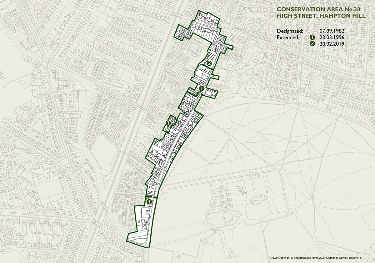
Figure 2 High Street, Hampton Hill Conservation Area Map
View an interactive map of the conservation area
The conservation area is predominantly aligned along the High Street of Hampton Hill, between Uxbridge Road to the South, and continues to the north terminating at the residential area along Park Road and Edward Road and adjoining Bushy Park to the East. The conservation area adjoins Bushy Park Conservation Area (61).
The buildings within Edward Road, Park Road and the High Street were logical inclusions to the conservation area. The extensions represent the very early stages of development of Hampton Hill with good quality later developments which reflect the changing phases and affluence of the High Street. The additional area is designed with high quality materials and design which is mostly intact and is considered to represent a homogenous area of development which would contribute to the historic character and special interest of the conservation area.
4. Historical Development
The evolution of the historical development of the area, including archaeology and plot morphology, that contribute to its special character.
Hampton Hill cannot lay claim to an extensive history, unlike its neighbouring village of Hampton which was already an established settlement in the Saxon period. There is little archaeological evidence of activity in the Hampton Hill area, beyond a small collection of Roman finds. The settlement itself only developed in its own right at the start of the 19th century.
Hampton has always been closely associated with Bushy Park and Hampton Court Palace. Bushy Park began to be enclosed from the 1490s, and this process was hastened with the development of Hampton Court Palace. It became a royal park in 1529 when Cardinal Wolsey gave it (and the Palace) to Henry VIII, who used it for deer coursing. Much of the land enclosed was part of Hampton Common. John Roque's map of 1754 shows the extent of Bushy Park and the location of Upper Lodge, which was built in 1709 by the Earl of Halifax when he became Ranger of the park. Roque's map also shows the Longford River which was excavated in 1639-40, on the orders of Charles I, for the purpose of supplying water to Hampton Court Palace. The river is 12 miles long and 21 feet wide and had a riverbed much deeper than today. As well as a changing profile, the river has changed its name, being variously known as The King's, The Queen's, Cardinal's, Wolsey's and the New River.
The land outside Bushy Park remained largely unchanged throughout the 18th century. The only other building, apart from Upper Lodge, in the vicinity of Hampton Hill was a smock (or flock) windmill built in 1785 at the end of what is now Windmill Road. It was built by John Naylor to grind corn and grain for Hampton village. It survived as a working mill until 1863 and was demolished in 1876.
Of major historic importance was the establishment in 1784 of the geodetic base for ordnance i.e. gunnery survey triangulation, under the direction of General Roy, Master of Ordnance. The base line was established and its south east end is marked with a gun barrel set in a small garden in Roy Grove. The base line was eventually used for the principal triangulation of Britain in 1791.
Fundamental changes to the landscape of Hampton Common occurred after 1811 when an Act of Enclosure enabled common land to be portioned out and enclosed. The Common gradually gave way to smallholdings and then to market gardens. A new settlement began to emerge, quite separate from the original riverside village of Hampton, and took the name New Hampton. It continued to expand along the route bordering the Park and by 1848 had become a community sizeable enough to support a variety of shops and businesses.
The problems caused by the overspill of this population into "respectable" Hampton brought about the construction of St. James's Church in Hampton Hill which was consecrated in 1863. Due to the nature of the expansion of Hampton Hill much of the housing was of low quality, parts were little more than slums (Providence Row or Road was one of the worst). However, the arrival of Reverend Fitzroy John Fitzwygram as the first vicar of St. James's was to be important for the future well-being of the village. He was the younger son of landed gentry renowned for their work in social reform. He and his equally dedicated wife poured much of their private fortunes into the village fabric; enabling the "miserable hovels" to be replaced with brick cottages at affordable rents (a number of these survive today and are characterised by use of rubble walls faced with thin brick tiles); instituting schools and sports facilities; and encouraging the development of larger villas to bring more wealth to the village. By the time of the Reverend's premature death in 1881 Hampton Hill was well on the way to becoming a self-respecting and self-helping community.
New Hampton officially changed its name to Hampton Hill in 1890 and the landmark tower and spire of St. James's Church were raised in celebration of Queen Victoria's Golden Jubilee. The village continued to expand, at a more restrained pace, into the 20th century. It was only in the 1920s that some of the market gardens started to be redeveloped as housing. The High Street was widened in 1910 to accommodate dual tramway tracks, involving the demolition of some buildings.
The population expanded rapidly between 1850 and the early 1860s with an influx of hundreds of artisans employed in the construction of the Hampton Waterworks and the Thames Valley Extension railway line. The village was able to boast a large selection of well frequented drinking establishments, most of which were not salubrious. The arrival of the railway gave a new lease of life to the market gardens which could now supply to consumers much further afield. Market gardening activity expanded as a result.
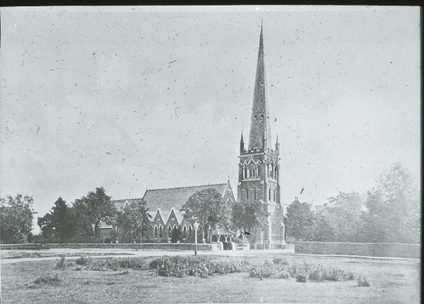
Figure 3 St James’s Church, c.1890
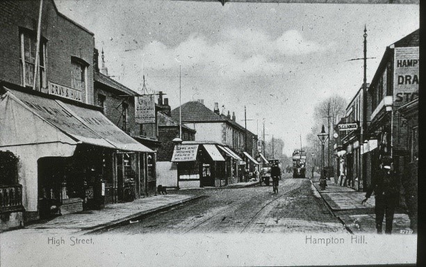
Figure 4 High Street, 1900s (1)
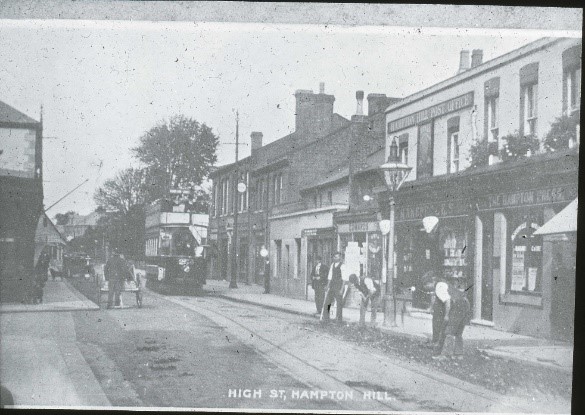
Figure 5 High Street, 1900s (2)
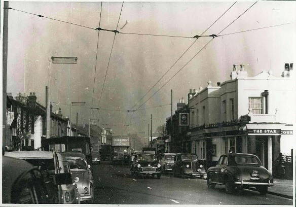
Figure 6 High Street, 1958
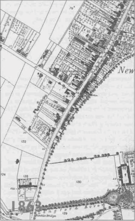
Figure 7 OS map (1863)
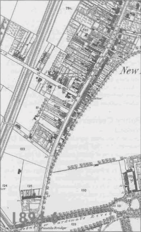
Figure 8 OS map (1894-6)
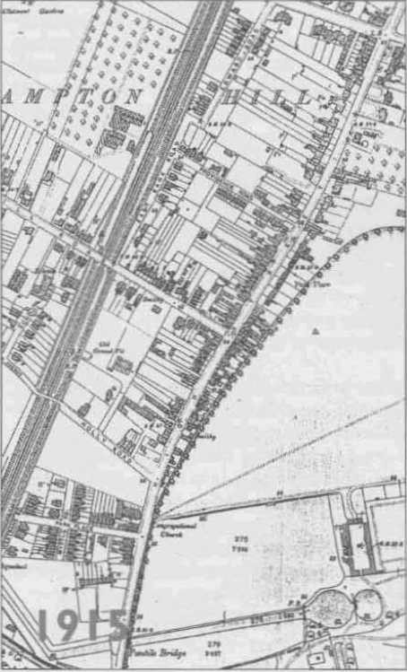
Figure 9 OS map (1915)
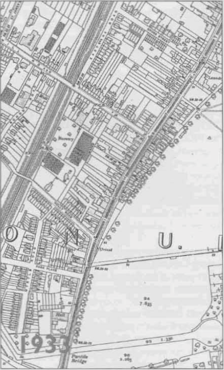
Figure 10 OS map (1933)
5. Architectural Quality and Built Form
A description of the dominant architectural styles in the area, the types and periods of buildings, their status and essential characteristics, and their relationship to the topography, street pattern and skyline. Also important is their authenticity, distinctiveness and materiality.
The High Street forms the busy centre of the conservation area and the historic core of the original settlement and its overall form and scale has changed very little since the end of the 19th century. The early settlement pattern of a linear street fronted by properties on narrow plots with long rear gardens is still apparent. This linear character is reinforced by the listed brick wall of Bushy Park along the eastern side, and areas of later terraced housing along the railway line to the west. The railway line forms the outer edge of the earliest part of the village.
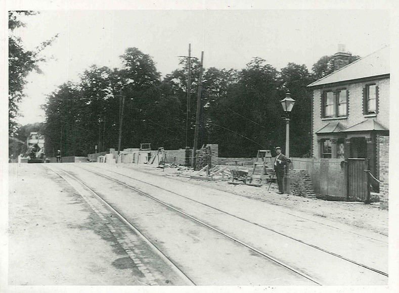
Figure 11 Pantile Bridge during construction c.1900-2 and 1 High Street
On approach from Hampton the start of Hampton Hill High Street is clearly marked by the Pantile Bridge which carries the road across the Longford River, and the small Pantile Bridge Open Space area, complete with a rustic, timber bus shelter, on the corner of the High Street and Uxbridge Road. This is an important landscape entry point to the High Street from the south, with trees on both sides of the road. After crossing the bridge buildings begin to line the road edge and the linear form of the High Street becomes apparent.
1 High Street is a detached, suburban Victorian Villa in a landscape setting unique to the High Street and still with most of its original form and detail intact. It forms a distinctive landmark at the start of the southern end of the High Street.
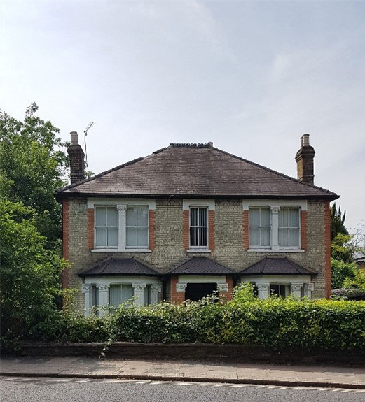
Figure 12 1 High Street
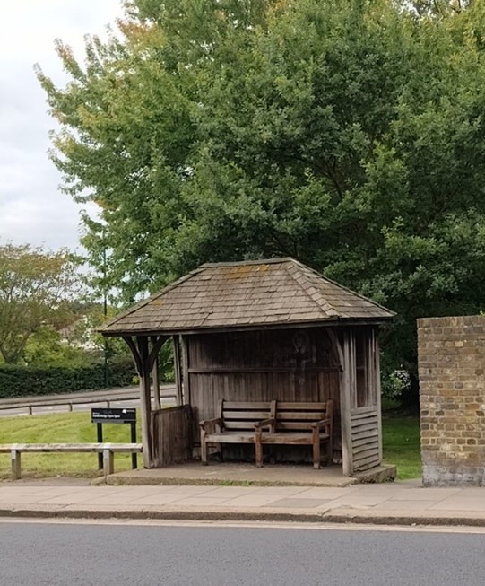
Figure 13 Timber bus shelter
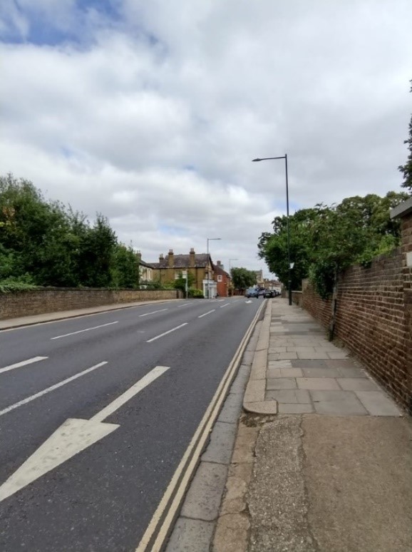
Figure 14 Approach to Pantile Bridge from south
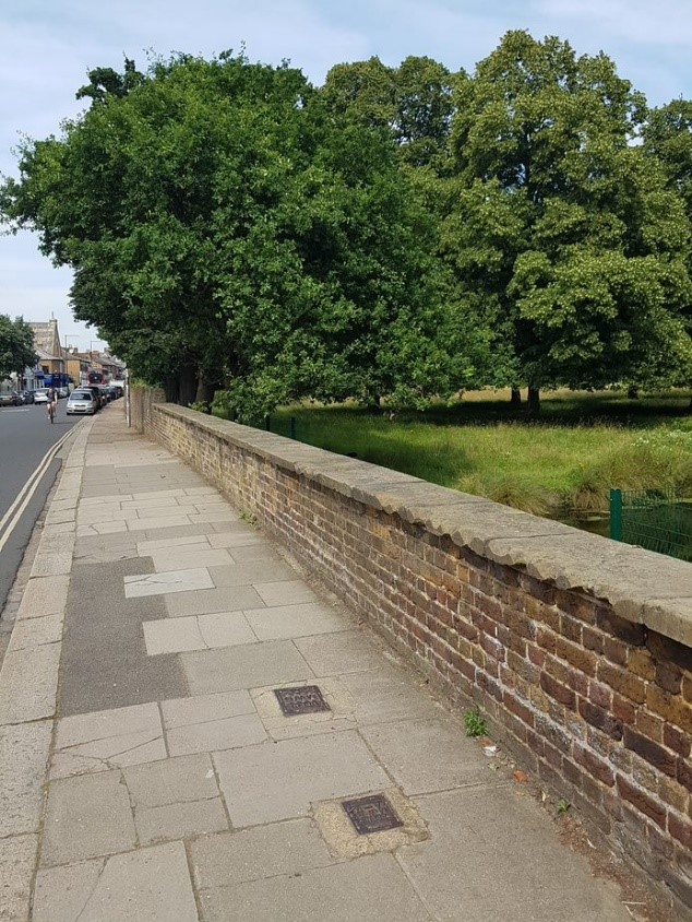
Figure 15 Pantile Bridge east side
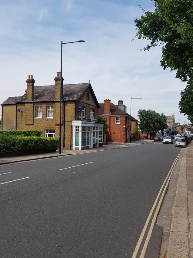
Figure 16 Views north from Pantile Bridge
On approach from Fulwell, however, the start of the conservation area is less obvious, with later extensions bringing in parts of Park Road and Edward Road to the west and more of the northern end of the High Street. After the crossroads, there is a noticeable transition to the compact and uniform scale of the High Street beginning at 165-7 High Street which date from 1827 and are listed. Opposite is 92 High Street, a former engineering works with a polychromatic brick facade. At this point the High Street begins to run alongside the boundary wall of Bushy Park, a relationship that continues through the entire conservation area.
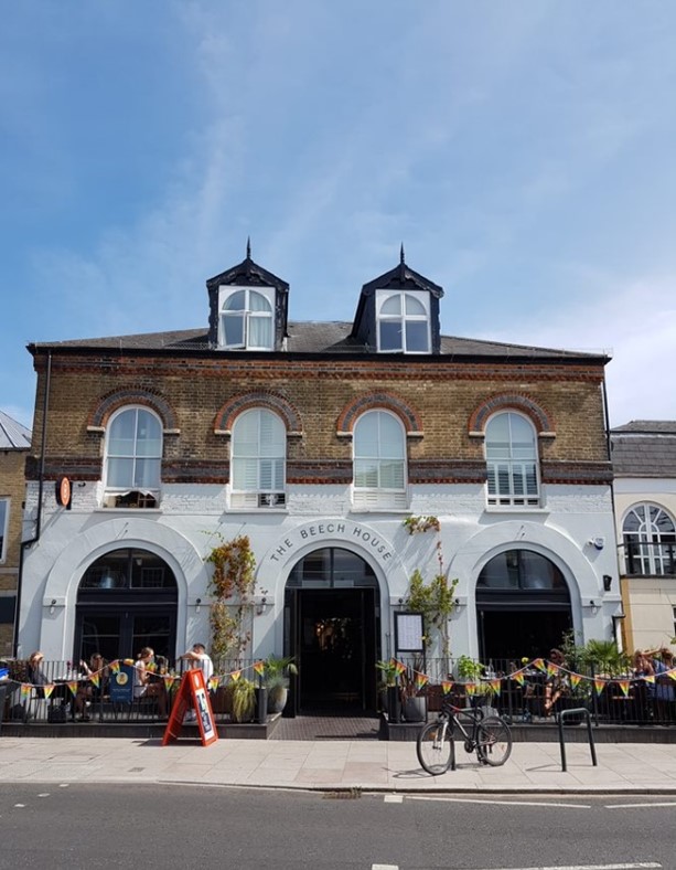
Figure 17 The Beech House, 92 High Street
The north end of the High Street differs somewhat in character from the centre and southern end; the main street becomes much wider, with a mixture of community, commercial and residential buildings set back from the road. Along the western side are the Grade II listed 165-167, a shopping parade (c.1960s) with residential accommodation above and further block with street-level commercial premises and accommodation meeting the crossroads. Along the eastern side is Hampton Hill Theatre, Grade II listed 114 (Templeton Lodge), Parkside residential development (c.1960s) and a block of commercial properties meeting the crossroads.
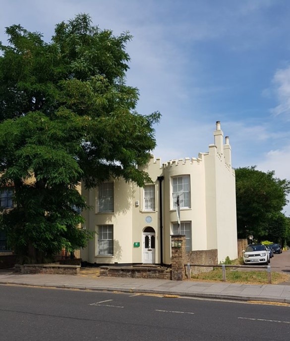
Figure 18 Templeton Lodge, 114 High Street
Figure 19 Park Gate Court and Hampton Hill Library, 68 High Street
Figure 20 165-167 High Street
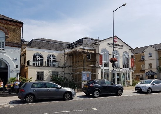
Figure 21 Hampton Hill Theatre, 90 High Street
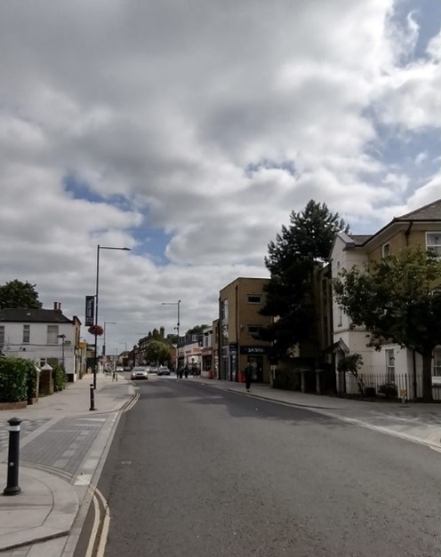
Figure 22 View north along High Street
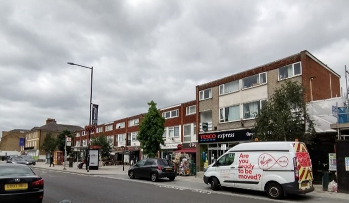
Figure 23 c.1960s shopping parade, 169-177 High Street
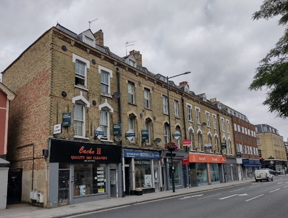
Figure 24 187-201 High Street
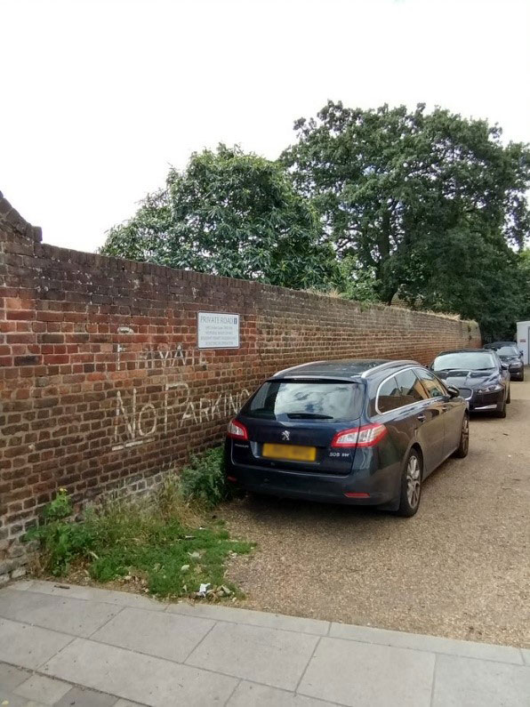
Figure 25 Bushy Park boundary wall
The Bushy Park boundary provides an almost continuous line of mature trees whose canopies extend above the roof line of the High Street properties. They create a dramatic backdrop and accentuate the linear form of the High Street and provide a tantalising clue to the vast expanse of open parkland beyond. The open character of Bushy Park contrasts sharply with the compact form of the village at its edge.
Additional individual trees sited in the long plots behind buildings on the western side of street also make a contribution to the High Street. The true boundary of the Park lies approximately 6-7 feet outside the line of the present walls; this perimeter strip originally formed a Deer Leap, however, over time this strip has been encroached on by development and little evidence of it survives today.
5.1 High Street
The High Street is a busy commercial and residential area. It supports an unusually wide variety of building uses for its size; there are houses, flats, cottages, a church, several public houses, restaurants and cafes, a theatre, newsagents, butchers, bakers, grocers, and more specialist shops selling joinery supplies, craft materials and bicycles; and other commercial concerns such as funeral directors, offices and hair salons. Many of the units have been developed from what previously were either residential or non-retail properties whose front gardens were to become single-storey shop units; there are also several purpose-built parades dating from the late 19th century and early 20th century.
This diversity creates a colourful environment with plenty of vitality. An entrepreneurial character pervades the area and there is a strong sense of community. These characteristics were also central to the spirit of the village's founders in the 1850s and have ensured that whilst the outer boundaries of Hampton Hill have changed through more recent development, it still retains its 'village-esque' character.
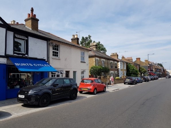
Figure 26 View along west side of High Street
Figure 27 View along east side of High Street
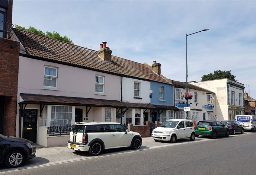
Figure 28 Residences along west side of High Street
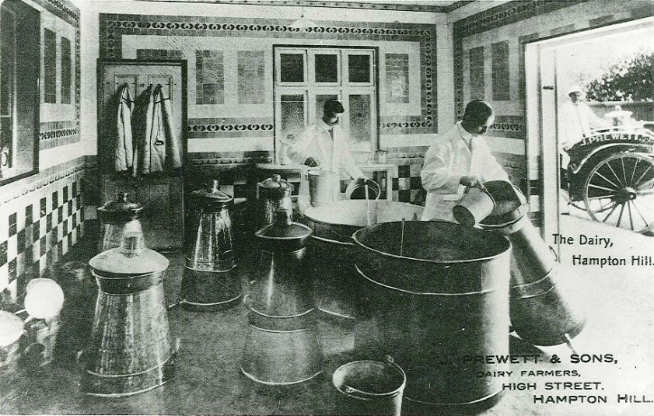
Figure 29 The Dairy, Hampton Hill c.1910
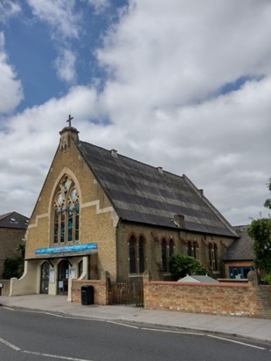
Figure 30 United Reformed Church, 35 High Street
The rapid expansion of the village in the mid 19th century is reflected in the mixture of building styles and the apparent arbitrary relationships between some properties. Although disparate in detail, the area is unified through scale, common materials and date. The 19th century buildings which line the High Street are predominantly of a modest two-storey scale.
Exceptions to this which make a positive contribution as local landmarks include Cambridge House, the United Reformed Church, 55 (ex Hampton Hill Dairy) and adjacent shops, 58-64 and 169-177, a parade of shops at the northern end of the conservation area. A particularly large-scale development dating from 1978 which has a negative visual impact on the High Street occupies 63-71 (odd). Facades are mostly brick, both yellow stocks and red, exposed, rendered or painted. The survival of many shallow pitched, slate roofs and chimneys also adds to the interest of the area
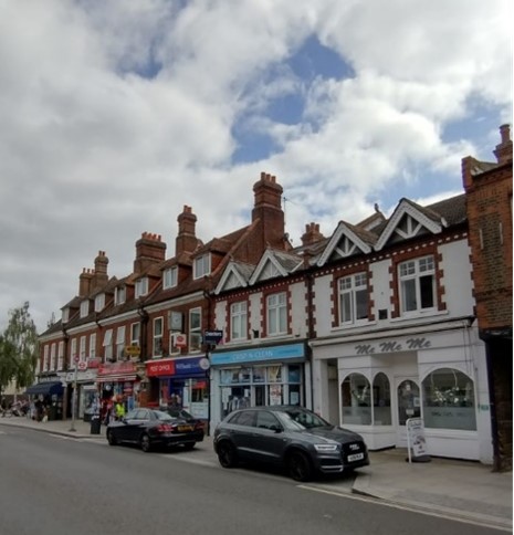
Figure 31 54-64 High Street
Figure 32 63-71 High Street
Figure 33 Cambridge House, 15 High Street
Some of the plots fronting the High Street still retain historic workshops behind, such as rear of 183 High Street which is accessed off an historic laneway from Park Road. The rear of properties along the High Street are particularly important with historic laneways still in existence. The historic character of activity to the rear of buildings fronting the High Street has contributed to the character of the public realm and is still relatively architecturally authentic today. This configuration allows a series of views north and south along this wide and gently curving street with glimpses up narrow streets and laneways between properties which add further interest to the street scene.
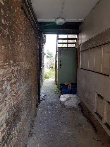
Figure 34 Lane to rear of property
Materials found throughout the area are predominately mixed stock brickwork with red brick dressings and painted timber sliding sash windows. Other buildings are either painted or rendered, all in a variety of architectural styles. The roofscape is characterised by mostly shallow pitched slate roofs with brick chimneys, all providing unity, rhythm and interest to the street. However, the gabled roof to Hampton Hill United Reformed Church and the Dutch gable roof the former Hampton Hill Dairy are distinctive.
The wider landscape setting of Bushy Park and the backdrop of mature trees contribute to the enclosure and distinctive character of this area. A major street scene enhancement was carried out c.2018 under the Council's ‘Uplift’ programme. This saw a range of public realm improvements along the High Street.
5.2 Public Houses
The presence of several public houses along the High Street is an important element in the character of the conservation area. These are located at 8, 29, 80, 99 & 147. Several remain in pub use while others have been converted to other uses
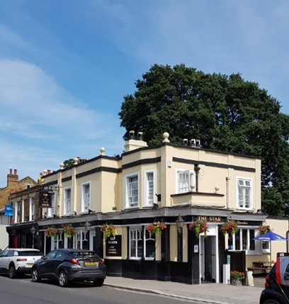
Figure 35 The Star public house, 8 High Street
Figure 36 Former Rising Sun public house, 29 High Street
Figure 37 Former public house, 99 High Street
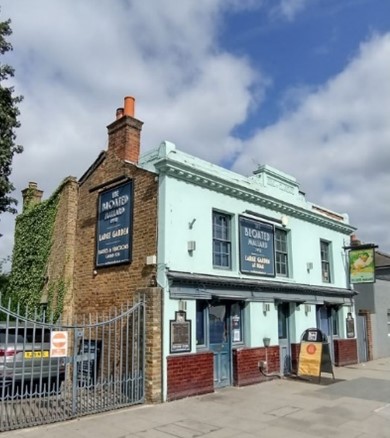
Figure 38 Former Duke of Clarence public house, 147 High Street
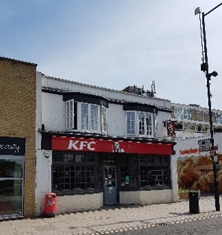
Figure 39 Former public house, 80 High Street
5.3 Shopfronts
The shopfronts within this area display a variety of styles representing the gradual growth of the original linear village centre. Compared with other core high streets within the borough, those found along High Street, Hampton Hill are smaller in scale and generally of a simpler design yet display an equal amount of charm. Some shopfronts form easily identifiable groups, united by roof form, first-floor architectural treatment, or common features such as awnings, cornices, decorative console brackets, pilasters, stall risers and ventilation grilles. Others stand apart as individual units.
A number of shopfronts survive on the High Street which have managed to retain a large proportion of fine original features, most notably 5, 12, 55, 64, 131 & 183. This group arguably represents the best-preserved shopfronts within the conservation area whose appearance and features should be used as reference for sensitive shopfront alteration within Hampton Hill. Regrettably, many have also been inappropriately altered and replaced by poorly designed modern shopfronts; through sensitive redesign, their alteration would greatly enhance the core of the conservation area.
General advice on shopfronts is the subject of a separate, specific supplementary design guide.
We can offer additional advice on reinstatement of original style shop fronts.
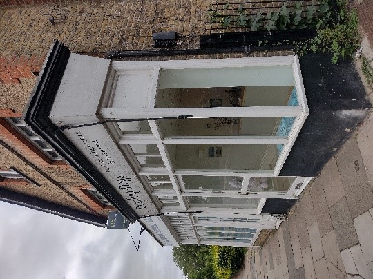
Figure 40 5 High Street
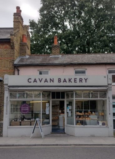
Figure 41 12 High Street (1)
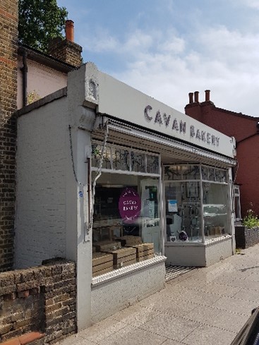
Figure 42 12 High Street (2)
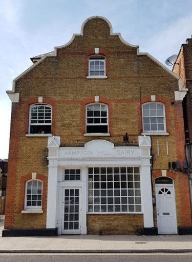
Figure 43 Ex Hampton Hill Dairy, 55 High Street
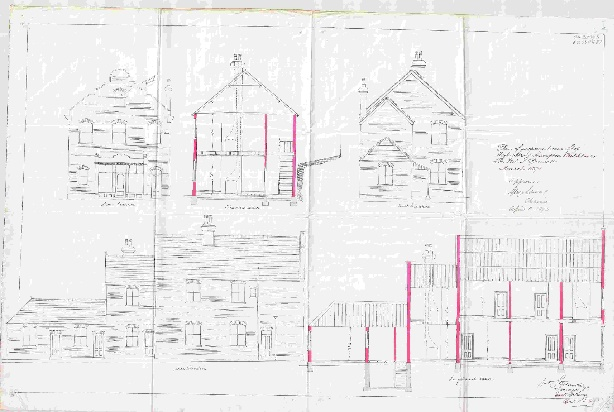
Figure 44 Hampton Hill Dairy architectural drawing
Figure 45 64 High Street
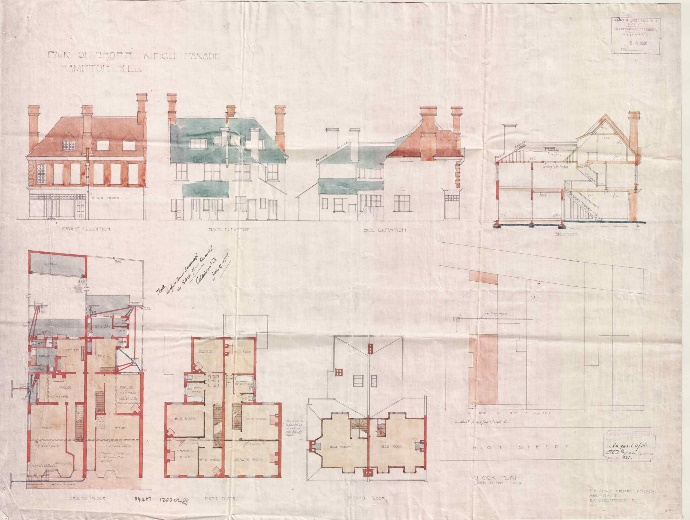
Figure 46 62-64 High Street architectural drawing
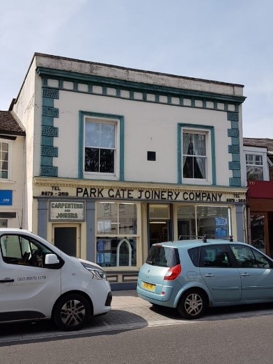
Figure 47 131 High Street
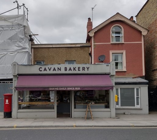
Figure 48 183 High Street
5.4 Park Road
Park Road is a wide, busy street lined on both sides with fine detached and semi-detached houses set back from the pavement behind front garden plots with spaces between dwellings. The houses vary in age and style, with a mixture of both 19th and 20th century residences. The dwellings along Park Road are constructed with mixed stock brick, and their scale, design, details and generous plots reflect their status of the time (c.1895). Boundary treatments vary, with a mix of brick walling, railings and hedges. The character of the road is enhanced further by the large, mature trees along both sides and at the end of long views.
3-9 are semi-detached three-storey Italianate houses with hipped slate roofs and shared chimneystacks on overhanging bracketed eaves. The walling is stock brick with rendered banding. At ground floor is a canted bay window with colonette detailing; first-floor windows have a rendered sunburst detail above. A recessed pitched side block contains the projecting rendered porches with timber doors under glazed fanlights.
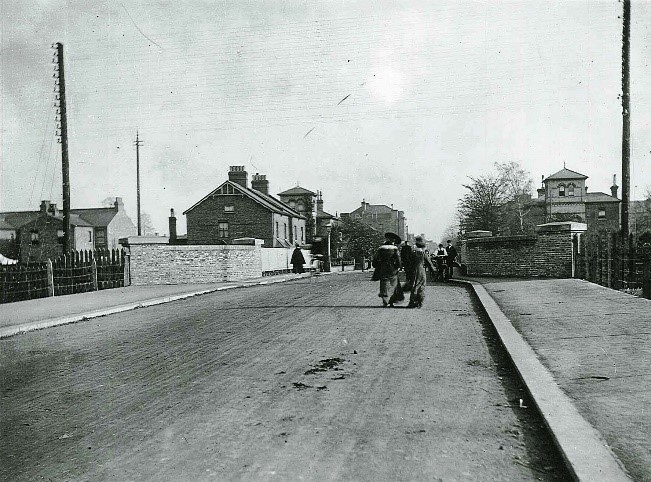
Figure 49 Park Road c.1906
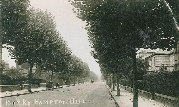
Figure 50 Park Road c.1900
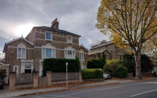
Figure 51 3-5 Park Road (1)
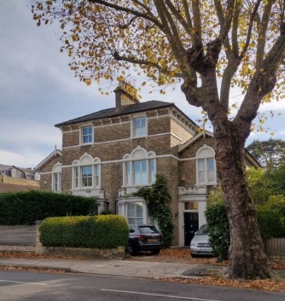
Figure 52 3-5 Park Road (2)
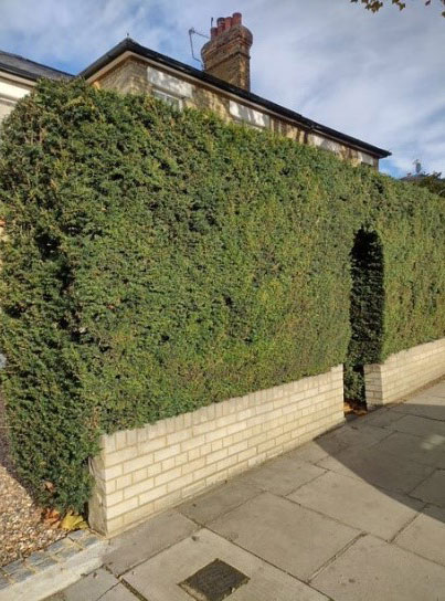
Figure 53 Boundary wall and hedge, Park Road
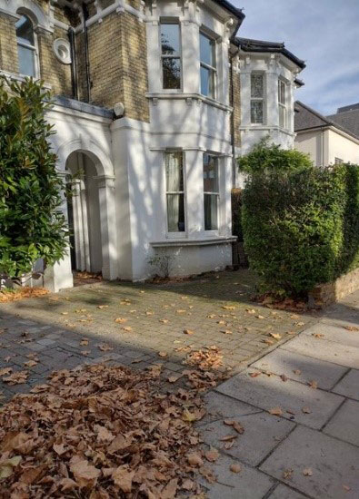
Figure 54 Hard standing for vehicle parking, Park Road
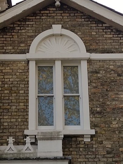
Figure 55 Window detail
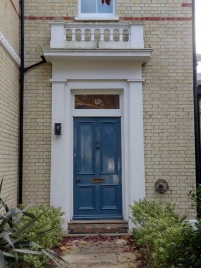
Figure 56 Door detail
16-19 are also semi-detached properties in an Italianate style. They have hipped slate roofs and shared chimneystacks on overhanging eaves with brick detailing. The walling is yellow brick with red brick banding. At ground floor is a rendered canted bay window with fish scale tiling; first-floor windows are round-headed with red brick arches and decorative keystones. The entrances are contained in a rendered surround with pediment and pilaster detailing and timber doors under glazed fanlights. 18 & 19 each have a three-storey belvedere which emphasises the importance of the corner plot.
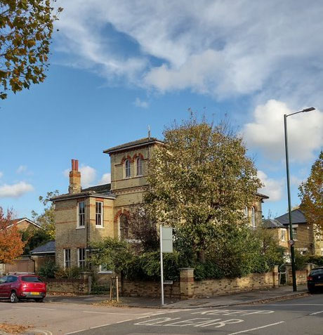
Figure 57 16-18 Park Road
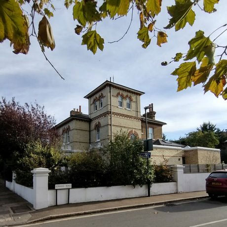
Figure 58 17-19 Park Road
5.5 Edward Road
A smaller and still distinctive group of dwellings exist along Edward Road. These are mostly semi-detached Victorian villas (c.1895) of similar design. Boundaries vary, with a mix of yellow brick walling, railings and hedges.
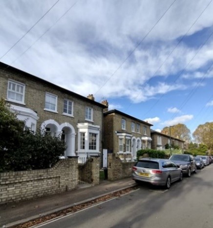
Figure 59 West side of Edward Road
Figure 60 East side of Edward Road
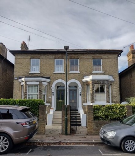
Figure 61 Semi-detached pair, Edward Road

Figure 62 Detached house, Edward Road
1-7 are characterised by their two-storey height, hipped slate roofs with yellow brick chimneystacks and yellow stock brick walling with cogged brick eaves. At ground floor they have paired round-headed entrances and recessed porches with a shared column between. Some original doors and fanlights containing stained glass remain. Ground-floor canted bay windows are rendered, with tripartite first-floor windows above. 9-15 are two-storey-over-basement in height with two-storey canted bay windows. 2-6 are similar to those opposite, though individual entrances are flanked by projecting square bay windows at ground floor containing tripartite sash windows with camber-headed first-floor windows above.
5.6 Cross Street/Windmill Road
There are a number of small side streets spaced regularly along the High Street. Their impact on the High Street is minimal because they are narrow, lined with small terraces and cottages and are foreshortened by the existence of the railway cutting.
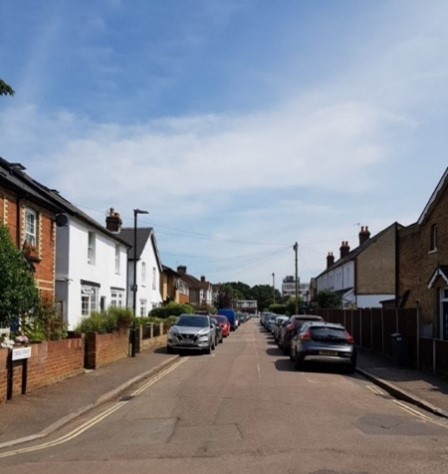
Figure 63 View along Cross Street
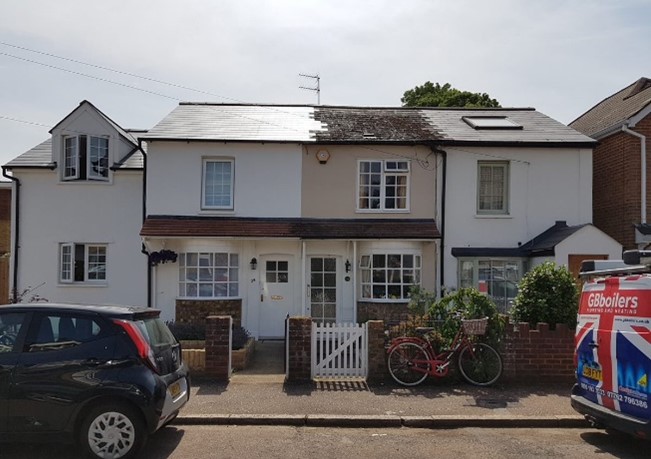
Figure 64 29-33 Cross Street
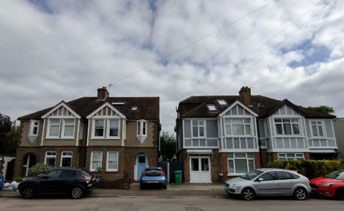
Figure 65 12-18 Cross Street
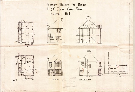
Figure 66 18 Cross Street architectural drawing
Cross Street is lined on both sides by a mixture of terraces and cottages of varying styles and ages. These are generally two-storey in height, with pitched slate roofs and a mix of brick and rendered walling. 1-3 are two within a terrace with a pitched slate roof and stock brick chimneystacks. The walling is stock brick with red brick banding below eaves and to window and door arches. Both have pitched shallowly projecting porches with painted timber bargeboards. 5-9 are of a similar scale but have been entirely rendered externally, with replacement windows and roofing throughout.
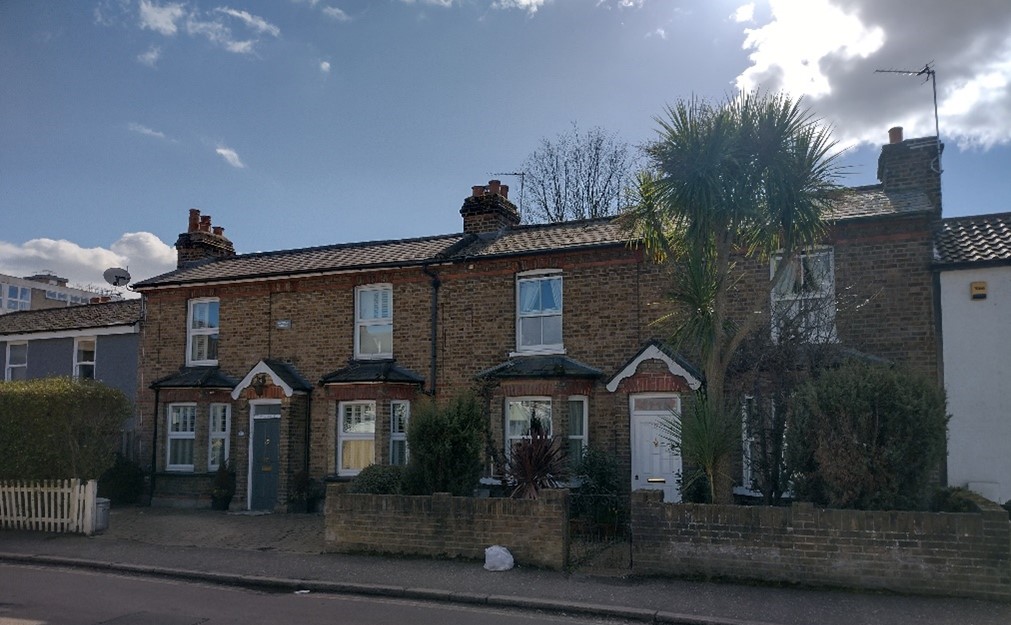
Figure 67 1-3 Cross Street
Windmill Road is well connected to the High Street because it is a wider through road which passes over the railway line to Uxbridge Road. Its history and importance as a route are reflected by a wider range of building types and scale. Windmill Road meets the High Street approximately halfway along its length. The old Hampton Hill Post Office and adjoining building are positioned at the junction approximately half-way along the High Street, making them a central focus.
The insertion of inappropriate window replacements is a major factor that detracts from the character of the residential streets leading off the High Street. Similarly, although many properties have managed to retain small front garden plots, a number have been lost to hard standing for vehicular parking.
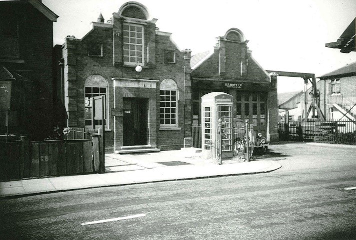
Figure 68 Former Free Library c.1960
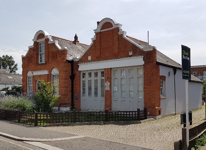
Figure 69 Former Free Library, 2021
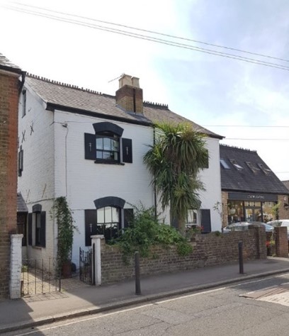
Figure 70 1-3 Windmill Road
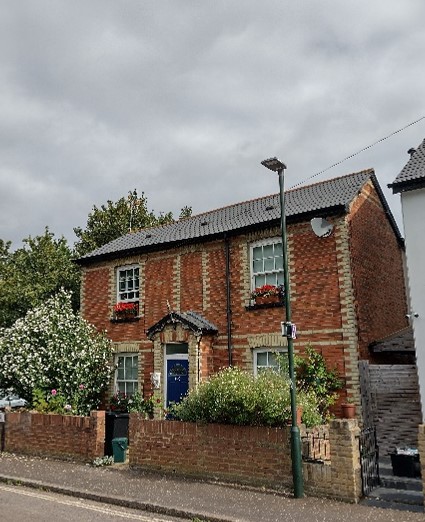
Figure 71 38 Cross Street
5.7 Listed Buildings
A listed building is a building that has been placed on the Statutory List of Special Architectural or Historic Interest. Buildings on this list may not be demolished, extended or altered without Listed Building Consent.
Templeton Lodge, 114 High Street: Grade II (List Entry Number: 1065420)
“Late C18 or early C19, 2-storey house. Three windows wide. Stuccoed, with battlemented parapet; dripstone and moulded surround to central first floor window. Double flat bowed front having curved window frames and sashes. Once lived in by the tenor John Templeton (1802-1886) who sang the first English production "Don Giovanni" and "The Magic Flute".”
165-167 High Street: Grade II (List Entry Number: 1065419)
“Originally a pair of houses, now in one ownership. 1827. Stock brick with stucco ground floor Slate hipped roof with central brick chimneystack. Three storeys: 4 windows to main part, one to extension. Mainly glazing bar sashes but French windows to first floor. Semi-circular headed entrance doors. Continuous cast-iron balcony in Gothick taste to first floor. Three storey, one window extension to left with separate slated hipped roof.”
Brick Boundary Walls: Grade II (List Entry Number: 1080875)
“Semi-circle of wall from east side of Upper Lodge and returning southwards along High Street and terminating just north of Hampton Court Road."
6. Architectural Details
The images below provide a visual reference to the conservation area’s general appearance, its typical forms, materials and colours.
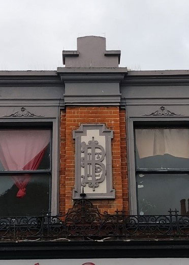
Figure 72 Stucco wall moulding, 99 High Street
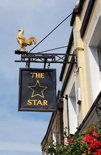
Figure 73 The Star hanging sign
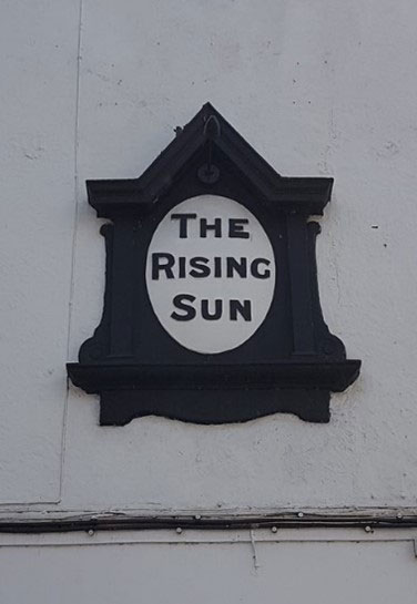
Figure 74 The Rising Sun sign
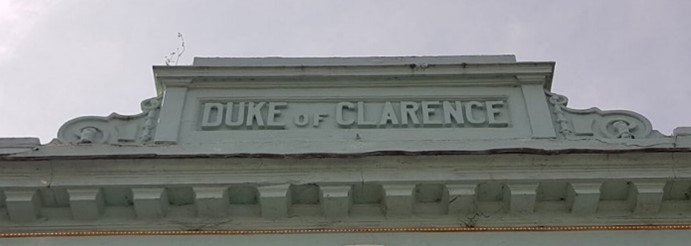
Figure 75 Decorative pediment
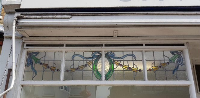
Figure 76 Stained glass detail
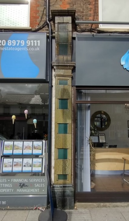
Figure 77 Shop pilaster detail
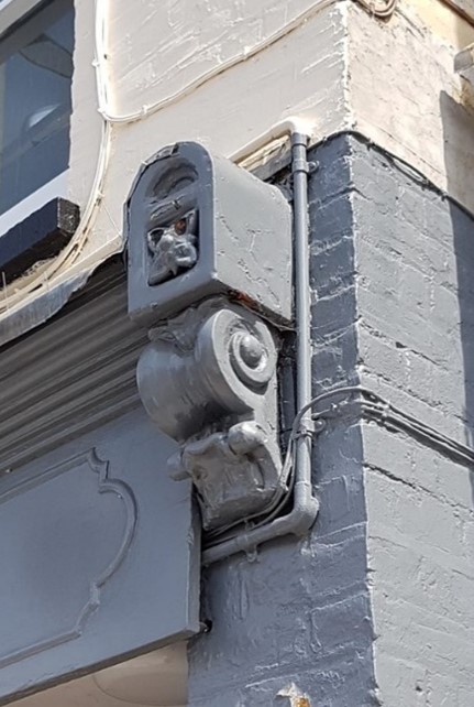
Figure 78 Console detail (1)
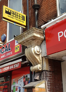
Figure 79 Console detail (2)
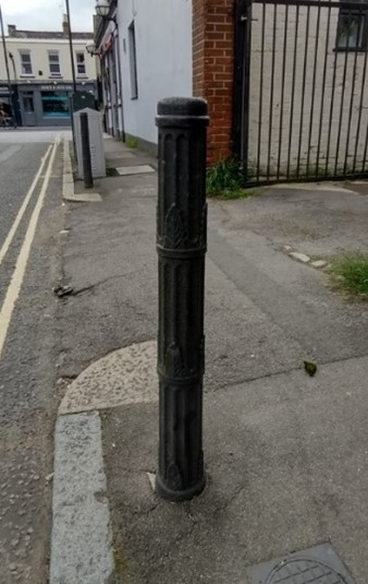
Figure 80 Bollard, Windmill Road
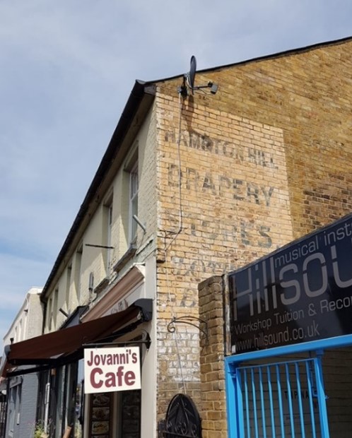
Figure 81 Ghost sign, 32 High Street
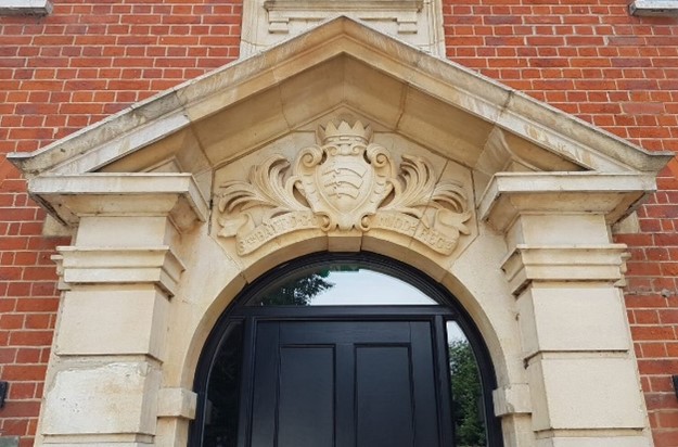
Figure 82 Cambridge House, 15 High Street
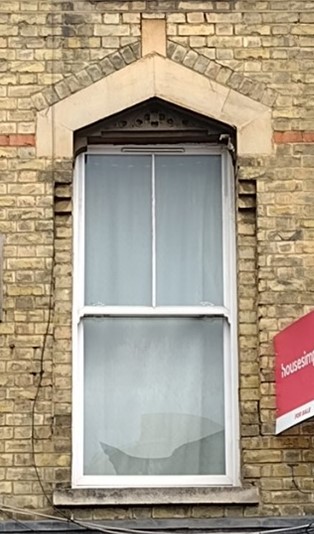
Figure 83 Window, 187 High Street
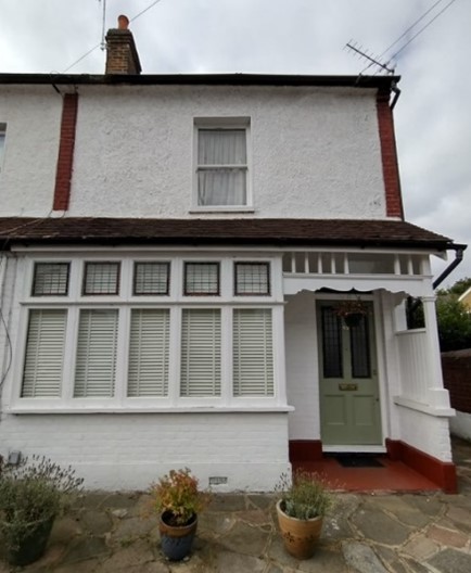
Figure 84 Window and porch, 45 Cross Street
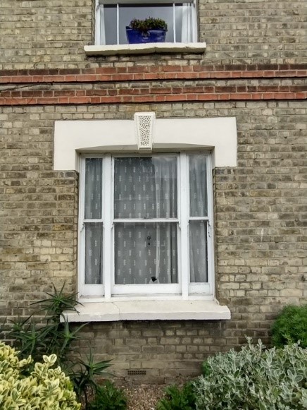
Figure 85 Tripartite sash window
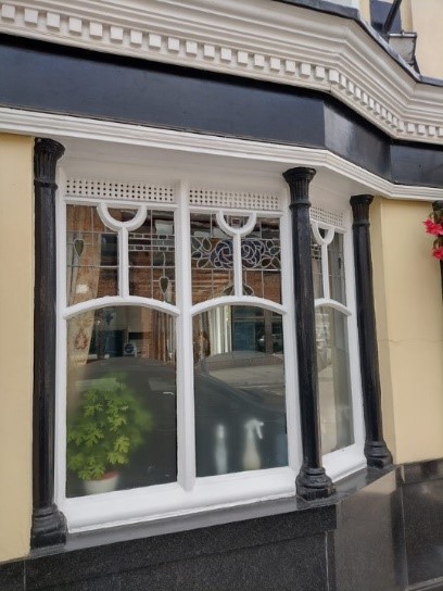
Figure 86 The Star public house window detail
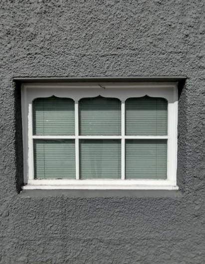
Figure 87 Window detail (2)
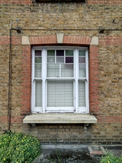
Figure 88 Tripartite sash window with stained glass
Figure 89 Gate detail, United Reformed Church
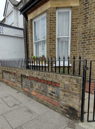
Figure 90 Boundary walling and railings, 14-16 High Street
7. Open Space, Parks, Gardens and Trees
An overview of private and public spaces; front gardens, trees, hedges, street planting, historic parks and gardens, civic spaces and their contribution to the character and experience of an area.
Bushy Park, a Grade I Registered Historic Park and Garden, is situated immediately east of the High Street and conservation area. At over 1000 acres, Bushy Park is the second largest of London’s eight Royal Parks. Lying just north of Hampton Court Palace, Bushy Park is famed for its mix of waterways, gardens, and roaming herds of red and fallow deer. Its presence running along the east of the conservation area is significant as it offers a vast open space for residents and visitors alike. Its location has also shaped Hampton Hill’s linear development and subsequent expansion westwards
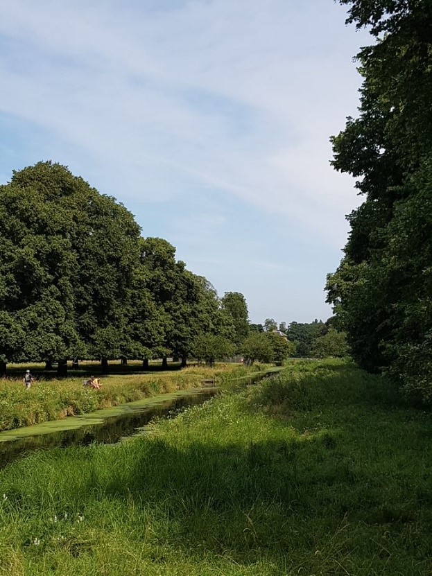
Figure 91 View of Longford River from Pantile Bridge
At the very southern end of the High Street one can appreciate the picturesque view from the Pantile Bridge along the Longford River towards the Water Gardens in Bushy Park. The low wall on the Park side of the bridge is the only place in Hampton Hill High Street where such views can be obtained and are a stark contrast to the enclosed character of the High Street to the North.
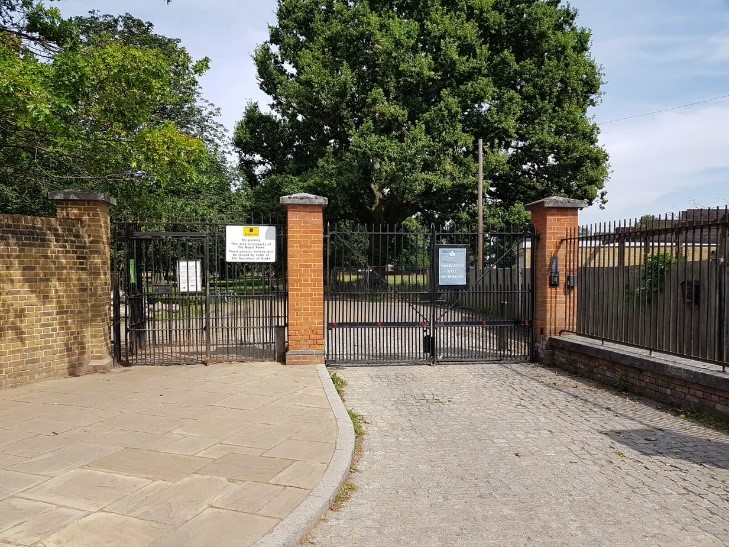
Figure 92 Entrance to Bushy Park to south of High Street
Figure 93 Entrance to Bushy Park to north of High Street
A number of houses along the High Street have small front garden plots that buffer the houses from the main street and passers-by. Generally, the main streetscape suffers from a lack of trees and planting. Along the High Street, there is a small area of green space that has come to host a beer garden connected to The Star pub.
Figure 94 Boundary railings 91 High Street
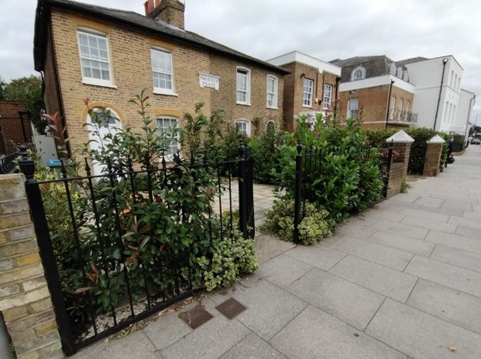
Figure 95 Boundary treatments, 157-159 High Street
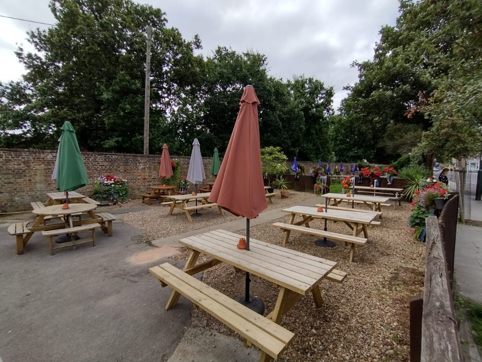
Figure 96 The Star pub garden
Pantile Bridge Open Space is a wedge of green space located at corner of High Street and Uxbridge Road, running along a stretch of the Longford River. With a handful of benches, it is a tranquil spot that provides some welcome calm away from the busy junction.
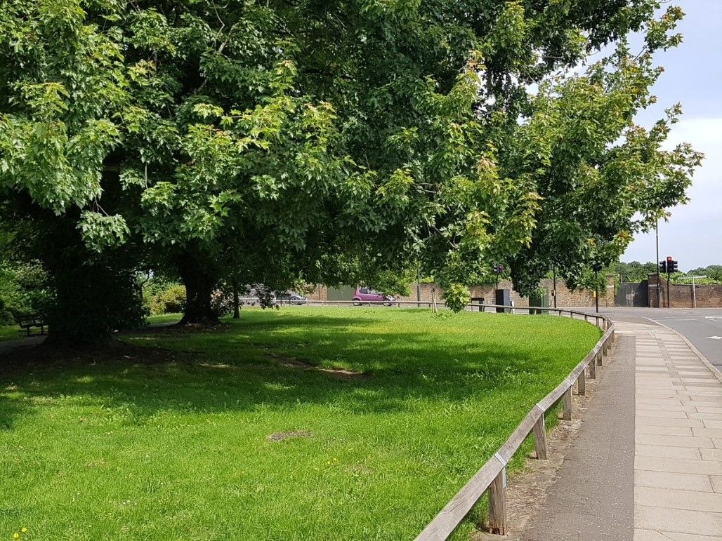
Figure 97 Pantile Bridge Open Space (1)
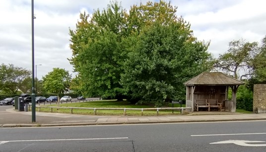
Figure 98 Pantile Bridge Open Space (2)
Many properties on the residential streets leading off the High Street boast modest front and rear gardens, though the insertion of hardstanding for vehicles is an increasing problem in the area.
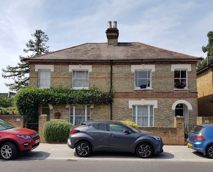
Figure 99 87-89 High Street
8. Management Plan
This Management Plan outlines how we intend to preserve and enhance the character and appearance of the conservation area in future. We have a duty to formulate and publish these proposals under the Planning (Listed Buildings and Conservation Areas) Act 1990.
The existing original layout of the High Street and surrounding residential streets are important features of the conservation area and are key to defining its overall special character.
However, the commercial aspect of the area makes it particularly vulnerable to development, particularly with regard to shop fronts, signage etc. With any change in proprietor, it is important that any changes to the shop fronts are minimal and sensitive to the building.
Please note that the following proposals include suggested environmental improvements, some of which may fall outside our control. Limits on our resources may also mean that proposals for which it is responsible may take longer than is desirable to implement.
8.1 Problems and pressures
- Loss of traditional architectural features and materials due to unsympathetic alterations and extensions
- Many good quality original shopfronts have been altered by the removal of historic features or addition of new poor quality ones, inappropriate details such as disproportionate signage, excessive illumination, loss of detailing such as plinths, pilasters, inset doorways and poor materials.
- Loss of public houses.
- Use of poor quality products in building works such as uPVC, roofing felt and GRP (glass-reinforced plastic) products.
- Poor quality and disproportionate roof additions.
- Poor quality window designs using uPVC.
- Loss of historic outbuildings and rear alterations which remove historic interest of the rear of properties.
- Appearance and massive scale of 63-71 High Street is unattractive and does not enhance the conservation area.
- Appearance of the recycling facility sited adjacent to the Star public house.
- Seating area adjacent to the Star public house against the Bushy Park boundary could be improved.
- Small amounts of existing planting in the High Street could be improved.
- Surfacing and appearance of the car park to rear of Park Gate Court are poor.
- Loss of front boundary definition, sometimes due to front garden parking to accommodate vehicles.
- Noise pollution and vibration caused by heavy traffic along the High Street.
- Conflicting parking needs of residents, shoppers, businesses and local employees.
- Pedestrian crossing can be difficult throughout the conservation area.
- Pair of advertising telephone kiosks to the front of group of shops at 169-175 High Street detract from the street scene.
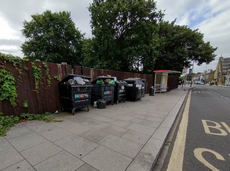
Figure 100 Recycling facility adjacent to The Star public house
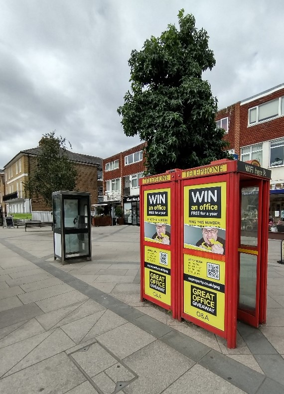
Figure 101 Advertising kiosks
8.2 Opportunities for enhancement
- Preservation, enhancement and reinstatement of architectural quality and unity that is preferably based upon historic evidence.
- Seek to encourage good quality and proportionate design and better-quality materials that are sympathetic to the period and style of the building.
- Retention and improvement in the quality of shopfronts; inappropriate materials, lack of detail, standard fascias, inappropriate blinds, inappropriate illumination and poorly modelled fronts should all be rejected.
- Continue improvements to paving and street furniture southwards to include the whole High Street. Paving and street furniture changes should accord with the guidance in the Public Space Design Guide.
- High Street: granite paving slabs, lighting and traffic related columns and street furniture in dark green (RAL 6021 Black- Green), granite kerbs and drainage channels, granite crossover entry treatments, granite surfacing to parking bays and permeable materials where appropriate.
- Encourage the reinstatement of appropriate walls, railings and hedges to boundaries throughout the conservation area. Also encourage improvement of existing boundaries where necessary.
- Retain any cast street nameplates.
- Increase tree planting and greening of High Street.
- Additional pedestrian crossings along High Street.
- Encourage redevelopment of Park Gate Court with buildings of less visual impact on the High Street and importantly, Bushy Park.
- Improve the appearance of the recycling facility south of The Star public house.
- Encourage good quality and sympathetic redevelopment of 63-71 High Street.
- Removal of pair of advertising telephone kiosks to the front of group of shops at 169-175 High Street.
- Encourage reinstatement of the spire on the United Reformed Church if feasible.
- Encourage reinstatement of cupola on the corner of 61 High Street if feasible.
- Seek to retain historic spaces set back behind the rear of properties fronting the High Street and retain historic outbuildings and support appropriate re-use of these buildings.
- Retain traditional slab paving on residential streets off the High Street.
- Improvement of links between the High Street and Bushy Park.
- Application of Article 4 Directions relating to basements and change from Class E (commercial, business and service uses) to C3 (dwelling houses).
References
Archive photographs: Richmond Local Studies Library
Historic England:
Up to: Conservation areas
Updated: 02 July 2026
